

Easter Tempest
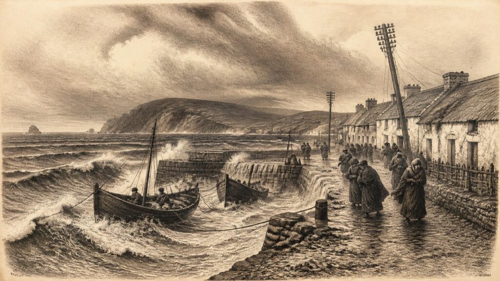
AI generated historical illustration, not a contemporary photograph.
At a Glance
Storm Dave crossed and passed close to Ireland during Easter weekend, 4–5 April 2026, bringing a brief but consequential spell of strong winds, heavy rain, high seas and transport disruption. Its importance lies less in being Ireland’s most destructive modern storm than in the unusually full documentary trail it left behind: forecasts issued while its track remained uncertain, instrumental observations taken as it developed, warnings tailored to particular risks, reports of interruption, and later climatic summaries which placed it in proportion. That record allows the event to be treated as history rather than merely as weather remembered.
Historical Scope
A storm only months old may seem an unusual subject for a historical archive. Yet weather becomes historical as soon as evidence can be examined in sequence and its contemporary meaning separated from later recollection. In the case of Storm Dave, that sequence is unusually clear. The event was anticipated several days beforehand; named on 2 April 2026 by the United Kingdom Met Office; monitored by Met Éireann as it developed over the Atlantic; experienced across Ireland on Saturday 4 April; and assessed afterwards through station observations, service reports and monthly climate statements. The available record is therefore not a legend of a great gale, nor a reconstruction made centuries after the event. It is a modern archive of forecasts, measurements, institutional decisions and public consequences.
The subject also has an unmistakable Irish dimension. The storm tracked near the west and north-west coast, with its centre passing over the north-west of Ireland late on Saturday 4 April before continuing towards Scotland. It affected the Republic and Northern Ireland, though not in identical ways or with equal intensity. Its route placed Atlantic and western coasts close to the changing core of the system, while the national warning reflected the fact that severe gusts, difficult travel and coastal overtopping could occur far beyond the immediate track. Irish history has long been shaped by exposure to Atlantic weather. Storm Dave belongs to that continuing history, but it must be judged by the evidence of 2026 rather than magnified through comparison with older, more catastrophic storms.
The name itself needs care. “Storm Dave” was not a folk designation coined after damage had occurred. It was part of the shared storm-naming system used by Met Éireann, the Met Office and the Dutch meteorological service. The Met Office named it because the most serious predicted effects were expected across northern Britain; Ireland nevertheless lay directly within the system’s area of influence. Thus the name was international in origin, while the event’s consequences and records were distinctly local. This distinction matters because a named storm is not automatically a national disaster. Naming is principally a communication device intended to make hazardous weather more memorable and warnings easier to convey.
For historians, another distinction is equally important. A weather warning is evidence of anticipated risk, not proof that every listed impact occurred. A dramatic photograph may show a real local condition, but it cannot represent the whole country. A report of a cancelled flight records a specific operational effect, not the total experience of aviation. Instrumental figures have their own meanings: a peak three-second gust differs from a ten-minute mean wind speed, and rainfall at a coastal station cannot simply stand for rainfall across an entire county. Storm Dave can be understood best by keeping these categories separate: forecast, observation, impact report, interpretation and memory.
Atlantic Setting
The immediate meteorological setting was a mobile Atlantic pattern during the opening part of April 2026. Met Éireann’s subsequent climate statement described a succession of relatively deep low-pressure systems travelling from south-west to north-east near the north-west of Ireland. This was not a single isolated disturbance arriving after a calm month. It was part of a wider spell in which the Atlantic’s usual spring variability became especially active. Such context is essential. A storm’s practical effect depends not only on its own wind field and rainfall, but on ground already softened by earlier rain, exposed trees and structures, tide levels, public holiday travel and the readiness of emergency and transport services.
Before Dave formed fully, forecasters identified a strong jet stream, driven by the contrast between colder air descending from the north-west and milder air advancing from the south-west. This upper-air environment encouraged the formation and rapid strengthening of low pressure. Met Éireann’s contemporary commentary used the technical term rapid cyclogenesis: the swift deepening of a depression as it moved north-eastwards. The commentary also stressed uncertainty. On 1 and 2 April, the exact position and depth of the still-developing low remained consequential unknowns. Small changes in track could alter where the strongest gusts occurred and whether warning levels needed revision.
This is a revealing feature of modern weather history. Forecasting does not remove uncertainty; rather, it records uncertainty explicitly and turns it into practical advice. The public received not a claim that every place would endure identical conditions, but a warning that an increasingly likely period of dangerous weather was approaching. The forecast linked wind strength with coastal processes. Spring tides, storm surge, large waves and persistent onshore winds were identified as a potentially damaging combination in exposed and low-lying coastal places. The language was probabilistic, but it was not vague. It named the forms of disruption that residents, travellers and local authorities needed to consider.
There is no evidence that Storm Dave was a tropical hurricane reaching Ireland. It was an extratropical Atlantic windstorm: a low-pressure system deriving energy from contrasts between air masses rather than from warm tropical seas. The difference is more than terminology. It explains why frontal rain bands, shifting wind directions and a rapidly moving centre formed such an important part of the event. It also cautions against casual use of “hurricane” as a general synonym for violent weather. Met Éireann’s official observations classified sustained conditions at Roches Point as storm force, a precise maritime category, while the peak gusts remained a separate measurement.
The storm’s passage also shows why Ireland’s position cannot be reduced to a western coastal stereotype. The developing depression approached from the Atlantic, travelled near the west and north-west coast, then cleared north-eastwards. Southerly winds strengthened as it arrived, later veering westerly. This shift affected exposure differently in different places. A coast open to a southerly gale is not exposed in the same way after winds turn west; harbours, estuaries, roads and airport runways each have their own orientation. In that sense, the history of one storm is also a history of local geography.
Warning System
The warning process was one of the most visible parts of Storm Dave’s Irish story. Met Éireann issued a nationwide Status Yellow wind warning for Saturday 4 April. In the early detailed commentary, the warning was expected to run from 2 p.m. until 11 p.m.; later updates extended the national period into the early hours of Easter Sunday. The changing times did not indicate confusion so much as a forecast being refined as new observations and model runs became available. Forecast products are working documents. Their evolution is itself historical evidence of how professionals judged a developing threat.
Status Yellow is frequently misunderstood in retrospective discussion. It does not mean that a storm is trivial, nor does it necessarily predict the sort of widespread structural devastation associated with the rarest events. It signals potentially dangerous weather and a need for awareness and preparation, especially among those exposed to travel, coastlines, trees, temporary structures or outdoor activity. For Dave, Met Éireann highlighted fallen trees and branches, displaced loose objects, difficult travelling conditions, wave overtopping and coastal gales. These were practical impact categories, not a catalogue of damage known in advance.
The national character of the warning was significant because Easter weekend was beginning. People were travelling, visiting family, attending religious observances, working seasonal tourism shifts or planning recreation outdoors and by the coast. A Saturday storm therefore met a country in motion. The warning message repeatedly advised the public to monitor updates, secure loose objects, take care on roads and avoid dangerous coastal conditions. It also acknowledged that high astronomical tides could increase the likelihood of coastal flooding in vulnerable locations. The emphasis on exposure is important: a wind event becomes disruptive through encounters with human routines and infrastructure.
Warnings north of the border were issued through the Met Office system. Northern Ireland consequently formed part of the wider all-island weather experience while operating within a different administrative framework. The forecast did not recognise political boundaries; public services necessarily did. This duality is common in the environmental history of Ireland. Rainfall, wind and sea state pass across the island and surrounding seas without regard to jurisdiction, but the recording, warning and response structures remain divided among national and regional bodies.
One documented example illustrates precautionary action in Northern Ireland. NI Water announced on 3 April that Silent Valley Mountain Park in County Down would close throughout Saturday because of the Met Office wind warning, reopening only after a safety inspection if conditions allowed. This was neither a sensational incident nor proof of damage at the site. It was a measured decision to prevent visitors from being exposed to the hazards that strong winds can create in a mountainous reservoir landscape: falling branches, unstable paths and dangerous conditions around water. Such modest administrative notices are historically valuable because they reveal how risk was managed before harm occurred.
Saturday Passage
On Saturday 4 April, the storm became an observed Irish event rather than a forecast possibility. Met Éireann’s daily weather summary records that Storm Dave tracked near Ireland’s west and north-west coast throughout the day. The country lay in a southerly airflow that strengthened from moderate or fresh conditions to strong gale force at times. Weather fronts moved over Ireland, bringing rain and drizzle northwards during the morning and more persistent rain eastwards during the afternoon. The official description is deliberately measured. It records a windy and wet day, not uniform exceptional weather from coast to coast.
Coastal fog lingered in the south-east for part of the day, a detail that complicates any simple image of a country swept only by clear, violent gales. Weather systems contain contrasts. Fog, drizzle, frontal rain, gusty winds and later showers existed within the same broad event. By the evening a brief clearance gave way to scattered showers, and overnight the storm cleared to the north-east while winds gradually eased. The change from southerly to westerly flow was part of the system’s passage and altered the immediate experience of exposed communities.
The day’s highest reported rainfall total was 38.6 millimetres at Belmullet, County Mayo. Met Éireann noted that this represented 54 per cent of that station’s monthly long-term April average, an effective illustration of how a single day’s rain can be substantial without determining the character of an entire month. Heavy rain was an important component of Dave, but the official evidence does not justify describing it as a nationwide flooding catastrophe. Reports did record localised rain-related problems in Donegal, including a landslide that blocked the R230 between Gleann Cholm Cille and Mín an Aoire at Bráid. Local disruption, however, should not be converted into a claim that all western roads were impassable.
At the exposed coastal station of Roches Point, County Cork, the highest ten-minute mean wind speed reached 48 knots, or 89 kilometres per hour. This attained storm-force status on the Beaufort scale. The highest three-second gusts recorded in Ireland were 60 knots, or 111 kilometres per hour, at both Roches Point and Valentia Observatory in County Kerry. These figures provide the firmest basis for describing the storm’s Irish wind strength. They are observations at particular stations, not an assertion that all parts of Cork and Kerry experienced precisely those winds.
The system’s lowest recorded mean sea-level pressure in the Irish storm-season summary was 980.8 hectopascals at Malin Head, County Donegal, around 7 p.m. on 4 April. Pressure figures can appear abstract, but their rapid fall and low values often shape public bodily memory: doors strain, chimneys hum, ears register a change, and forecasts acquire urgency. Still, pressure alone is not a measure of damage. Wind direction, gustiness, local topography, tree condition and the coincidence of tides all help decide whether a given depression leaves little trace or produces a difficult night.
Measured Winds
Instrumental measurements put Storm Dave in a more precise perspective than recollection can provide. Ireland’s official storm-centre summary identifies Dave as the final named storm of the 2025–26 season. It records a peak sustained wind of 89 kilometres per hour at Roches Point, a peak gust of 111 kilometres per hour at Roches Point and Valentia Observatory, a maximum calendar-day rainfall total of 38.6 millimetres at Belmullet, and a highest individual wave of 12.2 metres at Buoy M3 off the Cork coast. These figures establish Dave as a serious spring Atlantic event, especially for maritime and exposed coastal conditions.
They also establish limits. The same seasonal record identifies other storms in 2025–26 with stronger wind or more intense rainfall characteristics. Storm Amy, earlier in the season, produced higher peak winds; Storm Chandra had lower pressure and stronger gusts at Malin Head; Storm Claudia delivered the season’s greatest daily rainfall and highest individual wave. The comparison is not intended to diminish the disruption Dave caused. It prevents an error common in immediate commentary: treating the latest named storm as automatically the most severe. Historical judgement requires proportion.
Dave was, nevertheless, notable within April. Met Éireann recorded that three stations—Ballyhaise in County Cavan, Gurteen in County Tipperary and Athenry in County Galway—registered their highest April gusts on record on 4 April. The observation needs qualified reading because the records at these sites were between sixteen and twenty years long, not centuries long. They are valid station records, but they do not demonstrate unprecedented winds across all of Ireland. Their value lies in revealing how a particular spring storm could be locally unusual even when it did not surpass every national benchmark.
Roches Point’s storm-force mean wind also deserves interpretation. The Beaufort scale was developed for seafaring conditions and remains useful for communicating sustained wind intensity. “Storm force” refers to force 10, not to the colloquial fact of a storm having a name. By contrast, the 111-kilometre-per-hour figure was a short gust. Both are real, both matter, and neither should be casually substituted for the other. The distinction is especially important when comparing reports made by different agencies or stations, as summaries may foreground the strongest gust while marine operations may be more concerned with sustained wind and sea state.
The sea provided another form of evidence. Buoy M3 registered a highest individual wave of 12.2 metres off the Cork coast during Dave. An individual wave is not the same as the average significant wave height, nor does it mean that every shore received a twelve-metre wall of water. Offshore buoys are situated in particular locations and record conditions in open water. Yet the figure confirms the seriousness of the maritime environment surrounding the island. It also gives context to the warnings about wave overtopping: coastal danger can arise from the interaction of large waves, wind, tide and shoreline shape even where rainfall on land is limited.
Rainfall Patterns
Rain was integral to Storm Dave, but its distribution was uneven. The principal recorded daily total at Belmullet lay on the Atlantic-facing north-west coast, consistent with a system passing close to that part of Ireland. Met Éireann’s later monthly analysis described April as wet in the west and comparatively dry in the east. It attributed the contrast to repeated low-pressure systems passing near the north-west, while higher pressure over continental Europe reduced rainfall farther east. Dave therefore belonged to a broader regional pattern rather than determining the whole month on its own.
This matters for historical writing because rain has a tendency to become undifferentiated in memory. People remember an Easter weekend as “a washout” when journeys were delayed and outdoor plans were curtailed, even if a station record shows short dry intervals or modest totals locally. Such memories are not necessarily false; they are records of lived inconvenience. They are simply different from meteorological data. A family whose planned coastal walk was abandoned may remember the storm more vividly than a farmer whose gauge registered less rain than a place forty kilometres away.
Donegal supplied one of the clearer documented land impacts. Rain-related local problems were reported in Anagaire, Gaoth Dobhair, Gleann Cholm Cille, An Fál Carrach and Gort an Choirce, while the R230 blockage at Bráid required attention from Donegal County Council. The available reporting demonstrates that the storm’s effects extended beyond wind damage and aviation disruption. It does not provide a complete countywide survey of road conditions, property losses or agricultural impact. A responsible account must leave the record at that point rather than filling gaps with plausible but unproven detail.
On Sunday 5 April, the weather shifted into a strong and gusty westerly flow generated by the depression then centred north-east of Scotland. Met Éireann recorded a brighter, breezy day with sunny spells and scattered showers. Some showers brought hail and sleet, chiefly on higher ground, before easing later in the day. This post-frontal pattern confirms that the storm was not simply a prolonged deluge. It was a moving system whose principal wet and windy phase gave way to a colder, showery aftermath.
The later climate statement placed April 2026 among the wetter Aprils nationally, at 113 per cent of the 1991–2020 average, while also describing it as mild and quite sunny overall. This apparently mixed assessment is a useful corrective to simple narratives. A month can contain a memorable storm, be wetter than average, and still include substantial sunshine and later settled weather. Climate summaries operate at a different scale from event history. Dave is best understood as an acute episode inside a month whose character emerged from several weather regimes.
Coastal Exposure
Coastal risk was central to the forecasts because Storm Dave arrived close to spring tides. Met Éireann repeatedly warned that the combination of astronomical high tides, storm surge, strong onshore winds and significant waves could lead to wave overtopping and flooding in exposed, low-lying locations. The wording is important. It identified a mechanism and a vulnerability rather than promising that severe flooding would occur everywhere. Along Ireland’s varied coast, a harbour wall, promenade, estuary mouth or low road may be vulnerable at one tide stage and relatively protected at another.
Wave overtopping is often misrepresented in public memory as a storm surge covering whole towns. It can instead involve powerful waves breaking over sea walls and roads, depositing water, shingle or debris and making passage dangerous. Its local severity depends on coastal orientation and engineering as much as on the general strength of the storm. In Dave’s case, official warning material treated Atlantic-facing coasts as particularly exposed. The storm-season buoy record supports the seriousness of conditions offshore, but the evidence currently available does not support a broad claim of catastrophic coastal inundation around the island.
There is a deeper Irish historical context here. Communities around the coast have long understood that wind is not merely an atmospheric phenomenon. It affects fishing decisions, ferries, ports, sea walls, electricity lines, roads, tourism and the safety of people drawn to dramatic seas. Modern warnings translate that inherited knowledge into technical risk communication. The difference is that present-day authorities can combine satellite imagery, numerical models, tide predictions, buoys, airport observations and local forecast expertise. The hazard has not vanished; the means of anticipating it have altered.
Storm Dave also illustrates the importance of not confusing the island’s coasts. The west and north-west lay close to the depression’s track, yet peak recorded gusts occurred at Roches Point and Valentia in the south. This is not contradictory. Wind maxima depend upon the storm’s evolving circulation, local exposure and the time at which the strongest gusts pass a station. It is a reminder that maps of a storm track are guides, not complete impact maps. A low may pass north-west of Ireland while severe weather is recorded at coastal sites much farther south.
Folklore inevitably develops around the sea during storms: reports of waves “as high as houses”, claims that a particular pier had never before been overtopped, or retrospective assertions that the storm changed a beach overnight. Such accounts can be valuable leads for local history, especially when oral testimony is dated and compared with photographs, tide records and council documentation. They are not, by themselves, evidence for national conclusions. In the present record, official measurement and contemporaneous reports provide a stronger foundation than unverified social-media recollection.
Travel Disruption
The clearest widely reported practical consequences of Storm Dave were interruptions to travel. Dublin Airport recorded cancellations, diversions and go-arounds on Saturday 4 April as strong winds affected flight operations. By the following day, reporting based on airport and airline information indicated seventeen cancellations, thirteen diversions and fifty-three go-arounds. Such figures capture the instability created by gusty crosswinds and operational displacement. They should not be read as a measure of danger to passengers: a go-around is a routine safety manoeuvre when an approach is not continued, and cancellations are often the deliberate consequence of cautious operational judgement.
The airport disruption had a temporal dimension. Aviation networks do not reset at midnight. Aircraft and crews displaced by Saturday’s weather could affect services on Sunday even after conditions improved. This is a small but revealing example of how a storm extends through systems. The wind may be strongest for only several hours, but the consequences travel onward through timetables, passengers’ plans, hotel stays, ground handling and crew-duty rules. During a bank-holiday weekend, when services are already carrying seasonal movement, the social effect of such delay can exceed what the meteorological duration alone might suggest.
Road travel was also vulnerable. Forecasters warned of difficult conditions from gusts, debris and fallen branches, while localised rain-related problems occurred in Donegal. The prudent historical conclusion is that road users faced disrupted and hazardous travel in some places, not that a single national transport shutdown occurred. Weather reporting often privileges dramatic incidents because they are newsworthy. The quieter reality may consist of thousands of journeys slowed, rerouted or cancelled before they become reportable events.
Maritime services were exposed to the same basic combination of wind and sea state. Elsewhere around the Irish Sea, ferry disruption was reported, particularly on routes connected with Northern Ireland and Scotland. The weather’s political geography again becomes visible: an event affecting the Republic, Northern Ireland, Great Britain and surrounding waters crossed several transport jurisdictions. The island’s connections depend on sea and air routes that are resilient but not immune to the Atlantic. Storm Dave briefly demonstrated the continuing material importance of those links.
One must avoid treating every cancellation as evidence of infrastructural failure. In a modern safety system, some disruption is the intended result of good judgement. Airports, ferry operators, road authorities and public utilities act before conditions reach their worst, and their decisions often avert more serious consequences. The archive of Dave therefore records not only impact but preparedness: warnings were circulated, park access was restricted, passengers were advised to check with airlines, and electrical repair crews were mobilised once it was safe to work.
Power Outages
Electricity disruption was among the storm’s most tangible effects in the Republic. At the height of the event, approximately 18,000 homes, farms and businesses were reported without power. By early afternoon on Sunday 5 April, this figure had fallen to about 1,000 as ESB Networks crews worked on restoration. The numbers convey a genuine disturbance to daily life, particularly for households and rural enterprises dependent on electricity for heating controls, lighting, communications, refrigeration and water systems. Yet the rapid reduction also distinguishes Dave from the most destructive recent Irish windstorms, whose outages reached far larger totals and persisted for longer periods.
Outage figures need exact language. Reports referred to properties or customers without supply at a given time, not necessarily to an equal number of separate faults, households or permanently damaged installations. A fallen branch may interrupt a line supplying many premises; one repair can therefore restore a large number of connections. The peak number records the highest known interruption, while restoration figures show the changing state of the network. Neither should be conflated with the total number of people affected, which would require household and business occupancy data not contained in the available reports.
In Northern Ireland, power outages were also reported, though the public record consulted for this account is less complete on their precise scale. The Met Office’s post-event assessment noted that homes in Northern Ireland lost power, while wider UK reporting described thousands of outages across Wales, Scotland and Northern Ireland. A cautious all-island history should acknowledge the effect without attaching an unsupported single total to Northern Ireland. Different utility systems and different public reporting practices make neat comparison difficult.
Electrical infrastructure provides a useful historical measure of storm impact. Before universal electrification, a gale’s consequences were registered through roofs, crops, ships, telegraph lines, roads and human testimony. In the twenty-first century, the electricity network has become one of the most immediate indicators of exposure. It is also an indicator of recovery. Public concern shifts from the approach of the storm to the question of when lights, communications and essential equipment will return. The restoration timetable becomes part of the event’s social memory.
Comparison with Storm Éowyn in January 2025 clarifies Dave’s scale without making the comparison its central story. ESB Networks’ review of Éowyn described an unprecedented event affecting around 768,000 customers at peak. Dave’s approximately 18,000 peak outages were serious for those directly affected but markedly smaller. This comparison does not make Dave insignificant. Rather, it shows why historical language must be calibrated. Ireland’s experience of extraordinary recent storms can make lesser, though still hazardous, events appear ordinary. They are not ordinary to a household without power, a cancelled traveller or a community facing a blocked road.
Island Experience
Storm Dave was an all-island weather event, but not an all-island experience in any simple sense. Meteorologically, the same Atlantic depression and its fronts affected both jurisdictions. Institutionally, however, Ireland was served by Met Éireann in the Republic and the Met Office in Northern Ireland, with distinct warning channels, infrastructure operators and public bodies. The naming decision originated with the Met Office, while Met Éireann issued its own national warning and detailed commentary. The event therefore shows cooperation and parallel administration rather than a single unified emergency system.
For people in the Republic, the warning was shaped by the expected passage near western and north-western coasts, the prospect of gale-force winds and the coincidence with spring tides. For people in Northern Ireland, warning messages included concern for wind across the region, and institutions such as NI Water made precautionary decisions at vulnerable public sites. In both places, the most visible effects included wind exposure, travel changes and concern for coastal safety. Yet local topography mattered more than national labels. A sheltered inland town, an Atlantic headland, a Belfast commuter route and a County Down mountain park each met the storm differently.
The event also underlines the role of cross-channel relationships. Dave moved onward to Scotland and affected parts of Wales and northern England, while Irish aviation and ferry services linked weather on one side of the sea to disruption on the other. Historical accounts of Irish weather sometimes treat the island as a bounded unit. Storms challenge that habit. Their relevant geography includes the North Atlantic, the Irish Sea, Britain, offshore buoys and the wider circulation of the atmosphere.
There is no need to invent a constitutional lesson from this. The documented fact is simpler and stronger: the storm’s physical field crossed the island, while the institutions recording and responding to it were multiple. For researchers, this means that an adequate archive requires consultation of sources from both jurisdictions and from maritime as well as land-based agencies. A single national weather page gives an important but incomplete account.
Names Matter
Storm naming has changed the way severe weather enters public consciousness. Met Éireann’s storm-centre material records that the collaborative naming initiative began in the 2015–16 season. Since then, names have allowed agencies, broadcasters and the public to refer quickly to a particular forecast episode. They can improve the circulation of warnings, especially on social media and in crowded news cycles. “Storm Dave” gave a developing Atlantic depression a stable public identity before it reached land.
That identity can, however, produce distortions. A named storm may sound more singular, coherent and extraordinary than the weather actually experienced in every locality. Conversely, a person may assume that a storm without a name was insignificant. Neither inference is sound. Naming depends on the expectation of potentially disruptive weather and on coordination among forecasting services; it is not a permanent ranking system of severity. Dave was the fourth named storm in the 2025–26 list used by the Irish, British and Dutch services, though the seasonal summary counted five storms affecting Ireland because Claudia had been named by Spain’s AEMET.
The human familiarity of the name “Dave” also generated humour in public discussion. Such humour is part of contemporary folklore: ordinary people domesticate a hazard by imagining a storm as an unwelcome but recognisable visitor. It should not be mistaken for evidence about wind speed, damage or preparedness. Yet it is historically interesting. Earlier generations attached local names, saints’ days, feast days or memorable dates to storms. Contemporary culture increasingly uses official meteorological names, memes and short videos. The means of retelling weather has changed, even while the experience of waiting for wind to rise remains recognisable.
For archival purposes, names are useful search tools but imperfect historical categories. The same depression may be named by one meteorological service because of expected effects in one region while causing notable conditions elsewhere. Storm Dave’s name originated in Britain, but Irish official records carefully incorporated it because Ireland was affected. The historian should follow the atmospheric system and the evidence, not assume that the naming authority defines the only place that matters.
Evidence Limits
The strongest evidence for Storm Dave consists of contemporaneous official observations and warnings. Met Éireann’s daily weather reports state the storm’s track near the west and north-west coast, rainfall at Belmullet, wind observations at Roches Point and the changing conditions on Easter Sunday. Its monthly climate statement supplies later context and station-record information. The Irish storm-centre summary places Dave in the season’s sequence. The Met Office’s post-event report supplies a wider assessment of the system’s effects across the United Kingdom and Northern Ireland. These sources allow firm statements about measured weather and documented disruption.
News reports provide a different kind of evidence. They record airport cancellations, diversions, power outages, road problems and official statements made during the event. They are indispensable for reconstructing the social surface of a short-lived storm, particularly where no single state agency publishes a consolidated impact report. But journalism is necessarily time-bound. Early numbers can be revised; images select exceptional scenes; and an urgent headline may compress distinctions between forecast and observation. Later historical work should therefore retain dates and attribution rather than repeating every first report as settled fact.
There are also important absences. No comprehensive public damage survey for Storm Dave was identified in the material consulted. There is no basis here for an exact national estimate of insurance losses, agricultural losses, disrupted school days, total road closures or the number of coastal properties damaged. Nor should the absence of a great national assessment be construed as proof that nobody suffered significant local loss. It means only that the available public record is insufficient to quantify it responsibly.
Oral accounts, photographs, local social-media posts and personal videos will likely become part of the event’s memory. They may preserve details that official sources omit: a roof repaired in a particular village, a cancelled Easter gathering, a night without electricity, or a familiar shoreline temporarily altered by waves. Their historical value grows when provenance is clear—who made the record, where, when, and whether the date can be verified. Without that context, they are best treated as leads or illustrations, not as independent proof of broader claims.
Interpretation must likewise be kept distinct from documentation. It is a reasonable interpretation that the timing over a holiday weekend increased the visibility of travel disruption and coastal warnings. It is a reasonable interpretation that recent memories of more destructive storms shaped public attention. But neither conclusion can be converted into a measured fact without survey evidence. The discipline of uncertainty is not a weakness in historical writing; it is the means by which the known event remains distinguishable from the story people later wish it to have been.
Comparative Memory
Modern Irish storm memory is inevitably comparative. People who had experienced Storm Darwin in 2014, Ophelia in 2017, Darragh in 2024 or Éowyn in 2025 possessed reference points against which Dave could be judged. Official seasonal summaries make such comparison tempting because they gather peak winds, rainfall, pressure and waves into one table. Yet comparisons require humility. Each event has a different track, season, wind direction, duration, ground condition, tide state and pattern of human exposure. A lower gust at one station can still produce serious local damage if it strikes a vulnerable line, tree stand or coastal road.
Dave was not Ireland’s strongest recorded storm, nor did the available evidence place it among the country’s most destructive named storms. Its distinction lies elsewhere. It was a spring event with storm-force sustained winds at Roches Point, gusts of 111 kilometres per hour at two coastal observatories, substantial rainfall at Belmullet, a 12.2-metre individual offshore wave, widespread but comparatively short-lived electricity disruption and considerable aviation disturbance. It also occurred while the warning system and public memory were especially attuned to severe weather following the major storms of the preceding seasons.
That context can cause two opposing errors. One is complacency: because Dave did not equal Éowyn, it may be dismissed as routine. The other is escalation: because named storms attract attention, it may be narrated as a catastrophe beyond the evidence. The historical middle ground is more accurate. Dave was a serious, disruptive Atlantic windstorm that affected Ireland materially, especially on 4 April 2026, but whose impacts were bounded in duration and scale relative to the island’s largest modern wind events.
Comparative memory also changes folklore. When people say that storms are becoming “worse every year”, they may be expressing an experience of repeated disruption, not offering a tested climatic trend. Long-term climate analysis requires records extending beyond a few memorable seasons and careful attention to changes in exposure, reporting and infrastructure. It would be unsound to infer climate change from Storm Dave alone. It would be equally unsound to deny the relevance of climate science simply because individual storms have complex immediate causes. Event history and climate history meet, but they are not identical disciplines.
Archival Future
Storm Dave’s future historical importance will depend on the preservation of its records. Digital forecasts and web updates are often more fragile than printed newspapers once appeared to be. A warning page may be overwritten; a social-media post may disappear; live outage maps are designed for immediate use rather than posterity. The durable core currently lies in Met Éireann’s climate archives, daily bulletins and storm-centre summaries, in Met Office event material, and in institutional notices issued during the storm. These should be read alongside contemporary journalism, local authority records and, where available, photographs with verifiable metadata.
There is an opportunity for local archives as well. County libraries, heritage centres and community groups can collect dated testimony from people who experienced the storm: households that lost supply, coastal workers who altered plans, emergency crews, airport staff, road workers and those whose Easter arrangements changed. Such collection should not demand dramatic stories. The ordinary experience of a named storm is part of its history: checking a warning, bringing in bins, postponing a journey, hearing wind around a house, helping a neighbour after a branch falls, or watching repair crews restore power.
Any future account should preserve the separation between contemporary evidence and later narrative. It should record that Storm Dave was named on 2 April 2026, affected Ireland chiefly on Saturday 4 April into early Sunday 5 April, and was followed by a breezy, cooler showery day as it moved towards Scandinavia. It should preserve the key instrumental figures, but also their meaning: 111 kilometres per hour was a peak gust, 89 kilometres per hour a ten-minute mean at Roches Point, and 38.6 millimetres a single-station daily rainfall total at Belmullet.
The storm is thus a small but instructive case study in how Ireland records weather in the twenty-first century. It shows forecast uncertainty communicated openly, national and regional warnings deployed before the event, instrumental networks measuring the passage, public bodies acting cautiously, transport systems absorbing disruption, power crews restoring supply and climate services later setting the episode in context. It is history not because it was ancient, but because evidence allows the sequence to be understood.
Measured Legacy
Storm Dave left no single monumental ruin by which it must be remembered. Its legacy is more dispersed: a day of changing plans, high waves, gust-lashed coasts, rain in the west, fallen branches, local road difficulties, flight disruption and temporary loss of electricity. For a few hours during Easter weekend, the Atlantic reasserted its presence in the everyday systems of Irish life. The fact that those systems largely continued, albeit with interruption, is part of the story rather than a reason to overlook the event.
Documented evidence supports a restrained conclusion. Storm Dave was a real and significant Irish weather event, affecting both the Republic and Northern Ireland on 4–5 April 2026. It produced storm-force sustained winds at Roches Point, maximum recorded gusts of 111 kilometres per hour at Roches Point and Valentia Observatory, 38.6 millimetres of rain at Belmullet, large offshore waves and notable disruption to electricity and transport. It was not, on the available evidence, a nationwide catastrophe on the scale of Ireland’s severest recent windstorms.
Folklore will do what folklore always does: heighten the gusts, personalise the name, preserve the most frightening wave and the most inconvenient cancelled journey. History need not reject that human material. It should place it alongside the barometer, the rain gauge, the warning bulletin and the repair log. In that balance lies the proper record of Easter 2026: a named storm, measured carefully, remembered unevenly, and now part of Ireland’s continuing Atlantic archive.