Archived: 26 September 2026
Abstract
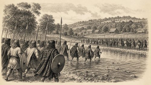
In 1159, Muirchertach Mac Lochlainn, Ireland’s leading overking, contested Ruaidrí Ua Conchobair’s power through shifting alliances across Meath, Bréifne, Airgíalla and Thomond. After reshaping Meath’s kingship, Mac Lochlainn faced Ruaidrí’s Connacht-Bréifne coalition, whose campaign was marked by Áed Ua Conchobair’s death at Athlone’s wicker bridge. At Ardee, northern and Airgíalla forces routed Ruaidrí’s army, killing numerous regional leaders. Mac Lochlainn subsequently ravaged Connacht and pressured Meath and Leinster, but gained neither Ruaidrí’s submission nor lasting control. Local raids, church deaths and rural military burdens reflected wider instability. Ardee confirmed his supremacy temporarily, yet preserved rivals and left Ireland’s kingship unresolved.
Read Article

Archived: 26 September 2026
Abstract
In 1148, Irish politics combined rivalry, raiding and shifting alliances with major ecclesiastical reform. Tairdelbach Ua Conchobair, king of Ireland with opposition, campaigned in Mide, while Muirchertach Mac Lochlainn intervened in Ulaid, where changing rulers, hostages and a relic-sanctioned peace reflected unstable power. Tigernán Ua Ruairc survived an assassination attempt, and Dublin’s Hiberno-Norse king Óttar was killed. At Inispatrick, Malachy Ua Morgair gathered bishops and clergy, advancing diocesan reform and plans for papal pallia. He consecrated Cnoc na Seangan, while Baltinglass Abbey was founded. Malachy died at Clairvaux, but his reforms helped shape the 1152 settlement at Kells-Mellifont in Ireland.
Read Article

Archived: 26 September 2026
Abstract
Irish annals portray 1066 as a year of fractured kingship, diplomacy, violence, religious authority and remarkable natural phenomena. Diarmait mac Maíl na mBó, Tairdelbach Ua Briain and Áed Ua Conchobair shaped high politics, with gold payments illustrating competitive alliances. Deaths and killings, particularly in Bréifne, exposed contested succession and conflict involving churches. Annals commemorated leading ecclesiastics, reflecting monasteries’ political, economic and spiritual roles. Observers recorded Halley’s Comet in late April and an exceptional hazelnut harvest. Dublin’s trade and coinage connected Ireland internationally. Irish writers also noted William’s English conquest, though it caused no immediate major transformation in domestic Irish politics.
Read Article

Archived: 26 September 2026
Abstract
In 1063, Tairdelbach Ua Briain, backed by his foster-father Diarmait of Leinster and Dublin, secured recognised kingship in Munster, although Donnchad mac Briain remained until 1064. Ardgar mac Lochlainn’s military progress through Connacht compelled regional rulers to acknowledge his temporary superiority, while an assault on a refuge at Cera caused heavy loss of life. Deaths among kings and churchmen altered local politics. Pilgrimage and ecclesiastical centres retained political importance. Later annals report sickness and scarcity, cautiously interpreted. Warfare, billeting, hostage-taking and raids, including Limerick’s burning, burdened rural communities, revealing Ireland’s fragmented, coercive kingship and interconnected trade, church and rural life.
Read Article

Archived: 26 September 2026
Abstract
In 1062, Ireland remained divided among competing dynasties. In Connacht, Áed Ua Conchobair defeated western rivals but lost his son in retaliatory violence, before Ardgar Mac Lochlainn raided the province for cattle and captives. Killings destabilised successions in Mughdorna, Fernmag and Ulaid. In Munster, campaigns by Diarmait of Leinster and Toirdelbach Ua Briain further undermined Donnchad mac Briain. Deaths of leading Columban and northern churchmen marked ecclesiastical change. Annalistic dating varies, particularly for Connacht events. Warfare damaged households through livestock seizures, captivity, destruction and disrupted farming, while urban trade and church networks linked Ireland to Britain, Alba and maritime worlds.
Read Article
Archived: 26 September 2026
Abstract
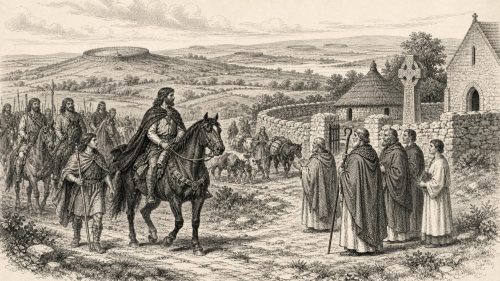
In 1006, Brian Bórama demonstrated the reach yet limits of his Irish overlordship by leading a broad coalition from Munster, Leinster, Mide, Connacht and Dublin through the north. His circuit secured Ulaid hostages and satisfied Armagh's claims, strengthening royal and ecclesiastical legitimacy, but Cenél Conaill and Cenél nEógain withheld submission. Provincial violence continued, including killings of regional kings, revealing unstable local rule. The deaths of Armagh churchmen underline clerical institutions' importance. A mild, food-rich winter offered relief after scarcity, while the army's passage burdened rural communities. Dublin's participation reflected its growing military, commercial and maritime value within Brian's negotiated supremacy.
Read Article

Archived: 10 September 2026
Abstract
31,816 BCE is a modern label for an uncertain Late Pleistocene interval, when Ireland experienced volatile MIS 3 climates, falling seas and expanding ice. Derryvree, County Fermanagh, preserves freshwater sediments between till layers, indicating treeless, periglacial wetland with grasses, sedges, juniper and pools. Castlepook Cave, County Cork, contains mixed, long-accumulated remains of mammoth, reindeer, giant deer and carnivores, but cannot reconstruct one contemporary fauna. A cut-marked reindeer femur may indicate brief Upper Palaeolithic human carcass processing with a stone tool. It does not prove settlement. Subsequent ice expansion reshaped landscapes and destroyed evidence, leaving Ireland a sparsely documented cold-world frontier.
Read Article

Archived: 10 September 2026
Abstract
Around 31,819 BCE, Ireland was a climatically unstable Late Pleistocene landscape, not a place with recorded human history. Lower seas, shifting ice margins and episodic connections shaped animal movement, although routes remain uncertain. Derryvree deposits in Fermanagh preserve evidence of cold, open tundra vegetation, freshwater habitats and an ice-free interval later buried by glaciers. Castlepook Cave in Cork contains remains of reindeer, mammoth, giant deer, hyaena and other cold-stage animals, demonstrating varied fauna before the Last Glacial Maximum. A marked reindeer femur may indicate human butchery, but cannot prove settlement. Later glaciation destroyed much evidence, leaving uncertainty central to interpretation.
Read Article

Archived: 10 September 2026
Abstract
31,831 BCE is a modern label, not a recoverable Irish historical year, and evidence belongs broadly to climatically unstable Marine Isotope Stage 3. At Derryvree, Fermanagh, freshwater silts dated to 30,500 radiocarbon years BP, between glacial tills, preserve signs of cold, open, waterlogged tundra rather than woodland. Cave assemblages show that reindeer, giant deer, horse, mammoth, predators and other mammals occupied Ireland during parts of MIS 3. A marked Castlepook reindeer femur may indicate butchery by humans around 33,000 years ago, but remains unconfirmed. Ice advances, changing coastlines and poor preservation limit secure conclusions about settlement, society, movement and subsistence.
Read Article

Archived: 10 September 2026
Abstract
Around 31,836 BCE, Ireland lay in the later Marine Isotope Stage 3, before the Last Glacial Maximum, but evidence cannot describe a precise year or society. Derryvree, County Fermanagh, preserves silts dated broadly to 36,900–31,700 calibrated years BP, showing cold, treeless, wet tundra with hardy plants and seasonal periglacial conditions. Castlepook Cave, County Cork, records diverse fauna, including mammoth and reindeer, although species did not necessarily coexist. A possibly cut-marked reindeer bone may indicate brief human activity, but no settlement is proven. Lower seas enabled changing connections with Britain and Europe before advancing ice erased much evidence from this period.
Read Article

Archived: 10 September 2026
Abstract
About 31,843 BCE, Ireland lay within the climatically unstable Late Pleistocene, before the last British–Irish Ice Sheet reached its maximum. Freshwater sediments at Derryvree, County Fermanagh, dated broadly to this period, preserve evidence of ice-free wet tundra, mosses, sedges and herbaceous vegetation between glacial advances. Cave records and faunal collections indicate fluctuating milder phases and varied mammals, including reindeer, mammoth and hyaena, although deposits cannot reconstruct single communities. Possible cut marks on a Castlepook reindeer bone suggest a human visit, not settlement. Subsequent ice expansion destroyed or buried much evidence, leaving fragmentary environmental archives rather than a documented human society.
Read Article

Archived: 10 September 2026
Abstract
Around 31,847 BCE, Ireland lay within the climatically unstable MIS 3 interval, not a precisely datable historical year. Cold, varied landscapes included periglacial tundra wetlands, documented at Derryvree, while later glaciation erased much evidence. Castlepook Cave, County Cork, preserves mixed remains of reindeer, mammoth, giant deer, hyaena, wolves, lemmings and other fauna, indicating periodically open, treeless habitats. A reindeer femur reportedly bears a stone-tool cut mark, suggesting possible human carcass processing around 31,000 BCE. However, no associated tools, hearths or settlement evidence confirm occupation. Changing sea levels, ice and lost coastal deposits obscure access routes. Perhaps transient human visits occurred.
Read Article

Archived: 9 September 2026
Abstract
About 31,874 BCE, Ireland lay within the climatically unstable Late Pleistocene, not a date recoverable as a discrete historical year. At Derryvree, County Fermanagh, freshwater silts between till layers indicate an ice-free interval marked by treeless, periglacial terrain, cold-adapted insects, mosses and sedges. The last British–Irish Ice Sheet was building towards its later maximum, while conditions varied regionally and abruptly. Cave remains show a wider Pleistocene fauna, although assemblages cannot define contemporaneous communities. Secure evidence for human settlement is absent; possible early contact remains unproven. This period is understood through fragmentary environmental archives, not political, social or cultural history alone.
Read Article
Archived: 9 September 2026
Abstract
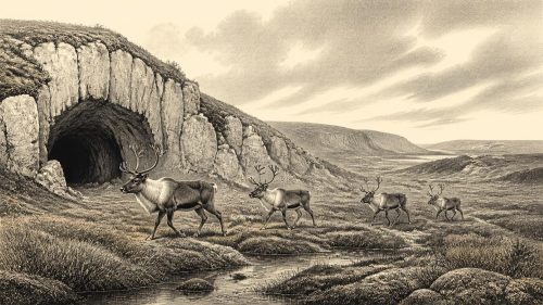
Castlepook Cave near Doneraile, County Cork, contains a reindeer femur whose deep mark may represent Ireland’s earliest evidence of human activity, perhaps from stone-tool butchery around 33,800 years ago. The date is a broad Late Pleistocene MIS 3 estimate, not a precise annual event, and bone dating records animal death rather than human handling. Excavated deposits were disturbed and include scavenger-accumulated fauna, limiting conclusions. Mammoth, reindeer, giant deer and carnivores indicate cold, open, intermittently habitable landscapes and changing access routes. The find suggests possible brief forager presence, but proves neither settlement, culture, identity nor permanent occupation in Ice Age Ireland.
Read Article

Archived: 9 September 2026
Abstract
Around 31,900 BCE, Ireland’s history is reconstructed from environmental rather than written evidence. Freshwater silts at Derryvree, County Fermanagh, dated broadly to 36,900–31,700 calibrated years BP, preserve a cold, treeless wetland of grasses, sedges, herbs and mosses between glacial deposits. Greenagho confirms earlier ice-free intervals, while ice-sheet growth and retreat made conditions regionally variable. Castlepook Cave, County Cork, contains cold-stage fauna, though deposits span periods and dating remains uncertain. A cut-marked reindeer bone may indicate early human visits, but no secure evidence demonstrates permanent settlement. Glaciers later destroyed or buried evidence, leaving fragmentary records of Ireland’s changing Ice Age landscape.
Read Article

Archived: 9 September 2026
Abstract
At roughly 31,931 BCE, Ireland lay in the climatically unstable Late Pleistocene, before the maximum extent of the last British–Irish Ice Sheet. Its cold, changing landscapes probably included open grassland, tundra, bare ground and restricted woodland, supporting mammals such as reindeer, mammoth, giant deer, bears, wolves, hyaenas and Arctic foxes. Castlepook Cave, County Cork, preserves crucial but imperfect faunal evidence. A reindeer femur reportedly bears a stone-tool cut mark, suggesting possible human butchery around 31,000 BCE. However, disturbed old deposits and the absence of settlements preclude claims of permanent occupation. Later glaciation and rising seas obscured sites; research remains necessary.
Read Article

Archived: 9 September 2026
Abstract
Around 31,932 BCE, Ireland lay in a cold, unstable pre-Last Glacial Maximum environment as the British–Irish Ice Sheet expanded. Precise annual dating is impossible; evidence derives from radiocarbon-dated cave fauna and reconstructions. Castlepook Cave, County Cork, preserved remains including mammoth, reindeer, giant deer, bear, wolf, Arctic fox, lemmings and hyaena, indicating intermittently habitable open terrain. A reindeer bone may bear stone-tool marks and date to about 33,000 years ago, suggesting a possible human visit. However, disturbed old collections and uncertain context prevent proof of occupation. Later glaciation erased much evidence, while modern re-dating and excavation continue refining Ireland's Palaeolithic record.
Read Article

Archived: 9 September 2026
Abstract
31,933 BCE is an artificial label for a period near the onset of the last Irish Ice Sheet's expansion, rather than a datable event. Ireland experienced uneven cooling, changing coastlines and glaciated landscapes, while maximum ice extent followed later. Buried sediments in Fermanagh indicate areas remained ice-free until roughly 34,000 years ago. Castlepook Cave, Cork, preserves remains of mammoth, giant deer, reindeer, bear, hyaena and Ice Age animals, demonstrating open habitats and food webs. A possibly butchered reindeer bone suggests, but does not prove, human visits. No evidence establishes settlement, society or political history; environmental change dominates the fragile record.
Read Article
Archived: 9 September 2026
Abstract
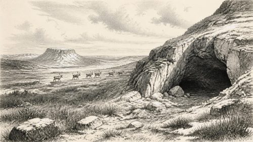
About 34,000 years before present, Ireland experienced cold, unstable Marine Isotope Stage 3 conditions as the British–Irish Ice Sheet began expanding. Deposits at Derryvree and Greenagho indicate north-central areas remained ice-free until roughly this period, although local glaciers and periglacial processes occurred. Open tundra-like habitats supported reindeer, giant deer, spotted hyaenas, bears and other fauna, evidenced especially at Castlepook Cave. A marked reindeer bone may indicate brief Upper Palaeolithic butchery, but cannot prove permanent human occupation. No settled communities or political institutions are evidenced. Changing coastlines, glaciation and disturbed deposits obscure evidence, leaving animal life and possible mobile human visits.
Read Article

Archived: 8 September 2026
Abstract
Ireland around 31,957 BCE lay within Marine Isotope Stage 3, a cold, changing Late Pleistocene period lacking written history or proven settlement. Castlepook Cave in County Cork yielded reindeer and other cold-stage fauna. A marked reindeer femur, interpreted as stone-tool butchery, may indicate brief human presence, but lacks securely associated tools or occupation evidence. Radiocarbon dates require calibration and cannot establish an exact year. Cave deposits were disturbed, while later glaciers erased or rearranged much evidence. Growing ice eventually covered Ireland at the Last Glacial Maximum. The find suggests possible early, discontinuous contact, but future excavation and dating remain necessary.
Read Article

Archived: 8 September 2026
Abstract
Around 31,964 BCE, Ireland lay on Europe’s north-western fringe during Marine Isotope Stage 3, before the Last Glacial Maximum. Castlepook Cave in County Cork preserved remains of mammoth, reindeer, giant deer, bear and hyaena, demonstrating intermittent Late Pleistocene ecological connections despite uncertain routes across changing seas and ice. A reindeer femur reportedly dated about 31,000 BCE bears marks potentially made by stone tools, suggesting human carcass processing. However, mixed cave deposits and absent associated artefacts prevent confirmation. Open steppe-tundra supported diverse fauna, but advancing ice later erased evidence. The human presence remains unproven, while climate and shifting coastlines governed survival.
Read Article
Archived: 8 September 2026
Abstract
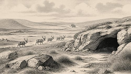
About 31,970 BCE, Ireland lay in the unstable later Marine Isotope Stage 3, with advancing but uneven ice cover, lower sea levels and changing routes for animals. Castlepook Cave, County Cork, preserves over 2,000 vertebrate remains, including mammoth, reindeer, giant deer, bear and hyaena, indicating open, varied cold-climate habitats. Cave processes, water disturbance and old excavations complicate interpretation, however. No dated human settlement, tools or burial belongs to this period. A possibly butchered reindeer bone suggests a tentative Upper Palaeolithic visit, but requires further testing. Later glaciation destroyed much evidence; future dating, DNA and offshore research may refine Ireland’s history.
Read Article

Archived: 8 September 2026
Abstract
Around 31,972 BCE, approximately 33,900 cal BP, Ireland lay in the later Marine Isotope Stage 3, as climate deteriorated before the Last Glacial Maximum. Lower sea levels altered coasts and potential connections with Britain and Europe, while open tundra-steppe supported diverse Ice Age fauna. Castlepook Cave preserves remains including mammoth, giant deer, reindeer, hyaena and Arctic fox, though redeposition and revised dating prevent precise reconstruction. No securely dated human site exists from this period. Possible cut marks on a Castlepook reindeer bone may indicate an early visit, but remain unconfirmed. Later glaciation destroyed or obscured much evidence, leaving caves archives.
Read Article

Archived: 8 September 2026
Abstract
Around 34,000 years before 1950, conventionally rendered as 31,988 BCE, Ireland occupied a cold, open and environmentally variable Ice Age setting before the Last Glacial Maximum. Ice extent, vegetation, coastlines and routes from Britain remain uncertain. Castlepook Cave in County Cork preserves important, though poorly excavated and potentially disturbed, faunal remains, including reindeer, mammoth, giant deer, bear, wolves, hyaenas and lemmings. A dated reindeer femur bears a possible stone-tool butchery mark, suggesting early human visitation. However, no associated tools, hearths or settlements confirm occupation. Later glaciation and rising seas obscured evidence; Ireland's Palaeolithic human record remains unresolved and highly tentative.
Read Article

Archived: 8 September 2026
Abstract
About 31,994 BCE, Ireland lay in the climatically unstable Late Pleistocene, before the Last Glacial Maximum. Expanding ice had not covered all regions: north-central and southern areas retained exposed ground, while low sea levels reshaped coasts. Castlepook Cave in County Cork preserves fauna including reindeer, mammoth, giant deer, predators and cold-adapted species, indicating open steppe-tundra habitats. A reindeer femur, dated near 31,000 BCE, bears a possible stone-tool butchery mark, but disturbed deposits and absent associated artefacts prevent confirmation of human occupation. Secure Irish human evidence is later. Glacial expansion subsequently shaped terrain, leaving this era ecologically significant yet archaeologically uncertain.
Read Article

