Guarded Waters
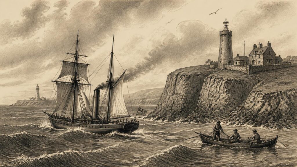
AI generated historical illustration, not a contemporary photograph.
At a Glance
Ireland’s security has always been shaped by the sea. Its long, indented coastline, position between Britain and the Atlantic, dependence upon ports and fisheries, and proximity to major northern sea routes made the surrounding waters both a resource and a recurring vulnerability. Yet ‘maritime security’ is a modern expression. Earlier generations spoke instead of defence, safe-conduct, piracy, wreck, smuggling, revenue, fisheries, invasion and the protection of trade. Their institutions were often improvised, divided between local communities and outside powers, and directed as much towards Britain or Europe as towards Ireland itself. The history of guarded Irish waters is consequently not a simple story of a national navy steadily growing stronger. It is a history of changing jurisdictions, uneven capacity and persistent local knowledge.
Sea Frontiers
An island’s coast is not naturally a frontier in the modern legal sense. For much of Irish history, the sea was a route before it was a boundary. People, livestock, fish, timber, pilgrims, merchants, soldiers and raiders crossed the narrow channels and wider Atlantic approaches with a regularity that makes a modern map of sovereign territory misleading. Communities on both shores of the Irish Sea, around the Hebrides, in western Britain and along the coasts of continental Europe participated in overlapping maritime worlds. Harbours such as Dublin, Waterford, Wexford, Cork, Galway and Carrickfergus were gateways, not merely defensive points. Smaller anchorages, islands and estuaries mattered too, because vessels required shelter, water, pilots, repair and provisions.
Security therefore involved more than warships. It depended on who could regulate a port, demand dues, compel labour, organise a watch, identify strangers, prosecute robbery, recover wreckage or summon armed men. It also depended upon environmental knowledge. A headland visible in clear weather, a sandbank shifting after winter storms, or a sheltered creek known to local boatmen could determine whether a ship arrived safely, escaped pursuit or came to grief. Such knowledge was valuable to fishermen and traders, but equally to smugglers, privateers and invading forces. The coast was a zone of opportunity precisely because authority there was often dispersed.
Documentary evidence is much richer for the medieval and early modern periods than for prehistoric Ireland. Archaeology establishes that coastal travel, fishing and exchange were long-standing features of life, but it cannot justify confident claims about a unified prehistoric system of maritime defence. Later origin stories sometimes project national fleets, coherent sea kings or permanent coastal guardians far back into the past. Those stories may preserve cultural memory, but they are not substitutes for evidence. The firmer historical record begins with evidence for seaborne settlement, trade, raiding and the growth of towns whose prosperity required some form of order at sea.
The central tension endured for centuries. The sea could connect Ireland to markets and allies, but the same waters enabled hostile landings and external intervention. A government which failed to control the approaches to a harbour could struggle to control the country behind it. Conversely, a government that held major ports might still lack the ships, money or local cooperation necessary to police the whole coast. Irish maritime security has repeatedly been decided in that gap between claims of jurisdiction and the practical ability to enforce them.
Medieval Waters
Viking Networks
The Viking Age brought this tension into unusually sharp relief. Scandinavian raiders first appeared in Irish annalistic records in the late eighth century, but their significance was not confined to sudden attacks on monasteries. Over time, raiding groups established seasonal bases, overwintering sites and urban settlements. Dublin, Waterford, Wexford, Cork and Limerick emerged within networks that linked Ireland to western Scotland, northern England, the Isle of Man, Scandinavia and the wider Atlantic world. Their ships were instruments of violence, commerce, migration and political communication at once.
To describe this period as a contest between an Irish land and foreign sea powers would be too crude. Norse and Norse-Gael groups became embedded in Irish politics, while Irish rulers used ships, coastal alliances and overseas connections for their own purposes. The control of rivers and estuaries was especially important: a fleet able to move along the Shannon, through Dublin Bay or into a southern harbour could transport fighting men and supplies faster than an army travelling over difficult roads. The security issue was not simply whether raiders could land, but whether coastal centres could be held, provisioned and incorporated into wider lordships.
Sources such as annals record fleets, burnings, captures and battles, yet they generally reflect the concerns of political and ecclesiastical observers rather than the daily experience of sailors. Archaeological finds and comparative studies of ships help fill part of that silence, but they do not produce a complete operational history. What can safely be said is that maritime power became inseparable from urban power. Dublin’s capacity to receive shipping, levy dues and sustain rulers gave it a strategic importance that survived the Viking age itself.
Later folklore has sometimes made every coastal fort, cave or unusual rock a Viking lookout or hiding place. Some traditions may have a basis in genuine memory, but many are impossible to date and should be treated cautiously. The durable historical lesson is less romantic: coastal security required access to people with seafaring skills, command of landing places, and reliable intelligence about movements across the water.
Island Lordships
Medieval Ireland remained politically plural. Gaelic lordships, Hiberno-Norman magnates, towns and ecclesiastical estates all possessed interests on the shore. In the west and north-west, maritime lordship could reach across channels and islands. The MacDonalds and other Hebridean dynasties operated within a Gaelic-Norse world in which galleys connected rather than separated territories. On the south-western seaboard, coastal lordships similarly relied on maritime access, fisheries and control of coves. Such power was not equivalent to a central navy; it was local, seasonal and personal. Nevertheless, it could obstruct rivals, carry tribute, facilitate alliances and threaten settlements.
The English colony centred on Dublin faced a distinct challenge. The Irish Sea was essential to communication with England, but it was also exposed to Scottish enemies, pirates and the ambitions of regional magnates. During the Bruce invasion of Ireland, the failure to prevent Edward Bruce’s landing in 1315 demonstrated the strategic consequences of inadequate sea control. Contemporary royal planning envisaged fleets in the Irish Sea, yet finance, ships and manpower were unreliable. Records show orders to raise vessels and efforts to counter Scottish maritime operations, but also reveal how rapidly ambitious plans could be reduced by shortage of money.
Ports were therefore defended not only by walls and weapons but by commercial relationships. A town could supply vessels, pilots and credit; it could also resist demands which it regarded as ruinous. Maritime security was a bargaining process between Crown, magnates and civic communities. The legal category of piracy was itself unstable. A mariner attacking an enemy in wartime, a retainer enforcing a lord’s claim, a crew taking an unlicensed prize, and an outright robber might all be described differently depending on the allegiance of the complainant. The sea did not erase politics; it multiplied jurisdictions.
Late medieval evidence confirms that piracy and raiding were not marginal curiosities. Scottish, French, Castilian and Breton attackers, as well as Irish and Anglo-Irish actors, could prey on shipping and exposed coastal settlements. The celebrated 1453 seizure of Archbishop Michael Tregury during a Breton raid on Dublin Bay is documented in later historical tradition and discussed by modern scholarship, but it should not be used to imply permanent lawlessness. It is better understood as one striking episode within a pattern of insecurity generated by war, trade and weak enforcement.
Royal Admiralty
Tudor Control
The Tudor expansion of English authority in Ireland altered the language and machinery of maritime control. The Crown’s priorities were twofold. One was strategic: preventing hostile powers, above all France and Spain, from using Irish harbours or landing forces. The other was legal and administrative: establishing a maritime jurisdiction capable of dealing with crimes, prizes, wrecks, wages, salvage and disputes arising from seafaring. John C. Appleby and Mary O’Dowd’s study of the Irish admiralty makes clear that these functions did not form a fully autonomous Irish naval system. Defence of the waters around Ireland was normally directed from the admiralty establishment in London because Irish waters were regarded as integral to the security of England as well.
This was an important constitutional fact. A Lord Admiral for Ireland, admiralty courts and commissions could exercise or claim authority, but the ships most capable of confronting an external enemy remained part of a larger English, later British, naval system. The distinction matters because it explains a recurring pattern in Irish history: ports and coasts were strategically important, while decisions about naval force were commonly made elsewhere. Local office-holders might issue warrants, investigate wrecks or hear maritime causes, but they did not necessarily command sufficient ships to enforce order beyond harbour waters.
The growth of admiralty jurisdiction did, however, make the sea more governable on paper. The law maritime handled disputes that ordinary local courts could struggle to resolve: collisions, contracts made aboard vessels, sailors’ pay, prizes and acts of robbery committed beyond the shore. In practice, access to justice remained uneven. Witnesses were mobile, ships disappeared, crews came from several jurisdictions and powerful patrons could shield offenders. The creation of procedure did not eliminate violence, but it supplied a framework through which authorities could identify some acts as piracy rather than legitimate warfare.
English campaigns in Ireland also emphasised the strategic value of harbours. Troops, artillery, food and money crossed the Irish Sea; any interruption exposed the fragility of operations on land. The fear that a foreign expedition might exploit Irish discontent encouraged attention to anchorages, fortified towns and intelligence. Yet the Crown’s ability to make coastal policy was constrained by the expense of ships and the difficulty of sustaining garrisons. Maritime security, as elsewhere in the Tudor state, was an aspiration requiring local cooperation and constant funding.
Privateering Perils
The sixteenth and seventeenth centuries blurred the boundary between public war and private profit. Privateering offered governments a cheaper means of attacking enemy trade: privately owned ships could be authorised by commissions to seize enemy vessels and bring prizes before admiralty jurisdiction. But a commission did not make every capture legitimate, and the distinction between a privateer, a pirate and a politically useful irregular could be hard to maintain. Irish harbours could provide refuge, markets and information to mariners whose loyalties were contingent.
War made Ireland’s western and southern ports especially sensitive. Spanish intervention during the Nine Years’ War and the disaster of the Spanish Armada in 1588 demonstrated that Atlantic weather, local assistance and political allegiance could influence events as much as formal strategy. The Armada wrecks off the Irish and Scottish coasts were a humanitarian catastrophe and a security crisis; survivors encountered responses ranging from assistance to capture and execution. Modern scholarship cautions against reducing these responses to a single national attitude. Local circumstances, official orders, fear of invasion and the position of individual communities all mattered.
In the wars of the 1640s and early 1650s, Irish waters became a theatre of sustained conflict. Confederate and royalist ports, parliamentary squadrons, foreign privateers and merchant shipping all became entangled. Elaine Murphy’s research shows both the scale of prize-taking and the brutal treatment sometimes inflicted upon prisoners at sea. It also demonstrates that Irish maritime conflict cannot be treated as a minor naval appendix to land campaigns. Blockade, convoy, interception and the availability of secure harbours influenced the ability of competing forces to obtain arms, recruits, provisions and diplomatic support.
Parliamentarian sea power became decisive after 1649. Warships helped isolate coastal towns, escort supplies and restrict the movement of hostile vessels. Convoys mitigated the threat from privateers, while the capture or neutralisation of ports narrowed the Confederates’ options. The surrender of Galway in 1652 and the eventual reduction of remaining maritime outposts marked the collapse of organised resistance at sea. This was not simply a story of superior ships defeating inferior ones. It was the integration of naval patrols with siege warfare, supply systems and political control on shore that made the difference.
Imperial Watch
Harbour Defences
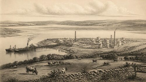
Following the Williamite wars and the consolidation of British rule, Ireland’s coast became part of an imperial defensive system. The principal danger was no longer local maritime lordship but invasion or disruption by Britain’s European rivals. Cork Harbour, particularly the anchorage at Haulbowline and the town later known as Queenstown or Cobh, acquired enduring importance. Its deep, sheltered waters could receive warships and merchant convoys, while its position on the south coast faced the Atlantic approaches and routes to Britain.
Fortifications materialised this strategic thinking. Batteries, forts and later more elaborate artillery works sought to deny an enemy easy access to major harbours. They were never invulnerable barriers. A fort required trained gunners, supplies, maintenance and a chain of communication with other authorities. Nor did defence begin at the fort’s wall. Naval patrols, pilots, signal stations, local reports and commercial intelligence all contributed to an understanding of approaching danger. Even a powerful harbour could be compromised if its outer approaches were not watched.
The eighteenth century also reveals the difference between protecting the island and protecting an empire. Irish ports supplied naval and merchant activity across the Atlantic world, while Irish seamen served in the Royal Navy and merchant marine. The benefits and burdens were unevenly distributed. Naval impressment, wartime disruption and the demands of imperial commerce could weigh heavily on coastal populations. It would be mistaken, therefore, to portray imperial maritime security as a wholly Irish public good. It secured British strategic interests, within which Ireland had a consequential but subordinate place.
Smuggling exposed another limitation. High duties on goods such as spirits, tobacco, tea and textiles made illicit landing profitable. The very geography that sheltered fishing boats could conceal contraband. Local participation was often essential: goods needed storage, transport, buyers and silence. Government patrols and customs officers could seize cargoes, but a coastline of this scale could not be sealed. Smuggling was not merely criminal opportunism; it reflected taxation, consumption, social ties and the continuing capacity of coastal communities to use geography against central authority.
Revenue Patrols
The nineteenth-century coastguard was among the most visible efforts to make the coast legible to the state. It should not be confused with the modern Irish Coast Guard, whose principal purpose is maritime safety and rescue. The British coastguard developed from anti-smuggling arrangements and, over time, became closely connected with naval reserve and coastal observation. Stations were distributed around the island, often in exposed settings near small harbours and landing places. Their personnel watched shipping, reported irregular activity and stood ready, in theory, to contribute to national defence.
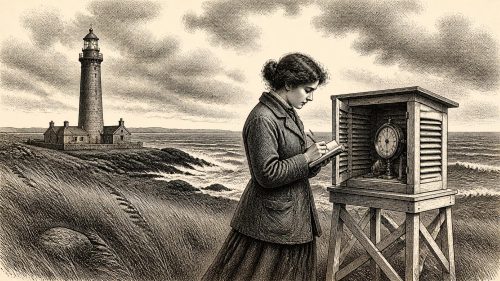
The station houses that survive in some places are historical evidence of this system’s reach. They also reveal its limits. A small detachment, often living with families in an isolated building, could observe and report, but it could not dominate a whole district. Its effectiveness rested on communications, the willingness of local people to provide information, and the prospect that naval or military assistance could arrive. Anti-smuggling duty made coastguards unpopular in some communities; their association with the British state also gave them political significance far beyond their numbers.
Technological change expanded surveillance. Telegraphy, lighthouses, lifeboat services, improved charts and later wireless communications altered what authorities could know and how quickly they could respond. These were not purely military developments. The Commissioners of Irish Lights, port authorities, customs, the Royal Navy and commercial shipping all had different responsibilities, yet their infrastructure could overlap. Navigation aids reduced shipwreck risk while also making routes more predictable; telegraph cables accelerated commercial information while enabling military reporting.
By the First World War, Ireland’s strategic location in the Atlantic assumed an intensity unmatched since the seventeenth century. German submarine warfare threatened transatlantic and British supply routes. Queenstown became a major base for Allied anti-submarine operations, including United States Navy destroyers after American entry into the war. Convoy systems, patrol craft, intelligence and the co-operation of merchant vessels transformed the coastal war. The United States Navy’s experience at Queenstown became an important chapter in its own institutional memory, but it also underlines how Irish harbours served a wider Allied maritime system rather than an independent Irish policy.
Revolutionary Coast
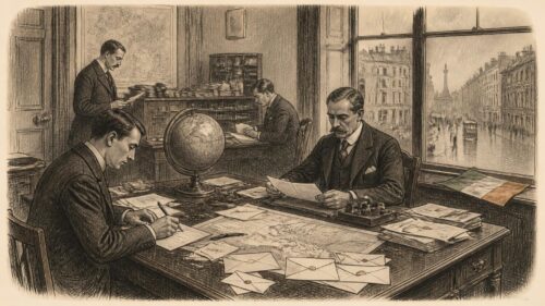
The revolutionary years after 1916 brought the inherited coastal security apparatus into direct conflict with Irish independence politics. The coastguard was then a branch of the Admiralty and a naval reserve. During the War of Independence it possessed an extensive network of stations, signal posts, radio facilities and associated communications around the coast. In practical terms, this made it an intelligence system. Coastguards could observe vessels and unfamiliar movements, while lighthouses, cable stations and commercial radio sites formed parts of a wider infrastructure vital to administration and naval operations.
That visibility made isolated stations targets. The historical record shows attacks, disarmings and burnings of coastguard premises, often motivated by the desire to obtain weapons and deny the British authorities useful observation posts. These operations were not simply assaults on buildings. They were contests over information and communications. Yet the human reality deserves emphasis: coastguard families lived in many of these small stations, and raids placed civilians as well as servicemen in danger. Accounts of individual incidents must be read carefully, since later memory can heighten drama or obscure the local context.
The Royal Navy retained overwhelming superiority at sea. Its vessels supported civil and military authorities, guarded installations, transported personnel and maintained a presence at vulnerable ports. The imbalance helps explain why republican activity focused on facilities ashore and on opportunities to seize arms rather than on an attempt to contest control of the sea directly. The Irish coast was, in this period, closely watched, but watching did not equal total control. The length of the coast and the number of inlets still enabled clandestine movement, particularly where local knowledge and sympathetic contacts existed.
The Anglo-Irish Treaty of December 1921 left maritime questions politically charged. Britain retained the Treaty Ports at Berehaven, Queenstown and Lough Swilly, reflecting imperial concern over Atlantic defence and naval access. The Irish Free State inherited limited means, and the treaty restrictions constrained the creation of a navy. Its early maritime arrangements concentrated on practical necessities such as harbour control, minesweeping and fisheries rather than the creation of a fleet capable of independent sea defence. The transfer of the Haulbowline dockyard in 1923 was symbolically important, but it did not by itself resolve the disparity between Ireland’s coastline and its resources.
The Civil War again demonstrated that sea transport could shape events on land. National Army movements by ship enabled landings and rapid redeployment along the coast, including the 1922 operation into Clew Bay. These were improvised uses of civilian or adapted vessels rather than evidence of a mature national naval arm. The episode nevertheless shows why maritime history should not be separated from the history of state formation. Possession of a port, a vessel or reliable sea passage could alter the tempo of a campaign.
Neutral Vigil
Coastal Intelligence
The return of the Treaty Ports to Irish control in 1938 enlarged the State’s responsibility at precisely the moment European war was approaching. When the Second World War began in September 1939, Ireland declared neutrality. Neutrality did not abolish danger. It required the State to assert jurisdiction over territorial waters, regulate belligerent activity, watch for invasion, protect shipping where possible and manage incidents involving mines, wrecks, aircraft and survivors. These were formidable demands for a young state with limited naval resources.
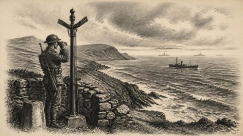
The Coastwatching Service became a central answer. Lookout posts were established around the coast, manned by personnel who recorded ships and aircraft, estimated direction and distance, and sent observations by telephone to headquarters. Sources differ slightly over the number of posts at particular stages, partly because the system developed during the Emergency, but the broad picture is secure: a national chain of concrete observation posts, staffed by several hundred men, gave the Defence Forces a continuous if basic picture of activity off the coast. The surviving logbooks in the Military Archives show the disciplined routine of observations, weather notes and reports.
These records are valuable precisely because they temper retrospective myth. The coastwatchers were not an all-seeing force and could not identify every vessel or aircraft in poor visibility. Their stations were unarmed, and their communications could be fragile. Nor did their existence mean that neutral Ireland could defeat a major naval power. What they supplied was localised maritime and aerial intelligence, a warning system and a means of asserting that the State was observing events in its own waters. In a period of uncertainty, even partial knowledge had strategic value.
Wartime memory has sometimes converted every lookout post into a site of espionage or secret Allied co-operation. There were important contacts and intelligence exchanges involving Ireland and the Allied powers, but each claim should be distinguished from the official function of the service. The documentary evidence supports a more sober conclusion: the posts watched, recorded and reported; their information formed one element in the State’s wider defence and neutrality arrangements. The men who staffed them confronted cold, monotony and occasional danger rather than the romance often added later.
Marine Beginnings
At sea, the State’s initial capacity was modest. The wartime Marine Service emerged from the Marine and Coastwatching Service and was given a statutory footing in 1940. It drew upon fisheries protection vessels, motor torpedo boats and personnel recruited for emergency duties. The service had to undertake patrol, port control and examination functions in waters affected by mines, submarine warfare and the movement of belligerent shipping. A Maritime Inscription reserve at Dublin Port assisted with port-control and examination work, while arrangements existed in other ports.
Its limitations should be stated plainly. Motor torpedo boats were not ocean-going substitutes for destroyers or frigates, and the former fisheries patrol vessels had restricted military capacity. During the Emergency, defending the entire Irish maritime area against a determined attack was beyond the State’s means. Ireland’s survival did not rest upon naval strength alone; geography, diplomatic calculation, British strategic interests, Allied sea power and the course of the wider war all mattered. To acknowledge this is not to diminish the service of Marine Service personnel. Their work represented a serious attempt to provide a national maritime presence where none had existed before.
The war also exposed a broader definition of security. Mines threatened fishermen and merchantmen; survivors of sinkings could arrive on remote coasts; neutral shipping required identification and regulation; ports had to manage traffic without becoming belligerent bases. Security was therefore not simply a question of fighting. It involved rescue, reporting, navigation, harbour administration and the legal obligations of neutrality. This wider understanding would remain important after 1945.
National Service
Permanent Fleet
In 1946 the State established a permanent Naval Service. The distinction from the wartime Marine Service is historically important. The new organisation acquired three former British Flower-class corvettes, subsequently commissioned as L.E. Macha, L.E. Maev and L.E. Cliona. These were seagoing ships capable of operating beyond the restricted coastal role that had constrained the motor torpedo boats. Their acquisition did not create a navy comparable with those of larger states, but it gave Ireland a durable maritime arm and a basis for training, doctrine and institutional continuity.
Haulbowline in Cork Harbour became the Naval Service’s home. The choice was logical: the former dockyard already embodied the layered history of British imperial maritime power, Treaty restrictions, transfer and Irish state ownership. At Haulbowline, a small service had to develop engineering, logistics, communications, seamanship, command structures and personnel systems. Such unglamorous work is often absent from popular narratives, yet it is what enables a ship to sail, remain at sea and act lawfully on behalf of a state.
Public ceremonial occasionally made the new service visible. L.E. Macha’s voyage in 1948 to return W. B. Yeats’s remains from France combined naval capability with cultural symbolism. It was not a security operation, but it demonstrated that Irish naval vessels could undertake an extended foreign passage under national colours. More routinely, patrols, training and support to civil authorities established the ordinary pattern of peacetime maritime presence. The historical significance lay in permanence: the State now possessed an institution whose purpose was not limited to a single emergency.
The Service nevertheless developed within tight financial and political constraints. Neutrality and non-alignment did not remove the need for maritime capability, but they shaped its scale and public justification. A small naval force was expected to protect sovereignty, assist civil power and enforce law rather than project force overseas. That emphasis helps explain why fisheries protection became central to its identity.
Economic Frontiers
Fisheries protection may appear less dramatic than defence against invasion, but it is a core form of maritime security. Fish stocks are mobile, commercially valuable and vulnerable to over-exploitation. Enforcement requires the capacity to board vessels, inspect catches and gear, establish position, gather evidence and operate in difficult weather. Ireland’s extensive maritime interests made this an important state function long before contemporary discussion of the blue economy or exclusive economic zones.
European integration transformed the framework. Membership of the European Economic Community from 1973 placed Irish fisheries within the Common Fisheries Policy, bringing both opportunities and disputes over access, quotas and enforcement. The Naval Service increasingly operated as a sea-going enforcement agency alongside fisheries authorities, while surveillance and monitoring became more technologically sophisticated. Its work illustrates an enduring truth: economic jurisdiction at sea is meaningful only when a state can observe activity and enforce rules.
The legal framework of maritime jurisdiction also developed. Modern Ireland claims rights and responsibilities under the law of the sea, including territorial waters and rights over maritime zones for resources and other purposes. These concepts are far more precise than the contested seaward claims of earlier centuries, but they do not make enforcement automatic. A legal boundary on a chart requires vessels, aircraft, communications systems, intelligence and co-operation with other agencies if it is to have practical effect.
The contemporary Naval Service’s tasks have therefore extended beyond fisheries. It supports the Gardaí, Revenue Commissioners and other public bodies; it contributes to search and rescue and pollution-related responses; and it works within European and international frameworks. Its principal historical identity, however, remains that of the State’s sea-going service. In this it differs from the Irish Coast Guard, whose modern role centres on maritime safety, co-ordination and rescue. Confusing the two obscures the division of labour built over decades.
Modern Mandate
In the twenty-first century, maritime security has acquired new vocabulary: maritime domain awareness, critical infrastructure, cyber resilience, undersea cables, environmental protection and transnational crime. These terms are new, but their underlying concerns are recognisable. Who is operating off the coast? What is entering or leaving a port? Which routes, communications and resources are exposed? How quickly can the State distinguish routine activity from danger? The coastwatcher’s notebook, the coastguard signal, the admiralty court and the patrol vessel all belong to the longer history of answering those questions.
Ireland’s first National Maritime Security Strategy, published in 2026, formally presents the protection of sovereign maritime interests, secure seas and international law as connected objectives. Its publication marks an administrative milestone rather than the beginning of Irish maritime security. The strategy belongs to a lineage stretching through wartime observation, fisheries enforcement, harbour defence and the older legal regulation of maritime activity. What has changed is the recognition that security includes data, infrastructure and inter-agency coordination as well as ships and coastal fortifications.
There are also hard continuities. Ireland remains dependent on sea-borne trade and on cables and energy infrastructure crossing or approaching its maritime space. It still has a large area of maritime interest in relation to the size of its population and naval establishment. It still relies partly on partnership, international law and the presence of friendly states, just as earlier governments relied on imperial fleets or Allied convoy systems. Independence has altered the authority in whose name security is exercised; it has not abolished geographic constraint.
Historical interpretation should avoid two opposite errors. One is to claim that Ireland was perpetually defenceless until the creation of a national naval service. Communities, ports and successive governments did develop practices of observation, defence and regulation. The other is to exaggerate those practices into seamless control. The evidence instead shows a recurring mismatch between the scale of the sea and the instruments available to those charged with policing it. Maritime security was usually partial, contingent and negotiated.
Historical Lessons
The history of Ireland’s guarded waters is best understood as the history of a maritime society repeatedly drawn into larger strategic systems. Viking fleets, medieval Scottish expeditions, Tudor anxieties, privateering wars, British imperial defence, American destroyers at Queenstown, neutral observation during the Emergency and European fisheries enforcement all placed Ireland within networks extending beyond the island. Irish agency mattered, but it operated amid asymmetries of power. Ports could be valuable precisely because other states needed them.
Documented evidence gives a clear chronology of institutions: medieval fleets and port communities; Tudor admiralty jurisdiction; seventeenth-century patrol and convoy warfare; British coastguard and harbour systems; revolutionary attacks on coastal intelligence infrastructure; the Emergency’s Coastwatching and Marine Services; and the permanent Naval Service after 1946. Interpretation is needed to connect these episodes, but it should remain proportionate. The strongest interpretation is that maritime security in Ireland has never been exclusively military. It has combined law, trade, fisheries, communications, safety, intelligence and the ability to make a presence felt.
Folklore and memory retain a place in this story, especially in coastal communities where shipwrecks, smugglers, Armada survivors and wartime sightings have generated powerful narratives. Such traditions may illuminate how people understood danger and opportunity. They should not, however, be treated as proof without corroboration. The sea has a particular capacity to produce stories: ships vanish, wrecks shift, distant lights invite explanation and local landmarks acquire names. Historical discipline requires separating those stories from what documents, archaeology and contemporary testimony can establish.
Ultimately, Ireland’s maritime past does not offer a simple prescription for the future. It does show why the sea cannot be treated as empty space beyond the land. It is an arena of jurisdiction, livelihood and risk. From a medieval harbour watch to a modern surveillance system, the purpose has been broadly consistent: to know what is happening over the horizon, to preserve lawful access to the waters on which the island depends, and to ensure that the approaches to Ireland are not left entirely to others.