

Waterborne Ireland
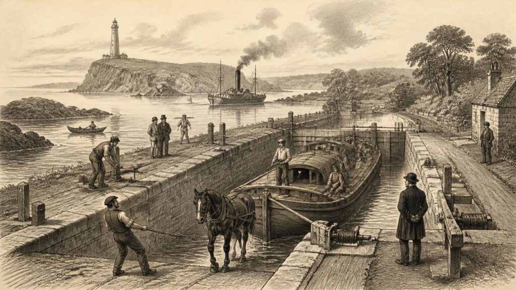
AI generated historical illustration, not a contemporary photograph.
At a Glance
Water Knowledge
Navigation in Ireland was never merely the art of steering a vessel from one point to another. It was a body of local knowledge: of tides, currents, shoals, river levels, weather, landmarks, seasons and safe shelter. It was also an organised public service, gradually expressed in charts, harbours, locks, canal cuttings, buoys, lighthouses and rules. Across many centuries, Ireland’s surrounding sea and inland waters were not simply borders. They were thoroughfares, food sources, workplaces and, at times, dangerous routes of invasion, migration and escape.
The island’s geography made this inevitable. Ireland has a deeply indented coast, many estuaries and bays, large inland lakes, and river systems that penetrate far into the interior. The Shannon, Barrow, Suir, Nore, Erne, Boyne, Liffey and Blackwater, among others, offered possibilities for movement that land travel could not always match. Before the modern road network, a boat carrying people, grain, turf, timber, cattle, stone, barrels or fish could often move more efficiently than a cart over poor roads. Yet water was never an effortless highway. A river could be too shallow in summer, too swift in flood, interrupted by weirs, narrowed by bends or blocked by mills. A harbour could become inaccessible with a changing tide. The sea demanded decisions based on wind, swell and visibility.
For that reason, Irish navigation should be understood as a history of adaptation. People adjusted their craft to particular waters: skin boats and currachs in exposed western seas, flat-bottomed cots and punts on rivers, sailing vessels in estuaries, and barges on engineered canals. They learned to read a landscape from the water. A headland, church tower, island, hill, beacon or colour of cliff could become a navigational mark. In shallow channels, knowledge might be held by pilots and fishermen rather than written in books. In the nineteenth century, that experience increasingly met formal science and state-backed engineering, but it did not cease to matter.
The evidence for this long history comes in different forms and needs to be handled accordingly. Archaeological remains can establish that boats, waterside structures or fishing installations existed, although they may not tell us precisely how far a craft travelled. Written records can document grants, tolls, harbour works, cargoes and official decisions, but tend to preserve the concerns of owners and administrators more readily than those of labourers or crews. Folklore and voyage tales preserve powerful memories and ideas about water, but cannot automatically be treated as factual sailing reports. The distinction is particularly important in Ireland, where practical seafaring, religious imagination and national legend have often been closely intertwined.
Material Traces
Human engagement with Irish waters reaches far beyond surviving written history. Archaeology demonstrates that rivers, lakes and coasts supported intensive activity in prehistoric Ireland, though it is prudent not to turn every find into evidence for long-distance voyaging. Timber survives especially well in wet ground, peat and silt, giving modern researchers rare glimpses of watercraft and waterside labour. The great hollowed-oak logboat from Lurgan townland in County Galway, preserved in the National Museum of Ireland, is among the most striking objects. Its scale shows that people could fell, shape and manage an exceptionally large tree for use on water. Its condition and construction have prompted debate about its intended function and whether it was completed. Those questions are reminders that an excavated boat is evidence of technological capacity, not a complete itinerary.
Other discoveries point to an older, wider water-world. The submerged fish traps found in the Liffey estuary show a community making elaborate use of tidal conditions, timber and woven materials. Such structures reveal close observation of water movement: fish had to be anticipated, channelled and caught as tides rose and fell. They do not prove that those fishers crossed open seas, but they demonstrate sophisticated environmental knowledge at an estuarine edge. The same care is needed with coastal distributions of stone, metal and pottery. They may suggest exchange by water, especially where sea passages are shorter or easier than overland routes, but the means and frequency of travel remain matters for interpretation.
The archaeological record also warns against a simple contrast between an ancient inland Ireland and a later maritime Ireland. Rivers and coastal margins were joined systems. A boat could carry a catch from a tidal estuary upriver; goods arriving by sea could pass into a river valley; lake shores could be places of landing, settlement and exchange. The practical divide was often not between land and water, but between waters that could be known and worked safely and those that could not. Seasonal rhythms mattered. A route possible in calm weather could be perilous during an Atlantic storm or impossible after prolonged drought.
Traditional craft help to explain, though not reconstruct exactly, this relationship with local waters. The National Museum of Ireland’s folklife collections preserve currachs, coracles, cots and other vernacular boats from diverse districts. Their variety is historically significant. It suggests that boat building was not one uniform Irish tradition but a series of regional solutions to different coasts, estuaries and rivers. A lightweight skin boat had advantages where a crew needed to launch from a rough shore or carry a craft above the tide; a broad river boat answered other needs. Such later examples cannot simply be projected backwards into remote prehistory, but they show how durable practical knowledge could be when communities depended on water.
Sea Roads
By the early medieval period, Ireland was linked to Britain, western Europe and the Atlantic archipelagos by sea routes that carried people as well as goods. The sea was hazardous, but it was not an empty void beyond a settled island. It formed a connective zone. Clerics, scholars, raiders, traders, captives and migrants moved within and across it. Written sources and archaeological evidence alike indicate contacts with the western coasts of Britain and with continental Europe. Imported materials found in Ireland, and evidence for Irish people abroad, show that the island participated in wider networks even where the surviving documentary record is thin.
It is difficult to identify the exact capabilities of every early Irish vessel. Organic boats rarely survive, and literary descriptions may be stylised. Nevertheless, early medieval sources refer to ships, crews and maritime travel often enough to make it untenable to imagine a society without competent seafaring. The UCD and Queen’s University Belfast study of the early medieval economy draws attention to references to an Irish ship in continental material and cautions against assuming that Irish communities were merely passive recipients of visiting merchants. That is an important corrective. Ireland’s maritime history cannot be reduced to foreigners arriving at its shores; Irish people also possessed skills, vessels and motives to travel outward.
Navigation at this stage relied principally on accumulated observation. Mariners could use the sun, stars, wind direction, flight of birds, colour and motion of water, coastal profiles and knowledge passed between experienced crews. None of this should be romanticised as infallible instinct. It was hard-won, revisable expertise exercised under uncertainty. Open-water crossings depended on a favourable combination of weather, vessel, provisions and crew. Coastal travel offered more landmarks and opportunities for shelter, yet introduced reefs, headlands and powerful tidal races. The safe passage was not always the shortest line on a modern map.
Monastic sites on islands and coasts occupy an important place in this story. Their locations reflected religious aspirations, but also access. Islands offered seclusion without complete isolation, while coastal monasteries could receive travellers and goods. The very movement of books, ideas and people associated with Irish Christianity presupposes maritime connections. It does not follow that every famous monastic voyage account records a literal expedition. Rather, the documented circulation of people and learning provides the practical context in which such stories could be imagined, written, copied and believed meaningful.
Saintly Voyages
No Irish maritime story is more famous than that of Saint Brendan. The Latin Navigatio Sancti Brendani, together with Irish voyage literature, has encouraged generations of readers to picture monks crossing the Atlantic in small hide-covered boats. The tale’s islands, marvels, sea creatures and spiritual trials are memorable precisely because they combine seafaring detail with wonder. But historical method requires a distinction between cultural significance and literal verification. The text is a work of religious and literary imagination, transmitted in many copies and widely read in medieval Europe. It is not a chart, a ship’s journal or an eyewitness record in the modern sense.
The importance of Brendan’s voyage lies partly in what it says about the sea in the Irish and European imagination. Water is a testing place: an unstable threshold between the known Christian world and regions of divine mystery. Islands become stages for discipline, temptation, hospitality and revelation. The voyage’s narrative plausibility depends upon familiar maritime experience, but its purpose is theological and moral. Its marvellous geography should therefore not be mined selectively for proof of particular Atlantic landfalls. Claims that Brendan definitively reached North America go beyond the evidence available in the medieval text.
This does not make the story historically worthless. On the contrary, it records how strongly seafaring mattered in a society where islands, channels and Atlantic horizons were lived realities. The tale’s repeated concern with provisioning, storms, landfall and fellowship at sea suggests an audience acquainted with the practical stakes of travel. Yet literary convention is always present. A monk’s voyage, like a pilgrimage, was also an inward journey. The sea could be both a physical medium and a symbol of spiritual uncertainty.
Folklore surrounding other holy wells, islands, saints and sea crossings should be approached in the same way. Local tradition may preserve place names, remembered hazards or a community’s attachment to a shore. It may also reshape events over centuries. Where a tradition can be compared with archaeology, contemporary documents or a securely dated building, historians can say more. Where that corroboration is absent, the responsible course is not dismissal but clear description: this is tradition, not demonstrated fact. Ireland’s water history is richer, not poorer, when folklore is allowed to speak in its own register.
Viking Harbours
The arrival and settlement of Scandinavian groups transformed navigation around Ireland from the late eighth century onward. Early raids brought the violence of seaborne attack to monasteries and coastal communities, but raiding was only one aspect of the change. Over time, Scandinavian and Hiberno-Scandinavian settlements developed into towns and trading centres, most notably Dublin, while Waterford, Wexford, Cork and Limerick also became deeply connected to maritime commerce. The Irish Sea became an artery joining Ireland, Britain, Scandinavia and routes extending towards the North Atlantic and continental Europe.
Dublin’s early Viking longphort, established in the ninth century, was a defensible waterside base rather than merely a fleeting camp. Its subsequent urban development demonstrates how control of a river mouth could turn maritime mobility into political and commercial power. The Liffey gave access inland, while Dublin Bay provided a point of arrival and departure. The city’s position was advantageous but not naturally perfect. Shoals, channels and tides required intimate knowledge, and later generations would spend vast sums altering the port and its approaches. The lesson is enduring: a harbour is not simply a geographical fact. It is a relationship between water, vessels, labour and maintenance.
Viking navigation has sometimes been represented as an almost mystical mastery of the northern seas. The reality was skilled but practical. Ships were designed for particular combinations of open sea, shallow water, beaching and river travel. Crews possessed knowledge of routes, seasonal winds and landmarks, and Scandinavian traditions of navigation were brought into contact with local Irish conditions. Irish communities were not passive spectators. They fought, traded, intermarried, negotiated and shared techniques with newcomers. The resulting Hiberno-Scandinavian world was hybrid in language, material culture and commerce.
Modern scholarship has rightly complicated a narrative focused entirely on raids. Trade, craft production, slavery, tribute and town formation all depended on waterborne connections. The sea could bring danger, but it also made towns prosperous and gave regional rulers access to wider markets. A vessel in an Irish harbour might be carrying luxury goods, salt, wine, metals, textiles, fish, hides or people. Navigation thus became inseparable from the political economy of medieval Ireland. Whoever secured a harbour, a river crossing or a fleet held an advantage that could be military, fiscal and social at once.
Medieval Gateways
After the Anglo-Norman invasion, water routes remained crucial to conquest, settlement and administration. Forces, supplies and settlers could arrive from Britain and Wales by sea, while rivers connected coastal landing places with inland lordships. Ports became gateways through which authority, commerce and law moved. The degree of control varied greatly across the island, and the documentary record is uneven, but surviving records of shipping, fisheries, customs and grants show that medieval maritime life was economically important as well as strategically useful.
The south-eastern coast illustrates the point. Waterford’s position on the Suir estuary and New Ross’s access to the Barrow and Nore made them significant ports. These were not isolated towns looking only towards the interior; they belonged to trading worlds that included Britain and continental Europe. The route up a tidal river, however, required careful navigation. Vessels had to judge tides and draught, and river traffic could be affected by changing channels, shoals and the competing needs of millers, fishers and landowners. A navigable waterway was always subject to negotiation as well as nature.
Hook Head offers a particularly durable symbol of this period. Irish Lights traces the present lighthouse’s origins to a tower ordered around 1207 by William Marshal to guide vessels towards New Ross, with monks associated with its early custodianship. The survival of the tower should not obscure the wider system of knowledge around it. A light marked danger and direction, but a mariner still needed a crew, a vessel suited to the passage, an understanding of tide and a destination harbour capable of receiving traffic. Medieval navigation was collaborative: the visible beacon relied upon people ashore, while its value was realised by people afloat.
Fishing likewise made navigation a daily necessity. Coastal communities did not simply launch into an undifferentiated sea; they worked named grounds, seasonal fisheries, landing places and local markets. Documentary sources are stronger for areas under English administration than for Gaelic lordships, a bias that historians must acknowledge. Even so, the evidence confirms that fisheries, shipping and port trade were integral to medieval life. The sea connected Ireland to external markets, but it also sustained small-scale local economies in which the ability to cross a bay, enter an estuary or return through a surf line could determine a household’s livelihood.
Imperial Charts
From the sixteenth century onward, navigation around Ireland increasingly entered the world of printed maps, state surveys and imperial maritime strategy. This did not replace local knowledge, but it changed who could claim authority over waters. Charts translated coasts into measured lines, soundings and named hazards. They supported naval operations, commercial shipping and the administrative ambitions of governments. Yet a chart was never a neutral mirror of the coast. It selected information for particular users and was only as reliable as its surveys, instruments and subsequent corrections.
Ireland’s waters were of particular importance to the expanding Atlantic traffic of the early modern period. Ships sailing between Britain, continental Europe, the Americas and the wider Atlantic encountered Ireland as a landfall, refuge, obstacle or staging point. The southern and western coasts could offer shelter, but they also posed dangers of rock, fog, gale and unfamiliar tide. The wrecks associated with the Spanish Armada remain the best-known reminder of those hazards. They should not be reduced to a simple tale of ships defeated by weather: navigational decisions, damaged vessels, local geography, supply and military circumstance all mattered.
The growth of hydrography brought new forms of expertise. Surveyors measured depths and coastal features; naval officers compared observations; publishers circulated charts; harbour authorities commissioned improvements. Francis Beaufort, born in County Meath and later Hydrographer of the Admiralty, stands prominently within this history. His name is associated with the wind scale that became internationally influential, but his larger significance lies in the institutional world of surveying, charting and standardising information for mariners. The work of hydrography did not eliminate danger. It made danger legible in more systematic ways.
Written directions and charts also reveal a tension that remained central to navigation. Standard information could travel widely, while local experience remained indispensable. A printed sailing direction could advise a ship’s master about a harbour approach, but it could not wholly capture a shifting sandbank, an unusual swell or the judgement of a pilot who had worked the channel for years. Ireland’s navigational history is therefore not a straight march from ignorance to science. It is the history of different knowledges meeting: inherited memory, observation, instruments, mathematics, official inspection and commercial necessity.
River Improvements
Inland navigation became a major object of improvement in the eighteenth century. Supporters saw navigable rivers and canals as engines of trade, capable of moving bulky goods more cheaply than road transport. Ireland’s rivers had long carried traffic, but they were often interrupted by natural obstacles and human structures. To render a river dependable for commercial navigation required dredging, cutting channels, building locks, regulating weirs and providing towpaths, quays and warehouses. It also required capital, legislation, surveys and continuing repair.
The Shannon was central to these ambitions because it linked a broad interior corridor from Lough Allen towards Limerick and the Atlantic. Its lakes and reaches could carry boats, but the route was not uniformly navigable. Falls, shallows and changing water levels imposed limits. Waterways Ireland’s historical archive records successive efforts to improve the system, including rebuilding locks and constructing or replacing canals around difficult stretches. The result was not a pristine engineered line imposed upon nature. It was a layered navigation in which lake, river and artificial cut worked together, and in which the condition of each section affected the usefulness of the whole.
The Barrow provides another revealing example. Eighteenth-century promoters hoped to develop it as a commercial route connecting the south-east with Dublin through the Grand Canal system. The work demanded lateral canals where the river itself was unsuitable, locks to manage level changes, dredging and new channels. William Chapman’s late eighteenth-century report on perfecting the navigation is evidence of the detailed engineering thought applied to an existing river. Its language makes clear that navigation had to coexist with mills, tributaries, bridges and property. A river was a living landscape already claimed by many interests.
These projects had social consequences. Labourers dug cuttings, built masonry, hauled boats and maintained banks. Boatmen, lock-keepers, carters, merchants and innkeepers found livelihoods tied to water traffic. Some landowners and communities welcomed the prospect of markets and employment; others faced disruption, water disputes or unmet promises. The official history of a navigation can make completion appear inevitable, yet many schemes struggled with cost overruns, inadequate water supply or traffic below expectation. The material remains—locks, aqueducts, towpaths and cuttings—are monuments not only to ambition but also to compromise.
Canal Ambitions
The canals were the most visible expression of Ireland’s eighteenth- and nineteenth-century faith in improved navigation. They were designed to overcome the limits of rivers by providing controlled water levels and predictable routes. The Newry Canal, begun in the eighteenth century, linked Lough Neagh with the sea and is often described as a pioneering summit-level canal. More ambitious schemes sought to join Dublin with the Shannon and the Barrow, thereby binding the capital to the interior and south-east through waterborne commerce.
The Grand Canal was the southern of the great Dublin-to-Shannon routes. Work began in the mid eighteenth century, freight reached Sallins before the century was out, and the through route to the Shannon was achieved in the early nineteenth century. Its Barrow line added another connection. The Royal Canal, taking a more northerly course, reached the Shannon later, after formidable expenditure and engineering difficulty. Waterways Ireland records the Royal Canal’s construction between 1790 and 1817, its importance to freight and passengers, and its later restoration. The dates convey only part of the story. A canal was never simply opened once; it had to be supplied with water, repaired after breaches, operated through locks and kept commercially useful.
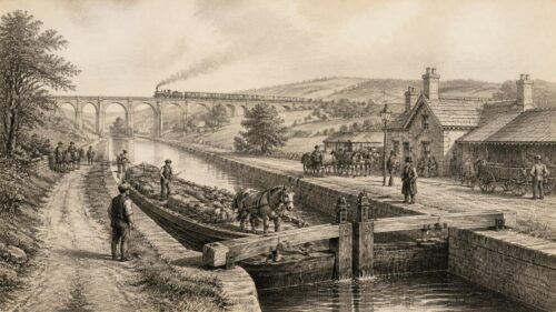
Canal traffic created its own tempo. Horses pulled boats along towpaths. Lock gates divided the journey into measured stages. Warehouses, harbours and lock-keepers’ houses became points in a working landscape. Passenger boats initially promised speed and regularity, while cargoes such as grain, turf, coal, building materials and manufactured goods could be carried in bulk. The canal did not abolish older transport systems. It interacted with coastal shipping, river boats, carts and later railways. At a junction or harbour, goods changed hands and modes. Navigation was a network rather than a single route.
The ideal of a connected island, however, was constrained by finance and geography. The Ulster Canal, intended to help link Lough Neagh and Lough Erne within a larger waterway system, opened in the nineteenth century but suffered from narrow locks, difficulties of water supply and a route that did not meet commercial expectations. Its history is a useful warning against judging engineering solely by construction. A canal’s success depended on the size of boats it could take, the price of tolls, the location of markets, competition from rivals and whether its dimensions matched adjoining waterways. Navigation was as much an economic system as a feat of excavation.
Lights Signals
While inland works sought to make waters more controllable, coastal aids to navigation aimed to make dangerous seas more intelligible. Lighthouses, beacons, buoys, lightships and fog signals did not guide vessels in a mechanical sense; they supplied information that skilled mariners interpreted. Their history is bound to shipwreck, expanding trade, state authority and changing technology. Ireland’s coast, exposed to Atlantic weather and intersected by important sea lanes, required a network rather than a single celebrated tower.
Hook Head embodies the long continuity of coastal warning, but the systematic administration of Irish lights developed much later. Irish Lights dates its institutional history to legislation of 1786 establishing the Corporation for Preserving and Improving the Port of Dublin. In 1810 responsibility for lighthouses around the Irish coast was transferred to that body, commonly called the Ballast Board. In 1867, responsibility for the wider lighthouse service was vested in the Commissioners of Irish Lights. These constitutional changes matter because they show navigation becoming a public, regulated service supported by inspection, records, engineering and light dues.
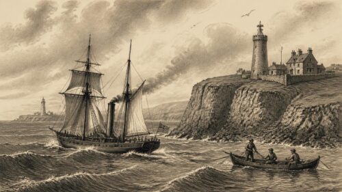
The physical character of a light carried navigational meaning. Colour, rhythm, range and sector told a mariner not only that land was near but which light was being seen and where danger lay. A red sector could warn of a shoal; a flashing pattern could distinguish one station from another. At Donaghadee, for example, the nineteenth-century light showed different colours towards the sea, harbour and Belfast Lough. Such details demonstrate how a lighthouse worked as part of a coded coastal language. The tower was the visible form; the optical apparatus, fuel, keepers, maintenance vessel and published notices were equally necessary.
Technology altered that language without making earlier systems irrelevant overnight. Oil, gas and improved optics increased effectiveness; electricity, radio beacons, radar aids and satellite positioning changed the ways vessels fixed their position. Irish Lights records the twentieth-century move towards automation and remote monitoring, while stressing the continuing role of visual and electronic aids as complementary safeguards. The historical lesson is that navigational systems are layered. A modern mariner may use satellite data, yet still value a buoy, a sector light, a chart, a radar response and local warning when electronic systems fail or conditions deteriorate.
Working Crews
Navigation is often narrated through inventors, admirals, engineers and famous ships. That emphasis can obscure the people whose repeated labour made movement possible. Fishermen launched and recovered boats in difficult weather. Boatbuilders selected timber, stretched skins, fastened planks and repaired hulls. Canal boatmen handled cargo, horses and locks. Pilots took responsibility for bringing unfamiliar vessels through channels. Lighthouse keepers maintained lamps and watched for failures. Dock workers loaded barrels, coal, timber and provisions. Their work made a navigational system real.
Women also belonged to this history, although records often render their roles less visible. In fishing and island communities, women processed catches, managed household economies affected by seasonal absence, helped maintain shore-based equipment and participated in local knowledge networks. In canal and port districts, families could be tied to boat traffic, warehouses, inns and supply trades. The archival record frequently names companies and officials rather than such households. Historians must therefore resist treating silence as absence. Material culture, oral history and local studies can help recover parts of this social world, while making clear where evidence remains incomplete.
The labour of navigation was frequently precarious. Storm, drowning, injury, loss of cargo and economic downturn were recurring risks. A shipwreck was not only a dramatic event for newspapers and official inquiries; it could remove a breadwinner, destroy an owner’s capital or interrupt supplies to a community. Canal work was physically demanding and often poorly rewarded. Large schemes brought temporary employment but could also produce conflict over wages, conditions and delays. The impressive masonry of a lock or lighthouse should therefore be seen alongside the bodily work required to build and operate it.
Knowledge was transmitted through practice. A young crew member learned by watching the handling of sail, oar, line and tide. A pilot acquired familiarity with a channel over many passages. A lock-keeper understood changes in water levels and gate mechanisms. This knowledge could be highly exact while remaining unwritten. Later official systems depended upon it more than their paperwork sometimes admits. Charts and regulations offered general guidance; the safe arrival of a boat still rested on decisions made in particular weather, at a particular hour, by particular people.
Rail Competition
The nineteenth-century arrival of railways altered the economics of Irish navigation profoundly. Canals had been built to move freight and passengers with regularity, but railways could offer speed, year-round service and routes less vulnerable to drought, frost or slow locks. In some places, railway companies and canal interests co-operated; in others, they competed fiercely. The effect was gradual rather than instantaneous. Water transport retained advantages for heavy or bulky goods, and coastal shipping remained important. But the commercial assumptions behind many navigation schemes changed.
The Barrow Navigation’s history illustrates this shift. Trade increased substantially during the earlier nineteenth century, but rail competition increasingly affected its prospects. The company’s eventual sale to the Grand Canal Company in 1894 reflected a wider pattern in which independent waterways found it difficult to maintain revenue and investment. This was not necessarily evidence that canals had been irrational projects from the beginning. They had served real needs in the conditions for which they were built. Their vulnerability arose when new systems changed costs, speeds and market geography.
In the twentieth century, motor road transport deepened the challenge. Commercial traffic declined on many waterways, and some branches closed or fell into disrepair. The closure of a route could have cultural as well as economic consequences. Boatmen’s skills, towpath routines, waterside workplaces and local memories became vulnerable to disappearance. Yet redundancy was never complete. Harbours continued to matter, fishing persisted, and water remained essential to industrial and agricultural life in particular places. Moreover, the built fabric of navigation proved unusually durable. Locks, bridges and canal basins could outlast the trade that had justified them.
The later revival of many waterways for recreation, heritage and environmental use should not be mistaken for a return to their original commercial world. A restored canal is both continuous with and different from the working route of the nineteenth century. It carries walkers, cyclists, anglers and pleasure craft as well as historical memory. This change has preserved structures that might otherwise have vanished, but it can also soften the harsher history of labour and economic failure. A balanced account should recognise both achievements: the renewal of a public landscape and the loss of a once-important transport economy.
Living Inheritance
Today, Ireland’s navigational inheritance can be read in many places: a working lighthouse on a headland, a buoy in an estuary, an old lock on the Barrow, a towpath beside the Grand Canal, a harbour wall at a former fishing station, a currach in a museum collection or a chart that records dangers invisible from shore. These are not separate heritage categories. Together they reveal how generations made water usable without ever wholly mastering it.
Waterways Ireland’s restoration of the Royal Canal, reopened to navigation in 2010, demonstrates the continuing value attached to historic routes. The Shannon, Barrow, Erne and canal systems now support leisure, tourism, angling, ecological habitats and local identity as well as boating. Their present uses bring new pressures: maintenance costs, invasive species, flooding, climate change and the need to protect archaeological fabric. The history of navigation is therefore not finished. Decisions about dredging, access, conservation and development continue to determine what these waterways will mean to future communities.
Coastal navigation has changed even more visibly through electronic position fixing, automatic identification systems and remotely monitored aids. Yet the older vocabulary survives because the underlying problem survives: vessels must still know where they are, what lies around them and how conditions are changing. Satellite technology can provide extraordinary precision, but it does not abolish weather, tide, fatigue or human judgement. The continuing work of Irish Lights makes this continuity plain. Modern equipment belongs to the same long effort that produced beacons, towers, charts and pilotage.
The strongest historical conclusion is that Ireland was not peripheral to water; it was constituted by it. Its seas connected it to neighbouring islands, Europe and the Atlantic world. Its rivers and canals connected regions within the island, imperfectly but consequentially. Its stories made the sea a place of fear, holiness, opportunity and wonder. Archaeology establishes deep habits of waterside life; documents trace institutions and commerce; folklore preserves meanings that cannot be measured in tonnage or soundings. Taken together, they reveal a waterborne Ireland whose routes were never merely lines between places, but changing fields of knowledge, labour and imagination.
The article highlights a productive tension between formal navigation systems and locally held expertise of pilots, fishers and crews. Charts, harbours, lights and canal works increasingly expressed state or commercial authority, yet safe passage still depended upon reading tides, weather, channels and seasonal change. Its careful separation of archaeological evidence, records and voyage traditions also suggests that different sources illuminate different kinds of water knowledge. This raises an interpretive issue: Ireland’s waterways connected communities, but they also shaped unequal access to trade and power. How might attention to vernacular knowledge change our view of who benefited historically from Ireland’s waterways?