

Chandra Reckoning
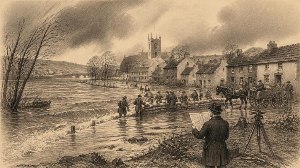
AI generated historical illustration, not a contemporary photograph.
At a Glance
Storm Chandra did not arrive in Ireland as an isolated spectacle of wind and rain. When it crossed the island on 26 and 27 January 2026, it encountered ground already saturated by repeated frontal rainfall, rivers already near or over bank-full level, and settlements whose roads, drains, water systems and homes had been shaped by older assumptions about weather. Its significance lies therefore not merely in the strength of a named storm, but in the way it revealed the accumulated condition of the landscape and the accumulated choices of society.
January Waters
Storm Chandra was named by the UK Met Office on 26 January 2026 and tracked northwards over Ireland overnight and through the following day. Met Éireann warned in advance that strong winds and heavy rain would fall on already saturated ground, creating a risk of local and river flooding. That warning proved central to understanding the episode. The rain attached to the storm mattered, but so too did the preceding weather: catchments had absorbed repeated rainbands during the latter half of the month, while streams and major rivers had little spare capacity.
Met Éireann’s subsequent January climate statement described a notably wet month in the south and east. County Dublin recorded its second-wettest January on record at both Phoenix Park and Dublin Airport, surpassed only by January 1948 in those local series. Johnstown Castle in County Wexford recorded its wettest January since 1996, while its combined rainfall for November 2025 through January 2026 was the highest three-month total in its eighty-five-year record. Such figures do not mean that every locality experienced identical conditions. They do, however, demonstrate the regional concentration and persistence of the wet spell that preceded and accompanied Chandra.
On 27 January the storm’s lowest pressure was recorded offshore at Buoy M3, south of Ireland. The system brought gale to strong-gale easterly winds in many areas, and Met Éireann recorded a 130 km/h gust at Malin Head, County Donegal. Yet the most consequential feature for many communities was flooding. Rivers rose, surface water collected rapidly where drainage was overwhelmed, roads became impassable, and homes and businesses in parts of the east and south-east faced damaging inundation. The Slaney catchment and towns in County Wexford received particular attention, but the effects extended beyond a single river or county.
To call Chandra a flood storm is not to deny its wind hazard. High winds affected electricity, transport, trees and coastal areas. Rather, it is to observe that hazards combine. Flooding occurs where water meets particular terrain, drainage systems, building patterns, antecedent rainfall and tidal conditions. A storm can be meteorologically impressive yet produce modest social losses in one place; a less exceptional daily rainfall total can prove destructive in another when soils are waterlogged, culverts obstructed, rivers elevated and vulnerable people unable to respond quickly.
This distinction is historically important. Irish communities have always known wet winters, Atlantic gales and swollen rivers. The documentary record is full of disruptive weather. But the modern idea of resilience asks a more searching question than whether a community has survived storms before. It asks whether it can anticipate, absorb, recover from and adapt to hazards without transferring disproportionate loss onto those with the least money, mobility, insurance, political influence or secure housing. Chandra made that question immediate.
Measured Weather
The historical value of Chandra rests partly on the quality of the evidence surrounding it. Ireland’s modern meteorological service did not merely record a memorable storm after the fact. It issued forecasts, weather warnings and flood-related advice before the event, maintained observing stations during it, and published subsequent data placing the episode within monthly and longer-term records. These materials allow a distinction between evidence and impression that older storms often deny historians.
Weather memory is vivid but selective. A gale may be remembered by a torn roof, a flooded kitchen or the sound of wind around a chimney. These experiences matter greatly as social testimony, but they cannot alone reveal whether a storm was nationally unusual, locally exceptional, or one part of a prolonged wet period. Instrumental observations add another scale. Rain gauges, barometers, river measurements, wind records and satellite imagery make it possible to reconstruct timing and compare one episode with another, while still recognising gaps in station coverage and changes in observing practice.
For Chandra, the official record indicates a rapidly deepening low-pressure system. It also indicates that the relationship between storm and flooding was cumulative. Heavy rainfall had repeatedly moved into the country from the south during the second half of January. A displaced jet stream and blocking high pressure over northern and eastern Europe contributed to a pattern in which low-pressure systems slowed or stalled to the south-west before moving northwards. This was not simply a single violent cloudburst landing upon dry ground. It was a sequence.
The difference may appear technical, but it has practical consequences. Forecasts of one-day rainfall do not tell the whole story if a river basin has already experienced a week or month of exceptional wetness. Neither does a wind-speed record fully convey the risks to a power network when soils are saturated and trees are less firmly anchored. Nor can flood maps be treated as permanent predictions when rainfall patterns, land cover, urban surfaces and river management change over time. Historical resilience depends on learning to see systems rather than isolated incidents.
Modern records also correct an easy but misleading assumption: that every damaging weather event is unprecedented. January 2026 contained serious extremes in particular places, but Ireland’s weather archive preserves earlier floods, windstorms, droughts and severe winters. The usefulness of comparison is not to diminish contemporary suffering by saying that people have faced worse before. It is to establish what is genuinely new: altered exposure, more interdependent infrastructure, growing settlement in vulnerable locations, a warmer climate, rising seas, and a more exact ability to measure loss and risk.
Older Tempests
Ireland’s historical weather record reaches far beyond the era of named storms. Met Éireann’s register of major weather events includes severe Dublin flooding in 1802, the destructive storm remembered as the Night of the Big Wind in January 1839, widespread floods in December 1954, Hurricane Debbie in 1961, and numerous later episodes of heavy rain, wind, snow and drought. The list is not a complete national inventory. It is a guide to events that left sufficiently strong meteorological or historical traces to be singled out.
The Night of the Big Wind occupies a distinctive place in Irish cultural memory. It has been remembered in oral tradition, newspapers, local histories and stories of damaged houses, uprooted trees and lost livestock. It was also used in later life: older people sometimes gave their age by reference to whether they had been born before the storm. Such recollections reveal how weather becomes a social landmark. They should not, however, be mistaken for a precise climate record. Folklore can preserve the emotional scale of a disaster while altering details, attaching moral meanings or blending events across generations.
That distinction between folklore and documentation matters especially in an age of social media. Images of floodwater and wind damage can circulate globally within minutes, often before causes, locations or dates are confirmed. The speed of modern communication makes disaster more visible, but it can also encourage false equivalences. A dramatic photograph does not establish a return period; a family memory of previous flooding does not by itself prove that a particular drainage failure was inevitable; a storm name does not mean that a whole country experienced one uniform event.
Nevertheless, cultural memory has an important role. It warns that official planning has sometimes ignored local knowledge. People living beside rivers, estuaries, low roads and coastal inlets may preserve practical observations about where water crosses a lane, which drains surcharge first, where a tide drives water inland, or how long a flood takes to recede. Such knowledge requires testing against surveys and hydrology, not dismissal. The most durable form of resilience joins local experience to public evidence rather than treating either as sufficient alone.
Earlier disasters also demonstrate that vulnerability changes with social conditions. A nineteenth-century storm could destroy roofs, boats, crops and communications, while a twenty-first-century storm can interrupt electricity, water treatment, mobile networks, railways, digital payments, hospital access and supply chains. The technology is different, but dependence is deeper. A household may possess better warnings and stronger buildings than its predecessors yet still become stranded if a road floods, a water pumping station fails, a care worker cannot travel, or a phone network loses power.
The historical lesson is therefore not that Ireland has always coped. Survival is not the same as resilience, and resilience is not equally shared. Earlier generations frequently endured hardship because alternatives did not exist. Their endurance deserves respect, but it should not become an excuse for modern institutions to accept avoidable harm.
Flooding Memory
Floods are among the oldest recurring environmental experiences in Ireland, but their causes are never simply natural. Rivers overflow after rainfall, yet the scale of damage reflects where people build, how land is drained, the condition of culverts and sewers, the loss or restoration of wetlands, the maintenance of channels, the level of tides, and the ability of households to insure, evacuate and recover. A flood is therefore both a hydrological event and a social event.
Irish flood history is often told through memorable episodes: the destructive floods of the mid twentieth century, local river floods, coastal surges, the November 2009 inundations, Dublin flooding in 2011, and the severe storms and floods of the 2015–16 winter. More recently, the flooding at Midleton in October 2023 illustrated the destructive potential of intense rainfall in a built-up town. These events should not be compressed into a simple story of ever-rising catastrophe. Each had its own meteorology and geography. Yet together they helped create the institutional and public context in which Chandra was understood.
That context includes a gradual change in policy. For much of the twentieth century, flood management was commonly imagined as an engineering problem: straighten a channel, raise a wall, deepen a drain, construct a barrier. Engineering remains indispensable in many places. Homes, roads, railway lines, water facilities and historic towns cannot simply be abandoned to recurrent flooding. But the limits of defence are now more widely acknowledged. A wall designed for one scale of event can be overtopped, bypassed or rendered insufficient by water arriving from another direction. A drainage network built for an older climate or smaller town may be overwhelmed by intense rainfall falling directly on streets and roofs.
This shift has encouraged the language of catchment management. Instead of treating water only at the point where it becomes destructive, planners examine how it travels from uplands to tributaries, rivers, towns and the sea. Soil condition, field drains, forestry, peatlands, floodplains, urban paving and maintenance all affect that journey. The approach is not a promise that landscapes can be returned to an imagined pristine state, nor a claim that natural measures can replace every engineered defence. It is an attempt to recognise that water must go somewhere.
Chandra made this visible because it occurred after persistent rainfall. The storm demonstrated that a locality may be at risk even if its own daily total appears less dramatic than an earlier record. A river basin can store the memory of rain in its saturated soils, reservoirs, drains and rising water tables. In that sense, a catchment is a historical archive: it carries the effects of weather over days and weeks. By the time floodwater enters a street, its story has already been developing across a wider landscape.
Named Storms
The naming of storms is a recent feature of public weather communication in Ireland and the United Kingdom. It is intended to improve clarity, encourage people to take warnings seriously and make it easier for public bodies, broadcasters and households to discuss an anticipated event. Chandra was named by the UK Met Office, while Met Éireann issued its own warnings and commentary for Ireland. The shared naming system reflects the cross-border character of weather systems, which disregard political boundaries and often require cooperation among meteorological, emergency and infrastructure agencies.
A name can be useful, but it can also create a misleading sense that the hazard begins and ends with a single labelled episode. The January 2026 flooding was not confined to the hours in which Chandra’s centre crossed the country. Further rainfall followed over saturated ground, and flood risk persisted. Met Éireann’s post-storm commentary accordingly stressed the continuing state of rivers and soils. The aftermath was not separate from the storm; it was part of the same chain of conditions.
There is a broader historical point here. Disasters are often dated as though they were moments: the night a gale struck, the day a river burst its banks, the morning a bridge failed. Yet recovery unfolds over weeks, months or longer. A household may spend years navigating insurance, repairs, debt, ill health or a decision to move. A local authority may need years to design and deliver a flood-relief scheme. A damaged water supply can reveal dependencies that are invisible in ordinary times. The calendar date is essential, but it should not be mistaken for the whole event.
Nor should a named storm encourage simplistic attribution. Weather systems have always affected Ireland. No responsible historical account can say that Chandra was ‘caused’ by climate change in a direct and exclusive sense. Scientific attribution instead examines how a changing climate may have altered the likelihood or intensity of particular conditions. The Climate Change Advisory Council’s 2026 review drew attention to an attribution assessment of the seven-day rainfall around Chandra. It reported that the accumulated rainfall was higher and substantially more likely in the present warmed climate than in a colder pre-industrial climate, while noting that the direct one-day rainfall associated with the storm was not itself particularly remarkable.
This is a more careful conclusion than slogans allow. It says that Chandra should be understood within a climate system changed by human emissions, but that its damage also depended on antecedent wetness, exposure and preparedness. Such complexity is not evasion. It is precisely what makes adaptation difficult and necessary.
Changed Climate
The evidence that Ireland’s climate is changing is stronger than any inference drawn from one storm. The Environmental Protection Agency has reported rising average temperatures, changing rainfall patterns, sea-level rise and shifts in weather extremes. Its assessment notes that heavy rainfall events have become more intense over recent decades, while projections indicate wetter winters and more extreme precipitation alongside increased risk of summer and spring drought. The apparent contradiction is real only if climate is imagined as a single dial marked ‘wet’ or ‘dry’. A warming climate can intensify both heavy rain and dry spells by changing atmospheric moisture, circulation and evaporation.
For Irish flood resilience, this means that the future cannot be planned around an assumption of uniformly wetter weather. Communities must prepare for river flooding, surface-water flooding, coastal flooding, water-quality problems and, in other seasons, water scarcity. A town may need drainage capable of dealing with intense downpours, while its wider region may also need secure water supplies during drought. Farmers may face winter waterlogging and summer soil moisture deficits. Infrastructure designed for a stable twentieth-century climate must increasingly operate across a wider range of conditions.
Sea-level rise sharpens the problem in coastal settlements and estuaries. High tides can impede river discharge and reduce the effectiveness of drainage outfalls, producing compound risk when coastal surge, rainfall and river flow coincide. Ireland’s major cities are coastal or estuarine, and many smaller communities are tied to harbours, bays and low-lying shorelines. Resilience in these places cannot be framed solely as river management or solely as coastal defence. It must account for the meeting of land and sea.
Wind projections involve greater uncertainty than some temperature and rainfall projections. It is therefore unwise to claim that every future storm will be stronger, or that Chandra proves a settled national trend in wind speeds. The more defensible point is that individual damaging windstorms remain a serious hazard, that changing storm tracks and compound conditions are relevant planning concerns, and that exposed systems should not depend on historical norms alone. Better preparation does not require certainty about every detail of future weather.
Climate change also has a temporal dimension that historical writing can clarify. Adaptation responds to effects already locked in by past emissions and to risks that will develop over decades. Mitigation, by reducing emissions, affects the scale of future adaptation required. The two are not substitutes. Stronger walls without emissions reduction can create a false sense of permanence; emissions reduction without adaptation leaves communities exposed to hazards already underway. Chandra offers a case study in this dual responsibility.
Public Defences
Ireland’s response to flood risk has become more organised over recent decades through national policy, local authority planning, flood-risk mapping, emergency management and the work of the Office of Public Works. The National Adaptation Framework, published in its current statutory form in 2024, describes climate adaptation as a whole-of-government and whole-of-society task. It identifies flooding, sea-level rise, drought, biodiversity loss and extreme weather among the effects for which Ireland must prepare.
Such language can sound abstract until a storm reveals its practical meaning. Public resilience includes forecasts that reach people in time, road crews able to close dangerous routes, emergency services with accurate information, councils that can deploy barriers or pumps, water utilities that can protect treatment and pumping systems, electricity networks that can restore supply, and social services that know who may need assistance. It also includes ordinary but crucial capacities: neighbours checking on older residents, schools communicating clearly, employers allowing flexibility, and community groups sharing verified information rather than rumours.
Flood defences are often most visible after a disaster. A wall, embankment, pumping station or relief channel can provide decisive protection. Their historical record should be judged fairly: where well designed and maintained, they save lives, homes and livelihoods. Yet they are not universal remedies. Defences may protect one area while changing flows elsewhere; they require maintenance, inspection and funding; and they cannot eliminate residual risk. Behind a wall, people still need warning systems, evacuation plans, insurance arrangements and an understanding that extreme events can exceed design standards.
Planning is equally important. Building new homes, services or critical infrastructure in areas known to be vulnerable can create exposure that later becomes politically and emotionally difficult to reduce. Conversely, refusing development without providing viable housing alternatives can deepen other inequalities. The historic challenge is not simply to prohibit building, but to make long-term risk visible before short-term pressures harden into permanent vulnerability. Future-proofing is as much a matter of planning decisions as of concrete structures.
Chandra also underlined the importance of critical infrastructure. Flood-related disruption to water systems showed that resilience cannot be measured only by how many properties are directly inundated. A damaged pumping facility or contaminated source can affect households far from the floodwater. Roads and telecommunications similarly act as links in wider systems. The event therefore supports an interpretation of resilience as networked: the safety of one community may depend on infrastructure located in another catchment or county.
Living Catchments
Catchment thinking invites a more nuanced relationship with land. Ireland’s drainage history includes arterial schemes, land reclamation, agricultural improvement, urban expansion, road building and changes to peatlands and wetlands. These developments brought real benefits: improved access, productive land, housing and public health. But they also altered how quickly water moved through landscapes. No single historical intervention explains present-day flooding. The effects are local, cumulative and often difficult to separate from natural variation. Still, it is no longer credible to treat land use as irrelevant to flood risk.
Natural water retention measures can slow runoff, store water and restore ecological functions. Examples may include rewetting degraded peatlands where appropriate, reconnecting rivers with parts of their floodplains, protecting wetlands, improving soil structure, planting and managing woodland sensitively, and reducing rapid runoff from urban surfaces through sustainable drainage. These measures are not instant solutions. They require landowner cooperation, long-term stewardship, scientific monitoring and careful attention to local ecology and farming livelihoods.
There is also a danger of romanticising nature-based measures. A restored wetland cannot by itself protect every densely built town from a major river flood; a tree-planting programme cannot substitute for an adequate sewer; and a household facing recurrent inundation needs more than a promise of future landscape improvement. The strongest approach is usually layered: prevention through planning, retention in the catchment, engineered defence where justified, effective drainage, reliable warning, prepared emergency response and fair recovery.
Urban areas deserve special attention. Surface-water flooding can occur far from a river when rainfall exceeds the capacity of gullies, pipes and drains or when water flows across sealed surfaces. Older towns often possess complex drainage systems built in phases, with unknown connections and constraints. New development can add pressure unless drainage is designed for changing rainfall conditions and maintained over decades. Chandra’s lessons therefore belong as much to street design, maintenance budgets and building regulation as to riverside embankments.
The historical perspective guards against another mistake: assuming that adaptation is merely a technical upgrade. It involves choices about which places receive protection, who pays, whose land is used to store water, what forms of heritage are preserved, and how communities participate. Those are political and ethical questions. The best evidence can illuminate them, but it cannot decide them alone.
Unequal Recovery
Floodwater does not distribute hardship evenly. Two houses can experience the same depth of water and face very different futures depending on insurance, savings, disability, age, tenancy, employment, language, transport and family support. The historical language of ‘community resilience’ can become hollow if it celebrates neighbourly endurance while overlooking these inequalities. Mutual aid is valuable; it should not be expected to replace public responsibility.
For homeowners, recovery may involve drying, repairs, temporary accommodation, disputes over insurance and the emotional strain of returning to a damaged home. For tenants, the consequences may include sudden displacement without control over repairs or future rents. For small businesses, closure can mean lost stock, lost income and the loss of a local service. For farmers, flooding may affect livestock movement, feed, access and soil conditions. For older people or those with chronic illness, disrupted electricity, water, heating or transport can turn an emergency into a health crisis.
These are not secondary matters. They determine whether a warning translates into safety. A person who owns a car, has savings, receives alerts promptly and can stay with relatives has more options than someone without those resources. Preparedness campaigns should therefore be accessible in format and language, and emergency planning should involve organisations that understand local vulnerability. Resilience is strongest when it is designed around real households rather than an imagined average citizen.
Historical evidence also suggests that recovery is a long process. Media attention is intense while floodwater is rising and often recedes as quickly as the water itself. Yet the aftermath can alter a community’s sense of security for years. Repeated events may affect property values, insurance availability and mental wellbeing. They can also change local politics, producing demands for defences, maintenance, compensation or different planning decisions. In this respect Chandra is not over because its warning period ended. Its historical significance will depend partly on the choices made afterwards.
The Climate Change Advisory Council’s response to the event stressed the urgency of adaptation investment and action. That does not mean every decision must be made in the emotional aftermath of a flood. It does mean that delay has a cost. If lessons are gathered only to be shelved until the next event, the language of resilience becomes commemoration rather than preparation.
Future Reckoning
Storm Chandra should not be treated as a prophecy. One event cannot specify the exact weather Ireland will experience in future years, nor can it settle every debate about flood defences, planning or climate policy. The documented evidence nevertheless supports a sober conclusion: Ireland is already facing a changing climate in which heavy rainfall, flooding, sea-level rise, drought and interconnected infrastructure risks require sustained adaptation.
The practical lesson is not to search for one perfect solution. Ireland needs accurate observations and transparent public warnings; resilient electricity, water, communications and transport systems; land and drainage management that recognises catchments; development planning that does not create avoidable exposure; engineered flood protection where evidence supports it; social protection for those least able to recover; and continued reduction of greenhouse-gas emissions. These measures work best together, not as competing slogans.
There is a historical humility in that conclusion. Earlier Irish communities faced severe weather with fewer instruments, fewer public services and fewer resources. Their memories remain important, but they should not be asked to bear the explanatory weight of modern climate science. Contemporary institutions possess data, modelling, communications and engineering capacity unavailable to previous generations. With that capacity comes responsibility. It is no longer enough to describe a flood as an unavoidable act of weather when risk has been mapped, warnings issued and vulnerabilities repeatedly identified.
Folklore will undoubtedly gather around Chandra, as it has around earlier storms: stories of darkness, stranded vehicles, sandbags, flooded rooms, neighbours helping neighbours and rivers transformed overnight. Such stories will preserve the human texture of the event. The documentary record supplies another memory: pressure readings, rainfall totals, warning notices, river conditions, damaged infrastructure and policy reviews. Neither kind of memory should erase the other.
The most useful historical reckoning joins them. It recognises the fear and effort experienced by households while demanding evidence about causes and solutions. It respects the force of Irish weather without treating damage as inevitable. And it understands resilience not as stoic acceptance, but as the continuing work of making lives, places and public systems less vulnerable before the next storm is named.
Civic Reckoning
Repeated events may affect property values, insurance availability and mental health long after the visible damage has been cleared. This is where Storm Chandra becomes more than a chapter in a chronology of Irish weather. It tests whether institutions count recovery only in repaired roads and reopened shops, or whether they also measure who remains exposed when public attention moves on. The distinction is especially important in places with a history of flooding. A household unable to obtain affordable insurance after an earlier event enters the next emergency with fewer means to recover, even where warnings and community support are strong.
Enniscorthy illustrates the problem with particular force. The Climate Change Advisory Council recorded severe flooding there during Chandra, affecting homes and businesses, while noting that some residents had already struggled to secure flood insurance following earlier extreme flooding, including the 2015 event. It also noted the long history of the proposed Enniscorthy Flood Relief Scheme: funding was allocated in 2014, plans were publicly exhibited in 2019, yet construction remained stalled because of planning issues. This is not evidence that planning scrutiny is unnecessary. Major works can affect property, heritage, ecology and communities, and deserve careful examination. It is evidence, rather, that delay itself has consequences when known risks continue to recur.
Historical resilience should therefore include institutional memory. Agencies must retain flood records, modelling, maintenance knowledge and the lessons of near-misses, rather than beginning afresh after each emergency. Local testimony has a place within that record: residents can identify routes by which water enters streets, the duration of isolation, or the practical obstacles faced during evacuation. But testimony needs to be connected to mapping, river and rainfall data, inspections and transparent public decision-making. Neither official expertise nor lived experience is enough by itself. Together, they can make risk legible before another storm supplies a painful demonstration.
The National Climate Change Risk Assessment provides a useful framework because it treats risk as more than a measure of weather severity. Exposure, vulnerability and consequence matter alongside the hazard itself. That approach helps explain why equal rainfall does not produce equal loss. A care facility, a rented ground-floor flat, a rural road serving scattered households and a water-treatment asset may each require different forms of preparation. It also warns against judging adaptation solely by the size of a capital project. Maintenance, staffing, clear communication, contingency arrangements and the ability to reach people who need help can determine whether a defence or warning system works in practice.
Accountability must extend across time. Immediate emergency expenditure is necessary, but prevention and adaptation require reliable investment over years: maintaining drains and defences, updating flood-risk information, improving infrastructure, planning development with future conditions in mind, and supporting households facing residual risk. The Environmental Protection Agency has stressed that a wait-and-see approach is not an adequate response to Ireland’s climate risks. That conclusion does not demand certainty about the precise location or date of the next damaging storm. It recognises that uncertainty is a reason to build flexibility, redundancy and preparedness rather than a reason to postpone action.
There is a democratic dimension as well. Decisions about flood protection and land use distribute both safety and burden. A scheme may protect established homes while requiring land to accommodate water; restrictions on development may prevent future loss but intensify housing pressures; costly adaptation can disadvantage those least able to pay unless public policy addresses fairness directly. Consultation cannot remove every conflict, but it can expose trade-offs and prevent resilience from becoming a word used to justify decisions made without those most affected. A resilient community is not one asked simply to endure; it is one given a meaningful role in shaping its protection and recovery.
Chandra’s enduring significance may lie in this reckoning. It was a named storm, but its impacts were produced by a longer sequence: saturated soils, raised rivers, vulnerable infrastructure, previous floods, delayed decisions and a climate already changing. Ireland’s weather history offers no promise that disruption can be eliminated. It does offer a record from which to learn. The task is to turn that record into durable public capacity: to reduce emissions that will shape future risk, adapt to hazards already unfolding, protect those most exposed, and judge recovery not by the fading of headlines but by whether communities emerge safer than before.
Chandra is compelling because it shows that flood damage was created by a sequence: persistent rainfall, saturated catchments, overwhelmed drainage, exposed settlements and recovery. The article’s comparison between instrumental records and local memory suggests that neither statistics nor experience alone can fully guide resilience planning. Its most challenging implication is that a named storm may focus attention on winds while obscuring slower, cumulative risks and unequal capacities to recover. How should Irish flood planning combine catchment-scale data, local knowledge, engineered defences and support for households least able to absorb losses, particularly as wetter winters, intense rainfall and coastal pressures interact?