

Harbour Threshold
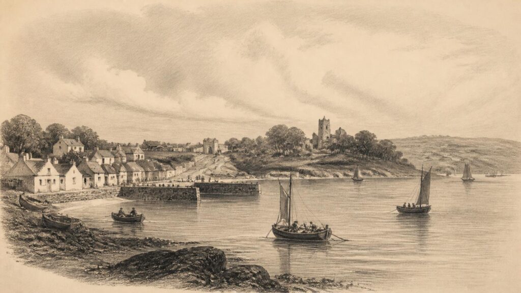
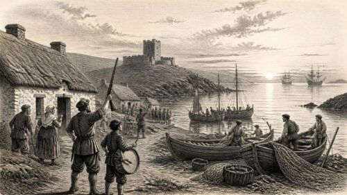
AI generated historical illustration, not a contemporary photograph.
At a Glance
Whitegate is a small place with a large historical reach. Set on the eastern side of Cork Harbour in County Cork, it has been a fishing village, a working shoreline, an estate district, a religious centre and, since the mid twentieth century, the site of Ireland’s sole oil refinery. Its history is therefore best understood not as a rural settlement overtaken by industry, but as a long negotiation between harbour, land, labour, power and memory.
Maritime Setting
Whitegate stands on the southern shore of the lower reaches of Cork Harbour, facing waters that widen towards Roches Point and the sea. This position is the starting point for any serious account of its past. The village did not develop in isolation from the water: its local economy, transport connections, estate landscape and later industrial importance all depended upon a harbour that joined the settlement to Cork city, Cobh, Midleton and the wider Atlantic world. The harbour is both a physical feature and an historical agent. Tides, sheltered anchorages, navigable channels and access to the sea made possible a succession of activities that would have been improbable inland.
The modern settlement is conventionally considered with nearby Aghada, Rostellan and Farsid. Such groupings are useful for planning and administration, but they should not obscure the older distinctions of parish, townland, estate and shoreline. Whitegate historically straddled the parishes of Aghada and Corkbeg, in the barony of Imokilly. That boundary position is significant. It helps explain why a modest village could be connected to several overlapping jurisdictions and social worlds: agricultural hinterland, landed demesne, harbour traffic, coastal defence and ecclesiastical authority.
Cork Harbour offered opportunity but also exposure. A settlement looking across a major waterway was affected by changing patterns of shipping, naval concern, commercial demand and national policy. Its relationship with the harbour altered repeatedly. In the nineteenth century, the water carried fish, sand, passengers and produce. In the twentieth, it became the approach for imported crude oil and the route by which refined products moved onwards. The scale changed dramatically, but the basic geographical logic remained remarkably consistent: Whitegate mattered because it was connected by water.
It is tempting to read this geography as destiny. That would be too simple. Geography provided possibilities rather than outcomes. Decisions by landlords, merchants, churchmen, engineers, governments and companies shaped what occurred on this shore. Yet the persistence of maritime work across very different periods confirms that the village’s relationship with the harbour was fundamental. Even after pipelines, tanks and jetties transformed the view, the settlement remained a harbour place whose history was written partly from the sea.
Place Name
The official Irish form associated with Whitegate is An Geata Bán, conventionally rendered as “the white gate”. The English and Irish names are familiar and evocative, but they should not be made to carry more evidence than they possess. A name may preserve a local visual feature, an entrance, a boundary marker or a remembered association, yet the surviving material considered here does not securely identify the particular gate from which the settlement took its name. It is better to acknowledge the apparent meaning than to turn it into a confident story about an otherwise undocumented object.
That caution matters because place-name explanations easily become folklore. Local names are often attached retrospectively to a gate, house, road or incident, and repetition can make a plausible tale appear historical. Whitegate’s name certainly conveys a distinctive sense of entrance and visibility, fitting a village positioned near a broad harbour approach. But resemblance is not proof. The documentary record supports the use of the name; it does not, on its own, supply a definitive origin narrative.
The name nevertheless has historical value. It signals that the place was recognised as a locality in its own right, rather than merely as an outlying part of a larger parish. By the nineteenth century, Whitegate was clearly identifiable as a village with homes, schools, maritime occupations and a relationship to neighbouring Corkbeg. Names also matter because they persist through change. The landscape around Whitegate has been altered profoundly since the 1950s, yet the name continues to connect a modern energy complex, a village street pattern and an older coastal community.
For historians, this continuity is useful but potentially misleading. A surviving name can create an illusion of an unchanged place. Whitegate has endured as a name, but its scale, employment, shoreline access and visual identity have altered more than once. The task is therefore to keep continuity and transformation in view together: a named harbour settlement, enduring through centuries, but repeatedly remade.
Medieval Ground
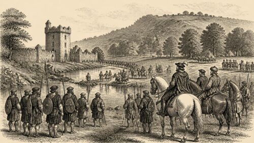
Whitegate’s deeper history is tied to Corkbeg, the adjoining district whose castle, churchyard and estate once formed a dominant local presence. The visible remains and documentary references establish that this was a place of long occupation and institutional importance. They do not, however, justify an elaborate reconstruction of everyday medieval life. The temptation to fill gaps with certainty is especially strong where ruined masonry survives. A ruin can show that a building once stood; it cannot, by itself, reveal every date, owner, household or event associated with it.
The surviving historical record identifies Corkbeg as a landed and defensible place before Whitegate emerged in its later village form. By the later seventeenth century, Garrett Fitzgerald had received a grant of the castle, town and lands of Kilcorkbeg, also called Corkbeg, together with other lands in Imokilly. This evidence does not begin the history of the site, but it provides a firm documentary point from which the estate’s later history can be followed. It also demonstrates that the local landscape was already organised through property, status and inherited rights.
Corkbeg’s ruined church is another reminder that Whitegate belonged to a parish landscape older than the village’s nineteenth-century appearance. The present Church of Ireland church occupies a site that includes the remains of an earlier church and a graveyard. The National Inventory of Architectural Heritage describes the ruin as evidence of continuing use across centuries. That is an important distinction. The site has continuity, but continuity did not mean immobility. Buildings were replaced, congregations changed, patronage shifted and the meaning of the churchyard evolved as surrounding society changed.
The castle and church should therefore be treated as historical anchors rather than as props for romance. They locate Whitegate beside an older territorial and ecclesiastical order. They also help explain why the later estate was more than an agricultural business. It rested within a landscape marked by lordship, parish organisation, burial, inherited land and the authority expressed by substantial buildings. When industrial development later erased much of Corkbeg Island’s built fabric, these remains became all the more important as reminders of what had preceded it.
Estate Order
For much of the eighteenth and nineteenth centuries, the Fitzgerald and Penrose Fitzgerald families were central to the history of Corkbeg and Whitegate. Their connection illustrates the ways in which estate power worked in rural Ireland: through landholding, residence, patronage, family alliances, tenancies and the ability to shape local institutions. The University of Galway’s Landed Estates database traces a complicated succession in which the Corkbeg property passed through Fitzgerald and Uniacke connections before the Penrose Fitzgerald name became established. The details are genealogical, but their local consequence was practical. A family with extensive property could influence the physical and social form of a district over generations.
The estate was not merely a distant legal entity. It was represented by houses, farms, schools, church connections and the rhythms of rent and employment. Corkbeg House became the principal domestic symbol of this order, while Whitegate House was also part of the local elite landscape. Samuel Lewis, writing in 1837, listed Corkbeg House, Whitegate House, Trabolgan, Hadwel Lodge and Aghada House among the residences embellishing the fertile country around the village. His language reflects the outlook of his day: cultivated scenery and substantial houses were presented as signs of improvement. Such descriptions tell us more readily about elite values than about the experience of labourers, fishermen or smallholders.
Estate power could include benevolence, but benevolence should not be confused with equality. Lewis recorded a boys’ school founded and endowed by Colonel Fitzgerald in 1831, alongside female and infants’ schools maintained by Mrs Blakeney Fitzgerald. These were real institutions, and access to schooling mattered. At the same time, their creation demonstrates the paternal structure of local society. Education was presented as a gift from patrons rather than as a public right guaranteed independently of landlord influence.
The archival record of the estate also cautions against treating the family as a single, unchanging actor. Property passed between relatives, houses were occupied by different members, and estates were sold or reconfigured. The Landed Estates database notes that lands belonging to Robert Uniacke Penrose Fitzgerald were advertised for sale in 1852, while later members of the family still held substantial acreage in County Cork. Estate history is thus a history of persistence mixed with financial pressure, inheritance and adaptation.
For local people, the estate system shaped opportunities and constraints simultaneously. Employment, housing, schooling and charitable assistance could be connected to the landlord world. So too could dependence, rent obligations and social deference. Whitegate’s later reputation as a picturesque coastal village should not obscure these relationships. Its nineteenth-century neatness was not simply an organic village quality; it existed within a managed landscape of demesnes, residences and unequal command over land.
Working Water
In 1837 Samuel Lewis described Whitegate as a village of 496 inhabitants and forty-six houses, small but neat and well built. He observed that the houses were whitewashed, giving the place what he considered a cheerful appearance. The passage is valuable because it provides a contemporary picture of the settlement before the age of petroleum. Yet it must be read critically. Lewis’s survey was compiled to describe places systematically, but its polished language naturally favoured visible order and improvement. It gives less access to overcrowding, insecurity or seasonal hardship than to buildings, occupations and institutions.
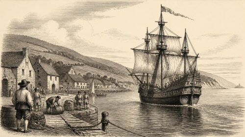
What emerges most strongly from Lewis’s description is a working maritime community. A substantial seasonal fishery employed boats taking hake, mackerel and herrings. Smaller vessels carried sand to Cork, Midleton and other places. Sand extraction may sound minor to modern readers, but harbour sand had practical agricultural value as manure and formed part of a wider exchange between coast and countryside. The activity required local knowledge of tides, banks, channels, weather and markets. It also joined Whitegate to a network of consumers beyond the village.
Fishing was similarly embedded in broader commercial patterns. The catch depended on seasons and stocks, while the value of fish depended upon transport, demand and preservation. Whitegate’s boats were small by the standards of oceanic commerce, but they were not insignificant. They linked households to the food supply of nearby towns and to the daily hazards of the harbour. A coastal livelihood could be skilled and independent in some respects while remaining precarious in others. Storms, poor catches, damaged gear and changing prices could quickly upset a household economy.
Passenger movement was also important. Lewis noted boats plying in summer to Cork and Cove markets and a steamboat calling weekly at a pier to the north-east. Such details reveal a settlement that was connected but not continuously accessible in the modern sense. Travel depended on season, timetable, weather and the modest capacity of small piers and vessels. The harbour shortened some journeys but imposed its own delays. For Whitegate residents, water was a route of opportunity, not an effortless highway.
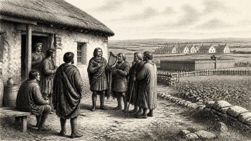
The local economy was not exclusively male or seaborne. Lewis also recorded women engaged in plaiting Tuscan straw for export and in working “traneen”, or crested dog’s-tail grass. These references deserve attention because women’s labour is often harder to trace in formal records. Plaiting work connected household labour to distant markets, probably through merchants and intermediaries. It illustrates the mixed character of village economies, in which fishing, farming, carrying, craft production and domestic work could overlap. Whitegate was never only a fishing village, even when fishing was among its most visible occupations.
Famine Memory
The Great Famine forms an unavoidable part of any nineteenth-century Irish local history, but the evidence for Whitegate requires careful handling. The wider catastrophe affected County Cork with terrible force. Crop failure, hunger, disease, eviction, displacement and dependence on relief remade communities across the county. It would be historically indefensible to imagine that a harbour village in east Cork stood outside those pressures. Equally, it would be wrong to convert general county suffering into unverified local statistics or specific incidents.
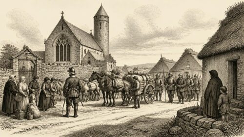
A valuable but limited source survives in the National Folklore Collection’s Schools’ Collection. In the 1930s, a Whitegate schoolchild recorded an account headed “The Famine in this District”. The account refers to potato blight, high rents, yellow meal, deaths and a large grave. It also recounts a claim that a soup kitchen required people to become Protestant, followed by a supernatural tale of a black moth extinguishing candles after the death of a woman said to have converted. This is a significant record of local memory, but it is not a contemporaneous Famine document.
The distinction is essential. The schoolchild’s text preserves what was said locally many decades after the events described. It may contain inherited recollection, moral interpretation, family memory and folklore in a single narrative. Its account of hunger is entirely compatible with the known realities of the Famine. The specific claim about conditional soup, however, cannot be treated as established fact without independent contemporary evidence. Stories of “souperism”, conversion in exchange for aid, circulated widely in nineteenth-century Ireland and remained powerful in collective memory. That does not mean every local version can be verified in the same way.
Rather than diminishing the source, this caution clarifies its value. It tells historians that Whitegate people remembered the Famine through the language of bodily suffering, religious tension and communal burial. It reveals how an event beyond living memory could remain morally present in a twentieth-century classroom. Folklore is not a failed archive. It is evidence of memory, belief and the meanings later communities attached to the past. It becomes unreliable only when it is presented as if it were a dated official record without qualification.
Whitegate’s maritime resources may have provided some forms of food or income unavailable to inland districts, but that possibility should not be romanticised into immunity. Fishing communities were themselves vulnerable when catches failed, weather prevented work or purchasers lacked money. The Famine was not one uniform experience, and the evidence presently available does not permit a complete reconstruction of Whitegate’s demographic or household history in the 1840s. The honest conclusion is that the village was part of a county-wide disaster, while the precise local pattern still requires further archival work.
Victorian Village
The later nineteenth century left visible marks in Whitegate’s churches, schools and domestic buildings. These structures demonstrate both continuity and change. The older parish landscape endured, yet it was reshaped by Victorian religious architecture, changing denominational identities and new ideas of respectability. The village became a place where the authority of church, estate and education could be read in stone, timber, boundary walls and graveyards.
St Michael’s Church of Ireland Church at Corkbeg, dated 1881, is especially important. The National Inventory of Architectural Heritage identifies it as a regionally significant Gothic Revival church, notable for its mixed sandstone, limestone and brick detailing, stained glass and later tower. It stands in a graveyard that retains the remains of an earlier church. The building’s architectural richness contradicts any assumption that a small village necessarily produced modest religious structures. It reflects patronage, denominational confidence and the Victorian appetite for expressive ecclesiastical design.
Architecture here is a historical source. The church’s materials and elaborate treatment show investment, while its setting in an older burial ground displays continuity of sacred space. Yet the church must not be reduced to an aesthetic object. It was a working institution within a society divided, though never simply, by denomination and class. Its congregation, clergy, patrons and neighbours experienced it differently. For some it was a centre of worship and community; for others it represented the established Protestant order that had long been associated with landholding power.
The school tradition recorded by Lewis also continued the importance of education in local life. The existence of schools for boys, girls and infants in the 1830s shows that Whitegate had institutions beyond the household and workplace. Their patronage by estate figures suggests how education could operate within a framework of local hierarchy. Over time, changing state involvement in schooling altered this relationship, but the older pattern remained part of community memory. Buildings and school sites became landmarks through which residents understood the village’s past.
Victorian Whitegate should therefore be seen as more than a quiet rural scene. It was a socially organised settlement with maritime work, estate influence, religious institutions and growing connections to regional transport. The harbour remained central, but the community’s identity was also shaped on land: in the churchyard, at school, in cottages and along roads leading to the larger settlements of east Cork.
Imperial Harbour
Whitegate’s position near the entrance to Cork Harbour gave it strategic significance beyond its size. The road noted by Lewis ran towards Carlisle Fort, now known as Fort Davis, on the harbour’s southern approaches. Fortifications in this area were part of a wider defensive landscape that included islands, batteries, channels and the naval importance of Cork Harbour. Whitegate was not itself a fortress town, but its locality belonged to a militarised seascape.
This proximity affected how the surrounding landscape was perceived. Harbour settlements were not merely commercial or agricultural places; they could also be viewed through the requirements of defence, navigation and imperial communication. Cork Harbour’s sheltered waters made it a valuable anchorage, while its entrance required protection. In such a setting, roads, piers and coastal vantage points had meanings that extended beyond local convenience.
For residents, military geography could bring employment, traffic and occasional opportunity, but it also placed the district within priorities set elsewhere. The needs of the state and armed forces were not identical with the needs of a fishing village or estate tenants. This is another example of Whitegate’s recurring position at the intersection of local life and larger systems. In the nineteenth century those systems included imperial defence; in the twentieth they included national energy security.
It is useful to resist a direct line from forts to refinery, as though every harbour installation were part of one continuous project. Their purposes, technologies and political contexts differed. The comparison is interpretative rather than literal. What persisted was the strategic value of location. A sheltered deep-water harbour near a major city could serve different national and international priorities in different eras. Whitegate’s later industrial transformation was made more intelligible, though not inevitable, by that enduring geographical advantage.
Refinery Arrival
The most dramatic rupture in Whitegate’s recorded history came with the construction of the oil refinery in the 1950s. The project brought a new industrial landscape to a district previously associated with farming, estate grounds, fishing and a relatively small village. Its scale was unprecedented locally. Tanks, process units, roads, pipelines, jetties and associated works changed both the physical appearance of the shore and Whitegate’s place in the national economy.
The refinery was built between 1957 and 1959 by a consortium comprising Esso, Shell, Texaco and British Petroleum. An environmental history prepared for the Environmental Protection Agency records that the wider development occupied agricultural land known as Furney’s Farm, part of the former Corkbeg demesne. On Corkbeg Island, tank infrastructure was created after the demolition of the Corkbeg Hotel and the clearance of its grounds, which included the ruins of an old castle and a small golf course. The official opening took place on 22 September 1959.
These facts make clear that industrialisation did not arrive on empty ground. It replaced particular landscapes and inherited structures. Corkbeg House had already passed from aristocratic residence to hotel use before the refinery scheme, illustrating the changing fortunes of the estate world. Its eventual demolition was not merely the loss of an isolated building; it marked the disappearance of a highly visible material link to the old demesne. The refinery’s construction represented a new valuation of the site: harbour access, industrial capacity and national supply were judged more important than the preservation of the former estate landscape.
That judgement was characteristic of post-war modernisation. Ireland’s growing dependence on petroleum, and the perceived need for reliable supply, encouraged the establishment of domestic refining capacity. The Economic and Social Research Institute later observed that, before 1959, oil used in Ireland had been imported as refined products. Whitegate made it possible to import crude oil and process it within the State. The development was therefore local in location but national in purpose.
For Whitegate residents, the project brought employment, construction activity and a new kind of connection to the wider world. It also brought disruption. The scale of plant and storage infrastructure altered familiar views and changed the balance between village, farmland and shoreline. Such transformations are sometimes described only in terms of economic progress, but that language can conceal what was displaced. The history of the refinery must include both the skilled work and strategic importance it created and the older built and social landscape it replaced.
State Energy
Whitegate’s refinery became an important test of Irish energy policy. Its ownership history shows how closely the site was connected to shifts in international oil markets, state intervention and corporate restructuring. Initially developed by multinational oil companies and managed by Esso, the refinery ceased operation in 1981 before resuming under state ownership in 1982 through the Irish National Petroleum Corporation. The interruption and restart reveal that strategic infrastructure was not immune to commercial pressures.
Under state control, the refinery’s role acquired a particularly clear national dimension. The move from Middle Eastern crude to North Sea crude reflected changing supply conditions and technical requirements. Investment programmes during the 1990s sought to improve capacity and modernise plant. In 2001, the operating assets of the Irish National Petroleum Corporation, including Whitegate and Bantry terminals, were sold to Tosco; subsequent corporate changes placed the refinery within Phillips Petroleum, then ConocoPhillips and later Phillips 66. In late 2016, the site was acquired by Irving Oil.
This sequence should not be read as a detached corporate chronology. Ownership affected decisions about investment, employment, maintenance, environmental management and the plant’s future. It also shows that Whitegate’s local history was embedded in global energy capitalism. Crude oil sources, refinery economics and corporate mergers could influence a small Cork village because its harbour site had become part of an international supply chain.
At the same time, the refinery’s importance has made Whitegate a key location in debates about security of supply. Cork County planning documents describe the Whitegate–Aghada area as a specialist energy location, associated not only with refining but with major power generation and nearby gas infrastructure. This concentration does not erase the community’s older history. Rather, it adds another layer to the long pattern by which the harbour has linked Whitegate to wider economic and political systems.
The local consequences of energy infrastructure are complex. It can provide skilled employment, rates, services and a sense of national relevance. It can also concentrate risk, heavy traffic and environmental anxiety in one locality. A balanced history must recognise the refinery as neither a simple symbol of progress nor an alien intrusion without local significance. It became part of Whitegate’s social fabric while remaining a development whose logic was always larger than the village.
Environmental Reckoning
Industrial history cannot be separated from environmental history. The refinery’s presence on Cork Harbour has required licensing, monitoring, engineering controls and public scrutiny. Environmental Protection Agency material describes the facility as a regulated industrial installation, with the main production area on the mainland connected to the harbour through a long jetty from Corkbeg Island. The existence of such regulation reflects the hazards inherent in refining and storing petroleum products near a sensitive coastal environment.
Historical change is visible in the language of regulation itself. Earlier accounts of industrial projects often emphasised construction, capacity and employment. Later documentation pays closer attention to soil, groundwater, emissions, firewater retention, waste, accident prevention and decommissioning responsibilities. This change does not mean that earlier communities were indifferent to safety or landscape. It means that public expectations, scientific methods and legal frameworks became more formalised over time.
The history of the refinery consequently includes work that is largely invisible to casual observers: sampling, reporting, containment, treatment systems and environmental assessment. These are not peripheral technical details. They form part of the modern history of Whitegate because they reveal how industrial activity has been governed and contested. The village’s identity as an energy centre has always carried the question of how industrial benefit should be balanced against environmental protection.
Whitegate Bay and the wider harbour also possess ecological importance independent of industry. County planning material recognises nearby natural heritage sites and the sensitivity of lands beside the foreshore and Cork Harbour Special Protection Area. This context matters historically. Industrial development did not occur in a blank technical zone. It occurred within a harbour of mudflats, shoreline habitats, birdlife, fisheries and long human use. The environmental story is therefore one of overlapping claims on the same water and land.
There is no final historical verdict available from these facts alone. Regulatory records can document obligations and assessments; they cannot by themselves settle every public concern or moral question. What can be said is that Whitegate’s twentieth-century transformation made environmental stewardship a permanent element of local history. The harbour that enabled the refinery also made its impacts and responsibilities impossible to ignore.
Living Landscape
Modern Whitegate contains several historical landscapes at once. The village shore and older street pattern recall a coastal settlement shaped by small-scale work. The churchyard and surviving ecclesiastical fabric preserve a much older parish inheritance. Houses, schools and estate traces evoke the nineteenth-century world of landlord patronage and rural hierarchy. The refinery and neighbouring energy infrastructure make the area nationally significant in a way that few Irish villages are. None of these layers cancels the others.
This coexistence can be difficult to see because industrial structures dominate distant views. The refinery’s tanks, stacks and jetty are visually powerful and readily become the public image of Whitegate. Yet the local area plan notes protected structures including Whitegate School, the bell tower of the former Catholic church and Whitegate House, while the National Inventory records a cluster of buildings around the village centre and Corkbeg. These designations are a reminder that the historic environment is made not only of grand ruins but of educational, domestic and religious buildings that have served everyday community life.
Historical interpretation benefits from walking, or imaginatively reconstructing, the relationships between these places. A churchyard is not far from a village that once relied on fishing. A former demesne is close to refinery infrastructure. Roads used by modern traffic follow a district long connected to Cloyne, Midleton and the harbour forts. The past is therefore not arranged in neat chronological zones. It survives in adjacency, where different eras face one another across roads, hedges, shorelines and industrial boundaries.
Community memory also remains selective. Some residents and visitors may chiefly remember employment at the refinery; others may think first of the shoreline, schools, sporting life, fishing families or religious landmarks. These perspectives need not compete as if only one were authentic. They arise from different experiences of the same place. The historian’s responsibility is to show how those experiences fit within a documented chronology while identifying where the evidence is firm and where recollection, tradition or interpretation begins.
Historical Meaning
Whitegate’s history challenges the habit of dividing Irish places into either traditional villages or modern industrial sites. It has been both, and neither term is sufficient on its own. Its harbour setting supported fisheries, sand carrying, passenger movement and small craft; its estate system organised land and local institutions; its churches and schools gave durable form to religious and social life; and its refinery connected it to the changing requirements of the Irish State and global oil economy.
The documentary evidence is strongest for the nineteenth-century village described by Samuel Lewis, the Corkbeg estate recorded in archival and landed-estate sources, the surviving church fabric surveyed by the National Inventory, and the twentieth-century refinery documented through planning, energy and environmental records. These sources allow a substantial history to be written. They do not answer every question. In particular, detailed evidence for ordinary households in earlier centuries, for local Famine mortality and for the daily experience of industrial change remains incomplete in the material consulted here.
That incompleteness should encourage further research rather than invention. Census returns, valuation records, estate papers, parish registers, newspapers, oral history and archaeological assessment may yet illuminate particular families, buildings, work patterns and losses. The Schools’ Collection, meanwhile, should be preserved and read seriously as evidence of remembered history, while never being confused with immediate testimony from the 1840s.
What can be stated with confidence is that Whitegate has repeatedly stood at a threshold: between land and water, between estate and village, between local livelihood and national strategy, and between inherited landscape and industrial transformation. Its history is compelling precisely because no single layer has wholly displaced the others. The harbour still frames the place. The older community remains legible in fragments. And the energy infrastructure that reshaped Whitegate continues the ancient geographical fact on which its history has always depended: this is a settlement whose future, as much as its past, is tied to Cork Harbour.
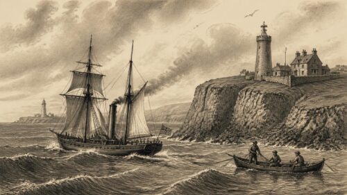
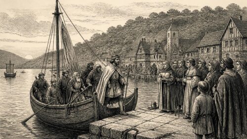
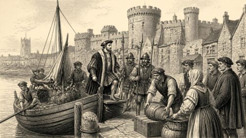


Whitegate’s transformation after 1959 is especially intriguing because the refinery did not simply replace an older village economy; it overlaid fishing, sand carrying, estate authority, churches and remembered hardship with energy infrastructure and environmental regulation. The article suggests that continuity lies partly in the harbour itself, whose waters connected local labour to changing regional and national systems long before crude oil arrived. This raises a challenge: should Whitegate be understood chiefly as an industrial community, a maritime community, or as a place where both identities remain inseparable? What local evidence might reveal how residents negotiated these overlapping identities across generations?