

Moving Island
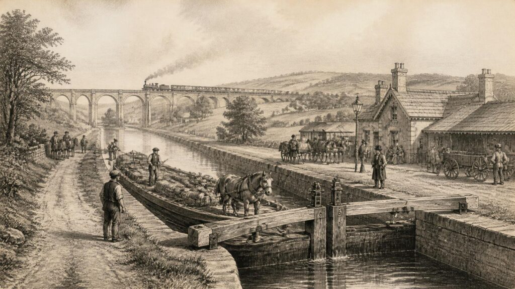
AI generated historical illustration, not a contemporary photograph.
At a Glance
Transport has never been a merely mechanical subject in Ireland. Paths, fords, quays, canals, railways and roads have determined which communities could trade, migrate, govern, worship, work or escape. They have joined an island of mountains, bogs, river basins and deeply indented coasts, but they have also revealed divisions of wealth, power and geography. Irish transport history is therefore a history of labour and engineering, but equally one of political authority, private enterprise, colonial administration, emigration and everyday life.
Early Pathways
Long before a road could be measured by statute miles or marked upon an Ordnance Survey sheet, people moved through Ireland by water, across open ground and along repeatedly used tracks. Rivers, lakes and the sea offered routes as well as obstacles. Coastal travel was often easier than travel inland, while river valleys created natural corridors between settlements. Archaeology demonstrates that movement through seemingly difficult country was neither accidental nor primitive. The survival of wooden structures in peat is especially important, because timber normally decays but can remain preserved in waterlogged bogs for extraordinarily long periods.
The Corlea trackway in County Longford is among the clearest examples. Its excavated remains show a substantial timber road laid across bogland during the Iron Age. Archaeological dating places it in 148 BC, an unusually precise result made possible by the preservation of the oak construction. That date should not be mistaken for the beginning of Irish transport: it documents one surviving structure, rather than a first moment of travel. The trackway nevertheless demonstrates planning, resource mobilisation and skilled carpentry on a considerable scale. It also suggests that a bog crossing could have political or ceremonial significance as well as a practical purpose. Archaeologists can establish its form and date; its precise social meaning remains a matter of informed interpretation.
Other ancient routeways are harder to date or define. Tracks became roads through repetition, adaptation and repair, while later communities frequently built over older lines. Some routes gained saintly or legendary associations. Tóchar Phádraig, traditionally associated with Croagh Patrick, belongs to this category of remembered landscape. Such traditions may preserve a real sense of antiquity, but they cannot on their own establish the route’s original date, builders or function. In historical writing, folklore is valuable evidence of later memory and local identity; it is not interchangeable with excavated or documentary proof.
For much of early Irish history, water remained the most dependable means of carrying bulky goods. Boats could transport stone, timber, livestock and people far more efficiently than pack animals on rough ground. Ireland’s rivers, loughs and sheltered coastal waters created a dispersed transport world in which landing places, islands, monasteries and market settlements mattered greatly. The Irish Sea was not simply a barrier between Ireland and Britain. It was a highway linking eastern Irish ports to western Britain, Scotland, Wales, the Isle of Man and continental trading systems. Monastic, Viking, Hiberno-Norse, Anglo-Norman and later commercial networks all depended upon seaborne movement.
Waterborne Worlds
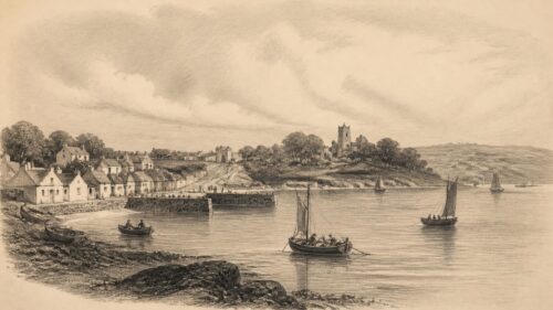
Medieval ports grew where geography allowed vessels to land, transfer cargo and find protection. Dublin’s relationship with the Liffey and its changing estuary illustrates the difficulty of treating a port as a fixed place. Channels shifted, banks silted and quays were repeatedly altered. Elsewhere, deep-water anchorages and natural harbours were crucial: Carrickfergus, Waterford, Cork, Kinsale, Galway and many smaller ports each occupied particular positions in regional and international exchange. Port infrastructure—quays, warehouses, cranes, slipways, breakwaters and customs houses—made maritime activity visible in stone and brick, but it rested upon sailors, pilots, carters, merchants, dock workers and boatbuilders.
Irish shipping carried exports outward and brought foodstuffs, coal, manufactured goods, people and ideas inward. The direction of traffic was never neutral. Ports reflected the economic priorities of changing rulers and trading interests. In the eighteenth and nineteenth centuries, for example, grain, cattle, butter, linen and later industrial products travelled through ports connected to British and imperial markets. Coastal vessels could often move goods more cheaply than inland carts. Yet the benefits were unevenly distributed. A harbour serving commercial agriculture or export industry might enrich merchants and landlords without securing prosperity for labouring communities nearby.
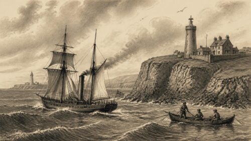
Passenger movement by sea could be routine, perilous or both. Cross-channel traffic connected Ireland to Britain for seasonal labour, military service, commerce and family life. Emigration made the sea especially consequential. During and after the Great Famine, departure from Irish ports became an experience of separation on a vast scale. The National Museum of Ireland records the variety of departure points and the grim inadequacy of some emigrant voyages. The phrase ‘coffin ship’ is now commonly used in accounts of the period, but it should not flatten every voyage into the same story. Conditions varied markedly by vessel, route, regulation and passenger resources. What is beyond doubt is that maritime transport formed the physical threshold between deprivation in Ireland and uncertain futures overseas.
Water also shaped internal communications. Ferries crossed rivers and loughs where bridges were absent or too expensive. At low tide, fords could be useful; at flood, they could become dangerous or impassable. A ferry landing might sustain an inn, a market, a post route or a village. Conversely, a missed boat or storm-bound crossing could interrupt legal business, food supply and personal travel. The vocabulary of Irish place names retains many reminders of these relationships: quays, fords, bridges, harbours and landing places survive not merely as labels but as records of movement embedded in landscape.
Turnpike Ambitions
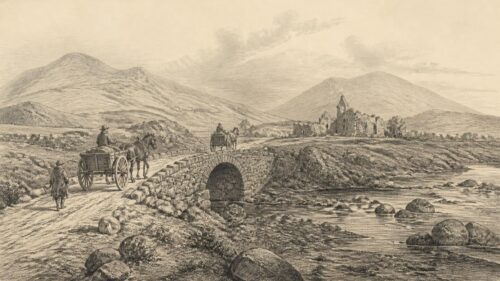
Until the eighteenth century, many overland journeys remained slow, seasonal and local. Roads often consisted of tracks negotiated by walkers, horses, drovers and carts rather than engineered surfaces designed for rapid wheeled travel. Their quality depended upon soil, weather, drainage and maintenance. The problem was not that Ireland lacked movement; people travelled constantly for markets, fairs, religious observance, labour and kinship. Rather, long-distance wheeled travel was unreliable, expensive and frequently uncomfortable. The state’s expanding administrative ambitions, together with commercial growth, created pressure for more coherent routes.
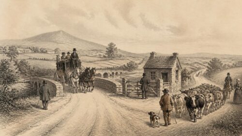
Turnpike legislation introduced a new model from 1729. Toll-paying roads were intended to fund construction and repair along specified routes, initially including roads radiating from Dublin. This was not a comprehensive national plan imposed all at once. It was a piecemeal system, shaped by parliamentary acts, local influence, commercial expectations and the willingness of proprietors and travellers to pay. Nonetheless, its effects were substantial. Better-drained, straighter roads made regular coach services more feasible and reduced the uncertainty of journeys between principal towns. The road itself became an advertisement for property and commerce: proximity to a turnpike could enhance the perceived value of a town, inn or estate.
Stagecoaches and mail coaches made distance more legible in terms of timetables. They also helped create a practical geography centred upon Dublin and other major urban places. Mail services required regularity; coaching inns required horses, food, stabling and workers; passengers required connections. Roads thus generated a service economy as well as a route. Yet this was not democratic mobility. Fares could be prohibitive, and much of the population continued to walk. For poorer travellers, a road might be a route to seasonal employment or eviction, not a ticket to leisurely travel. The ability to move was socially unequal even when routes were physically shared.
Charles Bianconi’s car services became one of the most celebrated developments in nineteenth-century pre-rail transport. Born in Italy and settled in Ireland from 1802, Bianconi began a scheduled horse-drawn service from Clonmel in 1815. His success lay not in inventing the road vehicle but in organising dependable, relatively affordable services across a growing network. His cars connected towns, fairs and eventually railway stations. The National Museum of Ireland rightly presents this enterprise as a major expansion of practical long-distance travel. Bianconi’s reputation has occasionally acquired the smoothness of legend, as though one determined entrepreneur single-handedly transformed the island. The documentary record supports his importance; it also reminds us that his business depended upon roads, horses, drivers, innkeepers, passengers and the wider economy already developing around improved communications.
Road building carried a harsher history as well. Grand juries, dominated by landowning interests, had important responsibility for local roads and bridges before elected county councils emerged at the end of the nineteenth century. Road works could serve estate management, military movement, market access or administrative control. During the Great Famine, public works included road construction. Many later became known as ‘Famine roads’. The term has powerful commemorative force, yet it needs careful use. Not every rough road popularly described in this way can be securely dated to relief schemes, and not all relief works were equally futile. Still, the broader record is unmistakable: labourers experiencing hunger and distress were employed on schemes that were frequently badly planned, punitive or of limited lasting value.
Canal Labour
Ireland’s canal age arose from ambitions to make water serve inland commerce more systematically. The Newry Canal, constructed in the eighteenth century, linked Lough Neagh’s wider water system to Newry and Carlingford Lough. It was a significant engineering achievement, particularly because it used locks to manage changes in level. The canal carried coal and other goods towards markets, demonstrating the economic logic that would inspire larger projects. Inland navigation promised to reduce the cost of heavy freight, especially where roads remained difficult and horse-drawn haulage expensive.
The Grand Canal was the grandest expression of that ambition in the south and midlands. Begun in 1755, it was intended to connect Dublin to the Shannon and, through its Barrow branch, to the south-east. Progress was prolonged, expensive and technically demanding. The canal reached the Shannon at Shannon Harbour in 1804, while branches and associated works continued afterwards. The Royal Canal, begun in 1790, followed a more northerly route from Dublin towards the Shannon and finally opened through in 1817. Its history included financial collapse, engineering difficulty and fatal accidents among workers. The existence of two Dublin–Shannon canals reveals both the confidence of the era and the dangers of speculative rivalry.
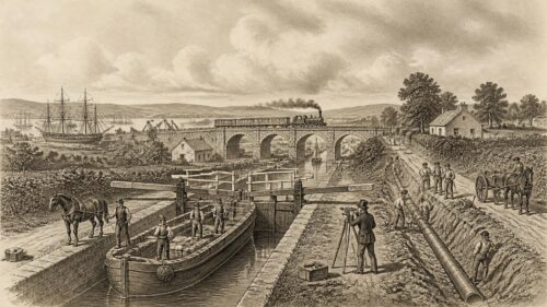
Canals altered the landscape visibly. Locks, bridges, aqueducts, cuttings, embankments, towpaths, warehouses and lock-keepers’ houses formed a new industrial architecture. They also altered the landscape socially. Bargemen and their families developed particular ways of life; villages gained wharves and depots; farmers encountered new possibilities for sending produce to market or receiving coal, lime and manufactured goods. Canal boats could carry passengers, but their principal advantage lay in freight. They were slower than later railways, yet capable of moving heavy loads with remarkable efficiency.
The human cost of construction must remain central. Canals were built by manual labour on an immense scale. Men and boys excavated channels, built embankments, cut stone and handled dangerous materials with little of the protection expected in modern civil engineering. The word ‘navvy’, later associated broadly with construction labour, originated in the description ‘navigator’. Irish workers became prominent not only on projects at home but in the construction of canals, railways and roads in Britain. This connection is historically important: Ireland supplied labour to the industrial transformation of neighbouring regions even while much of Ireland itself remained less industrialised.
Canal prosperity was real but limited. Trade in turf, grain, Guinness, coal, building materials and other cargoes gave waterways a substantial role before the railways matured. Their decline was not instantaneous. Some routes adapted, reduced charges or cooperated with rail interests. Yet rail transport increasingly offered speed, flexible routing and more direct connections to towns without navigable water. By the twentieth century, commercial canal carrying had contracted sharply. The Grand Canal closed to commercial traffic in 1951, though a final notable Guinness cargo travelled in 1960 on a surviving commercial barge movement. The Royal Canal closed to navigation in 1961 before restoration reopened it in 2010. Their later history is not a simple tale of obsolescence: canals became heritage landscapes, ecological corridors and recreational routes, even as their original commercial world faded.
Railway Revolution
The railway transformed Irish ideas of time and distance more rapidly than any previous mode of transport. The Dublin and Kingstown Railway opened in 1834 between Dublin and the developing harbour and resort of Kingstown, now Dún Laoghaire. It is regularly identified as Ireland’s first railway and as the world’s first commuter railway. That latter description captures its social character: it did not simply carry goods between industrial centres, but enabled regular travel between city and suburban coast. The line created a pattern that remains familiar—daily movement shaped by a fixed timetable, a station network and a distinction between home and workplace.
During the nineteenth century, separate railway companies constructed lines across much of the island. The Great Southern and Western connected Dublin with Cork and served towns through the south and midlands. The Midland Great Western drove westward from Dublin. The Great Northern Railway developed a major all-island system linking Dublin, Belfast and places between and beyond. Other companies served local, industrial and coastal districts. The outcome was not one centrally designed network. It was an accumulation of competing and cooperating enterprises, dependent upon parliamentary authorisation, private capital, land acquisition and state policy.
Railways made possible new forms of circulation. Farmers could send cattle and perishable produce to distant markets. Newspapers could reach provincial towns more quickly. Seaside resorts, sporting fixtures and political meetings acquired larger potential audiences. Commercial travellers could cover several towns in a day. For emigrants, railway journeys became part of the route to ports at Dublin, Queenstown—now Cobh—Belfast, Derry and elsewhere. The railway did not cause all these changes by itself; telegraphy, literacy, market integration and urban growth mattered too. But the railway supplied the physical rhythm through which many changes became ordinary.
Its engineering was inscribed across the country. Viaducts crossed valleys, embankments carried lines over wet ground, tunnels cut through hills and bridges rearranged older roads. Stations ranged from grand termini to modest platforms. Their architecture expressed hierarchy. Dublin’s principal stations projected corporate confidence and civic importance, while rural stations might consist of a house, a goods shed, a signal cabin and a short platform. Yet even small stations could be transformative. They connected a parish to national markets, created employment and introduced a timetable that governed local routines.
The railway age was uneven. Some areas gained several competing lines, while others remained remote from the network. Narrow-gauge railways served parts of Donegal, Kerry, Clare, Cork and elsewhere, often with lower construction costs and more difficult terrain in mind. Their supporters saw them as instruments of development; critics questioned their profitability and durability. Many lines carried a mixture of passengers, livestock, turf, fish and agricultural produce. Their eventual closure can tempt nostalgia, but the original systems were not always financially secure or convenient. A rural railway could be cherished by communities and still struggle economically.
Railway expansion also involved conflict. Landowners negotiated compensation; tenants and farmers worried about severance of holdings; workers endured dangerous construction conditions; shareholders expected returns. The railway was not an impersonal machine arriving from nowhere. It was a legal, financial and labour-intensive project. The CIÉ Group Archives, which preserves corporate records from dozens of railway companies as well as canal, tram and road concerns, offers evidence of this complexity. Minute books, plans, staff records and operational documents make it possible to see transport not simply as a map of lines but as a world of decisions, disputes and individual working lives.
Urban Motion
In Dublin, transport developed into a distinctive urban system of walking, horse vehicles, trams, railways and eventually buses. Eighteenth-century hackney coaches and sedan chairs served those able to pay, while working people walked. Horse trams appeared in the nineteenth century, running on rails laid in city streets. Their advantage was smoother and more predictable movement than an ordinary road carriage could offer. Electric traction then remade the tramway. The Dublin United Tramways Company became a powerful presence in the city’s daily life, its routes helping to shape suburban growth and the geography of work.
Trams altered more than journeys. They influenced where people could live while maintaining employment in the centre, encouraged shopping and leisure beyond traditional walking distance, and imposed a visible order on busy streets. Their wires, poles, tracks, depots and overhead equipment changed the cityscape. Dublin’s tram history is sometimes treated as a vanished golden age. There is truth in the affection, but not every past tram journey was idyllic: vehicles were crowded, labour relations could be contentious, and access still depended upon fare and route. Historical understanding is better served by recognising both utility and limitation.
Belfast developed an equally significant tram and later bus history, rooted in a larger industrial city with intensive commuter and workplace travel. Cork, Limerick and other towns had their own local transport arrangements, though on different scales. Ports, factories, rail termini and markets generated particular flows. Urban transport demonstrates that mobility was not simply about travelling from one county to another. It was also about the daily negotiation of streets—children walking to school, dockers reaching quays, domestic workers crossing the city, shoppers carrying goods and crowds attending matches, meetings or entertainments.
The relationship between railway and tramway was often complementary. A suburban rail journey could end with a tram connection; a tram could take passengers to a terminal. But road motorisation changed that balance. Buses could alter routes more easily than trams and did not require tracks or overhead wiring. Their flexibility, however, came with consequences: they were dependent on road conditions and later became entangled with traffic congestion. The replacement of trams by buses was therefore not simply technological progress. It reflected changing capital costs, planning choices, institutional decisions and assumptions about the future of the motor road.
Partitioned Networks
The political partition of Ireland after the revolutionary period created new difficulties for transport networks that had been planned on an all-island basis. Railways, roads, canals and ports did not automatically align with the border established in the early 1920s. The Great Northern Railway was especially important because its system crossed the new frontier repeatedly and linked Dublin with Belfast. Customs procedures, security concerns and divergent public policies complicated a network designed under a different political order.
Partition did not erase practical interdependence. The Dublin–Belfast rail corridor remained vital, and the Enterprise service, inaugurated in August 1947, became a durable symbol of cross-border connection. Its survival was not inevitable. The later twentieth century included political violence, security restrictions and periods of uncertainty that affected ordinary travel as well as infrastructure. Yet rail continued to provide one of the clearest physical links between the two principal cities on the island. The service’s history shows how transport can preserve contact even where constitutional arrangements divide territory.
Waterways also crossed or approached the border. The Erne system, the Ulster Canal and the Newry Canal belong to a geography that cannot be understood solely through either jurisdiction. The establishment of Waterways Ireland under the Good Friday Agreement gave institutional form to an all-island approach in this sphere. This was not a restoration of the old commercial canal age, but it recognised that rivers and navigations follow landscape rather than political boundaries. Restoration, tourism and environmental management became part of the waterways’ new public purpose.
Interpretation requires caution here. It would be too simple to describe partition as the sole cause of every railway closure or regional transport weakness. Financial problems, the rise of road haulage, population patterns and state investment choices mattered independently. Equally, it would be misleading to suggest that transport remained untouched by political division. Border controls, institutional separation and security conditions plainly altered journeys, freight and the viability of some services. The historical evidence supports both propositions.
Motor Ascendancy
The motor vehicle began as a novelty for the affluent, but it gradually reorganised Irish transport. Cars, lorries and motor buses challenged railways because they could use a widening road network and reach places without stations. Early motorists still faced poor surfaces, unreliable machines and limited fuel provision. Registration, speed regulation and road maintenance became matters for public administration. County councils, established in 1898, increasingly assumed responsibilities that had previously rested with grand juries and other bodies. The road became a public asset requiring continual investment rather than an occasional route repaired locally.
Buses were particularly important because they translated motor technology into collective transport. In rural areas they could connect villages to market towns, railway stations and county centres. In cities they offered a flexible alternative to trams. The first decades of motor bus operation involved many private companies, experimental routes and fierce competition. State regulation later reshaped the sector. The Road Transport Act of 1932 restricted private road passenger transport significantly, while the formation of Córas Iompair Éireann in 1945 brought major rail and road interests into a new public transport framework.
This process of coordination had practical logic. Railways, buses and canals were competing for limited traffic in a country with a relatively small and dispersed population. The 1949 Milne report concluded that the state possessed more transport infrastructure than its population and traffic could support economically. The conclusion helped justify rationalisation, but its effects were painful. Railway closures removed services from many towns and rural districts. What appeared administratively efficient at national level could feel like abandonment locally, especially where bus services were sparse or private car ownership remained low.
Road haulage increasingly took freight from rail and canal. It offered door-to-door delivery and avoided the transhipment required at stations or wharves. The change was commercially compelling, but it transferred growing burdens to roads and intensified dependence on fossil fuel. Lorries became essential to agriculture, retailing, construction and industry. The older landscape of goods sheds, cattle banks, railway sidings and canal stores lost much of its original function. Some buildings survived through adaptation; others became derelict or disappeared.
The Emergency during the Second World War exposed the vulnerability of motor transport to fuel scarcity. Rail, canal and even horse-drawn movement acquired renewed importance when petrol and imported materials were constrained. This episode is a useful corrective to any assumption of inevitable technological succession. A transport system is never merely a ladder on which one mode permanently replaces another. Its usefulness depends on energy supply, regulation, war, cost, maintenance and available labour. Older modes can recover relevance under altered conditions, even if only temporarily.
Airborne Connections
Aviation added a new scale to Irish mobility. Early flying was experimental and prestigious, but air services gradually became part of commercial and political life. Airports connected Ireland more directly to Britain, continental Europe and North America, reducing the significance of sea crossings in passenger time while not eliminating their importance for freight and travel. Dublin Airport, Shannon Airport, Cork Airport and Belfast’s airports became gateways shaped by differing regional roles and international routes.
Shannon’s twentieth-century history illustrates how aviation could create a place of global significance beyond the largest city. Transatlantic operations, refuelling and later customs and commercial innovations gave the airport a distinctive identity. Aviation also contributed to a changed understanding of Irish distance. The emigrant journey that once involved a long sea passage became, for many, a flight measured in hours. That transformation affected family relationships, tourism, business and the frequency of return visits. It did not erase emotional distance, but it made transnational lives more practicable.
Air travel remained shaped by wealth and access. Fares, airport location and connections to surrounding areas determined who benefited most. The growth of lower-cost aviation in later decades broadened access considerably, though not evenly. Airports required roads, buses, taxis, parking, freight systems and labour. Like railways and ports before them, they were not isolated pieces of technology but nodes in wider networks. Their history belongs within transport history precisely because they depend upon every other mode to deliver passengers and goods to the runway.
Social Geography
Transport infrastructure has repeatedly redistributed opportunity. A station, bypass, bridge or harbour can shorten one journey while lengthening another in social terms. Communities connected to main routes may gain trade, jobs and services; those passed over may lose population or investment. The history of Irish transport is therefore inseparable from regional inequality. Western, north-western and border areas have often faced particular difficulties because of dispersed settlement, rugged terrain, weaker industrial bases or distance from decision-making centres. These difficulties are historical, not natural inevitabilities.
Gender also matters. Women used transport as workers, shoppers, migrants, carers and travellers, but their experiences were shaped by safety, respectability, fares and access to income. Domestic servants travelled to towns; women emigrated independently or with families; market women used carts, trains and buses; female conductors and other transport workers entered roles once strongly coded as male. Such experiences are less visible in corporate records than engineering projects or company board minutes, which makes oral history, photographs, letters and local research especially valuable. Absence from an archive should not be confused with absence from history.
Disability, age and poverty likewise affected mobility. A road or bus service did not guarantee independence if a fare was unaffordable, a vehicle inaccessible or a journey unsafe. The romantic image of the isolated rural traveller on a donkey cart or bicycle may obscure the labour and hardship involved in reaching a doctor, school, market or railway station. Conversely, the private motor car offered freedom to many households while imposing new costs and dependence on driving ability. Transport choices are always social choices, allocating time, money and risk.
Migration brings these themes together. Irish people have moved within the island and beyond it for centuries. Roads led to ports; trains delivered emigrants to ships; buses carried workers to stations; aircraft later compressed journeys between Ireland and diasporic communities. Each technological change altered the texture of departure and return. The ‘American wake’ recorded by the National Museum of Ireland expresses a cultural recognition that emigration could resemble death in its finality. Later transport did not eliminate loss, but more frequent and faster travel made reunion more conceivable.
Historical Evidence
The study of transport benefits from unusually varied evidence. Archaeology can reveal trackways, roads, bridges, harbour works and objects associated with travel. Maps show routes, gradients, stations, quays and changing settlement patterns. The nineteenth-century Ordnance Survey is especially important because it recorded roads, ferries, canals, railways and many associated structures in systematic detail. Company archives preserve minutes, contracts, engineering drawings, timetables, staff files and financial accounts. Newspapers record accidents, openings, advertisements, complaints and the excitement or resentment provoked by change.
Each source has limits. A company report may record revenue precisely while saying little about the discomfort of passengers or the unpaid labour of families supporting transport workers. A newspaper may exaggerate novelty or disaster. An old photograph may show a busy street but conceal who could not afford the vehicle in view. Oral testimony can preserve experiences absent from formal records, but memories may compress dates or blend events. Good history does not dismiss such evidence; it compares forms of evidence and makes uncertainty visible.
Folklore deserves the same respectful discipline. Stories of impossible journeys, haunted coaches, drowned ferrymen, hidden railway tunnels and roads built solely as famine relief often attach themselves to real infrastructure. They can reveal how communities have understood danger, loss and modernisation. But the historian must distinguish a documented construction date from a story repeated generations later. In Ireland, where landscapes are densely storied, this distinction is not an attempt to drain places of meaning. It is a way of preserving the difference between memory, interpretation and verifiable fact.
Living Legacies
Much Irish transport heritage remains in use, though often in altered form. Rail corridors still carry intercity, commuter and cross-border services. DART, introduced in 1984, adapted an older coastal railway corridor to electric suburban travel. Canals have become navigation and recreation routes. Old station buildings serve as homes, museums, cafés or community spaces. Greenways reuse former rail alignments, allowing cyclists and walkers to experience gradients, bridges and cuttings created for steam-era movement. Such reuse can protect historic fabric, but it also changes its meaning from working infrastructure to amenity landscape.
Preservation requires choices. A viaduct may be celebrated as an engineering monument while the working-class settlement that supplied its labour is forgotten. A restored canal lock may be admired without acknowledging the hazards faced by navvies. A station canopy can be conserved as architecture while the timetable and social world it once served have disappeared. The most useful heritage interpretation connects structure and people: stonework and signal boxes, certainly, but also ticket clerks, boatmen, drivers, maintenance gangs, porters, tram conductors and passengers.
The island’s present transport debates—between road building and public transport, urban concentration and rural access, climate obligations and car dependency—have deep historical roots. Ireland has repeatedly faced the problem of providing connection across a dispersed population and difficult terrain. Earlier generations answered with turnpikes, canals, railways, buses and roads, each promising a better future and each producing unintended consequences. History cannot dictate a modern policy, but it can expose the long pattern: systems built around one dominant mode tend to create new exclusions as well as new freedoms.
Transport made Ireland more connected, but never uniformly connected. It enabled commerce while serving systems of extraction; it offered escape while facilitating eviction and emigration; it compressed time for some while others remained far from the nearest reliable service. Its surviving tracks, towpaths, stations and quays are therefore more than relics. They are evidence of how Irish people have negotiated distance, opportunity and belonging. To follow those routes is to encounter an island continually remade by movement.
One striking theme is that Ireland’s transport systems connected communities while distributing opportunity unevenly. The article traces this pattern from toll roads and railways centred on towns to ports serving imperial markets, and through partition’s disruption of all-island routes. It suggests infrastructure changed social experience: timetables, migration paths, and access to work could matter as much as engineering achievement. This raises an interpretative question about whether transport networks primarily overcame geographical barriers or created new forms of dependence on political and commercial centres. How should historians weigh the benefits of faster connections against the inequalities they could reinforce across Ireland?