Shannon Citadel
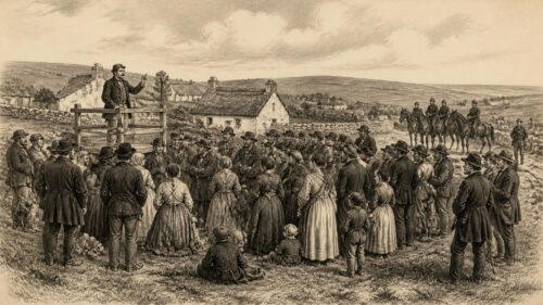
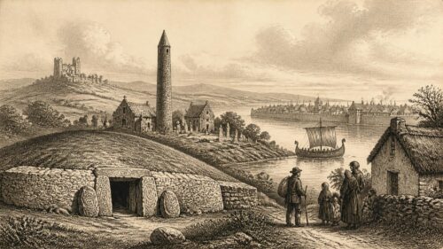
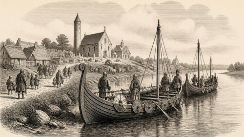
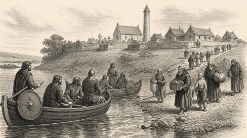
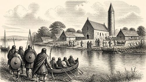
AI generated historical illustration, not a contemporary photograph.
At a Glance
Limerick’s history is inseparable from the River Shannon: its islands, fords, tidal waters and bridges made the place a meeting point, a port, a defensive position and, repeatedly, a battlefield. The city’s distinctive character was made not by one founding moment but by successive communities—prehistoric settlers, Gaelic dynasties, Viking traders, Anglo Norman colonists, merchants, soldiers, labourers and migrants—who adapted a strategically difficult landscape to their own needs.
River Landscape
Limerick stands at a decisive point on Ireland’s longest river. Here the Shannon, broadening towards its estuary, divides around King’s Island and meets the Abbey River. The position offered access inland towards the midlands and outward to the Atlantic world, while also controlling one of the important crossing places between Munster and Thomond. That geography helps to explain why Limerick has so often mattered beyond its immediate hinterland. It was a route, a market, a military objective and a threshold between political territories.
The modern county extends south and east from the Shannon through fertile lowlands, rolling ground and uplands at its margins. Its historic economy has rested heavily on agriculture, especially in the eastern Golden Vale, but the city has always had a rather different relationship with the land. It drew produce, people and wealth from a wide rural region, then linked them to coastal and overseas exchange through its harbour. The distinction between city and county is therefore useful, but never absolute. Their histories continually overlap in the movement of grain, cattle, tenants, merchants, labourers, military forces and religious institutions.
The name Luimneach has attracted several interpretations. Older explanations sometimes present it confidently as meaning a bare, flat or barren place. Scholarly certainty is harder to sustain. Place names can preserve very old linguistic forms, change meaning over time, or be attached to particular localities before being applied more widely. It is safer to say that Luimneach was an established Irish name associated with the Shannon setting before the medieval town acquired the English form Limerick. The competing explanations themselves show how later generations sought to make the river landscape legible through language.
Limerick’s physical setting has also imposed limits. Tidal water, flood risk, soft ground and constrained island sites required substantial engineering. Bridges and quays altered patterns of movement; walls and embankments attempted to turn watery boundaries into defences; later drainage and navigation works exposed archaeological deposits while changing the river’s edge again. The city visible today is thus a layered construction. Its streets, riverbanks and buildings should be understood alongside the buried channels, reclaimed ground and earlier shorelines beneath them.
Ancient Traces
Human activity in County Limerick long predates the city. The best known archaeological landscape lies around Lough Gur, east of the modern city, where monuments and artefacts demonstrate that the region was inhabited and reshaped over many millennia. Stone circles, burial monuments, settlement evidence and later medieval remains make the area exceptional, although no single monument should be treated as a complete account of the past. Archaeological chronology is built through excavation, comparative study and scientific dating; it is continually refined as methods improve.
The Grange stone circle at Lough Gur is among Ireland’s most impressive surviving prehistoric monuments. Its scale and careful construction indicate collective effort and social organisation, but its exact original meaning cannot be recovered simply by looking at it. Claims that such monuments were observatories, temples, courts or sites of a particular ritual may be plausible interpretations, yet they are not direct proof of individual belief. The enduring value of Lough Gur is that it supplies physical evidence for long settlement, farming and ceremonial activity within a richly inhabited landscape rather than a blank countryside awaiting historical development.
In and around Limerick city, archaeological work associated with the Main Drainage Scheme and the Lower Shannon Navigation has recovered evidence from many periods. Worked flint found in the river environment points to very early activity on the Shannon’s banks. A spiral headed pin, dating broadly to the early medieval period, was recovered at the ford near Baal’s Bridge. Such finds do not provide a continuous narrative of a town before the Vikings, but they establish that the river crossing and its approaches had importance before urban settlement on King’s Island.
Early Irish genealogical and literary traditions refer to places in the Shannon area, including Inis Sibtonn and Luimneach. These texts are important historical sources but must be handled with care. They were copied and reshaped over generations, often serving dynastic, ecclesiastical or learned purposes. They cannot straightforwardly be read as modern maps or eyewitness reports. Their value lies partly in showing that the lower Shannon occupied a recognised place in Irish political and cultural geography before the evidence for a Viking town becomes clearer.
Folklore has accumulated densely around Lough Gur and Limerick’s riverside landscapes. Stories of enchanted lakes, vanished inhabitants, giants and supernatural horsemen are part of the county’s cultural inheritance. They can preserve landscape memory and reveal how communities understood striking places, but they are not substitutes for excavated evidence. A responsible history can value such stories without claiming that they verify prehistoric events. The distinction matters because Limerick’s deep past is already remarkable on the strength of documented archaeology alone.
Viking Foundations
Limerick emerged as an urban centre during the Viking age. Scandinavian raiders operated on the Shannon in the ninth century, exploiting the river’s ability to carry ships and armed parties far into Ireland. The annals record attacks on ecclesiastical and political sites along the waterway. Such activity was violent and disruptive, but the traditional image of Vikings solely as raiders is incomplete. In Ireland, their settlements became places of craft production, trade, coin use and cultural exchange.
Historical sources associate a Viking leader called Yorus with a base at Limerick in 861. The precise site of the earliest longphort, a defended ship camp, remains uncertain. Archaeologists and historians have proposed locations near Athlunkard, St Thomas’s Island or King’s Island, but the evidence does not justify a categorical answer. This uncertainty is important. It reminds us that early Limerick is known from a combination of annalistic notices, topography and later finds rather than from an excavated Viking street plan comparable to that of some other Irish towns.
By the tenth century, however, a Viking settlement existed on King’s Island. It occupied a location of exceptional strategic value: protected by water on several sides, near river crossings, and positioned to benefit from trading routes between the western seaboard and the interior. The settlement was part of the wider network of Irish Sea towns that included Dublin, Waterford, Wexford and Cork. It connected Gaelic Ireland to markets and peoples in Britain, Scandinavia and continental Europe, while remaining deeply entangled with local Irish politics.
Finds from the Abbey River demonstrate this commercial and material world. A silver penny minted in London during the reign of Cnut, Viking metalwork and other recovered objects point to exchange networks wider than Munster. They do not mean that Limerick was a simple colonial outpost; rather, the town was a contact zone in which Scandinavian, Gaelic and Hiberno Norse communities negotiated power and profit. Coinage, imported goods and local craftwork provide more concrete evidence for that interaction than later romantic portraits of Viking life.
The town’s political independence was never secure. The Norse rulers of Limerick faced rival Viking groups and the expanding power of Irish kings, notably the Dál Cais of north Munster. The defeat of the last Viking king of Limerick by Brian Boru is traditionally placed within the conflicts that elevated Brian’s authority. The larger historical point is clearer than every detail of the narrative: Limerick was drawn into the consolidation of regional Gaelic kingship, and its river port was too valuable to remain outside such contests.
Gaelic Power
The rise of the Dál Cais transformed the political setting of Limerick. Their power base lay in Thomond, north of the Shannon, and their most celebrated ruler, Brian Boru, became a dominant figure in late tenth and early eleventh century Ireland. Later tradition has often simplified Brian’s career into a story of national liberation from Vikings. The contemporary political world was more complicated. Gaelic rulers fought one another as well as Scandinavian leaders; alliances crossed ethnic and dynastic lines; and control of towns was one element in struggles for tribute, prestige and military advantage.
Limerick mattered to Brian and his rivals because it combined wealth with location. A port brought customs, goods and access to maritime contacts. A fortified settlement provided a forward position near the boundary between Thomond and the kingdoms of Munster. The town was also a symbol of authority. To control it was to influence the lower Shannon corridor, a practical and political asset in an island whose waterways remained essential lines of communication.
The apparent distinction between Viking town and Gaelic countryside should not be pressed too far. Urban communities depended on nearby food supplies and rural producers; local Irish elites engaged with commerce; Scandinavian settlers could adopt Irish language, customs and marriage ties. The evidence supports interaction rather than sealed ethnic compartments. Nevertheless, urban political control could change abruptly, and the capture or loss of Limerick was repeatedly registered in annals because it had consequences far beyond its walls.
Christian institutions also formed part of this changing landscape. Monasteries had long been important centres of learning, landholding and exchange, and their wealth made them targets during the raiding era. Over time, urban churches and episcopal structures grew in importance. The later establishment of St Mary’s Cathedral on King’s Island belongs to the post Viking and Anglo Norman transformation of the town, but it also occupied a setting already shaped by centuries of Gaelic and Hiberno Norse power.
For historians, the period demonstrates the limits of tidy origin stories. Limerick was neither purely Viking nor purely Gaelic. It was a river town whose inhabitants and rulers operated across cultural boundaries. The surviving records are uneven, and archaeology is necessarily selective, but together they reveal an early urban place formed by conflict, exchange and adaptation.
Norman Conquest
The arrival of Anglo Norman forces in Ireland after 1169 altered Limerick decisively. The town was captured in the 1170s during the wider conquest of Munster. Accounts differ in detail and must be read critically, especially those written by writers sympathetic to the conquerors, but there is no doubt that the occupation introduced a new political order. Limerick became a key royal and colonial stronghold on the western edge of English power in Ireland.
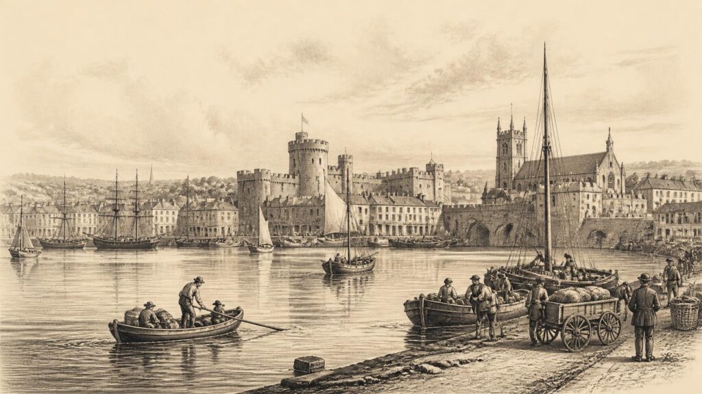
A charter granted in the reign of Richard I formalised urban privileges, while King John’s Castle was built or substantially developed around the beginning of the thirteenth century. The castle, dominating the northern end of King’s Island near Thomond Bridge, was both a practical fortress and a statement of royal authority. Its massive walls and towers survive as one of the city’s most visible historical structures, although what visitors see is the result of medieval construction, later alteration, restoration and modern interpretation.
Anglo Norman Limerick developed a spatial and social division remembered in the names Englishtown and Irishtown. Englishtown occupied King’s Island around the castle and cathedral. Irishtown lay to the south of the Abbey River. The labels should not be interpreted as a precise census of ethnicity. Medieval towns contained people of varied backgrounds, and legal categories could be more significant than ancestry. Yet the names do indicate the unequal political order of a colonial town in which English law and urban privileges were connected to the settlers’ community.
St Mary’s Cathedral, founded in the late twelfth century, embodies the transition. It is traditionally associated with the former Viking royal site, though such associations should not be treated as wholly demonstrable. Its fabric contains Romanesque and Gothic elements, and its survival reflects the centrality of the cathedral to the city’s religious and civic life. Like the castle, it makes visible the way conquest was expressed through enduring institutions and monumental stonework.
Walls enclosed both principal urban districts, while bridges and gates controlled movement. Recent archaeological discoveries beneath later streets and quays have located parts of the medieval defensive system and bridge structures. Their recovery is particularly valuable because much of the visible medieval townscape was dismantled during later redevelopment. Archaeology makes clear that Limerick’s apparently modern waterfront conceals a much older military and commercial infrastructure.
Medieval Commerce
Medieval Limerick was not merely a garrison. It was a port and market town with links across the Irish Sea and beyond. Its merchants dealt in hides, wool, fish, wine, salt and other goods circulating through English, French, Iberian and Irish networks. The exact volume and composition of trade varied with war, piracy, royal policy, harvests and changing markets, but the city’s position on a navigable tidal river gave it a durable commercial advantage.
The corporation and freemen played an important role in civic life. In medieval and early modern terms, freedom of the city was not an honorary distinction; it brought recognised rights to trade, participate in the corporation and enjoy particular legal privileges. Those rights were restricted and unequally distributed. Women, poorer inhabitants, migrants and rural people could be essential to the town’s economy while remaining outside the governing circle. To describe Limerick as self governing should therefore not imply democratic government in a modern sense.
The relationship with the Gaelic lordships beyond the city was frequently tense but economically necessary. Limerick sat near a frontier between the English lordship and powerful Irish territories. Periods of warfare could interrupt agriculture and commerce, yet the city relied upon regional exchange. Markets brought country and town together, while political boundaries were crossed through trade, labour and negotiation. The frontier was real, but it was porous.
Churches, religious houses and hospitals also shaped the medieval city. They held property, supplied spiritual services, offered some charitable provision and connected Limerick to wider ecclesiastical networks. Their records are fragmentary, particularly after later upheavals, but the surviving buildings, charters and archaeological evidence show a religious landscape more varied than the cathedral alone. Medieval Christian life was woven into urban government, household life, burial practice, education and the calendar of markets and festivals.
The later Middle Ages brought instability. The authority of the English crown in Ireland contracted sharply outside certain areas, while Limerick’s political and commercial elite navigated relations with neighbouring Gaelic powers. It is misleading to portray the city simply as abandoned by England or wholly independent. More accurately, it occupied an exposed position in which local leaders had to bargain, defend privileges and maintain trade amid changing balances of power. That political flexibility became one of Limerick’s recurring historical traits.
Confessional Change
The sixteenth century brought the Reformation, Tudor state expansion and renewed warfare. These developments affected Limerick in ways that were religious, constitutional and commercial. The English crown sought to establish royal authority more consistently across Ireland, while the break with Rome changed the legal position of churches and religious orders. In practice, allegiance and belief did not divide neatly. Local families, clergy and officeholders could adapt cautiously, resist, conform outwardly or combine loyalties that later historians might regard as contradictory.
Limerick remained strategically important because it was a fortified port at the Shannon crossing. The crown needed its loyalty, while its inhabitants needed royal protection and access to trade. At the same time, the city’s Catholic majority and its connections with continental Europe ensured that confessional questions could not be reduced to administrative decree. Religious identity became increasingly entangled with fears of political disloyalty, particularly during wars involving Spain, France and the English crown.
The dissolution of monasteries and the restructuring of church property altered the material as well as spiritual landscape. Some religious buildings were suppressed, adapted or fell into decay; land and revenues changed hands. St Mary’s Cathedral became part of the established Church of Ireland, yet Roman Catholic devotion persisted in households and communities. The survival of religious practice outside official structures is difficult to quantify, but the later strength of Catholic institutions in Limerick makes clear that the Reformation did not create a uniformly Protestant city.
During the later Elizabethan wars, Limerick supported the crown against major Gaelic rebellions. That loyalty did not mean a simple embrace of every Tudor policy. It reflected civic calculation, fear of disorder and the desire to safeguard trading and legal privileges. The city’s history repeatedly shows that municipal decisions were shaped by local interests as much as by grand ideological categories. Civic elites acted within imperial and confessional struggles, but they also tried to preserve their own authority and prosperity.
By the early seventeenth century, Limerick was a substantial walled urban centre, described in contemporary accounts as two adjoining towns divided by the Abbey River. The division between Englishtown and Irishtown persisted in topography even as the social realities of the city changed. Its walls remained central to its identity. They offered security, but they also made Limerick a place whose capture or resistance could influence events throughout Ireland.
Siege City
Few episodes have marked Limerick’s historical memory as deeply as the seventeenth century sieges. The city endured conflict during the Confederate Wars, the Cromwellian conquest and the Williamite War. These were not isolated local dramas. They formed part of interconnected wars across Ireland, Britain and Europe involving religion, monarchy, parliamentary power, landownership and international alliances. Yet their consequences were intensely local: hunger, disease, destruction, displacement and the remaking of property.
In 1642, amid the rebellion and the formation of Confederate Catholic government, Limerick’s Protestant English garrison surrendered to Catholic forces. The city then became an important Confederate and royalist centre. Its position allowed it to serve as a port with continental connections, including links to Catholic Europe. But those advantages also made it a target. The parliamentary conquest of Ireland brought a determined campaign against remaining royalist and Confederate positions.
Henry Ireton’s army besieged Limerick in 1651. The conditions within the city were appalling. Disease and famine weakened the defenders and civilian population; the loss of access to supplies proved decisive. Ireton himself died shortly after the surrender, having contracted disease during the campaign. The fall of Limerick did not simply end a siege. It opened the way to confiscation, military occupation and a far reaching reordering of land and political power under the Cromwellian regime.
Contemporary and later accounts often focus on heroic commanders and dramatic sorties. Those stories have their place, but they can obscure the experience of ordinary inhabitants. Siege warfare was fundamentally an assault on civilian sustenance. Artillery damaged buildings, while blockades turned food, water, disease control and fuel into weapons. Limerick’s ability to hold out in later sieges derived partly from its walls and water, but those features could also trap people within an increasingly desperate space.
The city recovered sufficiently to become a major Jacobite stronghold after the accession of William III and Mary II in 1689. For supporters of the deposed James II, Limerick became the principal remaining fortified city after defeats elsewhere. Its choice of side reflected the political and religious alignments of the age, but no account should overlook the diversity of motives among soldiers, clergy, merchants and residents. Military allegiance, Catholic interest, local survival and expectation of foreign support could coincide without being identical.
Williamite Resistance
William III’s army reached Limerick in August 1690. The siege that followed has become central to popular memory, especially the successful defence against the assault on the walls near Irish Town. Patrick Sarsfield’s celebrated raid on Williamite artillery at Ballyneety is one of the best known episodes. Its strategic effect has sometimes been magnified in retelling, but it was plainly an important success for the Jacobite defenders, delaying the bombardment and raising morale.
The Williamite assault of 27 August 1690 failed. Defenders repelled troops who had entered through a breach, and William withdrew shortly afterwards. Accounts and later illustrations frequently depict women of Limerick participating by carrying ammunition or throwing stones. There is a long tradition for this claim, and it is entirely plausible that civilians assisted in a besieged town. However, the precise actions of named or unnamed women are difficult to document with the certainty sometimes implied by commemorative narratives. The broader truth is that siege defence depended upon civilian as well as formal military labour.
The reprieve was temporary. In 1691, after the Jacobite defeat at Aughrim and the surrender of Galway, Limerick was isolated. Baron de Ginkel commanded the Williamite forces. The city was again attacked from several directions, and the strategic situation had changed. Its defenders had courage and strong positions, but they lacked the wider military support necessary to reverse the war’s course. Negotiation became unavoidable.
On 3 October 1691, the Treaty of Limerick was concluded. The agreement consisted of civil and military articles. The military articles allowed Jacobite soldiers who wished to do so to leave for France, an episode associated with the ‘Wild Geese’. The civil articles promised protections to certain Catholics who accepted Williamite rule and took an oath of allegiance. The original treaty documentation and contemporary copies are crucial evidence, because the treaty has often been surrounded by later political myth.
Its legacy was bitter. Subsequent legislation and political practice did not preserve the breadth of security that Catholic supporters believed had been promised. The treaty came to stand in Irish nationalist memory as a broken compact, though historians debate the precise legal and political mechanisms by which its guarantees were narrowed. What is beyond doubt is that Limerick’s surrender became a defining symbol of defeat, exile and dispossession for later generations. The city’s association with war was condensed into a single phrase: the Treaty of Limerick.
Georgian Expansion
After the wars, Limerick remained a significant commercial city, though political power rested increasingly with a Protestant ascendancy. The eighteenth century brought a remarkable physical expansion beyond the confined medieval core. The demolition of sections of the old walls and the construction of new routes southward enabled an ambitious planned district known as Newtown Pery. Its broad streets and regular plots contrasted strongly with the dense, irregular lanes of Englishtown and Irishtown.
Edmund Sexton Pery, later Viscount Pery and Speaker of the Irish House of Commons, was central to this development. In the 1760s and 1770s, plans were prepared for the systematic laying out of his lands south of the older town. Christopher Colles is closely associated with the grid plan. Developers leased plots and constructed terraces, while other landowners, builders, investors and public bodies also influenced the evolving town. Newtown Pery was not the product of one person acting alone, but Pery’s estate power and political connections were decisive.
The Georgian city represented confidence in trade, property and improvement. Streets such as O’Connell Street, Mallow Street, Hartstonge Street and Pery Square formed a planned urban landscape of brick terraces, stone public buildings, fanlights, railings and disciplined facades. Yet the order of the architecture should not be mistaken for social equality. The houses were built through systems of leasehold, credit, craft labour and service. Their elegance depended upon a city in which wealth was unequally held and poorer households often lived in far less secure conditions.
The port underpinned much of this prosperity. Limerick merchants participated in Atlantic commerce, exporting agricultural produce and importing goods for regional markets. The city’s mercantile fortunes were linked to the wider British imperial economy, including systems shaped by colonial exploitation and Atlantic slavery. It would be misleading to call every Limerick merchant a direct participant in slave trading without specific evidence, but the prosperity of Irish ports and consumer markets was connected to imperial circuits that depended on coerced labour overseas.
Georgian expansion changed the city’s centre of gravity. The medieval city did not vanish, but commercial and fashionable life increasingly moved south. That migration was architectural, social and symbolic. The old island town came to be treated by some improvers as cramped and obsolete, while Newtown Pery represented modernity. Later decline and redevelopment would challenge that confidence, but the Georgian plan still structures much of central Limerick.
Urban Hardship
The nineteenth century brought both growth and hardship. Limerick became a transport, market and manufacturing centre for the region, with bacon curing, flour milling, clothing, shipping and related trades contributing to its economy. Railways later improved connections with Dublin, Cork and other towns. Yet industrial development did not create a city comparable in scale or prosperity to the major manufacturing centres of Britain. Employment remained vulnerable to fluctuations in agriculture, trade and small scale industry.
The Great Famine exposed and intensified existing inequalities. Limerick city received people displaced from rural districts as potato failure, eviction, destitution and disease devastated communities across Ireland. Workhouses, charitable bodies, religious institutions and local authorities struggled with overwhelming need. The city’s position as a regional centre meant that it became a place of refuge, administration and departure, but no urban institution could fully absorb the human catastrophe unfolding around it.
It is important not to represent famine history only through statistics or iconic images. The crisis was experienced differently by tenants, labourers, cottiers, artisans, merchants, clergy, officials and emigrants. Some families entered workhouses; some relied on relief; some moved internally; some left Ireland. Mortality, illness and the breakdown of household security left long consequences for the city and county. The famine also accelerated transformations in landholding and population that had begun before the 1840s.
Nineteenth century maps and valuation records offer unusually detailed evidence for the city’s changing form. They show streets, premises, quays, yards, industrial sites and expanding suburbs. Such sources can reveal patterns of property and infrastructure, though they do not by themselves disclose the quality of domestic life inside every building. The contrast between handsome Georgian streets and overcrowded poorer districts is one reason maps need to be read alongside census returns, health reports, newspapers and local testimony.
Public health became a pressing concern. Water supply, drainage, housing density and infectious disease were not merely technical matters; they reflected who possessed political influence and who bore the costs of inadequate urban investment. Later sanitary works improved conditions in some respects, but the history of urban improvement should not be written as a smooth march of progress. It involved disputes over taxation, property rights, municipal capacity and the uneven distribution of benefit.
Newcomer Communities
Limerick’s history includes communities whose presence is sometimes omitted from conventional civic narratives. In the late nineteenth century, Jewish families, many with roots in Lithuania, settled in the city. They established homes, businesses, communal organisations and religious life, particularly around Collooney Street, now Wolfe Tone Street, and nearby streets. Census evidence records a small but active community whose members worked in trades including clothing, books and other retail businesses.
In January 1904, the Redemptorist priest Father John Creagh delivered antisemitic sermons that made false and hostile accusations against Jewish residents. A boycott followed, accompanied by intimidation and assaults. The event is commonly known as the Limerick Boycott. It damaged livelihoods and encouraged many Jewish families to leave the city, some moving to Cork and elsewhere. Contemporary opponents included Michael Davitt, who publicly rejected the anti Jewish agitation, but such opposition did not prevent serious harm.
Language matters when discussing the episode. It has sometimes been called a pogrom, a term that can suggest a particular scale and form of organised mass violence associated with eastern European history. Recent local historical work has cautioned against using that label without qualification, while fully acknowledging the antisemitism, violence, coercion and two year economic boycott that occurred. The evidence supports neither minimisation nor rhetorical inflation. Limerick’s Jewish citizens were subjected to an indefensible campaign that reduced a once growing community.
The story also complicates idealised accounts of Irish nationalism and Catholic solidarity. Ireland’s own history of colonial subordination did not immunise an Irish city against prejudice. The boycott reveals how religious authority, economic anxiety and imported antisemitic ideas could be mobilised against a vulnerable minority. Its history deserves attention not merely as an isolated embarrassment but as evidence of the responsibilities of civic memory.
Other forms of migration shaped Limerick too. Rural people entered the city for work and education; emigrants departed through wider transport networks; soldiers and officials came and went; religious orders created institutions staffed by people from beyond the county. The city was never culturally static. Its documented Jewish history is especially important because it leaves identifiable names, businesses, burial places and institutional records that connect local history to European displacement and diaspora.
Labour Politics
The early twentieth century made Limerick a notable centre of organised labour. Trade unionism expanded among workers in transport, food processing, mills and other employments. The city’s industrial profile, including the large Cleeves enterprise, produced conflicts over wages, conditions and control. Labour activism existed alongside constitutional nationalism, republicanism and unionism; these currents sometimes cooperated, sometimes competed and often addressed different constituencies.
The Limerick Soviet of April 1919 is the best known episode. It followed the death of Robert Byrne, a republican and trade unionist, and the British authorities’ declaration of Limerick as a Special Military Area. The permit system required many people entering or leaving the city to pass military controls. Limerick’s Trades Council responded by calling a general strike. A strike committee organised food supply, issued its own paper currency and attempted to sustain essential services.
International journalists gave the episode the name ‘Soviet’, borrowing a term made famous by the Russian Revolution. The label should not lead to anachronism. The Limerick committee was not a durable revolutionary government, and participants did not necessarily share a single socialist programme. It was a practical, city wide response to military restrictions, rooted in strong local labour organisation. Its ability to administer food and publicity for a short period was striking, but its limits were equally real.
The strike ended after roughly two weeks, when its organisers judged that sustaining it was becoming impossible. Accounts differ over whether it should be regarded as a victory, compromise or retreat. The authorities altered aspects of the permit regime, but the episode did not transform political power in the city. Its historical significance lies in demonstrating the organisational capacity of workers during the War of Independence and in showing that labour questions could not be reduced to the national struggle.
Further strikes and workplace occupations occurred in County Limerick during the revolutionary years, including the Knocklong and Bruree soviets of 1921. Their slogan, ‘We make bread not profits’, captured an aspiration to worker control, though these experiments were brief and contested. Civil War, economic constraints and conservative political forces limited the broader labour radicalism of the period. Nevertheless, Limerick’s labour history remains a necessary corrective to accounts focused only on military and parliamentary nationalism.
Revolutionary Years
The War of Independence and Civil War left a physical and political imprint on Limerick. Republican organisation had existed in the city and county before 1916, but the revolutionary situation intensified after the 1918 election and the establishment of Dáil Éireann. The conflict involved ambushes, arrests, raids, reprisals, intelligence work and the pressures of military occupation. Experiences differed sharply between urban neighbourhoods and rural districts.
Limerick city was a strategically valuable communications centre. Barracks, bridges, railways, roads and the Shannon all carried military importance. British forces, the Royal Irish Constabulary, republican units and later National Army and anti Treaty forces all understood the city’s logistical value. Civilians had to negotiate curfews, searches, permits and insecurity, even when they were not directly involved in political organisations.
The Anglo Irish Treaty of December 1921 divided nationalist opinion. During the Civil War, Limerick saw serious fighting between pro Treaty and anti Treaty forces. Archaeological recovery from the Abbey River has included weapons, ammunition and military material associated with 1922. These objects provide a tangible reminder that events often called ‘recent history’ are already becoming archaeological history. They also suggest the hurried disposal of arms by retreating combatants, though individual artefacts cannot always be tied to a particular person or incident.
The Civil War’s aftermath shaped local memory for decades. Families and communities carried bereavement, imprisonment, political division and competing claims to legitimacy. Public commemorations often privileged one tradition, while private memory could be more ambivalent. For that reason, historians should avoid treating the period as a simple contest between heroes and villains. The documented record records violence and conviction on several sides; it also reveals the lasting human cost of political fragmentation.
Independent Ireland did not erase the city’s older inequalities or its dependence on regional agriculture and trade. It inherited ageing infrastructure, housing needs and constrained municipal resources. Limerick’s twentieth century history would therefore be shaped as much by employment, planning, education and emigration as by the legacy of revolutionary politics.
Modern Transformations
Twentieth century Limerick changed through industrial development, suburban expansion, education, road building and the changing role of the river. The Shannon Hydro Electric Scheme at Ardnacrusha, completed in the 1920s, was a landmark national project close to the city. It demonstrated the new state’s ambition to harness natural resources and modernise electricity supply. Its benefits and symbolic importance extended far beyond County Limerick, but its presence confirmed the Shannon’s continuing centrality to local life.
The city’s port and docks remained important, though shifts in shipping, rail and road transport altered traditional commercial patterns. Older industries faced pressures from changing markets and technology. As elsewhere in Ireland, emigration shaped households and expectations through much of the century. The growth of housing estates beyond the historic core changed the social geography of the city, while central districts experienced both decline and renewal.
The founding of the National Institute for Higher Education, Limerick, in 1972, later the University of Limerick, was a major institutional development. It broadened educational opportunity and contributed to the region’s intellectual, cultural and economic life. Its campus at Plassey, east of the city, also expressed the outward growth of Limerick beyond the old riverine core. Such institutions should not be credited with remaking the city alone, but they became significant agents in its late twentieth and early twenty first century development.
Heritage conservation has become an important question. King John’s Castle, St Mary’s Cathedral, Newtown Pery, the quays and surviving industrial structures attract attention because they make Limerick’s past visible. Yet conservation involves choices. Restoring prominent monuments can strengthen public understanding, while neglecting ordinary streets, workers’ housing, archives or archaeological deposits can narrow the story told. The city’s heritage is not confined to picturesque buildings; it includes burial grounds, waterways, maps, oral memory, street names and evidence below ground.
Recent regeneration projects and cultural initiatives have sought to reconnect Limerick with its riverfront and historic fabric. Their long term historical significance cannot yet be judged. What can be said is that the city continues an old pattern: adapting inherited spaces to new economic and social purposes. The past is not a decorative backdrop to this process. It is part of the material framework within which choices about housing, public space, transport and identity are made.
Living Memory
Limerick’s public memory often gathers around powerful emblems: the castle, the cathedral, the Treaty, the Wild Geese, Georgian terraces, the rugby field, the Soviet and the Shannon itself. These emblems are meaningful, but none can contain the whole history. A city made by trade and war was also made by domestic work, illness, schooling, worship, migration, craft, market exchange and the daily labour of maintaining streets and homes.
Historical evidence is uneven. Archaeology can recover objects from periods in which written records are sparse, but it may not identify their owners. Official records preserve the actions of corporations, churches, governments and property holders more readily than those of poorer people. Newspapers offer vivid contemporary detail but carry political and social biases. Oral tradition can retain experiences absent from formal archives, yet memories alter with retelling. The strongest account of Limerick uses these sources together while acknowledging their limitations.
Folklore and civic pride have a legitimate place in the story when clearly identified. The city’s martial motto, its tales of sieges and its celebrated figures speak to the ways residents have imagined their home. But pride is best served by accuracy. The record of Limerick includes courage and creativity, as well as sectarian conflict, exclusion, famine and violence. To suppress either side produces heritage rather than history.
The enduring thread is the Shannon. It brought Viking ships and medieval commerce, constrained armies, supplied defensive water, carried imported goods, received objects lost or discarded in war and enabled industrial power. It has also required continual adaptation: bridges, quays, drainage, navigation works and flood management. Limerick is a river city in the fullest sense, not simply because water runs beside it, but because the river has structured its opportunities, dangers and imagined horizons.
From Lough Gur’s ancient monuments to the densely built streets of Newtown Pery, from a Viking trading settlement to a modern regional city, Limerick has repeatedly been remade. Its history is not a straight progression from origin to present. It is a record of overlapping landscapes and contested inheritances. That complexity is precisely why Limerick remains one of Ireland’s most compelling historical places.