
Coastguard Structures
At a Glance
Archive Context
The archival material places coast guard infrastructure inside a broader public works record. The National Archives description of the Office of Public Works collections says the archive runs back to 1831 and includes records on harbours, civil buildings, and working papers. It also identifies a Coastguard Stations category within OPW secretarial records, showing that coast guard buildings were documented alongside roads, piers, harbours, and other infrastructure in the same administrative corpus. [1]
The same guide also shows that coast guard material sits among multiple record forms. It mentions correspondence, reports, plans, and engineered drawings, and it lists a series devoted to pier and harbour structures. Within that arrangement, coast guard stations are not isolated as a single file type; they appear in a system that also preserves plans, letters, and functional categories tied to public works management and coastal infrastructure. [1]
Tramore Station
At Tramore, the record describes a terraced coastguard house of about 1850. It is a three-bay, two-storey building with dormer attic, rendered walls, sash windows, and an elliptical-headed door opening with fanlight. The entry states that it remains in private residential use and preserves much original fabric, while also noting later reroofing, renovation, and the addition of dormers around 2000. [2]
The same Tramore entry emphasizes setting and grouping. The house is one of five identical terrace houses, set back from the road with a shared forecourt, and the appraisal calls the terrace a formal feature in the townscape. The description links the building’s significance to its original intended use as a coastguard house and to maritime activity in Tramore, while keeping the account rooted in surviving fabric and form. [2]
Waterville Station
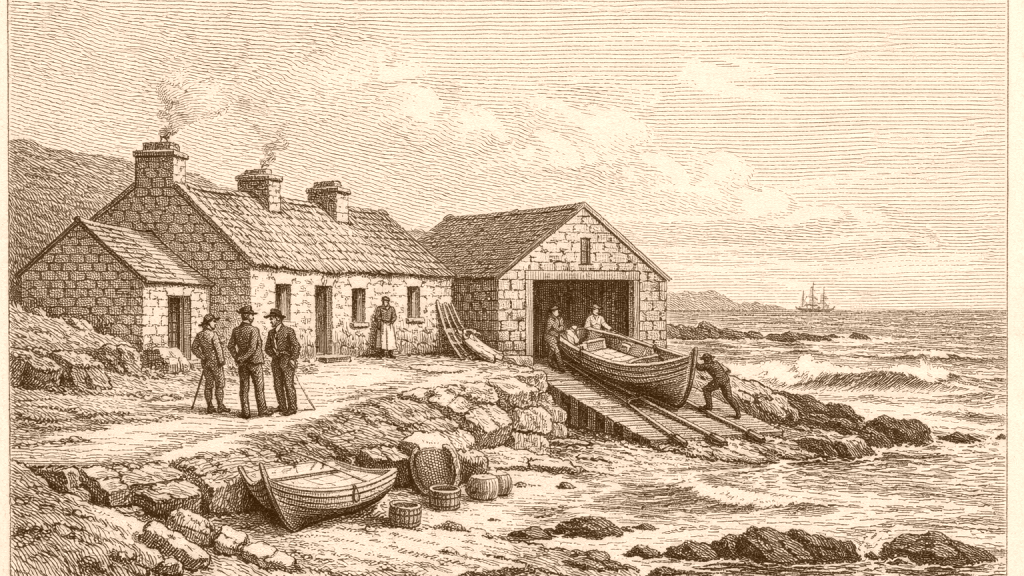
Waterville presents a different coast guard form: a pair of semi-detached single-storey houses built about 1830 as a coast guard station. The record says the north house has been altered by reroofing, refenestration, and extension, while the south retains an original aspect. Materials include rubble stone walls, slate roofs, chimneystacks, sash windows, and replacement doors, indicating a mix of survival and adaptation within one station complex. [3]
Waterville also shows how coast guard buildings may move into later domestic use. The record notes that the former station is now used as a house and shop, and that the left-hand house retains timber two-over-two sash windows with exposed sash boxes. This is evidence of continued occupation rather than abandonment, but the entry does not explain when or why the change of use occurred. [3]
Coad Complex
The Coad entry preserves the most explicitly multiple-building coast guard complex in the set. It describes a group of detached stone-built structures, built about 1900, originally forming a coastguard complex and later used as a sanatorium. The surviving elements include several detached houses, an outbuilding, and other ranges, but the record states that they are now ruinous or derelict, placing survival and decay in the same landscape. [4]
Its fabric description is equally explicit. The buildings are recorded with pitched slate roofs, ridge tiles, pebbledashed or rendered walls, corrugated iron on one outbuilding, and remains of timber sash frames. These details show that the coast guard complex was not a single standardized block, but a cluster of related structures whose materials and present condition are individually noted in the architectural survey. [4]
Harbour Comparison
A harbour case from Fethard broadens the picture from stations and houses to related maritime works. The study describes Fethard Quay as a small harbour built in 1741 for the Commissioners of Customs, and it states that the structure was purpose-built to harbour a single vessel, the King’s Barge. It also links the work to a safe haven for a revenue cruiser operating along the coast. [5]
That comparison matters because the same study notes visible ambiguity in the surviving record. It says the archival record does not fully resolve whether the original construction included one pier or two, and later surveys represented the harbour differently. In this set of documents, then, coastal infrastructure appears as a combination of built remains, administrative purpose, and incomplete or varied description. [5]
Documentary Limits
The combined record is uneven in what it presents. The OPW guide identifies coastguard stations and harbour material in its holdings, but it does not supply individual station histories on the guide page itself. Likewise, the building records are rich in fabric and use, yet they usually stop short of explaining the administrative life of each site. The evidence therefore documents form, use, and survival more clearly than institutional sequence. [1] [2] [3] [4]
A broader pattern is visible in the way these records combine description and omission. The buildings of Ireland entries register dates, materials, and later changes; the Fethard study compares early survey descriptions; and the archival guide points toward plans and working papers without reproducing them. Taken together, these excerpts show coast guard infrastructure as a field that survives partly in buildings, partly in catalogued records, and partly in the gaps between them. [1] [2] [3] [4] [5]
Source References
Hover over a number to see the source. Select it to open the source.

- [1] Office of Public Works Collections | The National Archives of Ireland
- [2] Clyde House, 3 Atlantic View, Church Road, TRAMORE WEST, Tramore, WATERFORD - Buildings of Ireland
- [3] Waterville Coastguard Station, WATERVILLE, Waterville, KERRY - Buildings of Ireland
- [4] COAD, KERRY - Buildings of Ireland
- [5] Fethard Quay, RAMSTOWN Td., Fethard, County Wexford - Buildings of Ireland


How do the cited records document the physical form, later reuse, and archival trace of coast guard infrastructure in Ireland?