

Built Capacity
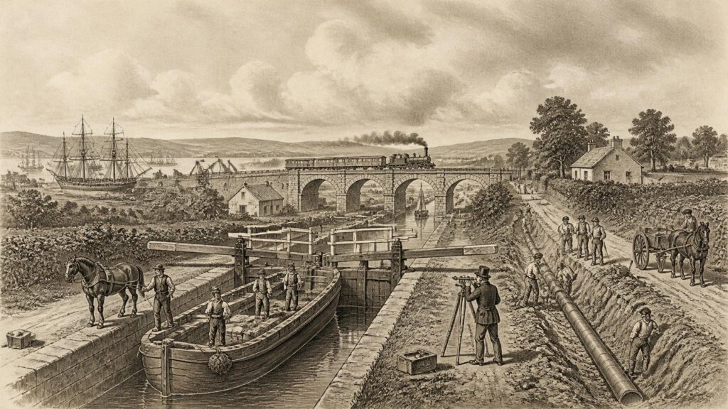
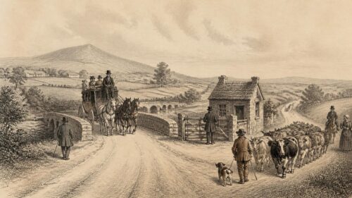
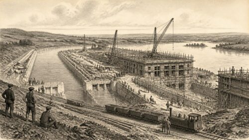
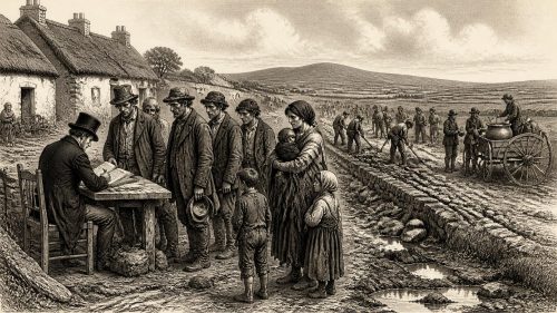
AI generated historical illustration, not a contemporary photograph.
At a Glance
Ireland’s infrastructure has never been merely a background to national history. Roads, quays, canals, railways, reservoirs, wires and cables have determined who could move, trade, communicate, work and obtain basic services. They also expose the limits of political power: grand projects required law, taxation, credit, technical knowledge, land acquisition and labour, while their benefits were unevenly distributed between town and countryside, east and west, and, after 1921, north and south.
Meaning Matters
“Infrastructure” is a modern umbrella term, but the things it describes are old. A harbour wall, a drained field, a market road, a millrace and a bridge all supplied a form of productive capacity. They made it possible to transport people or goods, manage water, convert energy, protect settlements, circulate information or sustain public health. In Ireland, as elsewhere, such works were also political statements. They showed which places authorities regarded as worth connecting, defending, improving or investing in.
Capacity is equally important. It means more than the physical size of a railway, reservoir or generating station. It includes the ability to survey land, raise money, enact legislation, maintain assets, train engineers, settle disputes and organise a workforce. An impressive structure may therefore reveal considerable capacity at one moment while concealing weakness elsewhere. Ireland repeatedly produced projects of international technical interest, yet often struggled to sustain a balanced national network or to extend comparable services to dispersed rural communities.
The historical record does not support a simple tale of persistent neglect followed by modern improvement. Different regions possessed different advantages. Dublin developed as the principal administrative and commercial port; Belfast became a major industrial city and shipbuilding centre; Cork, Limerick, Waterford, Derry and other ports developed distinct economic roles. River valleys, boglands, mountain barriers, shallow estuaries and a long indented coastline created opportunities as well as obstacles. The island’s political divisions, imperial connections and patterns of landholding also mattered as much as terrain.
For that reason, Irish infrastructure should not be judged solely by route mileage or the scale of individual works. It is better understood as a succession of choices about access, risk and priorities. Those choices were made by landlords, merchants, municipal corporations, central departments, railway boards, engineers, voluntary communities and, eventually, the governments and public bodies of two jurisdictions. The physical legacy remains visible in towpaths, viaducts, granite quays, abandoned station buildings, turbine halls, reservoirs and lines of poles crossing the countryside.
Early Connections
Prehistoric and early medieval Ireland did not possess infrastructure in the industrial sense, but communities altered land and water over long periods. Trackways crossed wet ground, fords connected routes at rivers, and boats moved people and materials along coasts, lakes and navigable rivers. Archaeological evidence demonstrates substantial skills in woodworking, stone construction and landscape management, although it would be misleading to impose a later national transport system upon this evidence. Routes were local, seasonal and shaped by political territories that were themselves fluid.
Monastic settlements became important nodes of movement and exchange. Their churches, workshops, schools, mills and cultivated lands depended on access to water, timber, labour and food. Many were positioned near rivers, lakes or sheltered coastal sites. This was not a centrally planned network, but it created enduring patterns: river crossings, landing places and ecclesiastical centres often attracted later roads, markets and settlements. The practical landscape of medieval Ireland was built through many small interventions rather than a single public programme.
The Anglo-Norman invasion introduced new forms of lordship, urban settlement and commercial organisation in parts of the island. Walled towns, castles, bridges, mills and ports were instruments of control as well as economic facilities. Dublin’s position on the Liffey, and the development of ports including Waterford, Drogheda and Galway, bound urban life to Irish Sea and Atlantic trade. Yet river mouths silted, channels shifted and storm damage was recurrent. A port was not simply a naturally gifted place: it required continuing expenditure on quays, dredging, protection works and navigation.
Road travel remained difficult for most people. A route that was adequate for a horse, pack animal or pedestrian could be impassable for wheeled vehicles in winter. The difficulty was not a uniquely Irish condition; it reflected pre-industrial materials, maintenance systems and settlement patterns. But the relative thinness of towns across much of Ireland made costly all-weather road building particularly hard to finance. Local responsibility, tolls, landlord initiatives and state intervention existed side by side, with uneven results.
Imperial Frameworks
The eighteenth century brought a more recognisable age of public works. Dublin’s expansion, commercial agriculture, military concerns and the growing fiscal reach of the state encouraged investment in roads, harbour improvements, drainage and inland navigation. This did not mean that works were planned for the benefit of all inhabitants. Many schemes served export trade, landlords, administrative control or strategic movement. Nonetheless, they created institutions, surveying practices and engineering expectations that would shape the nineteenth century.
The construction of the Great South Wall at Dublin Bay illustrates the scale and persistence required by maritime infrastructure. Begun in the early eighteenth century, it sought to improve access to Dublin Port by managing the movement of sand and channel water. Its length and exposed setting made it an exceptional undertaking for its era. It also demonstrated a recurring Irish reality: ports required continuous adaptation to natural processes. A quay, wall or harbour mouth could not simply be built once and forgotten.
Turnpike roads represented another attempt to overcome distance. Toll-funded trusts and public grants improved sections of route, provided bridges and encouraged the spread of coaching services. Better roads reduced journey times between major towns, although conditions varied sharply away from the principal lines. Their political importance was considerable. Roads carried mail, soldiers, officials, agricultural produce and news; they made state authority more immediate. They also brought burdens, including tolls and demands for labour or land.
The Board of Works, established in the nineteenth century from earlier administrative arrangements, became central to the state’s practical presence in Ireland. Its remit extended across drainage, navigation, fisheries, public buildings and relief works. Such institutions made it possible to conceive projects beyond the resources of one town or estate. Yet central administration could also be remote. Decisions taken in Dublin or London were not necessarily aligned with local knowledge, and a technically rational proposal could have harsh social consequences when imposed on vulnerable communities.
Waterway Ambitions
Canals were among the most visible expressions of eighteenth- and early nineteenth-century ambition. They promised an inland alternative to difficult roads, using locks, embankments, cuttings and basins to link markets with ports. The Newry Canal, opened in the eighteenth century, is often identified as the first major Irish canal. The Grand Canal and Royal Canal represented far larger efforts to bind Dublin to the interior, while navigation works sought to make rivers, especially the Shannon, more reliable routes.
The Grand Canal’s long development exposes the institutional complexity of such works. It passed through successive authorities and financial arrangements before reaching the Shannon system. Its line required engineering structures as well as political persistence: locks to manage changes in level, bridges for intersecting roads, warehouses at transfer points and branches serving particular districts. The canal was not only a watercourse. It was a corridor of labour, maintenance, property rights, fuel supply and commercial expectation.
Waterways could carry heavy goods more cheaply than road carts, a major advantage for grain, turf, building stone and other bulky materials. They also affected settlement. Towns with wharves, depots or repair facilities gained new connections, and canal-side industries found access to coal and markets. But the benefits depended on traffic volumes and reliable water. A canal that looked convincing on a map could be constrained by leakage, insufficient supplies, high tolls, awkward transfers or competition from another mode of transport.
That competition arrived quickly. Railways did not render canals instantly obsolete, and many waterways continued to carry freight for decades. Yet rail offered speed, more flexible timetabling and easier connections to places away from navigable water. Some railway companies acquired canal interests; others built alongside them. The later recreational value of canals should not obscure their earlier commercial purpose, nor should their elegant locks and bridges conceal the financial disappointments that accompanied many schemes.
Drainage and river engineering overlapped with navigation. Landowners and public authorities hoped to reclaim wet ground, reduce flooding, improve agricultural output and make rivers more manageable. Such work could indeed increase usable land and protect settlements, but it also altered habitats, fisheries and water flows. The historical language of “improvement” tended to frame wetlands as wasted space. Modern environmental understanding makes clear that drainage schemes involved trade-offs which contemporaries often underestimated or chose not to value.
Harbours Trade
Coastal infrastructure was indispensable to an island economy. Ireland’s external trade moved overwhelmingly by sea, and even internal connections often depended on coastal shipping. Harbours varied greatly: some were sheltered natural anchorages, others required expensive artificial protection. Dublin, Cork, Belfast, Waterford, Limerick, Derry and smaller ports each developed through a combination of geography, trade patterns, municipal initiative and state support.
Dublin’s port works were inseparable from the city’s position as an administrative capital and commercial centre. The Liffey quays, docks, warehouses and navigation improvements channelled imports and exports through a highly visible urban landscape. Harbour engineering changed the relationship between city and river, producing new working districts and altering older waterfront communities. The apparent solidity of granite quays should not suggest permanence: dredging, channel management and reconstruction remained necessary.
Belfast’s growth illustrates how infrastructure could reinforce industrial concentration. Improvements to the harbour and channel supported larger vessels, while dock facilities, railway connections and industrial sites helped create an integrated manufacturing and shipbuilding economy. The scale of Belfast’s nineteenth-century industrial development was exceptional within Ireland. It also made the city’s prosperity vulnerable to fluctuations in global markets, changes in shipbuilding technology and the political tensions that later hardened around the city’s industrial geography.
Elsewhere, port capacity could be highly specialised. Cork’s maritime trade, including provisioning and food exports, shaped its quays and warehouses. Waterford’s links to the Suir and its hinterland sustained commerce. Smaller fishing and ferry harbours tied island communities and coastal villages to regional markets. Such facilities often depended on local campaigns for grants, evidence that public works were frequently won through lobbying rather than distributed according to a coherent national formula.
Harbours also illuminate labour history. Dockers, shipwrights, carters, sailors, warehouse workers, pilots and engineers made maritime infrastructure function. Their work was dangerous and often irregular. A port’s capacity was not merely the depth of its channel or length of its quay; it rested on practical skill, mutual knowledge and the ability to coordinate people, vessels, cargo and tides. This human infrastructure rarely survives as visibly as the masonry, but it was indispensable.
Railway Transformation
The railway age transformed Irish ideas of distance. The Dublin and Kingstown Railway opened in 1834, linking the capital with the port and resort now known as Dún Laoghaire. It is commonly described as Ireland’s first railway and as an early commuter line. Its significance lay not only in technical novelty but in demonstrating that regular mechanised travel could reshape daily routines, property values and urban expansion.
From the 1840s, railway construction accelerated. Private companies, parliamentary authorisations, contractors and investors created competing systems radiating from Dublin and linking Belfast, Cork, Limerick, Galway, Waterford, Derry and many intermediate towns. William Dargan, the contractor and promoter, became a prominent figure in this process. Engineers surveyed gradients and river crossings; labourers cut embankments and tunnels; masons raised bridges and stations. The network was a remarkable mobilisation of capital and labour in a country whose industrial base was uneven.
Railways changed market relationships. Perishable goods could travel more rapidly, newspapers circulated more widely, and travel was no longer confined to those with private horses or the means to hire carriages. Excursion traffic encouraged seaside resorts and sporting events. Standardised time became more useful as timetables governed departure and arrival. These effects should not be exaggerated: fares, class divisions and station locations limited access. But rail made a national public sphere more conceivable, even where everyday life remained intensely local.
The network’s growth coincided tragically with the Great Famine. Railway building continued during years of mass hunger, eviction, mortality and emigration. It provided employment to some, but it did not resolve the catastrophe. A railway could move food, people and information, yet it could not by itself overcome the political failures, poverty and unequal power that made famine so devastating. The coexistence of engineering achievement with social disaster is one of the clearest reasons not to equate infrastructure automatically with humane progress.
Railway geography also reflected commercial calculation. Main lines concentrated on routes expected to generate traffic, while more thinly populated western districts were harder to serve profitably. Later narrow-gauge lines and light railways extended access to some rural regions, but they often faced weak revenues and high maintenance costs. The famous image of a rail network knitting every locality into prosperity is therefore partly folklore. The documented pattern was more selective: rail connected many communities, but not all equally or permanently.
Network Limits
The Irish railway system was never a single seamless organism before the twentieth century. Companies differed in financial strength, route priorities and operating arrangements. Gauge questions, competing termini and duplicated ambitions complicated coordination. The result was a network rich in local history but expensive to operate. In some places, rival routes represented competition; in others, they reflected political and commercial hopes that outran likely traffic.
Road transport increasingly challenged rail after the First World War. Motor lorries and buses could reach places without stations and required less fixed capital than track, viaducts and signalling. The transition was gradual, not instantaneous. Rail retained important freight and passenger roles, but many branch lines lost traffic. Closures later became symbols of rural marginalisation, sometimes fairly and sometimes through nostalgia that overlooked the low passenger numbers, operating deficits and changing patterns of work.
Partition added a new layer of difficulty. The boundary created in 1921 did not follow the logic of railways, waterways or commercial hinterlands. Lines and services crossed the new frontier, while different administrations acquired responsibility for infrastructure within their territories. Northern Ireland inherited a more concentrated industrial economy around Belfast; the Irish Free State faced the task of building institutions across a predominantly agricultural and dispersed territory. Cross-border links continued, but they became subject to political and administrative constraints unknown to the earlier all-island system.
Nonetheless, the network did not disappear. Main lines remained essential to cities, ports and larger towns, while public transport became increasingly organised through state-backed bodies. The historical lesson is not that rail was a failure. Rather, rail’s usefulness depended on density, maintenance, coordination and integration with other modes. Its most durable routes were those that continued to match population patterns and economic activity. The surviving structures remain evidence of both a remarkable building campaign and the limits of Victorian confidence.
Public Health
Water supply and sewerage brought infrastructure directly into domestic life. Before piped systems expanded, households depended on wells, pumps, rivers, springs, carriers and, in some urban areas, canals. Quantity and quality varied sharply. Contaminated water, crowded housing and inadequate waste disposal contributed to recurring public-health crises. Cholera and other diseases made clear that an individual household’s water could not be separated from the sanitary condition of the wider town.
Municipal waterworks required a new kind of capacity. Town councils had to identify sources, obtain statutory powers, acquire land, finance construction and maintain a network that was largely invisible once buried. Engineers had to calculate catchments, gradients, reservoir levels and pipe capacity. Ratepayers had to accept costs, while poorer residents needed access that was not confined to affluent districts. Sanitary infrastructure was therefore both a technical and a democratic question.
Dublin’s Vartry scheme became a landmark example. Developed by Dublin Corporation in the 1860s, it drew water from County Wicklow through reservoirs, a tunnel and long trunk mains to the city. The undertaking was a major feat of nineteenth-century engineering, carried out with tools and transport very different from those available today. It substantially improved the city’s supply and helped reduce the risks associated with contaminated water, though no public-health system can be credited alone for every change in disease patterns.
The Vartry system also demonstrates long continuity. Its original infrastructure continued to contribute to water supply long after its construction, while later generations faced the difficult task of renewing an ageing asset without interrupting a living city. Such continuity is characteristic of infrastructure history. Pipes and reservoirs are inherited systems: decisions made in one century define opportunities and vulnerabilities in the next.
Cork and other towns followed their own paths. Waterworks, sewers, gas lighting and street improvements emerged at different rates and under different local conditions. Rural areas often remained beyond municipal networks. This was not simply because rural households were overlooked; dispersed settlement made conventional pipe systems expensive. Yet the outcome was a profound inequality in service provision. The history of rural water is therefore a history of both engineering difficulty and public-policy choice.
State Power
The establishment of the Irish Free State created an urgent practical question: could a new state manage large technical systems? The Shannon hydroelectric scheme offered a dramatic answer. Begun in the mid-1920s at Ardnacrusha in County Clare, the project harnessed the River Shannon through a dam, power station, headrace and tailrace works, transmission system and associated structures. It was not a simple power station but a national undertaking linking generation, distribution, administration and public persuasion.
The scale of the scheme was extraordinary for the young state. ESB Archives records that it involved thousands of workers, including Irish and German employees, and a budget that represented a striking share of public revenue. The project depended on the expertise of Siemens-Schuckert and on Irish political leadership, engineering direction and labour. Its international dimension is important: national capacity did not mean national self-sufficiency. Ireland’s state-building project used foreign technology, capital goods and specialist knowledge while seeking domestic control over a strategic service.
The Electricity Supply Board, established in 1927, embodied a new model of public authority. It was expected to operate the Shannon scheme, develop a national network and encourage people to use electricity. This last task mattered. A grid without customers could not support itself, so the Board promoted electric lighting, cooking and industrial power. Infrastructure required demand as well as supply. The familiar idea that engineering ends when a structure is opened misses the ongoing work of connection, billing, repair, marketing and public trust.
Ardnacrusha became a powerful symbol of independence and modernity. Such symbolism was real, but it must be interpreted carefully. The scheme did not immediately electrify every home or eliminate economic disadvantage. It supplied a framework from which wider connection could proceed. Its lasting historical importance lies in proving that the state could coordinate finance, legislation, engineering and administration on a national scale, even amid political disagreement and fiscal constraint.
Rural Power
Rural electrification extended that achievement into everyday life. The programme began after the Second World War and reached communities over several decades. Its technical challenge was formidable: poles and wires had to cover a dispersed settlement pattern, while individual homes and farms required connection and equipment. Its social consequences were equally extensive. Electric light, pumping, milking machinery, refrigeration and domestic appliances altered labour, time and expectations.
It is tempting to describe rural electrification as a universal liberation. Contemporary promotional material often did so, and many households remembered the arrival of power as a major turning point. Those testimonies are valuable. Yet the benefits were not identical for everyone. Connection costs, appliance prices, housing quality and household income influenced what electricity could achieve. Women’s domestic labour changed in important ways, but it did not disappear; new appliances could coexist with persistent expectations of unpaid work.
The programme’s success rested partly on organisation. ESB engineers and crews had to survey routes, negotiate wayleaves, standardise equipment and respond to local concerns. Communities watched the advance of poles with intense interest because they represented admission to a new national standard of living. The wire crossing a field was both a technical object and a social promise. In that sense, rural electrification was an exercise in state legitimacy as well as energy distribution.
Postwar generation policy also reveals the compromises of capacity. Hydroelectricity was supplemented by other sources, including peat-fired stations. Peat development promised employment and indigenous fuel, particularly in the Midlands. It also involved major environmental alteration and, in later decades, became difficult to reconcile with environmental priorities. The historical point is not to judge earlier planners by present assumptions, but to recognise that every energy system transfers costs across places, occupations and generations.
Communications Growth
Transport and energy are only part of the story. Postal services, telegraph lines, telephones, broadcasting and later digital networks have also shaped Irish capacity. The nineteenth-century telegraph compressed time in a manner comparable to the railway. Messages that once travelled at the pace of horse or ship could be transmitted rapidly between cities, ports, railway stations and administrative offices. Commercial decisions, newspaper reporting and government communication acquired a new tempo.
Telegraphy was not equally accessible. It initially served official, commercial and urban needs most readily. But its presence altered expectations about communication and encouraged later telephone expansion. Exchanges, poles, cables and trained operators formed another network layered across the landscape. Like railways, communication lines could bring local places into wider circuits while also reinforcing the importance of larger nodes where traffic concentrated.
Broadcasting added a cultural dimension. Radio could reach households that remained physically distant from urban institutions, creating shared reference points in music, news, sport and public debate. Its spread depended upon electrical power, receiving sets, transmission infrastructure and regulatory decisions. The history of communication therefore cannot be separated from the history of energy and household income.
Modern telecommunications have changed the material form but not the underlying question. Fibre, mobile masts, data centres and undersea cables may appear weightless compared with canals or railways, yet they depend on land, power, planning permission, maintenance and secure connections. The historical pattern persists: access can stimulate economic and social opportunity, while weak coverage or limited capacity can reproduce geographical disadvantage. The technologies differ; the politics of connection remains recognisable.
Road Expansion
The motor age remade Irish transport after independence. Roads became the principal means of reaching dispersed communities, and buses, lorries, cars and tractors altered daily mobility. This was not simply a triumph of convenience. Roads demanded surfacing, drainage, bridges, signage, depots, fuel supply and an expanding system of maintenance. They also shifted public expenditure towards flexible individual and freight movement rather than fixed-route rail.
Road building could bring immediate practical gains. It connected farmers to creameries and markets, enabled school transport, supported bus services and improved access to hospitals and towns. In rural areas, the difference between a rough lane and a reliable all-weather road could be profound. Yet road investment was never evenly spread. Remote districts could receive improved access while still losing local shops, rail stations or other services to larger centres.
Urban road planning created different tensions. Wider streets, bypasses and car parking could relieve congestion, but they could also displace residents or weaken older streetscapes. The later growth of commuter settlements placed new demands on roads, water, schools and public transport. Infrastructure systems are interdependent: a housing development requires more than houses, and a new road can generate further travel rather than simply accommodating existing demand.
The modern motorway network represented another major increase in state delivery capacity, particularly from the late twentieth century. It improved links between Dublin and other cities while raising familiar questions about regional balance and environmental cost. The historical significance of the network lies not only in engineering scale. It shows the accumulated ability of public bodies to plan, procure, regulate and maintain complex works, while also demonstrating how national investment can concentrate movement through particular corridors.
Border Effects
Infrastructure on the island cannot be understood without partition. The new political border divided administrative systems but could not erase shared rivers, road approaches, electricity networks, rail routes or commercial habits. Some connections continued because practical necessity demanded it; others weakened as institutions, regulations and political relationships diverged. Border communities experienced these changes most directly, often finding that familiar journeys now involved checks, uncertainty or altered services.
Northern Ireland’s infrastructure history developed under its own government and later United Kingdom frameworks. Belfast’s industrial base, ports and urban services gave it a distinctive profile, while rural and western parts of Northern Ireland faced different challenges. In the south, the Free State and later Republic pursued national institutions such as ESB and Córas Iompair Éireann within a different fiscal and demographic setting. Comparisons should therefore be cautious. Similar technologies operated within different political economies.
The Troubles brought further physical and psychological burdens. Security installations, road closures, damaged property and the threat to transport routes all affected ordinary movement and commercial life. Yet the period also demonstrated the resilience of cross-border everyday connections. Roads, rivers and family networks ignored neat administrative categories even when political violence made their use dangerous.
Since the peace process, cross-border infrastructure has gained renewed importance. This is not evidence that division ceased to matter, but it shows that shared practical needs can encourage cooperation. Electricity interconnection, road upgrades, tourism routes and waterway restoration each involve technical work alongside negotiation between institutions. The history of the border confirms that infrastructure can intensify division or help make coexistence materially easier; it does not determine politics by itself.
Environmental Reckoning
Earlier generations commonly celebrated infrastructure as conquest over nature. Rivers were straightened, bogs drained, estuaries dredged and hills cut through. These works produced real gains in transport, flood control, farming and energy. But historical evidence also shows that landscapes responded in unexpected ways. Drainage could shift flood risks downstream; navigation works could affect fish; extraction could transform habitats; road schemes could fragment land and communities.
Modern environmental regulation has made these consequences harder to ignore. That does not mean present-day projects are free from conflict. It means that capacity now includes the ability to assess ecological effects, consult affected communities, protect archaeological sites and account for climate risk. In historical terms, this is a significant change in what society expects infrastructure to do. The older question, “Can it be built?”, has been joined by “Who bears the cost?” and “What does resilience require?”
Water offers a particularly clear example. Nineteenth-century reservoirs and mains were major achievements, but they were designed for the knowledge, population patterns and standards of their day. Later upgrades have had to address leakage, treatment standards, ageing pipes and changing demand. The persistence of old systems is not necessarily evidence of failure; durable infrastructure is meant to last. It does, however, create a maintenance burden that can become visible only when a crisis occurs.
The same applies to energy. Ardnacrusha remains a monument to hydroelectric ambition, yet contemporary energy systems must manage different concerns: decarbonisation, grid stability, storm resilience, community consent and new forms of demand. History does not supply a technical blueprint. It does show that infrastructure choices have long lives and that maintenance, adaptation and public legitimacy are as important as initial construction.
Uneven Legacies
The most enduring feature of Irish infrastructure history is unevenness. Some places accumulated connections because commerce, population and political influence reinforced one another. Others received investment later, less densely or through schemes designed to overcome the disadvantages of distance. This unevenness should not be reduced to a crude opposition between Dublin and everywhere else, though the capital’s dominance has been substantial. Belfast, Cork, Limerick, Galway, Waterford, Derry and many smaller towns each occupied changing positions within wider networks.
Nor should historical shortcomings be attributed solely to geography. Terrain and dispersed settlement imposed real costs, but institutions decided how those costs would be shared. Whether to subsidise a railway branch, extend a water main, maintain a harbour or electrify a remote district was a political decision as well as an engineering calculation. Capacity is therefore inseparable from public values.
Folklore often attaches itself to abandoned lines, drowned valleys, old bridges and “roads that led nowhere”. Such stories can preserve local memory, but they should be distinguished from documented evidence. An unused station may evoke a vanished golden age while records reveal that it carried little traffic. A celebrated project may be remembered as universally beneficial while contemporary reports show disputes over land, labour or cost. Both memory and archival evidence matter, but they answer different questions.
Irish infrastructure is best seen as an unfinished inheritance. Canals became amenity corridors as well as commercial routes; railways survived selectively and acquired new urban roles; Victorian waterworks continue beneath modern cities; electricity networks carry new forms of generation; harbours adapt to changing trade. The island’s history is not one of absence of capacity. It is a history of repeatedly building capacity under constraint, then confronting the social, financial and environmental consequences of what was built.
Lasting Lessons
The great projects of Irish history were never solely feats of engineering. They were institutional achievements, requiring agreements between governments, localities, financiers, engineers and workers. They were also moral choices. A road or wire can enlarge opportunity, but only if people can afford to use the services it enables. A reservoir can protect public health, but it can also alter a valley. A railway can connect a town, but it can also redirect commerce away from another.
That complexity gives the subject its historical value. The remains of infrastructure are among Ireland’s most accessible archives. A canal lock reveals assumptions about freight and water management; a station platform records changing habits of travel; a reservoir wall marks a decision to treat urban health as a collective responsibility; an electricity line across a field recalls the extension of state services into domestic life. These are not neutral artefacts. They are evidence of how successive societies imagined improvement.
The central lesson is therefore not that Ireland lacked ambition, nor that every ambitious scheme succeeded. It is that capacity was made, unevenly and painstakingly, through long-term commitments to organisation and maintenance. The future condition of roads, water, energy and communications will be judged in the same way. What matters is not only whether new works are announced, but whether they are designed fairly, maintained competently and adapted honestly to the changing needs of the people and landscapes they serve.
The article’s treatment of partition is thought-provoking because it shows how a political boundary disrupted networks designed around commercial hinterlands, rather than two separate jurisdictions. Railways and waterways could continue across the frontier, yet administration, investment priorities and industrial concentration diverged. This suggests that infrastructure can preserve connections while revealing inequalities and institutional limits. It also complicates assumptions that national independence produces coherent national systems. When considering transport, energy and communications planning on the island, how far should policy prioritise restoring cross-border network logic, and how far should it address the distinct regional needs created by partition and uneven development?