
Golden Vale
At a Glance
Vale Defined
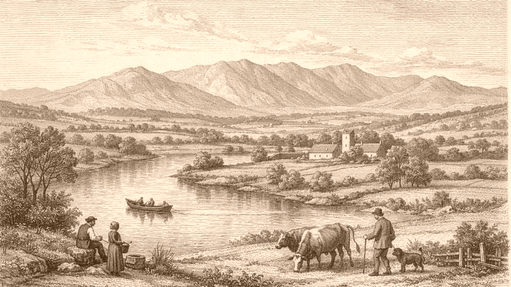
The Golden Vale is presented as a named tract of lowland in county Tipperary and province of Munster. One topographical account says the parish of Cardangan extends into a plain that is called the Golden Vale because of its fertility and beauty, and adds that it contains some of the richest land in Ireland, though it also includes heathery mountain. Another account places Golden itself within what is called the Golden Vale. [3] [1]
A second set of descriptions shows that the name is not used for a tiny spot alone. Lewis says the plain between the Kilnamanagh and Galtee ranges, with Tipperary in its centre, has been designated the Golden Vale because of the surpassing richness of its soil. He also gives boundaries eastward, westward, and by surrounding uplands, making the vale a recognizable landscape unit rather than a single farm or townland. [2]
Fertile Ground
The strongest repeated feature is fertility. Cardangan is said to lie in a plain whose beauty and fertility explain the name, and to hold some of the richest land in Ireland. Relickmurry is likewise described as part of the tract called the Golden Vale because of the superior quality of the land, with a large portion under grass. These accounts stress productive ground rather than political boundaries or settlements. [3] [4]
The same quality appears in Lewis’s county description, where the surface is described as several extensive and fertile tracts, and the plain that became known as the Golden Vale is set among those tracts. He contrasts the fertile level country with bog, mountain, and waste elsewhere in the county. In these passages, the vale is a highly productive part of a wider varied county landscape, not the whole of Tipperary. [2] [6]
River Boundary
Water is part of the vale’s description. Relickmurry lies on the river Suir, and Golden is described as divided into two parts by that river. Lewis’s county account also identifies the broad tract of the Suir as the greatest level country in Tipperary, stretching from near Roscrea to Ardfinnan. The Golden Vale therefore appears as low ground associated with the Suir corridor, not as an inland upland. [4] [2] [6]
The same county text gives the vale clear physical margins. It is bounded by bog to the east, by the Slievardagh hills to the south-east, by Slieve-na-man, and by the higher mountains to the south and north. Arthur Young’s travel account later presents the Golden Vale as a rich level seen from Galtymore. Together these passages show a plain enclosed by rises of land on several sides. [2] [5]
Travel View
Arthur Young’s account gives the Golden Vale a traveller’s perspective. From the top of Galtymore he looks down on a great extent of mountain, and to the north sees the famous Golden Vale of Limerick and Tipperary spreading a rich level to the eye. This is an observable contrast between high ground and low ground, with the vale standing out as the level surface below the Galtees. [5]
Young also links the vale to a wide prospect. He notes mountains to the south and south-east, then says the view extends into eight counties. The Golden Vale is only one part of that larger scene, but it is the part that appears as a rich level in contrast with the surrounding ridges, heights, and distant coast. The passage gives the strongest visual sense of the name in use. [5]
Local Places
The name Golden is itself attached to a specific post-town and village within the tract. Lewis places Golden in the parish of Relickmurry, says it has houses and inhabitants, and notes that it lies in what is called the Golden Vale. This indicates that the vale was not only a descriptive phrase for farmland but also a region in which named settlements sat within the broader fertile plain. [1] [4]
Relickmurry and Cardangan also show that the vale encompassed parishes as well as villages. Cardangan is described as extending into the plain; Relickmurry is described as part of the tract, with a church in Golden and the River Suir beside it. The evidence here is local and descriptive: the Golden Vale appears as a place-name used for an agricultural district with churches, roads, and settlement within it. [3] [4] [1]
Regional Meaning
Taken together, these descriptions make the Golden Vale a Munster lowland, especially in Tipperary, famed for rich soil and grassland. It is a plain associated with the Suir, framed by hills and mountains, and visible as a broad level from elevated ground. The repeated emphasis on fertility suggests why the place-name endured, but the passages themselves stop short of explaining how or when the name first arose. [2] [3] [4] [5] [6]
The passages also show a useful distinction between description and interpretation. They describe what the vale is like: fertile, level, bounded, and visible from hills. They do not, in these excerpts, supply a full history of the name or a formal administrative definition. What can be said with confidence is narrower but clearer: the Golden Vale is a richly cultivated plain in south-central Munster, especially around Tipperary and the Suir. [2] [3] [4] [5] [6]
Source References
Hover over a number to see the source. Select it to open the source.

- [1] Golden - Topographical Dictionary of Ireland (1837)
- [2] Tipperary Topography - Topographical Dictionary of Ireland (1837)
- [3] CARDANGAN, or CURDANGAN, a parish - Topographical Dictionary of Ireland (1837)
- [4] Relickmurry - Topographical Dictionary of Ireland (1837)
- [5] Part 45 of A Tour in Ireland, with general observations on the present state of that kingdom in 1776–78
- [6] Tipperary - Topographical Dictionary of Ireland (1837)
How do the retrieved nineteenth- and eighteenth-century descriptions define the Golden Vale of Tipperary and Limerick?