Maguirebridge’s Double-Till Record30126 BCE
Thirty-thousand years BCE is a modern chronological label, not a recoverable Irish year. Around this period, during MIS 3, Ireland experienced fluctuating climates and advancing, retreating ice. At Derryvree near Maguiresbridge, freshwater silts between two tills, broadly dated to 34,950–29,750 BCE, preserve cold treeless wetland plants and insects, demonstrating locally habitable refuges between glacial episodes. Castlepook Cave’s imperfectly recorded fauna, including mammoth, reindeer, giant deer and predators, indicates connections with wider mammoth-steppe ecosystems. A possible cut-marked reindeer bone may suggest human presence, but no secure evidence establishes settlement. Environmental instability, later glaciation and fragmented survival of evidence prevent conventional history.
Dateline
The label 30,126 BCE cannot describe a recoverable Irish year in the ordinary historical sense. It is a modern conversion, approximately 32,075 years before AD 1950, within Marine Isotope Stage 3 (MIS 3) of the Late Pleistocene. No calendar, written testimony, named ruler, settlement sequence or archaeological event enables historians to distinguish one year from the next at this depth of time. The responsible approach is therefore to place the date within calibrated ranges and to examine the small, uneven body of geological, environmental and faunal evidence that illuminates Ireland around it.
That evidence depicts neither a timeless frozen wilderness nor a country ready for later human settlement. Ireland was part of a volatile north-west European world in which climate, ice extent, coastlines and animal ranges repeatedly changed. Around the thirty-first millennium BCE, the island lay on the approach to the Last Glacial Maximum, but conditions varied greatly between regions and through time. The most useful local evidence comes from a freshwater deposit trapped beneath a Fermanagh drumlin at Derryvree, near Maguiresbridge, and from the old animal-bone collections of Castlepook Cave near Doneraile in County Cork.
A Date Within Broad Ranges
Radiocarbon years are not calendar years. The quantity of carbon-14 in the atmosphere has altered through time, so laboratory measurements require calibration against independently dated environmental records. Uncertainty is especially substantial beyond 30,000 years ago. At Derryvree, organic silts produced the conventional radiocarbon determination BIRM-166: 30,500 years before present, with an error margin of roughly a thousand years. Modern calibration places the deposit in a broad range of about 36,900–31,700 calibrated years before present, or approximately 34,950–29,750 BCE. The requested date lies within that range, but it must not be mistaken for the date of a particular day, season, flood or human action.
The Derryvree sequence is valuable because it preserves relative order as well as a radiocarbon measurement. Roadworks in 1969 cut through a drumlin and revealed a lower till, a body of freshwater silts, sands and organic material, and an upper till. Till is the unsorted debris deposited directly by glacier ice. The sequence demonstrates that ice had occupied the locality, that an interval followed in which open water and wet ground supported life, and that ice later returned and sealed the deposits. It does not establish that all Ireland was ice-free at once, nor that the wetter interval endured without climatic disruption.
A Cold Wetland in Fermanagh
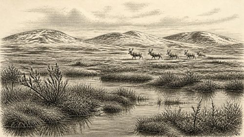
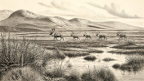
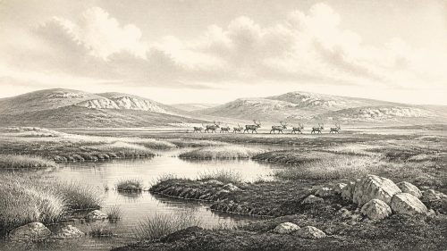
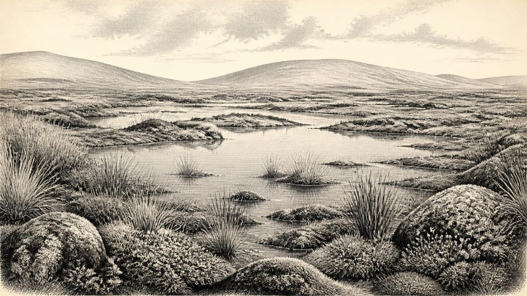
The plants and insects from Derryvree offer the closest evidence for a living Irish landscape around this broad interval. The assemblage has a full-glacial character: treeless vegetation adapted to cold, exposed ground, with aquatic and wetland plants indicating pools or slow water. Mossy ground, sedges and open water formed a local mosaic rather than a uniform plain. Finds of arctic-alpine and tundra-associated vegetation, alongside insect evidence, support the interpretation of a harsh periglacial environment. Winters were severe; the growing season was short; trees did not form woodland there.
Yet “tundra” should not be imagined as bare snow in every direction. Derryvree’s organic material records productive microhabitats: shallow water, submerged plants, saturated mossy surfaces and patches of herbaceous vegetation. These would have offered food and shelter to insects and, seasonally, to grazing animals. Its very existence shows that a portion of northern Ireland could sustain freshwater ecosystems between glacial advances. It cannot tell us whether the same conditions prevailed in Cork, Connacht, Leinster or the Irish Sea basin in precisely the same century.
Further Irish records reinforce the need for regional caution. Organic deposits between tills at sites including Aghnadarragh in County Antrim, as well as cave mineral deposits in south-west Ireland, show that the Midlandian glacial cycle contained episodes of less severe or locally ice-free conditions. Speleothems in Crag Cave, County Kerry, grew intermittently during warmer episodes of the last glacial period, because dripping water and unfrozen ground were necessary for their formation. Such records reveal climatic pulses, not a continuous national weather report. They nevertheless overturn older, overly simple images of Ireland as permanently entombed beneath ice before the Last Glacial Maximum.
Ice Sheets in Motion
At 30,126 BCE, Ireland was moving towards a much more extensive phase of glaciation. The later Last Glacial Maximum, broadly about 26,500–19,000 years ago, saw the British–Irish Ice Sheet cover all or almost all of Ireland and extend far across the continental shelf. That maximum lay several millennia in the future of the date considered here. Research on the ice sheet’s earlier history instead indicates growth, retreat and renewed advance during MIS 3. The island’s geography was consequently unstable on long timescales: ice could scour older surfaces, dam drainage, reshape valleys and bury the evidence of previous habitats beneath till.
This geological instability explains why the Irish record is so fragmentary. Later glaciers removed many sediment layers and almost certainly destroyed many traces of former camps, animal pathways and shorelines. The evidence that survives is therefore biased towards caves, protected hollows and chance exposures beneath later deposits. It is unsafe to infer an empty island merely because few sites are known; equally, it is unsafe to fill those gaps with imagined settlements. What can be said is that changing ice margins were among the decisive forces shaping Ireland’s environment, more consequential than any political boundary or human institution identifiable at this time.
Animals at Castlepook
Castlepook Cave provides a different window. Excavations undertaken in the early twentieth century recovered a remarkable Late Pleistocene fauna, including remains attributed to mammoth, reindeer, giant deer, brown bear, wolf, fox, mountain hare, lemming and spotted hyaena. The precise relationships between individual bones, sediment layers and dates are difficult to reconstruct because the principal excavations pre-dated modern recording standards. Later radiocarbon research has also shown that some earlier bone dates need reassessment, as improved pretreatment methods can remove contaminants that made old samples appear younger or older than they truly are.
Even with those limitations, Castlepook shows that Ireland was connected ecologically to wider north-west European mammoth-steppe and tundra communities during parts of the Late Pleistocene. Herd animals and predators reached the island, whether across exposed, glaciated or intermittently shallow landscapes whose exact configuration remains debated. Their presence should not be converted into a fixed scene for 30,126 BCE. A cave assemblage is accumulated over time and can include prey, carnivore kills, scavenged material and redeposited bones. It is evidence for animal communities over a long span, not a census of one year.
The Human Question
A reindeer femur from Castlepook has been reported as bearing a linear modification interpreted as a possible stone-tool cut made while a carcass was processed. If that interpretation and its age association are sustained by further work, it may point to a human visit during the Upper Palaeolithic, broadly close to the period under discussion. The claim is important precisely because it is so slight: one modified bone would suggest an encounter between people and a reindeer, not a proven village, population or occupation lasting generations.
No securely excavated hearth, stone-tool assemblage, house floor, burial, human skeleton, ornament or artwork demonstrates a resident Irish population around 30,126 BCE. Nor can archaeology presently identify the language, kinship rules, beliefs or political organisation of any possible visitors. It would be wrong to describe chiefs, tribal territories, alliances, warfare or diplomacy. There is no evidence for agriculture, herding, metalworking, trade institutions or permanent settlement. If people did reach Ireland, the most economical interpretation is of highly mobile foragers, but even that remains an inference rather than a documented social history.
Economy, Culture and Belief
The principal economy visible in the evidence is ecological rather than human: grazing by large herbivores, predation and scavenging by carnivores, and plant growth in temporary wetland refuges. Mammoth, reindeer and giant deer signal access to substantial animal biomass during suitable phases, while hyaena and bear indicate complex food webs. They do not prove that people hunted any particular species. A possible butchery mark may eventually add a human episode to that landscape, but it cannot establish organised hunting territories or exchange networks.
Religion and learning leave no trace that can responsibly be assigned to this date in Ireland. Caves might later become places of ritual significance in many societies, but Castlepook’s Pleistocene animal remains are not evidence of ceremony. The careful distinction matters. Deep prehistory is not empty of human possibility; rather, it is full of evidence that must be read at the scale it can bear: sediments, pollen, insect fragments, cave bones, mineral deposits and changing ice.
An Island Before History
The most important development around this point in time was environmental instability. Derryvree records a cold but biologically active freshwater landscape between two glacial episodes. Castlepook records an Ice Age animal world that included large grazers and formidable carnivores. The expanding British–Irish Ice Sheet was remaking the island and would later cover much of it. These conditions determined where water gathered, where plants could grow, which animals could survive and whether any people could have travelled through the region.
For Ireland in 30,126 BCE, then, there are no kings, battles or treaties to chronicle. There is instead a rare geological archive: a Fermanagh wetland preserved under two tills, a Cork cave retaining bones from a changing fauna, and a landscape on the threshold of fuller glaciation. The evidence supports a picture of cold open habitats, intermittent environmental opportunity and profound uncertainty. Its lesson is not that nothing happened, but that the survival of the record is too uneven to turn one modernly numbered year into a conventional historical narrative.
Primary Sources
- A Middle Midlandian Freshwater Series at Derryvree, Maguiresbridge, County Fermanagh, Northern Ireland
- A Reconsideration of the Radiocarbon Dating of the Marine Isotope Stage 3 Fauna from Southern Ireland
- The Irish Quaternary Fauna Project
- The Exploration of Castlepook Cave, County Cork, Being the Third Report from the Committee Appointed to Explore Irish Caves
- Occurrence of Mammalia Relicts at Site Castlepook Cave
- Archaeology Research Excavation Grant 2022: Castlepook Cave Final Report
- Castlepook Cave, County Cork, Excavations 2022
- Sedimentary Ancient DNA Reveals Late Pleistocene Faunal Connectivity Between Ireland and Eurasia
- Episodic Speleothem Deposition Tracks the Terrestrial Impact of Millennial-Scale Last Glacial Climate Variability in SW Ireland
- The IntCal20 Northern Hemisphere Radiocarbon Age Calibration Curve (0–55 kcal BP)
- Growth and Retreat of the Last British–Irish Ice Sheet, 31,000 to 15,000 Years Ago: The BRITICE-CHRONO Reconstruction
- The Timing and Magnitude of the British–Irish Ice Sheet Between Marine Isotope Stages 5d and 2
- Deglaciation Chronology of the Donegal Ice Centre, North-West Ireland
- Trimlines, Blockfields and the Vertical Extent of the Last Ice Sheet in Southern Ireland
- Stratigraphic and Palaeo-Geomorphological Evidence for the Glacial-Deglacial History of the Last British-Irish Ice Sheet in the North-Western Irish Sea
- Radiocarbon Constraints on the Age of the Maximum Advance of the British–Irish Ice Sheet in the Celtic Sea
- Maximum Extent and Dynamic Behaviour of the Last British–Irish Ice Sheet West of Ireland
- Deglaciation, Earth Crustal Behaviour and Sea-Level Changes in the Determination of Insularity: A Perspective from Ireland
- The Problem of a Late Quaternary Landbridge Between Britain and Ireland
- Ireland: Submerged Prehistoric Sites and Landscapes
- Cenozoic: Tertiary and Quaternary (until 11,700 years before 2000)
- New Insights on the Fauna of Ireland's Younger Dryas and Early Holocene from Alice & Gwendoline Cave