
Derryvree Bogbean Macrofossil30123 BCE
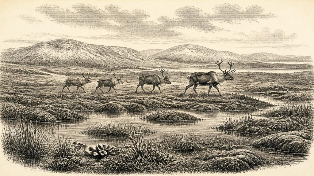
30,123 BCE is a modern label for an uncertain Late Pleistocene horizon, not a recorded Irish year. At Derryvree, County Fermanagh, organic freshwater sediments between glacial tills, radiocarbon-dated broadly to this period, preserve bogbean, pollen, mosses and insects. They indicate locally ice-free, treeless tundra wetland with pools, sedges, grasses, herbs and juniper. Ireland experienced changing ice margins before the later Last Glacial Maximum, while lower sea levels did not guarantee access routes. Castlepook Cave, County Cork, contains cold-climate fauna. A possibly tool-marked reindeer bone may indicate human carcass processing, but cannot demonstrate settlement. No evidence supports society, agriculture or institutions.
Dateline
30,123 BCE is a modern calendar label, not the date of a recorded Irish event. No contemporary calendar, written testimony, named individual or precisely datable settlement allows historians to describe a single year at this depth of time. In archaeological convention, it lies about 32,073 years before AD 1950, within the Late Pleistocene and Marine Isotope Stage 3. The responsible picture is therefore regional and approximate: Ireland during a cold, changeable phase of the last Ice Age, reconstructed from buried sediments, fossil plants and insects, cave fauna, glacial landforms and radiocarbon measurements with wide margins of uncertainty.
The closest relevant Irish chronology comes from a buried organic deposit at Derryvree, near Maguiresbridge in County Fermanagh. A conventional radiocarbon determination of 30,500 BP, with a large quoted error range, was obtained from material in silts lying between two tills. Calibration is essential because radiocarbon years are not identical to calendar years. Using modern calibration methods, this deposit has been associated broadly with a span of roughly 36,900–31,700 calibrated years BP, or about 34,950–29,750 BCE. Thus 30,123 BCE can sit within the outer range of this environmental archive, but cannot be identified with one season, one plant, or one historical occurrence.
Fresh Water Between Ice Advances
Derryvree matters because its stratigraphy establishes a sequence rather than a story. Beneath and above the organic layer are tills: unsorted deposits left by glacier ice. Between them accumulated freshwater silts, sands and organic material. The direct evidence is clear enough: at some point between episodes of glacial deposition, this locality supported standing or slow-moving fresh water, wet ground and vegetation. The inference is that the area was locally ice-free during that interval. It does not demonstrate that all Ireland was simultaneously free of ice, nor that the country possessed a stable, long-lasting climate.
The organic sediments preserve pollen, plant macrofossils, mosses and insect remains. Together they indicate open, largely treeless terrain with saturated hollows, shallow pools and abundant low vegetation—often described as a cold muskeg or tundra wetland. Grasses, sedges, herbs and juniper are among the important indicators reported from the sequence. The recovery of a seed of bogbean, Menyanthes trifoliata, is especially vivid. Bogbean is associated with freshwater margins and wet ground; its fossil presence is concrete evidence of local or nearby wetland conditions, not merely a modelled climate signal.
Such a landscape should not be imagined as an unbroken, snow-covered void. Even in a severe periglacial climate, waterlogged basins and sheltered ground could support productive seasonal plant communities. Mosses, sedges and aquatic plants made use of the brief growing season, while frost, thaw, wind and long winters controlled the wider terrain. Conversely, it would be equally misleading to picture the later wooded island of oak, elm and hazel. The Derryvree evidence supports a mosaic of exposed ground, wetland and low vegetation, not forest.
An Island in a Changing Ice-Age World
Ireland’s wider position was unstable. The island formed part of the north-west European margin of the British–Irish Ice Sheet system, but the scale, timing and precise configuration of ice before the later Last Glacial Maximum remain subjects of active research. Recent large-scale reconstructions place major growth and retreat of the last British–Irish Ice Sheet within approximately 31,000–15,000 years ago, while also emphasising that different sectors advanced and retreated at different times. Other work stresses that pre-30,000-year ice-sheet behaviour is less securely known. Around the notional date considered here, Ireland was approaching a major glacial reorganisation rather than occupying a simple ‘before’ or ‘after’ state.
The strongest later maximum of the last glaciation is generally placed much later, around 26,000–20,000 years ago, when ice profoundly reshaped Irish topography. At 30,123 BCE, therefore, the eventual Last Glacial Maximum lay ahead, but cold conditions and shifting ice margins already governed habitats and routes. Sea level was lower than today on a global scale, altering coastlines and the geography of the Irish Sea basin. Yet lowered water alone does not prove a usable route into Ireland at any specific moment: ice, sea channels, terrain, weather and the behaviour of animal populations all mattered. The evidence permits mobility as a possibility, not a mapped highway.
Glacial erosion and later deposition have also made the archive fragmentary. Much evidence that might once have recorded campsites, animal deaths or ancient ground surfaces was removed, buried or disturbed by ice. This helps explain why Ireland’s record for this period is so much thinner than that of some regions of Britain and continental Europe. It is not sound to treat absence of discovered settlements as proof that no person ever reached the island; equally, the sparse evidence cannot be converted into a claim for a settled population.
Castlepook and the Reindeer Question
The principal animal archive relevant to this period is Castlepook Cave—also known as Mammoth Cave or Doneraile Cave—near Doneraile in north County Cork. Its limestone passages yielded more than two thousand Pleistocene bones during excavations and collecting campaigns, especially in the early twentieth century. Geological Survey Ireland describes it as Ireland’s richest site for vertebrate fauna dating towards the Last Glacial Maximum. Individual bones have supplied radiocarbon ages extending across a long interval, rather than a single occupation horizon.
The assemblage includes species suited to open, cold or highly seasonal environments: reindeer, woolly mammoth, giant deer, brown bear, wolf, foxes, mountain hare, lemmings and spotted hyaena. These finds establish that Ireland was connected ecologically to the wider Ice-Age fauna of north-west Europe during parts of the Late Pleistocene. They do not mean every listed species lived together at Castlepook on one day, or even in one millennium. Cave deposits accumulate through many processes—carnivore activity, natural deaths, water movement, collapse, scavenging and, in this case, antiquarian excavation with less precise recording than modern fieldwork.
A reindeer femur from Castlepook has nevertheless made the cave important beyond palaeontology. Ruth Carden identified a deep mark on the bone as consistent with fresh-bone processing by a sharp stone tool, and the specimen has been publicly associated with an age of about 33,000 years. If the mark is confirmed as anthropogenic, it is powerful evidence that people handled a reindeer carcass in Ireland during the wider period under discussion. It would be a trace of activity, perhaps butchery, not proof of a permanent settlement, a hunting camp, repeated seasonal migration, or a distinct named people. No securely associated stone-tool assemblage, hearth, dwelling floor, burial or human remains currently establishes an enduring Irish population at this date.
Life, But Not Yet Society
For this reason, the usual categories of a year-by-year history must be handled differently. There is no evidence for political institutions, rulers, territorial kingdoms, diplomacy or organised warfare in Ireland around 30,123 BCE. There are no known farms, fields, houses, monuments, cemeteries, mines, craft workshops or markets. Agriculture had not begun anywhere in Ireland; there is no basis for discussing cereal cultivation, domestic livestock, metalworking or trade networks on the island in this period.
If humans did visit, they were almost certainly mobile foragers operating within a demanding Ice-Age landscape, rather than members of a documented resident society. That is an inference from the possible modified reindeer bone and from comparative Upper Palaeolithic lifeways elsewhere, not a fact demonstrated by an excavated Irish camp. Reindeer would have offered meat, marrow, hide, sinew and bone, but the Castlepook evidence alone cannot tell us whether an animal was hunted, scavenged, transported or processed by one person or many.
Religion, language, art and learning are similarly beyond recovery here. No Irish cave art, portable art, grave rite or symbolic object can securely be placed at this date. Silence in the record is not evidence that Ice-Age people lacked culture; it means that no material proof has survived or been recognised in Ireland. The deepest lesson of the period is methodological. A bogbean seed, a beetle assemblage, a layer of silt and a marked reindeer bone each answer different questions, and none can responsibly be made to carry the weight of a national origin story.
A Narrow but Significant Horizon
What can be said is compelling enough. Around the broad calibrated horizon that includes 30,123 BCE, portions of Ireland supported cold, open and locally wet landscapes between episodes of glaciation. Fermanagh preserves evidence for freshwater pools and tundra vegetation; north Cork preserves a striking, long-lived archive of large mammals and carnivores. The island was environmentally connected to the wider Ice-Age world, while its coasts, ice cover and habitable corridors changed repeatedly.
The possible humanly modified reindeer femur gives this otherwise geological landscape an extraordinary human dimension, but caution is part of its importance. It may record a fleeting encounter between people and prey, not the foundation of a continuous settlement. Modern calendar precision cannot recover an Irish ‘year’ in 30,123 BCE. It can, however, focus attention on a real prehistoric horizon: a landscape of bogbean-fringed water, treeless ground, reindeer and predators, with ice advancing and retreating across a country whose earliest human traces remain tantalisingly few.
Primary Sources
- Figure 6.— The Subdivision of the Quaternary Period in Ireland
- Irish Pleistocene Biostratigraphy
- Castlepook Cave: Cork County Geological Site Report
- Prehistoric Details
- Quaternary
- Ireland Through Geological Time
- Growth and Retreat of the Last British–Irish Ice Sheet, 31,000 to 15,000 Years Ago: the BRITICE-CHRONO Reconstruction
- Growth and Retreat of the Last British–Irish Ice Sheet, 31,000 to 15,000 Years Ago: the BRITICE-CHRONO Reconstruction
- The Timing and Magnitude of the British–Irish Ice Sheet Between Marine Isotope Stages 5d and 2
- Pleistocene Glaciations in Ireland
- Pattern and Timing of Retreat of the Last British-Irish Ice Sheet
- Radiocarbon Constraints on the Age of the Maximum Advance of the British–Irish Ice Sheet in the Celtic Sea
- Deglaciation Chronology of the Donegal Ice Centre, North-West Ireland
- Episodic Speleothem Deposition Tracks the Terrestrial Impact of Millennial-Scale Last Glacial Climate Variability in SW Ireland
- The IntCal20 Northern Hemisphere Radiocarbon Age Calibration Curve (0–55 cal kBP)
- IntCal Publications
- Occurrence of Mammalia Relicts at Site Castlepook Cave
- The Irish Quaternary Fauna Project
- 32564: Castlepook Cave, Castlepook South, Doneraile, Cork
- Heritage Artefacts of County Cork
- IAH Field Trip 2014
- Menyanthes trifoliata: Fossil Record
