
Hyenahall’s Reindeer World30522 BCE
Thirty thousand five hundred and twenty-two BCE cannot be tied to an Irish event, but evidence from MIS 3 reconstructs an unstable Ice Age environment. At Derryvree, County Fermanagh, freshwater sediments between glacial tills indicate an ice-free, treeless tundra wetland with hardy vegetation. Expanding regional ice reshaped drainage and coastlines. Castlepook Cave, County Cork, preserves remains of mammoth, reindeer, giant deer, hyaena and cold-adapted animals, though deposits are mixed. A possibly cut-marked reindeer bone suggests brief human presence around 33,000 years ago, without proving settlement. Later glaciation and sea-level rise destroyed much evidence, leaving landscape history rather than an annal.
Dateline
A Year That Cannot Be Recovered
30,522 BCE is a modern chronological label, not a year that can be identified in an Irish record. No calendar, writing, annual sediment layer or securely dated human episode allows historians to say what happened in Ireland in that particular year. In archaeological convention it falls about 32,472 years before AD 1950, in the later part of Marine Isotope Stage 3 (MIS 3), a long and climatically unstable stretch of the last Ice Age. The responsible history of Ireland at this depth of time is consequently a reconstruction from buried mud, fossil plants and insects, animal bone, cave sediments and the tracks left by glacier ice—not an annal of people or events.
The closest securely relevant Irish chronological anchor is not a point-date but the organic freshwater deposit at Derryvree near Maguiresbridge, County Fermanagh. Its conventional radiocarbon result, BIRM-166, was 30,500 radiocarbon years before present, with an uncertainty of +1,170/−1,030 years. Calibration produces a broad age range commonly expressed as roughly 36,900–31,700 calibrated years before present, or approximately 34,950–29,750 BCE. Thus 30,522 BCE lies within the wide interval illuminated by the deposit, but cannot be attached to an individual plant, season, flood, animal movement or human action.
A Freshwater Hollow at Derryvree
Derryvree is exceptionally important because roadworks in 1969 exposed a sequence inside a drumlin: freshwater silts and fine sands, including organic material, lay between two thick sheets of till. Till is debris laid down by glacier ice. The lower till proves that ice had earlier crossed the locality; the upper till records a later advance that buried the wetland. Between them was an interval in which a basin held freshwater long enough for sediment, plants and small animals to accumulate. It is decisive evidence that part of south Fermanagh was locally ice-free during this broad period, although it cannot serve as a climatic map for every coast, upland and valley of Ireland.
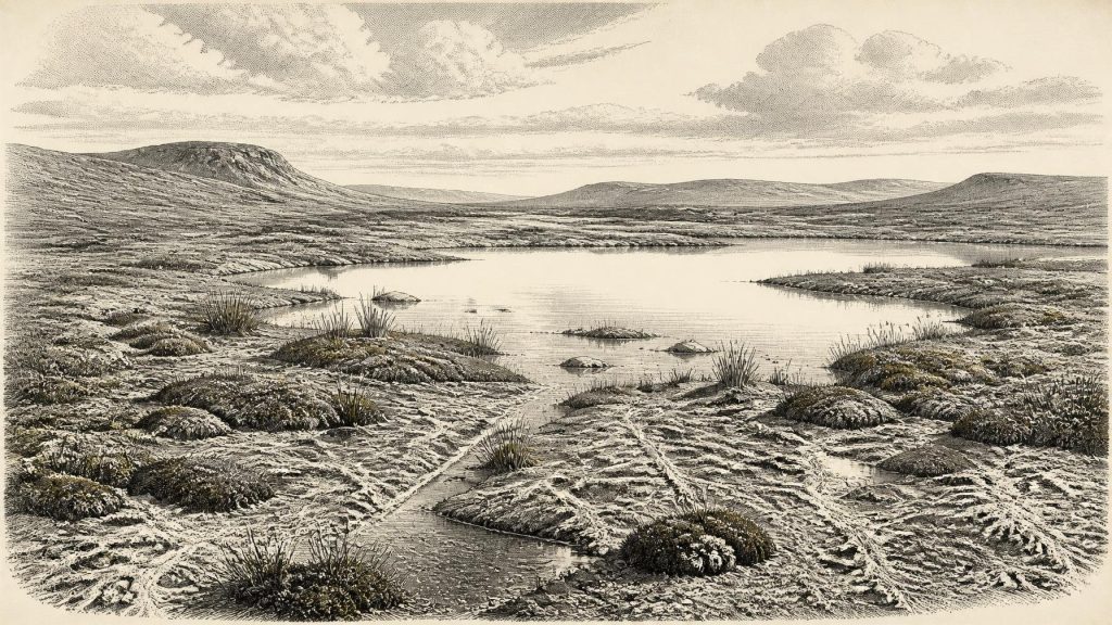
The fossils indicate a treeless, open tundra landscape governed by periglacial conditions: intense cold, seasonal thaw, frost action and short growing seasons. Herbaceous pollen was poorly preserved, but the assemblage included mosses and other hardy plants, while fossil spores of alpine clubmoss have also been reported. Aquatic and wet-ground vegetation shows that cold did not mean uniformly dry or lifeless ground. Around sheltered hollows there were pools, marshy margins and flowing or standing freshwater. Beyond them, vegetation was probably sparse, low and patchy, with exposed mineral ground and frost-disturbed soils rather than woodland.
This is the strongest evidence for everyday environmental conditions around the date, but it must be read at the scale at which it was found. Derryvree records a particular freshwater basin, not a panoramic view. It demonstrates a viable local wetland amid a severe climate; it does not prove a continuous green corridor across the island, nor an exact temperature, snowfall total or seasonality for 30,522 BCE. Such limits are not evasions. They are what make the reconstruction dependable.
Ice Building Across the Region
Ireland was not yet at the fullest overall extent of the last British–Irish Ice Sheet. Modern reconstructions place the ice sheet’s greatest total area later, about 26,000 years ago, and show that its margins advanced and retreated at different times in different sectors. Yet this was an age of rapid change rather than environmental stability. By about 31,000 years ago, ice was expanding quickly in the wider north-western British–Irish region. An Irish location could be ice-free while another lay under ice, near an ice margin, or received meltwater and sediment from it.
That regional transformation mattered more than any political boundary could have done. Growing ice altered drainage, reshaped ground, lowered sea level globally and repeatedly removed or buried the surfaces on which people and animals might once have travelled. At roughly 31,000 years ago, reconstructions indicate sea levels in the region were substantially lower than today, but the exact coastlines and routes between Ireland, Britain and continental Europe remain dependent on changing ice, water depth and local crustal movement. It is unsafe to imagine a fixed modern island, or equally unsafe to assume a simple, permanent land bridge.
Castlepook’s Animal Archive
For animal life, Castlepook Cave near Doneraile in north County Cork is the principal Irish archive relevant to this era. Also called Mammoth Cave, its narrow galleries and chambers yielded more than 2,000 bones during excavations in the early twentieth century. Direct dates from specimens cover a long span, approximately 45,700 to 19,950 years before present. This is not one perfectly sealed deposit: water movement, carnivore activity, old excavation methods and later disturbance mean that bones from different ages can be mixed or displaced. Nevertheless, it provides Ireland’s richest picture of vertebrate life before the Last Glacial Maximum.
The cave’s assemblage includes woolly mammoth, giant deer, reindeer, brown bear and spotted hyaena, with Arctic fox, wolf and lemmings among other cold-stage animals. These finds show that Ireland supported, or was at least repeatedly reached by, a varied large-mammal community during MIS 3. They do not prove that every named species occupied the same hillside at the same moment, and still less that all lived in the year under review. A cave bone is evidence first for the animal, its age and its route into a cave; its wider ecological meaning must be cautiously inferred.
Spotted hyaena are especially revealing. Their presence at Castlepook helps explain why the cave accumulated bones: it was not simply a natural museum or a human dwelling, but a place shaped by scavenging, predation, carcass transport and denning. Reindeer and giant deer suggest open feeding country, while carnivores point to a food web more complex than the familiar modern Irish fauna. Later re-dating has also demonstrated how older radiocarbon work could underestimate the age of cave bones, a warning against treating inherited chronologies as final.
The Uncertain Human Question
A reindeer femur from Castlepook has been reported as bearing a deep mark interpreted by palaeozoologist Ruth Carden as a cut made with a sharp stone tool on fresh bone. County Cork’s heritage record presents the find as a potentially very early sign of human handling of a carcass, broadly around 33,000 years ago. If that interpretation and dating relationship are sustained, it would suggest that people may have reached Ireland far earlier than the traditionally accepted terminal-Pleistocene evidence.
Its importance is matched by its limitations. The marked femur is a single object from an old cave collection, not a modernly excavated habitation floor. There is no securely associated hearth, stone-tool assemblage, shelter, burial, repeated butchered assemblage or occupation surface of comparable age. The bone cannot tell us whether people killed the reindeer, encountered a carcass, stayed briefly, travelled in a larger party, or ever returned. It provides a possible trace of carcass processing, not proof of settled population or continuous occupation.
Society Beyond the Evidence
Accordingly, political affairs, diplomacy, named communities, leaders, warfare, religion and formal learning cannot be recovered for Ireland around 30,522 BCE. No evidence identifies a language, kin group, ritual, territory or social institution. There is no support for speaking of Irish “tribes”, trade networks or a national population at this date. Nor can cave fauna be used to create a dramatic story of mammoth hunters. The possibility of a humanly modified reindeer bone is striking precisely because the evidence is otherwise so slight.
If people did enter the island during this period, the most restrained interpretation is that they were highly mobile hunter-gatherers operating in very small numbers in a difficult, changeable landscape. Their practical knowledge would have concerned weather, animal behaviour, stone and fuel, shelter and safe passage. That is an inference from the environmental setting and wider Upper Palaeolithic lifeways, not a direct description of a known Irish camp. No Irish evidence presently demonstrates exchange in goods, long-distance trade, artistic production or religious practice at this time.
A Landscape, Not an Annal
The most important development around 30,522 BCE was therefore environmental. In Fermanagh, a cold freshwater wetland accumulated between glacial advances. In Cork, caves preserve fragments of a mammal world that later ice and extinction would profoundly alter. Across the region, the British–Irish Ice Sheet was entering a phase of major growth. These are not background details to an absent human story: they are the history that the surviving evidence can genuinely tell.
Much was lost when later ice scoured older surfaces and when rising seas drowned former lowlands. What survives has to be continually retested through improved radiocarbon preparation, calibration, sediment analysis and careful re-excavation. For this date, certainty lies not in an imagined event but in the recognition of an open, cold and locally watery Ireland—an unstable Ice Age landscape inhabited by hardy plants and large mammals, and perhaps visited briefly by people whose presence remains tantalising rather than proven.
Primary Sources
- A Middle Midlandian Freshwater Series at Derryvree, Maguiresbridge, County Fermanagh, Northern Ireland
- Palaeoecology
- Figure 6.— The Subdivision of the Quaternary Period in Ireland
- A Reconsideration of the Radiocarbon Dating of the Marine Isotope Stage 3 Fauna from Southern Ireland
- Castlepook Cave: Cork County Geological Site Report
- Heritage Artefacts of County Cork
- Castlepook Cave, Co. Cork: Excavation Report 2022
- Growth and Retreat of the Last British–Irish Ice Sheet, 31,000 to 15,000 Years Ago: The BRITICE-CHRONO Reconstruction
- The Timing and Magnitude of the British–Irish Ice Sheet Between Marine Isotope Stages 5d and 2
- Trimlines, Blockfields and the Vertical Extent of the Last Ice Sheet in Southern Ireland
- Deglacial Rates and Controls for the Western Margin of the British–Irish Ice Sheet
- Exploring Controls of the Early and Stepped Deglaciation of the Western Margin of the British–Irish Ice Sheet
- Dimensions and Chronology of the Last Ice Sheet in Western Ireland
- A Stratigraphic Investigation of the Celtic Sea Megaridges Based on Seismic and Core Data from the Irish-UK Sectors
- Dynamic Cycles, Ice Streams and Their Impact on the Extent, Chronology and Deglaciation of the British-Irish Ice Sheet
- The Irish Quaternary Fauna Project
- New Insights on the Fauna of Ireland’s Younger Dryas and Early Holocene from Alice & Gwendoline Cave
- First Evidence of a Late Upper Palaeolithic Human Presence in Ireland
- Karst of Ireland
- Selaginella selaginoides
- Pleistocene Vertebrates in the British Isles
- The Geological Heritage of Clare
