
Derryvree’s Sedgewater Horizon30365 BCE
About 30,365 BCE, Ireland was a geographically shifting, climatically unstable late Pleistocene region, not a recorded historical society. Derryvree, County Fermanagh, preserves an organic freshwater layer between glacial tills, indicating cold, open tundra-like wetlands with sedges, mosses, aquatic plants, dwarf willow and juniper before later ice covered the site. Its radiocarbon date provides only a broad calibrated range. Castlepook Cave’s mixed fauna, including mammoth, reindeer and predators, demonstrates intermittent animal presence but no single contemporary ecosystem. No secure human settlement exists. A possibly cut reindeer bone suggests only unconfirmed, fleeting Upper Palaeolithic visits, while politics, culture and population remain unknowable.
Dateline
The label “30,365 BCE” is a modern way of locating a point in deep time, not a date at which an Irish event can be recorded. No calendar, written testimony, named people, settlement sequence or monument can be assigned to this particular year. In scientific terms it is about 32,314 calendar years before AD 1950, the reference point used for “BP” dates. Even that conversion should not imply false precision. Radiocarbon measurements of this age must be calibrated, and their resulting ranges commonly span many centuries or millennia. The responsible subject is therefore Ireland during a broad late Pleistocene interval, rather than an invented episode on a single day or in a single year.
A Cold-Stage Island Region
This was the later part of the Pleistocene, within Marine Isotope Stage 3: an Ice Age period marked not by uniform cold but by pronounced climatic instability across the North Atlantic world. Ireland lay at the western edge of north-west Europe, exposed to changing temperatures, snowfall, sea levels and ice margins. It was not yet possible to speak of Ireland as a political country, a society with institutions, or a homeland occupied continuously by a known population. “Ireland” is used here only as a geographical convenience for the landmass and surrounding shelves that would later form the island.
The better-dated Last Glacial Maximum, when ice covered much or all of Ireland and extended onto its continental shelf, belongs mainly to a later span, roughly 27,000–23,000 calibrated years BP in broad reconstructions. At 30,365 BCE, the growth of the British–Irish Ice Sheet was an important regional process, but it should not be projected backwards as an unchanging blanket over every district. Evidence from north-western offshore Ireland suggests ice reached the shelf edge at about 29,000–27,000 calibrated years BP; other work demonstrates substantial differences between regions in the timing, thickness and limits of ice. The island’s geography was therefore dynamic: some areas may have retained exposed ground while others were shaped by advancing ice, meltwater and permafrost.
The Derryvree Evidence
The closest important Irish environmental archive is at Derryvree near Maguiresbridge, County Fermanagh. Roadworks exposed a sequence beneath a drumlin in which an organic-rich freshwater deposit lay between older and younger glacial tills. This positioning matters. It shows that a landscape containing freshwater sediment, plants and small animals existed after one phase of glaciation but before ice later crossed the site and sealed its remains beneath till.
A conventional radiocarbon measurement from the Derryvree organic material, BIRM-166, gave 30,500 radiocarbon years BP, with a sizeable uncertainty of +1,170 and −1,030 years. Modern calibration does not turn that result into a precise historical date. Rather, it places the deposit within a wide calendar-age interval that can broadly overlap the era represented by 30,365 BCE. The deposit is consequently an invaluable local witness to conditions in late Pleistocene Fermanagh, but not proof that every plant, insect or sediment grain belongs exactly to that numbered year.
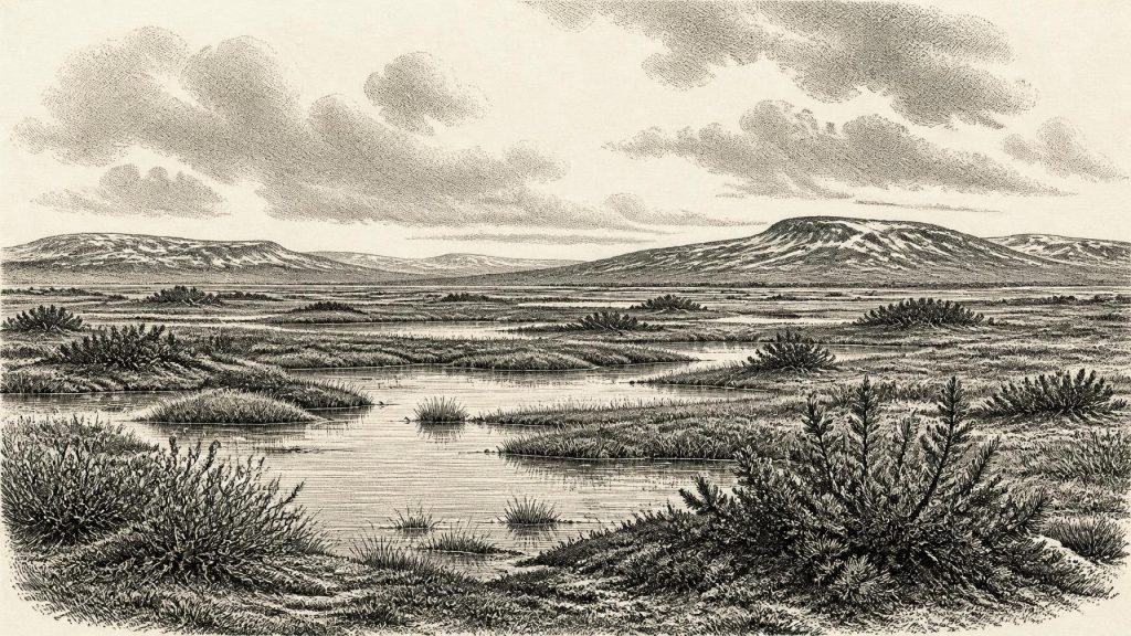
Its contents support a picture of cold, largely open country with wet ground and standing or slow-moving freshwater. Freshwater mosses and sedges, together with aquatic plants including water-milfoil and bogbean, indicate shallow pools, marshy margins and saturated sediment. Dwarf willow, juniper and herbs associated with northern or alpine environments point to a treeless, tundra-like mosaic rather than woodland. Insect evidence likewise suggests a cold climate. This was not a barren ice desert: during the interval represented at Derryvree, plants grew, water supported aquatic life and soils accumulated organic material. But it was also a landscape in which frost, short growing seasons and shifting drainage imposed severe limits.
Wetlands Beneath Later Ice
Derryvree’s strength is that it preserves a small, particular environment rather than an imaginary panorama of all Ireland. A pond edge in Fermanagh cannot tell us the exact appearance of Munster, Connacht or the Irish Sea basin at the same moment. Nor can it establish average temperature for a whole year. Earlier reconstructions inferred very cold winters and cool summers from the plants and insects; such estimates are useful hypotheses, but they remain ecological interpretations drawn from an assemblage, not thermometer readings taken in prehistoric Ireland.
Still, the site gives texture to the word “cold”. Sedges could colonise wet margins; mosses bound damp surfaces; low shrubs found sheltered patches; and shallow water permitted species that could not survive on permanently frozen ground. Seasonal thaw probably transformed parts of the landscape into mud, pools and channels, while winter freezing disturbed exposed soil. Such places might have formed local refuges for vegetation and invertebrates between harsher episodes. Later ice erosion removed much of the evidence from this period, making the survival of an organic layer below a drumlin especially significant.
Animals in a Changing Landscape
For a wider view of Ice Age fauna, Castlepook Cave, also called Mammoth Cave, near Doneraile in north County Cork is indispensable. Its old collections and more recent reassessments contain remains attributed to woolly mammoth, reindeer, giant deer, brown bear, wolf, Arctic fox, mountain hare, lemmings and spotted hyaena. The cave is Ireland’s richest known Pleistocene vertebrate site. It demonstrates that, at various times during the middle and late Ice Age, large herbivores and predators reached parts of Ireland.
Yet Castlepook must be handled carefully. Its deposits accumulated through multiple processes over a long period: carnivore activity, natural death, water movement, sediment disturbance and antiquarian excavation. Individual bones have differing dates, and an animal listed from the cave need not have lived beside every other listed species or at the same time as Derryvree’s wetland. A mammoth date once used to characterise the assemblage was about 33,400 radiocarbon years BP, while more recent reassessment has shown that some of the cave’s faunal chronology is older and more complex than early summaries suggested. The defensible conclusion is intermittent animal presence in an environmentally variable Ireland, not a single complete food web frozen at 30,365 BCE.
Even so, the animal evidence matters for everyday ecology. Reindeer and mammoth required extensive forage and movement across open landscapes; hyaenas, wolves and foxes indicate carnivore and scavenger opportunities; lemmings and Arctic fox fit a cold-climate setting. Their occurrence implies that Ireland was not always isolated from the wider north-west European fauna. Lower global sea level altered coastlines and exposed areas now underwater, but the exact routes, duration and ease of animal crossings at this particular date remain uncertain. It is safer to say that connections existed at intervals than to assert a specific land bridge or migration corridor.
The Human Question
There is no secure settlement, hearth, human burial, house floor, stone-tool assemblage, artwork or lasting occupation surface from Ireland that can be dated to this era. Consequently, there is no responsible basis for describing political leadership, warfare, diplomacy, family organisation, religious practice, language, trade or formal learning. Those headings are not gaps waiting to be filled with imagination; they are subjects for which the surviving Irish evidence is silent.
A single object makes that silence less absolute but not straightforward. A fragment of reindeer femur from the Castlepook collection has been reported by zooarchaeologist Ruth Carden as bearing an incision consistent with processing by a sharp stone tool, and the bone has been publicised as approximately 33,000 years old. If the mark is confirmed as human-made, it would be potentially dramatic evidence for a brief Upper Palaeolithic human presence in Ireland far earlier than the long-established post-glacial record. It might mean that visitors butchered or processed a reindeer for meat, marrow, hide, sinew or bone.
That remains interpretation rather than settled fact. The femur derives from an old collection rather than a modern excavation of a sealed camp, and there is no securely associated tool kit or hearth. Cave bones can acquire damage through carnivore teeth, trampling, sediment movement, weathering and excavation. Nor does one modified bone identify the size, origin, duration or social structure of a visiting group. At most, it opens the possibility that people entered Ireland’s cold-stage landscapes intermittently. It cannot establish a permanent population, an Irish cultural tradition or continuity with later inhabitants.
No Society Yet Recoverable
The absence of evidence here has historical consequences. There were no demonstrable Irish polities to negotiate alliances or wage wars, no documented exchange system linking communities, and no evidence for farming, herding, seafaring or managed land. The economy visible in the record is ecological rather than human: water, vegetation, herbivores, predators and decay moved energy through cold environments. If people did visit, they may have been drawn by animal resources and temporary access across changing landscapes, but that is a plausible explanation, not a recorded history.
Religion and culture are equally beyond recovery for this date. It would be misleading to attach later Irish monuments, myths, languages or identities to a time tens of millennia before the Mesolithic, Neolithic and historic periods. Derryvree instead preserves a deeper inheritance: the physical processes that formed drumlins, altered drainage, buried wetlands and destroyed or concealed much earlier evidence. Around 30,365 BCE, Ireland’s most legible history is one of a cold freshwater margin beneath a future ice cover—a landscape inhabited securely by plants and animals, and perhaps touched fleetingly by people, but not yet a society whose yearly affairs can be narrated.
Primary Sources
- Early Midlandian–Middle Midlandian, Pleistocene, Northern Ireland
- A Middle Midlandian Freshwater Series at Derryvree, Maguiresbridge, County Fermanagh, Northern Ireland
- The Geology of Ireland
- Figure 6.— The subdivision of the Quaternary Period in Ireland
- Irish Quaternary Association: Publications
- Irish Quaternary Association: Outreach and Education Resources
- Marine geophysical evidence for Late Pleistocene ice sheet extent and recession off northwest Ireland
- Late Pleistocene chronostratigraphy and ice sheet limits, southern Ireland
- Last Glacial Maximum cirque glaciation in Ireland and implications for reconstructions of the Irish Ice Sheet
- The evolution of the terrestrial-terminating Irish Sea glacier during the last glaciation
- Ireland: Submerged Prehistoric Sites and Landscapes
- Castlepook Cave, County Geological Site Report
- A reconsideration of the radiocarbon dating of the Marine Isotope Stage 3 fauna from southern Ireland
- Pleistocene Vertebrates in the British Isles
- Occurrence of mammalia relicts at site Castlepook Cave
- Proceedings of the Royal Irish Academy: Castlepook Cave
- New insights on the fauna of Ireland's Younger Dryas and Early Holocene from Alice & Gwendoline Cave
- The IntCal20 Northern Hemisphere radiocarbon age calibration curve (0–55 cal kBP)
- IntCal Publications
- Lateglacial vegetation and environment in Ireland: First results from four western sites
