
Derryvree’s Twin Till Seal30216 BCE
Around 30,216 BCE, a modern calendar label rather than a recoverable date, Ireland experienced unstable MIS 3 conditions before the Last Glacial Maximum. At Derryvree, County Fermanagh, freshwater silts between two glacial tills, radiocarbon dated broadly to 36,900–31,700 years ago, preserve tundra wetland plants and small-animal evidence. They show a locally ice-free interval, not island-wide conditions. Cave fauna from Castlepook, County Cork, indicates varied cold-country mammals, although deposits span long periods. A possibly tool-marked reindeer bone suggests early human visitation, but no secure settlement evidence exists. Advancing ice, ecological patchiness and subsequent erosion left only exceptional, fragmentary records for Ireland.
Dateline
The label 30,216 BCE is a modern point on a calendar, not a date that can be recovered from Ireland’s Late Pleistocene record. It corresponds broadly to 32,200 years before present, where “present” in radiocarbon practice is 1950. Neither people nor animals in Ice Age Ireland left written dates, and even the best scientific measurements resolve spans of centuries or millennia rather than a single year. The responsible setting is therefore the later part of Marine Isotope Stage 3, a climatically unsettled interval before the Last Glacial Maximum. For Ireland, the clearest evidence relevant to this broad moment comes from a buried freshwater deposit at Derryvree, near Maguiresbridge in County Fermanagh, supplemented cautiously by cave fauna in County Cork and wider studies of the British–Irish Ice Sheet.
A Date Within a Range
Derryvree is valuable precisely because it has no historical narrative attached to it. Roadworks in 1969 cut through a drumlin and revealed organic silts and fine sands trapped between two separate tills: layers of sediment laid down by glacier ice. The intervening deposit was once freshwater wet ground. A conventional radiocarbon determination, Birm-166, returned 30,500 radiocarbon years before present, with a substantial uncertainty of +1,170 and −1,030 years. Subsequent calibration places the deposit broadly within about 36,900–31,700 calibrated years before present. The requested calendar point lies within that large window, but cannot be isolated as its precise age.
This distinction matters. The radiocarbon result dates organic material in a sedimentary layer, rather than an event occurring everywhere in Ireland. Calibration converts radiocarbon years into estimated calendar ranges by comparison with independently dated records of past atmospheric carbon. At this depth in time the curve is irregular and the uncertainties are wide. Derryvree therefore illuminates conditions during an interval, not the weather, inhabitants or political circumstances of one imagined year. It is best regarded as a rare surviving glimpse of an Irish landscape that existed between glacial episodes.
A Wetland Beneath the Drumlin
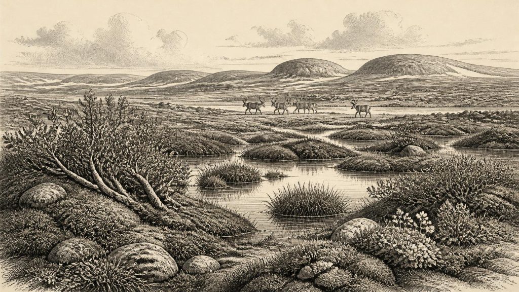
The Derryvree sediments preserve an unexpectedly living environment below the later shape of the drumlin. Plant remains, pollen and small animal evidence indicate open tundra vegetation and a periglacial regime: intensely cold ground affected by frost, seasonal thaw and scant tree cover, but not necessarily buried under permanent ice at every moment. Mosses, sedges and Arctic-alpine plants occupied damp ground around shallow pools, channels or marshy margins. The famous deposit has yielded evidence including bogbean, water-milfoil, dwarf willow, mountain avens and lesser clubmoss. Such species should not be assembled into a neat modern habitat; rather, together they indicate a cold, exposed and wet mosaic capable of supporting freshwater vegetation during a brief geological interval.
Its position between tills is as important as its biological contents. An earlier advance of ice had laid down the lower till. Ice-free or comparatively ice-free conditions then allowed freshwater sediment and plants to accumulate. A later glacial advance sealed the wetland beneath another till. The sequence demonstrates changing local conditions, but it does not establish that all Ireland was simultaneously clear of ice. Later glaciers removed, reworked and concealed much older evidence. Northern Fermanagh may have preserved a record that elsewhere was destroyed. The island at this time was not a single, uniform environmental zone.
Cold Landscapes in Motion
At around 32,000 years ago, Ireland stood within a North Atlantic world of abrupt climatic swings. Greenland ice-core chronologies show repeated warmer interstadials and colder stadials during Marine Isotope Stage 3. Speleothems at Crag Cave, County Kerry, formed episodically during ameliorated phases, giving independent evidence that south-west Ireland responded to these wider shifts. The Derryvree deposit is often correlated broadly with a group of Greenland interstadials, but its dating range is not sufficiently fine to assign it securely to one short-lived episode. The prudent conclusion is that it represents a comparatively favourable interval within a generally cold age, not a warm Irish countryside.
Ice was also expanding unevenly around Ireland and Britain. Modern reconstructions show that the British–Irish Ice Sheet did not reach one island-wide maximum on a single date. Its sectors advanced and retreated at different times, while mountain ice, marine ice streams and regional ice masses interacted. By the wider 31,000–30,000-years-ago period, major ice growth was under way in the north-western British–Irish region; the much later maximum volume of the combined ice sheet came around 23,000 years ago. Derryvree’s intervening wetland accordingly belongs to a long pre-maximum story of local thaw, renewed ice and shifting margins.
Animals and Their Evidence
County Cork offers a complementary, though more difficult, archive. Castlepook Cave near Doneraile, long known as Mammoth Cave, produced a rich collection of Late Pleistocene bones through early twentieth-century excavation. Reassessment and improved radiocarbon pretreatment have shown that some bones previously thought relatively young are much older, placing important elements of the assemblage firmly in Marine Isotope Stage 3. The cave assemblage includes, across its long history, remains of animals suited to open or cold country, among them reindeer, woolly mammoth, giant deer, horse, mountain hare, Arctic fox, brown bear, wolf and spotted hyaena.
That list must not be mistaken for a census of one valley in 30,216 BCE. Cave deposits accumulate over long periods; carnivores may drag prey into shelters, water can move material, and antiquarian excavation rarely recorded layers to modern standards. Individual bones also have different dates. Castlepook nevertheless establishes that parts of southern Ireland could support, or at least receive, a varied large-mammal fauna during the wider MIS 3 interval. Herbivores would have depended on seasonal grazing across open landscapes; predators and scavengers followed both prey and carrion. Their presence is the strongest evidence for food webs, movement and ecological opportunity, rather than for a stable, densely populated animal community.
The Human Question
A reindeer femur from Castlepook has made this period especially important to Irish archaeology. It bears a deep linear mark interpreted by palaeozoologist Ruth Carden as damage from a sharp stone tool while fresh carcass tissue was being processed. Public heritage accounts have associated the bone with an age of roughly 33,000 years ago. If that interpretation and association are sustained, it would indicate a human presence in Ireland far earlier than the formerly accepted terminal-Pleistocene evidence: perhaps a short visit by Upper Palaeolithic hunters who butchered a reindeer.
Yet this is not evidence for an occupied Irish settlement in the year under review. No securely dated camp, hearth, stone-tool assemblage, dwelling, grave or human bone from around 30,216 BCE is known. The marked bone does not name a group, establish its numbers, identify a route into Ireland, or prove continuity with later inhabitants. It may document a single act of carcass processing, and the cave need not have been the place where that act occurred. The National Museum of Ireland’s long-standing caution that clear Palaeolithic settlement evidence is absent remains useful, even as new work has made earlier human incursions a serious possibility.
Society Beyond the Evidence
Consequently, the normal headings of political affairs, diplomacy and warfare have almost no direct application here. There were no states, kingdoms, boundaries or institutions that archaeology can identify in Ireland at this date. Nor is there evidence for ritual monuments, formal burial, art, writing, language or religion on the island. Silence is not proof that people lacked beliefs, social ties or knowledge; it is simply the limit of the surviving Irish record. To invent chiefs, tribes, alliances or ceremonies would turn a thin and contested trace into false history.
If people did reach Ireland during this wider interval, their practical economy was likely founded on highly mobile hunting, gathering and the skilled use of animal resources, as elsewhere in Upper Palaeolithic north-west Europe. But that is an inference from comparable societies, not a demonstrated Irish fact. Ireland’s evidence supports no claim for farming, livestock, pottery, metalworking, permanent villages or regular trade. A possible butchered reindeer bone indicates practical knowledge of a carcass, not an economy in the full sense. Nor can lowered sea level by itself prove an easy land crossing: the geography of the Irish Sea, shifting ice margins and potential land connections remains a complex, debated problem.
An Island of Interrupted Records
The chief historical development around this date was environmental instability. Freshwater life could persist at Derryvree between glacial advances; large mammals ranged through at least some Irish landscapes; and ice was becoming an increasingly powerful agent of change. Subsequent glaciation reshaped the land, eroded older surfaces and buried fragile deposits. That destruction helps explain why Derryvree’s silts and the scattered cave bones matter so much. They are not abundant evidence, but exceptional survivals.
For Ireland around 30,216 BCE, then, the most accurate picture is neither an empty white wilderness nor a populated prehistoric nation. It is a patchwork of cold open ground, wetlands, pools, animals and advancing or retreating ice, observed through a few difficult deposits. Derryvree’s buried fen provides the firmest local testimony: for a time measured in centuries or longer, a tundra wetland flourished in Fermanagh before the ice returned and sealed its record away.
Primary Sources
- Middle Midlandian Freshwater Series at Derryvree, Maguiresbridge, County Fermanagh, Northern Ireland
- Middle Midlandian Freshwater Series at Derryvree, Maguiresbridge, County Fermanagh, Northern Ireland
- A Reconsideration of the Radiocarbon Dating of the Marine Isotope Stage 3 Fauna from Southern Ireland
- Growth and Retreat of the Last British–Irish Ice Sheet, 31,000 to 15,000 Years Ago: The BRITICE-CHRONO Reconstruction
- The Timing and Magnitude of the British–Irish Ice Sheet Between Marine Isotope Stages 5d and 2: Implications for Glacio-Isostatic Adjustment, High Relative Sea Levels and ‘Giant Erratic’ Emplacement
- Last Glacial Maximum Cirque Glaciation in Ireland and Implications for Reconstructions of the Irish Ice Sheet
- Late Pleistocene Chronostratigraphy and Ice Sheet Limits, Southern Ireland
- Dimensions and Chronology of the Last Ice Sheet in Western Ireland
- Vertical Dimensions and Age of the Wicklow Mountains Ice Dome, Eastern Ireland, and Implications for the Extent of the Last Irish Ice Sheet
- Episodic Speleothem Deposition Tracks the Terrestrial Impact of Millennial-Scale Last Glacial Climate Variability in SW Ireland
- New Insights on the Fauna of Ireland’s Younger Dryas and Early Holocene from Alice & Gwendoline Cave
- Investigating Seasonal Mobility in Irish Giant Deer Megaloceros giganteus Through Strontium Isotope Analysis
- The IntCal20 Northern Hemisphere Radiocarbon Age Calibration Curve (0–55 cal kBP)
- The IntCal20 Approach to Radiocarbon Calibration Curve Construction: A New Methodology Using Bayesian Splines and Errors-in-Variables
- Prehistoric Details
- The Archaeological Heritage of County Cork
- Heritage Artefacts of County Cork
- The Mesolithic in Ireland: When Was It?
- The Problem of a Late Quaternary Landbridge Between Britain and Ireland
- Deglaciation, Earth Crustal Behaviour and Sea-Level Changes in the Determination of Insularity: A Perspective from Ireland
