

Crossing Ireland
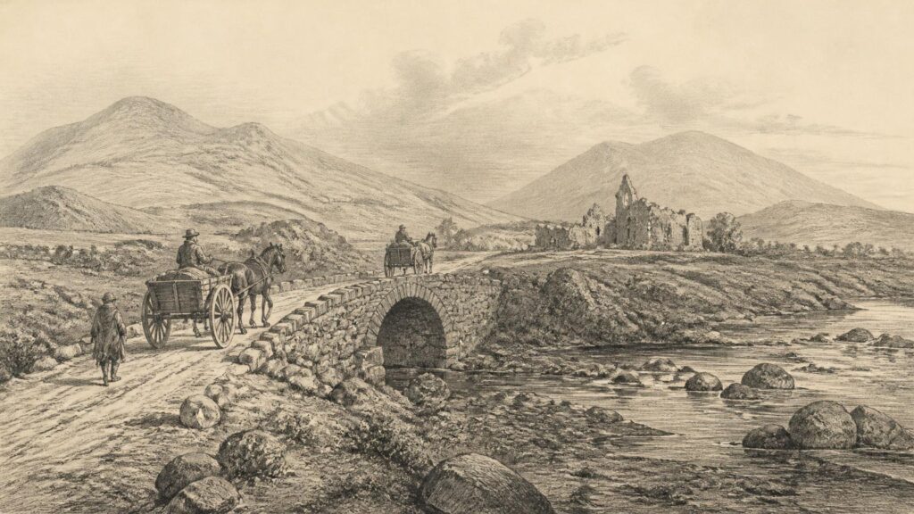
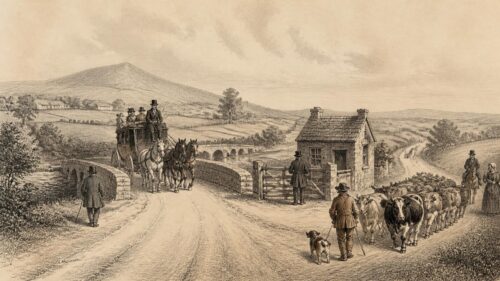
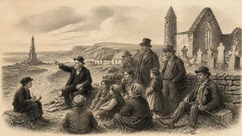
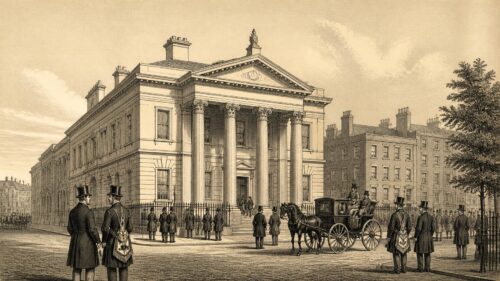
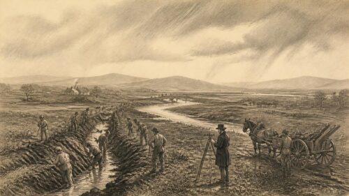
AI generated historical illustration, not a contemporary photograph.
At a Glance
In Ireland, a bridge has rarely been only a piece of engineering. A crossing could determine where a settlement grew, where a market assembled, where an army halted, where tolls were levied, and where one jurisdiction met another. From modest timber structures and narrow dry-stone arches to broad masonry works and cast-iron spans, bridges have formed a persistent, if often overlooked, part of the island’s historical landscape. Their remains and records reveal movement across rivers, streams, canals and tidal waters, but also the changing organisation of power, labour and communication.
River Beginnings
Rivers have always been both routes and obstacles in Ireland. They supplied water, fish, power and transport, while their floodplains offered fertile land and their estuaries connected inland communities with coastal trade. Yet the same waterways could impede journeys. A ford, ferry or bridge was therefore a valuable point of passage. It was also a point at which movement could be watched, taxed or defended. The history of Irish bridges begins not with an uninterrupted sequence of surviving monuments, but with a mixture of archaeological traces, documentary notices and later structures occupying older routes.
The earliest crossings need not have been bridges at all. Natural shallows, stepping stones and deliberately improved fords were often adequate for pedestrians, livestock and horse traffic. Their archaeological visibility is poor. A ford can leave little durable evidence, particularly where later dredging, embankment construction or road building has altered a river. Consequently, it is important not to assume that every significant ancient route had a formal bridge, or that a later bridge necessarily marks the exact site of the earliest crossing. A later bridge may have replaced a ferry; it may have moved traffic away from an older ford; or it may have been created to serve a newly planned town, estate or road.
One unusually important discovery illustrates both the potential and the limits of the evidence. The heritage survey of County Offaly records the excavated remains of a timber footbridge across the Shannon near Clonmacnoise, dendrochronologically dated to about 804. It is described there as the oldest identifiable bridge in Ireland. This is a strong and specific claim because it rests on excavated timber and scientific dating, rather than on tradition alone. It does not mean that no older crossings existed. Rather, it identifies the oldest bridge presently known through secure archaeological evidence.
The Clonmacnoise crossing also makes historical sense in its setting. The monastic settlement stood beside one of Ireland’s major rivers, in a position connected to routes between east and west. A bridge or managed crossing could serve religious travellers, local communities, labourers and traders. It may also have helped connect a settlement whose significance was never confined to its immediate hinterland. Archaeology can establish the presence and approximate date of a timber structure; interpretation begins when historians consider the traffic, authority and economic relationships that made such construction worthwhile.
Timber was a practical material for many early bridges. It could be worked with local tools, repaired after floods and replaced when necessary. It was not, however, permanent in the way stone appeared to be. Waterlogged wood survives only under exceptional conditions, while exposed timber decays. This uneven survival shapes the historical record. Stone bridges can still dominate the landscape centuries after their construction, whereas a wooden bridge of equal importance may survive solely as a buried trace, a place-name, a map symbol or a passing reference in a chronicle.
For this reason, claims about ancient Irish bridges require restraint. Folklore sometimes assigns great antiquity to a picturesque structure, and antiquarians occasionally repeated local stories as fact. Such traditions can be valuable evidence of memory and attachment, but they are not automatically evidence of construction date. The strongest accounts bring together fabric, archaeological investigation, documented repair, map evidence and regional context. Irish bridge history is most persuasive when it acknowledges its gaps: many early crossings were real and important, yet remain archaeologically elusive.
Monastic Pathways
Early medieval Ireland contained a dense network of ecclesiastical sites, local kingdoms and seasonal routes. Major monasteries were not isolated places of prayer. They could possess land, mills, workshops, guest accommodation and connections with political elites. Their setting beside rivers was often advantageous, but it also made access a practical question. Pilgrims, tenants, clerics and visitors needed routes to reach them, while the movement of goods and animals required dependable crossings.
At Clonmacnoise, the documented timber bridge provides one of the clearest indications that a major monastery could be associated with river infrastructure. It should not be imagined as a modern public bridge in the contemporary sense. The precise character of access, ownership and regulation cannot be assumed from the surviving evidence. Nevertheless, its existence points to organised intervention in the river landscape. It was a structure requiring timber, skilled labour, planning and maintenance. Whether directed by an ecclesiastical community, a local ruler or a combination of interests, it reflects the importance of the crossing.
Other monastic landscapes preserve bridges of later date, or traditions concerning crossings whose origins are difficult to prove. The important distinction is between an association and a construction history. A bridge beside an abbey may have served the religious house, but it may equally have been built after the community declined, serving a post-medieval village, estate or public road. Conversely, a bridge that has disappeared may be known from records even though no visible masonry remains. The chronology of religious sites and crossings must therefore be examined separately before their relationship is described.
Holycross in County Tipperary offers a useful example of the layered character of bridge history. The National Monuments Service urban survey records a bridge beside Holycross Abbey that was rebuilt in 1626 by James Butler, Baron of Dunboyne, and his wife Margaret. It was later noted in the Civil Survey of the 1650s as a stone bridge over the Suir. Its present form contains evidence of alteration: earlier segmental-pointed arches and later round-headed spans can be distinguished. The bridge’s relationship with the medieval abbey is visually compelling, but the documented fabric chiefly records a seventeenth-century rebuilding and subsequent modification.
This is not a lesser story. On the contrary, it shows how religious landscapes acquired new lives after the medieval period. Bridges could support continued access to churches, graveyards and settlements even as monastic institutions changed or disappeared. A crossing beside an abbey might become part of a local road network, while the ruins beside it supplied building stone, picturesque associations or a focus for antiquarian interest. The survival of a bridge may thus tell us more about later adaptation than about the medieval world it appears to evoke.
Irish devotional travel also gave crossings symbolic force. Water, boundaries and thresholds have long featured in religious custom, and bridges could become part of the experience of approaching a sacred place. Yet historians should resist converting every atmospheric association into evidence of formal pilgrimage infrastructure. A bridge could be used by pilgrims without having been built for pilgrims. Its importance may have been practical before it became symbolic. The historical richness lies precisely in that overlap: the crossing was an ordinary route for local people and, at particular moments, part of a wider spiritual journey.
Medieval Masonry
The medieval stone bridge is perhaps the most familiar image in the history of Irish crossings. Narrow carriageways, pointed or segmental arches, projecting cutwaters and rough masonry can give an immediate impression of age. However, appearance alone can mislead. Stone bridges were repeatedly widened, rebuilt, faced, repaired and altered to suit new vehicles and road standards. A bridge that looks medieval may include later fabric; an apparently eighteenth-century bridge may stand on medieval foundations or preserve an older alignment.
Recent specialist research has emphasised the need to reassess medieval Irish bridges through archaeological, architectural and historical evidence together. This approach matters because the evidence is uneven. Some bridges are securely documented in medieval charters, civic records or surveys. Others are dated by constructional comparison. Still others have acquired an ancient reputation without decisive proof. A responsible history must distinguish between a bridge that is demonstrably medieval, one that is probably medieval and one that is simply said to be medieval in local tradition.
Garfinny Bridge, near Dingle in County Kerry, is among the most striking survivals. Heritage Ireland describes it as a medieval bridge crossing the Garfinny River, thought to have been built in the fourteenth or fifteenth century. Its single arch uses radial stones and dry-stone corbelling, while the surface was paved with stone slabs. The bridge is narrow, around 2.5 metres wide, and its form reflects the scale of traffic for which it was made. It was not designed for modern vehicles. Its later replacement by a nearby road bridge demonstrates a recurring pattern in Irish transport history: old crossings often survived because new traffic was diverted elsewhere.
Garfinny’s status is exceptional. Heritage Ireland identifies it as the only bridge in Ireland declared a National Monument. That designation confirms national recognition of its historical and archaeological value, but it does not settle every question of interpretation. The bridge is reputed to be the oldest in Ireland, yet the word “reputed” is important. The excavated and dated timber structure near Clonmacnoise is older in terms of known bridge evidence, while Garfinny is valued as an exceptionally early surviving masonry bridge. These are different claims and should not be collapsed into one.
Local tradition associates Garfinny Bridge with the advance of Lord Deputy Arthur Grey’s forces in November 1580 during the Second Desmond Rebellion, on their way to Dún an Óir. The tradition is historically plausible in a broad geographical sense, since the area formed part of that violent campaign. But a tradition that soldiers crossed a bridge is not equivalent to a contemporary record proving the precise route or the bridge’s role. It remains best treated as local historical memory, supported by the bridge’s survival and setting but requiring caution regarding detail.
Cadamstown Bridge in County Offaly demonstrates another aspect of medieval masonry. Heritage Ireland describes the pointed stone arch over the Silver River as possibly late thirteenth century in origin, with seventeenth- and eighteenth-century interventions. It is unusually narrow, and its survival without the widening required by the Road Act of 1727 makes it a valuable record of an earlier road scale. The language of possibility is appropriate: archaeological evidence suggests an early origin, but the bridge’s later work means that no single phase should be presumed to represent the entire visible structure.
These bridges should not be treated as isolated relics. Each formed part of a route, connecting farms, settlements, ecclesiastical places or lordly estates. Their arches are evidence of masonry skill, but their location is equally revealing. The bridge was a decision about where traffic should be concentrated. In medieval Ireland, as elsewhere, controlling that decision could offer political and economic advantage.
Town Gateways
Bridges were especially significant in medieval and early modern towns. A town was not simply a collection of houses; it was a regulated place in which market rights, tolls, defences and routes could be organised. A bridge on an approach road directed people and goods towards gates, quays and commercial spaces. It could carry a street over a small river or drain, while a larger bridge might link a town with its agricultural hinterland or secure a strategic riverbank.
The evidence from Waterford is particularly instructive because it corrects a tempting assumption. The city lies beside the Suir, and later observers claimed that a medieval bridge had crossed the river. The National Monuments Service survey states that there is no good evidence for such a medieval Suir bridge. It notes antiquarian reports of piles and other remains, but does not regard them as sufficient proof. The only medieval Waterford bridge for which the survey finds good evidence is John’s Bridge, spanning the smaller John’s River on the principal road approach to the city.
John’s Bridge was already referred to as “the old bridge” in a grant dating no later than 1199. That does not establish exactly when it was built, but it indicates that the crossing pre-dated the document. Later medieval references use related names, while seventeenth-century maps show the bridge associated with the city’s defensive arrangements, including a gate, walls and a drawbridge. Here the documentary sequence permits a more grounded narrative than broad claims about a grand medieval crossing of the Suir. It also reminds us that modest waterways could matter greatly when they lay on a town’s principal entrance.
Kilkenny offers another example of continuity and replacement. The urban archaeological survey records that John’s Bridge, originally called the Bridge of Kilkenny, had been built by 1211, when it appeared in the charter of St John’s Priory. Floods swept it away in 1564 and again in 1763, after which new bridges were erected at the same location. The present bridge dates from 1910, with later renovation. The history is therefore not the story of one unchanged medieval monument; it is the history of a crossing repeatedly re-created because the route remained essential.
Flood damage was not an accidental footnote to bridge history. It was one of the central facts of it. A bridge had to cope with ordinary flow, seasonal spate, debris and changes in river channel. Narrow arches could obstruct water or trap timber; piers could be undermined; parapets and carriageways could be carried away. Rebuilding after a flood was a practical necessity, but it could also provide an opportunity to widen a route, improve the masonry or alter the approach roads. For historians, each rebuilding complicates the desire to assign a single date.
Town bridges also brought together public and private interests. Merchants wanted reliable access; civic authorities wanted orderly traffic and revenue; landowners might hold rights in the approaches; religious houses could possess property nearby. The bridge’s fabric may be silent about these arrangements, but charters, civic records and maps can reveal them. A bridge should therefore be read as part of an urban system: road, gate, market, quay, millstream and defensive line. Its significance lay as much in the network it organised as in the arch itself.
Strategic Crossings
Because bridges concentrated movement, they possessed military value. Armies needed crossings for men, horses, artillery, supplies and communication. A river could protect a territory, but only if its usable crossing points were held or denied. This made bridges and fords recurring sites of conflict, fortification and destruction. The historical record often notices a bridge precisely when warfare exposed its importance.
The Shannon was especially significant in this respect. As one of the island’s great waterways, it could be an internal route and a formidable barrier. Crossings at places such as Athlone, Banagher, Shannonbridge, Killaloe and O’Brien’s Bridge had regional importance because they linked provinces and road systems. Their military value was inseparable from their commercial and social value: the same passage that enabled market traffic could admit an invading force or provide a defensive choke point.
The history of Killaloe and O’Brien’s Bridge, set out in a modern route-selection report prepared for Clare County Council, preserves valuable references to earlier timber crossings. The report notes an annalistic reference to a plank bridge at Killaloe in the period associated with Brian Boru, and a sixteenth-century reference to a wooden bridge made by an O’Brien across the Shannon. It also records a 1536 account describing the capture of O’Brien’s Bridge and its fortification. These notices show that major Shannon crossings could be constructed in timber, militarised and reconstructed across long periods.
The present stone bridges at Killaloe and O’Brien’s Bridge largely belong to later phases. This distinction matters. A bridge location may be medieval, and a crossing may have a documented medieval role, while the standing stone structure belongs to the seventeenth or eighteenth century. Such continuity of place can create the illusion of material continuity. The historian’s task is to recognise both: the route may be ancient, but the visible masonry may be relatively recent.
Shannonbridge is an illuminating later example. The Heritage Council’s waterways study describes the place, formerly Raghra, as one of the Shannon’s few crossing points and notes prehistoric artefacts recovered from the river at the ford later occupied by the bridge. That evidence indicates long-term activity at the location, though it cannot by itself prove a prehistoric bridge. The present historical importance of Shannonbridge derives from successive uses of the crossing: road traffic, river navigation, military works and settlement development.
In the early nineteenth century, Shannonbridge was fortified against the possibility of Napoleonic invasion. The bridgehead and associated barracks demonstrate that a bridge could remain strategically important long after the era of medieval castles. The site was not merely a convenient road feature; it was a point at which the state expected movement to be controlled in time of threat. The military landscape around it turned the crossing into a defended threshold between counties and regions.
War also leaves stories that are difficult to verify. Bridges invite narrative because they offer a clear stage for a march, pursuit, ambush or stand. Some such stories are supported by records; others derive from later local remembrance. Their historical value need not be dismissed, but the distinction must remain visible. A tradition may show how a community understood a place, even where it cannot securely reconstruct an event. The bridge’s strategic meaning is real; the exact episode attached to it may be uncertain.
Road Reform
The eighteenth century transformed Irish bridge building through road improvement, turnpike development, county presentments and the growing expectation that routes should accommodate wheeled traffic. Bridges that had served pedestrians, packhorses and light carts became bottlenecks. Their narrow decks, steep approaches and low parapets were increasingly unsuitable for commercial movement. This did not mean that medieval bridges ceased to matter; rather, they were widened, bypassed, incorporated into new works or left standing beside replacement structures.
The Road Act of 1727 is important in this history because it set a minimum width of twelve feet for bridges. Heritage Ireland identifies this requirement as one reason Cadamstown Bridge became obsolete. Its narrowness, formerly normal, no longer suited official expectations for improved roads. The bridge’s survival is therefore historically valuable: it preserves a form of crossing that later road policy sought to supersede. What was inefficient to eighteenth-century administrators became significant to later conservationists.
Road reform involved more than technical standards. It reshaped the relationship between localities. A new bridge could direct traffic away from an old village centre, make a market town more accessible or reduce the importance of a ferry. Conversely, failure to secure a reliable crossing could isolate communities during floods or make long detours necessary. Bridges were expensive works, and decisions about their location could reveal which routes authorities considered worthy of investment.
Fermoy illustrates the repeated remaking of a river crossing in response to changing needs. The Cork urban archaeological survey records that a ferry operated there before the Earl of Cork built a bridge in 1626. That bridge was swept away by flood in 1628; provision for replacement appeared in the Earl’s 1642 will. A later bridge, described in 1687 as new and stately, had thirteen semicircular arches. It was altered, fortified during the Williamite conflict and widened in 1797. The present seven-arch bridge dates from the nineteenth century. Its history is an unusually clear reminder that a bridge is often a succession rather than a single object.
Changes in bridge design were shaped by local materials and labour. Masonry might use local limestone, sandstone or rubble, with dressed stone reserved for arches, parapets and cutwaters. The scale of work depended on the river, available finance and expected traffic. Some bridges were modest single arches; others crossed major rivers through long sequences of smaller spans. A multi-arched bridge could suit broad floodplains, allowing water to pass through several openings, though it also required many piers and foundations.
Road bridges could also embody political language. Commissioners, landowners and civic bodies sometimes commemorated themselves through inscriptions, plaques or bridge names. Names could honour governors, aristocratic patrons, monarchs or local political figures. Later renaming might replace imperial associations with national ones. Thus a bridge was never merely part of a neutral road network. It could become a visible statement about who financed public works, who exercised authority and whose memory ought to occupy the landscape.
Waterway Engineering
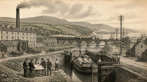
Inland navigation created a new set of demands for Irish bridges. A road bridge over a navigable river or canal had to accommodate more than carts and pedestrians. It had to allow boats, barges and towlines to pass. This could require higher arches, movable spans, altered approaches or entirely new alignments. The result was a landscape in which bridges, locks, quays, towpaths and warehouses worked together.
Shannonbridge offers a notable example of this interaction. The County Offaly architectural heritage survey describes the sixteenth-arch masonry road bridge over the Shannon as dating from about 1757. At its eastern end, arches accommodated the navigation channel and towpath. In 1843, the opening span was replaced by a cast-iron twin-leaf swivel bridge designed by Thomas Rhodes and manufactured by J. and R. Mallet of Dublin. The movable structure was later replaced, but survives beside the quay as a record of nineteenth-century engineering.
This sequence shows how bridge history cannot be reduced to a simple progression from primitive to advanced forms. The 1757 masonry bridge was a substantial achievement, yet new navigational demands required an iron mechanism that could open for waterborne traffic. The swivel bridge did not merely improve the road crossing; it reconciled two potentially competing forms of movement. Boats needed a navigable channel, while people and vehicles needed a continuous route across the river.
At Banagher, another important Shannon crossing, the Offaly survey notes that the nineteenth-century six-arch masonry bridge replaced an earlier bridge of about seventeen arches. The contrast between many smaller arches and fewer larger ones reflects changing engineering choices and the management of water. Such changes could improve navigation, reduce obstruction or alter the bridge’s relationship with the riverbank. They also altered the visual character of towns. A bridge’s length, number of spans and approach roads could determine how a settlement presented itself to travellers arriving by land or water.
Navigation works brought specialised engineering knowledge into Irish river landscapes, but they also depended on older local geographies. Canals and improved channels did not erase the importance of traditional crossing points. Instead, they often intensified it. Where a route already met a river, engineers had to solve the problem of maintaining both passage across and passage along the water. The resulting bridges are evidence of negotiation between road transport and water transport.
These structures are particularly vulnerable to misunderstanding because their later alterations can obscure their original purpose. A fixed modern span may replace a former swing or swivel bridge; a canal branch may be filled; a towpath may become a roadside verge. Historic photographs, engineering drawings and surveys are therefore essential complements to visible fabric. Without them, the surviving masonry can appear simpler than the working landscape once was.
The heritage value of such crossings lies not only in their aesthetic form. They testify to the integration of regional economies. A bridge at a navigable river connected local roads to a wider circulation of grain, turf, livestock, building materials and manufactured goods. It was a node in a system, and its history should be read alongside that of the river it crossed.
Iron Horizons
The nineteenth century introduced new materials, industrial techniques and expectations of mobility. Cast iron, wrought iron and later steel changed the possibilities of bridge construction, particularly for railway and urban crossings. Yet the older masonry bridge did not disappear. Ireland’s nineteenth-century landscape combined traditional stone arches with metal spans, railway viaducts and engineered river works. This mixture reflected practical needs, available capital and the differing demands of roads, railways and pedestrians.
Dublin’s Ha’penny Bridge is one of the most recognisable examples of this transformation. Built in 1816 as Wellington Bridge, it replaced a ferry service operated by William Walsh. According to the National Archives exhibition on Dublin waters, the crossing retained turnstiles and a toll well into the twentieth century, with the turnstiles removed in 1919. The popular name records the halfpenny charged to cross. Its history therefore combines industrial material, private enterprise, municipal permission and the daily routines of ordinary pedestrians.
The bridge’s cast-iron form was modern for its time, but its origin in a ferry concession shows continuity with older patterns of river crossing. Walsh’s ferries served the Liffey before the bridge, and the bridge converted a service dependent on boats, weather and operators into a fixed passage. It also created a new regulated space. The toll was not incidental: it was part of the financial arrangement under which the structure was built. To cross was to participate in an economic system as well as to move through the city.
Urban bridges acquired symbolic lives because they framed familiar views and daily habits. The Ha’penny Bridge became a meeting point, a promenade and an emblem of Dublin, even though it began as a commercial undertaking. This development is historically revealing. Infrastructure can become heritage not simply because it is old, but because generations incorporate it into memory, literature, visual culture and routine. The bridge’s survival depended on repair and conservation, yet its public meaning depends equally on use.
O’Connell Bridge offers a different urban history. The Dictionary of Irish Architects records major alterations in the late 1870s under engineer Bindon Blood Stoney, including a new superstructure and approaches adjusted to the width of Sackville Street. The bridge was renamed O’Connell Bridge. Here the crossing was shaped by grand urban planning: it was expected to correspond with one of the capital’s principal streets and to support traffic on a metropolitan scale. The name itself placed nationalist memory in the centre of the city’s circulation.
Railways made bridge engineering still more consequential. Tracks could not follow the irregular gradients tolerated by old roads, and they required carefully calculated structures across valleys, roads and waterways. Railway bridges brought new materials and standardised components, but also new hazards and visual intrusions. In towns and cities they could divide neighbourhoods while connecting distant regions. Their story belongs to bridge history because it shows the shift from local crossing to network infrastructure: a bridge no longer served only those approaching it on foot or by cart, but a system moving people and goods across the island.
Civic Symbols
By the nineteenth and twentieth centuries, bridges had become potent civic symbols. They represented connection, commerce, improvement and municipal ambition. City authorities commissioned ambitious structures; engineers were celebrated; newspapers reported openings and failures; and the bridge increasingly appeared in photographs, postcards and tourist imagery. Yet public symbolism did not make bridges politically neutral. Their names, alignments and ceremonial uses could reveal competing versions of Ireland’s past and future.
Dublin is the clearest example because its Liffey bridges form a visible sequence through the capital. Older crossings were replaced, renamed and enlarged as the city changed. The present Grattan Bridge occupies the site of Essex Bridge, built in 1676 and named for the lord lieutenant Arthur Capel, Earl of Essex. The present O’Donovan Rossa Bridge occupies the site of Ormond Bridge, erected in 1684. Such succession illustrates how the city’s river crossings became palimpsests: physical structures changed, but sites continued to bear political names and historical associations.
Renaming was one way of making that palimpsest legible. An imperial or aristocratic name could be replaced by one associated with Irish parliamentary, nationalist or revolutionary memory. This was not simply cosmetic. Street and bridge names influence how citizens narrate familiar space. They turn a daily walk or tram journey into an encounter with a public historical vocabulary. The bridge, already a link between two banks, became a link between present movement and remembered politics.
Bridges also became sites of spectacle and commemoration. Public processions crossed them; crowds gathered on them; official visits used them as stages; photographs recorded damaged or transformed crossings. Their broad decks and central positions made them natural places for civic display. In this respect, bridges resemble squares and monuments, though their primary purpose remained practical. Their public meaning grew out of their utility.
There is a danger, however, in treating famous urban bridges as the whole story. Most Irish historical crossings were not monumental city landmarks. They were rural bridges over streams, approaches to small towns, estate crossings, canal bridges and structures known principally to local users. Their histories may survive in county surveys, engineering records and oral tradition rather than in national imagery. The well-known Liffey bridges should therefore be understood as highly visible members of a much larger bridge landscape.
That wider landscape included bridges associated with work as well as ceremony. Farm traffic crossed small stone arches; labourers used footbridges to reach fields or mills; market carts passed through town bridges; schoolchildren traversed local streams. The social history of bridges is often hard to recover because ordinary crossings were rarely described in detail. Nevertheless, the very frequency with which bridges were repaired, widened and replaced indicates their everyday necessity. Their significance lay not only in great occasions, but in repeated, unrecorded use.
Memory Folklore
Bridges encourage folklore. Their age, isolation and dramatic setting invite stories of builders, soldiers, saints, ghosts, smugglers and hidden treasure. A narrow arch over a mountain stream may seem to belong to a remote past; a bridge beside a ruin may appear to have served monks or knights; a name may be explained through a memorable local tale. Such traditions should not be dismissed as worthless. They reveal how communities have made sense of familiar places. But they require a different evidential treatment from archaeological dating or contemporary documentation.
Garfinny Bridge provides a clear case. Its local association with Grey’s 1580 campaign is part of the bridge’s historical afterlife. The tradition reflects the bridge’s position within a landscape marked by the Second Desmond Rebellion. Yet the documentary certainty lies elsewhere: the bridge is a protected medieval monument, its masonry and dimensions can be examined, and its likely construction belongs to the later medieval period. The precise story of an army crossing it remains a tradition unless corroborated by primary evidence.
The phrase “oldest bridge” similarly demands care. It may mean oldest surviving stone bridge, oldest bridge with a local reputation, or oldest bridge demonstrated by scientific dating. These are not interchangeable. The timber bridge near Clonmacnoise, dated to about 804, is the oldest identifiable bridge recorded in the Offaly survey. Garfinny is reputed to be the oldest bridge in Ireland and is exceptionally important as a surviving medieval stone bridge. Both sites are remarkable; neither claim should be stretched beyond the evidence on which it rests.
Folklore can also preserve practical memory. A tale that a bridge was dangerous in flood may reflect real hydrological experience. Stories of a lost crossing can point researchers towards an old route, ferry site or riverbank anomaly. Place-names may retain references to bridges long vanished. Such evidence is most useful when it prompts further investigation rather than closing it. Oral tradition can generate questions for archaeology, map study and archival research.
The same principle applies to romantic descriptions. Nineteenth-century writers often admired old bridges as picturesque survivals, particularly when they stood near abbeys, castles or mountain scenery. Their observations may record features later lost to repair or demolition, but their dating can be speculative. Antiquarian enthusiasm preserved much valuable information, yet it sometimes made structures older, more dramatic or more singular than the evidence allows. Modern heritage practice benefits from these accounts while testing them against fabric and records.
Distinguishing folklore from fact does not diminish a bridge’s cultural importance. It clarifies it. A bridge can be historically significant because it is medieval, architecturally rare, associated with a documented route and remembered in local stories. Each category adds a different layer. The strongest interpretation does not force them into one kind of proof; it allows archaeology, archives and memory to speak in their own registers.
Conservation Duties
Historic bridges face an inherent difficulty: many were built to carry movement, yet the movement expected of them has changed beyond recognition. A narrow stone bridge designed for pedestrians, horses and light carts may now lie beside a road used by heavy vehicles. A cast-iron pedestrian bridge may endure intense footfall and environmental exposure. A bridge once maintained as ordinary infrastructure may become protected heritage, requiring conservation methods that differ from routine repair.
The National Monuments Service explains that archaeological sites and monuments in Ireland may be protected through several forms of designation, including inclusion in statutory records, state guardianship and preservation orders. Garfinny Bridge’s national-monument status represents the highest visibility of this process. Protection recognises that the bridge’s value is not exhausted by its former transport function. Its construction, setting and historical associations are considered matters of public inheritance.
Conservation is not preservation by neglect. Water, vegetation, scour, inappropriate mortar, vehicle vibration and altered drainage can all damage historic masonry. Repair may be necessary, but it can also obscure evidence if carried out without adequate recording. The choice of mortar, stone, parapet detail and drainage arrangement affects whether a bridge remains legible as an historic structure. Good conservation therefore begins with understanding: survey the fabric, identify different phases, assess the river behaviour and establish what elements are original, altered or vulnerable.
There can be tension between safety, access and authenticity. A bridge may need barriers, a new deck or restricted vehicle access. Such measures can alter appearance, but allowing uncontrolled traffic may destroy the structure. The best outcome is seldom to freeze a bridge in an imagined original state. Historic bridges have always been repaired and adapted. The question is whether present intervention respects evidence, avoids unnecessary loss and leaves a clear record for future researchers.
County surveys have become important tools in this work. The National Inventory of Architectural Heritage and local-authority bridge surveys record structures that might otherwise escape attention because they are small or remote. Their value lies partly in creating a comparative record. A bridge that appears ordinary within one parish may prove rare when considered alongside other surviving examples of its type, date or engineering technique.
Conservation also raises questions about public interpretation. Visitors may understandably want a simple statement of age and significance, but the best interpretation acknowledges uncertainty. “Probably medieval,” “rebuilt in 1626,” “on the site of an earlier crossing” and “traditionally associated with” are not weak phrases when they accurately describe the evidence. They prevent heritage from becoming a collection of unsupported certainties. In a country whose bridge history is made from layers of survival and loss, intellectual honesty is itself a form of care.
Living Connections
Bridges remain living parts of Ireland’s historical environment. Even where their transport role has ended, they influence walking routes, tourism, local identity and the visual character of townlands and towns. A bypassed medieval bridge can become a destination; an urban crossing can remain an everyday thoroughfare while also serving as a national image; a former navigation bridge can preserve the memory of a river economy that has otherwise vanished.
The enduring importance of bridges lies in their ability to connect different scales of history. A single arch may speak of local stone, local labour and a small stream. At the same time, its location may reveal a medieval route, an estate boundary, a military line or a county road. A large bridge over the Shannon can tell of regional trade and state engineering, but also of the people who crossed it daily to attend market, school, church or work. Bridge history therefore resists a division between grand national narratives and local experience.
It also demonstrates continuity without assuming permanence. The crossing at Kilkenny survived through replacement after floods. Fermoy’s bridge history moved from ferry to successive masonry structures. Shannon crossings shifted between timber, stone, navigation works and military defence. Dublin’s bridges changed names, materials and urban roles. In every case, the route retained importance even when the fabric altered. The bridge was not always the same object, but it answered a recurring need to pass from one side to another.
This distinction is central to historical interpretation. A bridge site can be old while the bridge standing there is comparatively recent. A monument can be medieval while the road crossing it has changed. A local tradition can be meaningful without being documentary proof. Once these differences are recognised, the story becomes richer rather than poorer. Ireland’s bridges are not static survivals from a single past. They are evidence of repeated decisions to connect communities across difficult ground and water.
For Emerald Archives, the most useful way to view an Irish bridge is therefore as a historical meeting place. Stone, iron and timber meet there; archaeology meets memory; state policy meets local labour; river movement meets road traffic; medieval routes meet modern conservation. Whether it is the excavated timber crossing by Clonmacnoise, the dry-stone arch at Garfinny, the rebuilt town bridge at Kilkenny, the navigational works at Shannonbridge or the cast-iron span over the Liffey, each bridge joins more than two banks. It joins fragments of Ireland’s past into a landscape that remains legible, if carefully read.
The article’s distinction between a bridge’s surviving fabric and the older crossing it may replace is revealing. At Kilkenny, repeated flood destruction did not erase the route’s importance, while at Waterford the evidence favours a medieval crossing rather than an assumed Suir bridge. Together, these examples suggest that continuity in movement can matter more than continuity in masonry. They also raise questions about how communities remembered crossings whose forms changed, vanished or shifted. When interpreting Ireland’s bridge heritage, should historians prioritise the longevity of a route, the date of visible structures, or the social functions making particular river crossings necessary?