Drained Ireland
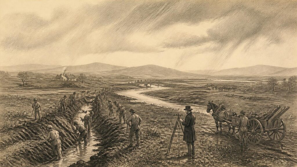
AI generated historical illustration, not a contemporary photograph.
At a Glance
Drainage has remade Ireland as surely as roads, railways or enclosure. Ditches beside a boreen, straightened rivers, embanked fields, lowered loughs and cut bogs can look ancient and inevitable; in fact, many are products of contested decisions about food, labour, property, flooding, fuel and nature. The history is neither a simple tale of progress nor one of environmental vandalism. It is the record of people attempting to live from a wet country, and of the costs that followed when water was treated chiefly as an impediment to be removed.
Waterlogged Island
Ireland’s drainage history begins with physical conditions rather than legislation. Abundant rainfall, modest gradients across many central lowlands, poorly permeable soils, lake basins and extensive peatlands all encouraged standing water, seasonal flooding and wet ground. A field need not lie in a dramatic marsh to be difficult to cultivate: water held above an impermeable layer may prevent roots from penetrating, delay spring grazing and leave a surface unable to bear animals or machinery. Teagasc still describes the basic purpose of agricultural drainage as lowering or controlling the water table so that soil can support crop growth, deeper roots and use by livestock. That modern definition also helps explain the long historical ambition: not simply to dry land permanently, which is rarely possible or desirable, but to alter the timing and movement of water.
Yet “wet land” was never one uniform thing. Fen, floodplain, lake margin, wet meadow, raised bog and blanket bog differed in soil, vegetation, ownership and possible use. A riverside meadow could yield hay when summer water receded. A bog supplied turf, grazing at its margins, berries, timber preserved beneath peat, and routes whose seasonal practicability was known locally. Floodwater could deposit fertile silt while also destroying a crop. The language of improvement often treated such places as vacant or defective land awaiting redemption; rural communities frequently knew them as working landscapes with several uses.
The archaeological record warns against imagining an untouched prehistoric Ireland followed abruptly by modern engineering. Wooden trackways and other objects preserved in peat demonstrate long interaction with wetland environments. They do not prove a national programme of prehistoric drainage, and exact dates or motives should not be invented for every ditch or embankment. What they establish is more important: bogs, marshes and shallow waters were crossed, exploited and culturally significant over very long periods. National Parks and Wildlife Service material stresses that peatlands preserve evidence of farming and objects from surrounding societies precisely because waterlogged conditions can protect organic material that would otherwise decay.
Medieval and early modern people also modified local watercourses, mills and fields, but the surviving evidence is uneven. Drainage could occur through small grips, open ditches, turf banks, mill races and communal maintenance rather than grand schemes. Such works leave a more fragmentary documentary trail than nineteenth-century state projects. It is therefore sensible to distinguish evidence from later folklore. A local claim that a particular drain was “dug in famine times” may be plausible in a district touched by relief works, but it is not proof without estate papers, valuation maps, engineering drawings, newspaper reports or oral testimony close to the event. The persistence of a watercourse is not, by itself, a date.
Local Knowledge
Before large public schemes, drainage was commonly tied to the management of farms and estates. Landlords with capital might finance reclamation, channels, embankments and underdrains as improvements expected to raise rent or make leases more valuable. Tenants and labourers supplied work, whether voluntarily, by agreement, or under the pressures of a highly unequal rural economy. The results varied. A carefully maintained field drain could transform a wet pasture; an outlet blocked by silt, vegetation or a downstream neighbour could undo the investment. Drainage was thus a continuing social obligation, not a single act of excavation.
Words used around Ireland preserve this practical diversity. A ditch, gripe, sheough or marein could carry runoff, spring water or discharge from a field system into a larger stream. These terms are not merely picturesque survivals. They indicate that farmers understood distinctions of slope, soil, water source and maintenance. The exact meaning of a term could vary locally, so it is unwise to force every name into a standard engineering category. Nonetheless, such vocabulary challenges the assumption that technical knowledge arrived only with state surveyors. Formal engineering added surveying instruments, calculations, standard specifications and administrative authority; it did not encounter an empty landscape.
The crucial issue was scale. Field drainage concerned water inside or immediately beside a holding. Arterial drainage concerned the main channels into which smaller drains discharged: rivers, streams, lakes, flood outlets and major cuts. A farmer could lay tiles or cut open drains, but these would fail if the receiving river stayed high. Conversely, a deepened river might improve an outlet while making it easier for upstream owners to send water downstream. From the beginning, drainage required decisions about whose land benefited, whose land carried risk, and who should pay.
That problem of collective action encouraged legislation. It also fostered disputes. Mill owners feared changes to water power; navigation interests feared that a lower, faster river would frustrate traffic; fisheries interests feared injury to spawning and passage; occupiers questioned rates levied for improvements that seemed remote from their fields. These conflicts were not accidental defects in an otherwise neutral technology. They arose because a river is shared infrastructure and a living system. The later history of the Lower Bann, where drainage, navigation, fishing and lake levels repeatedly had to be balanced, makes this especially clear.
Imperial Engineering
The Office of Public Works, often remembered as the Board of Works, became central to the nineteenth-century enlargement of drainage in Ireland. The Drainage (Ireland) Act 1842 gave the Commissioners powers in a new legislative framework that linked drainage with navigation and, in some cases, mill power. The National Archives of Ireland identifies extensive OPW records for this era, including engineers’ reports on proposed arterial schemes from the 1840s onwards. Their survival matters: maps, estimates, correspondence, specifications and compensation papers allow historians to reconstruct projects as planned institutions rather than rely solely on later memories.
The 1842 legislation expressed a characteristic improvement ideal. Engineering was expected to convert periodically inundated or waterlogged land into productive property while improving the movement of boats and, where relevant, supporting industrial power. In practice, these goals could conflict. A river deep enough and swift enough to discharge water might not provide the steady level desired for navigation or mills. Locks, weirs, cuts and sluices were attempts to reconcile incompatible demands rather than proof that they had been reconciled.
In the Lough Neagh basin, the Lower Bann illustrates this interdependence on an island-wide scale. John MacMahon’s mid-nineteenth-century plans addressed the river between Lough Neagh and the sea. Work included locks, weirs, channel alteration and the removal of obstacles, with the stated aims of aiding navigation and regulating water levels as well as improving drainage. The Waterways Ireland archive records five locks constructed in the late 1840s and 1850s. The project shows why “drainage” should not be reduced to agricultural ditching. It altered a large lake’s outlet, transport route, fisheries and surrounding lowlands.
The Board’s intervention brought greater technical capacity, but neither expertise nor statutory authority removed uncertainty. Estimates could be wrong; siltation and maintenance could defeat designs; costs could outrun expected gains; and the distribution of benefit was disputed. A nineteenth-century engineer’s report is excellent evidence for the scheme’s proposed mechanics and official assumptions. It is less reliable, by itself, as proof that every promised improvement occurred, that local people accepted it, or that environmental consequences were negligible. Reading archival records critically means attending to the purpose for which they were made.
Famine Labour
The Great Famine gave drainage a grim new prominence. Following the potato failures of the mid 1840s, public works were organised as relief employment. Drainage appeared attractive to officials because it was labour-intensive, apparently useful and capable, in theory, of producing a lasting return through improved land. The National Archives’ account of OPW records notes the Drainage (Ireland) Act 1846, which enabled a much wider programme under more direct government responsibility. It records more than 1,500 baronial drainage presentments in twenty-nine counties approved between October 1846 and February 1847.
Those figures demonstrate administrative activity, not humanitarian success. Relief works occurred amid catastrophic hunger, disease, eviction and migration. Making desperate people earn food or wages through arduous outdoor labour was a policy choice, not a natural necessity. Roads and drains dug under relief arrangements have consequently acquired a powerful place in Irish memory. They are sometimes described as useless works, a phrase that contains a moral judgement about the wider relief system as well as an assessment of engineering value. Some projects were poorly chosen, poorly timed or inadequately maintained; others created channels and roads that remained part of local infrastructure. The documentary evidence does not support treating all famine drainage as either futile theatre or effective rural development.
Labour itself is often obscured by official language. Plans identify districts, acreage, rates and proprietors more readily than the names, health or experiences of labourers. Newspaper accounts, workhouse records, letters and local testimony can sometimes restore part of that human history. They show why drainage cannot be considered only as an engineering subject. A drain may be a physical trace of famine administration, but it may also mark coercion, hunger and unequal power. The same embankment could be viewed by a proprietor as improvement, by an official as expenditure, and by a labourer as the condition of survival.
There was also a contradiction at the heart of the policy. State-funded or state-supervised works were frequently justified on the basis that landowners would repay the cost once their holdings benefited. But famine damaged the very rural economy on which repayment depended. The National Archives notes the subsequent difficulty of collecting charges. This was more than an accounting problem. It revealed the gap between an improvement model premised on capital, solvent proprietors and future rents, and a society devastated by mass poverty and demographic collapse.
It is tempting to draw a straight line from relief drains to present field boundaries, yet such certainty is rarely warranted. Subsequent schemes deepened or re-routed channels; farms were consolidated; machines replaced hand labour; and local maintenance altered original profiles. The most responsible local history identifies a feature as possibly associated with nineteenth-century works only where map sequences and surviving records make the connection credible. Famine folklore is historically valuable as memory, but memory and engineering chronology should be kept distinct.
Property Claims
Drainage was inseparable from property. To lower a river or reclaim a marsh was to change the practical value of land, access, grazing, fishing and sometimes common rights. Improvement language could conceal this redistribution. A landlord might receive higher-value pasture, while neighbouring users lost seasonal access to wetland resources. A channel that protected one district could hasten water through another. Compensation provisions in nineteenth- and twentieth-century laws acknowledge that drainage created both advantages and injuries, although legal recognition did not ensure equal bargaining power.
Estate improvement had a long life after the Famine. Scholarly work on Irish landlord investment demonstrates that reclamation and drainage belonged among the improvements owners might finance, alongside buildings and other works. But the pattern was uneven. It depended on estate resources, anticipated returns, local soils, tenant arrangements and political conditions. No national generalisation can tell the story of every townland. In some places, drainage was a major visible investment; in others, wetness remained a routine constraint because expensive works could not be justified or maintained.
Throughout this period, public and private activity overlapped. A major channel could be constructed through statutory powers while farm-scale drains were made by occupiers. The effectiveness of one depended on the other. This helps explain why statistics concerning acres “drained” should be handled cautiously. They usually refer to land within a scheme’s benefiting area or land influenced by an arterial outlet, not necessarily every acre transformed into dry, highly productive soil. The distinction is vital. An arterial scheme might make field drainage possible; it did not automatically install it in every field.
Legal and administrative records can supply a more exact picture. Valuation material, drainage maps, rate books, estate rentals and compensation files may identify affected properties. The National Archives’ guide to OPW collections points researchers towards reports, minute books and related material, while local archives may preserve county and estate records. Such documents are especially useful for moving beyond general narratives. They allow the historian to ask: who petitioned? What channel was authorised? Which lands were assessed? What objections were recorded? Who maintained the work once the engineers departed?
Peat Frontiers
No part of drainage history has been more consequential environmentally than the transformation of peatlands. Ireland’s raised bogs, blanket bogs and fens are wetland systems formed over very long periods. They were never simply empty wasteland. Turf cutting supplied household fuel; bog margins supported local economies; and the peat itself preserved archaeological and environmental evidence. However, the prospect of extracting peat, gaining agricultural ground, planting forestry or making routes across bog encouraged drainage on an expanding scale.
The history of bog drainage also exposes the limits of imported assumptions. Peat does not behave like mineral soil. When water is removed it can shrink, crack, subside and lose the hydrological conditions needed for peat-forming vegetation. The University College Dublin account of Irish bogs describes nineteenth-century government drainage efforts as failures in part because peat-drain behaviour was poorly understood. The lesson was learned gradually and imperfectly: a drain is not merely a trench in a passive surface. It changes the water regime of an entire bog, often beyond the line of the excavation.
Industrial peat production brought a different scale of intervention. Bord na Móna, established in 1946, became associated with mechanised development of midland bogs, but the preparatory work began with drainage. Networks of channels, progressively deepened as peat dried and settled, allowed machines to operate. The technical story is impressive: specialised low-ground-pressure machinery and carefully organised drainage converted difficult terrain into a fuel-producing landscape. The social story is equally important. Peat employment, railways, workshops and power generation reshaped communities in the midlands, while turf traditions persisted in many other places.
Historical accounts should avoid a false choice between celebrating turf as heritage and condemning all peat use as ignorance. Turf was a crucial domestic fuel for generations, particularly where other fuels were unaffordable or inaccessible. At the same time, the ecological implications of drainage and extraction are now well established. NPWS guidance explains that drains lower water tables, dry peat, compromise bog structure and expose formerly waterlogged material to decomposition. The consequence is loss of specialised habitat and release of stored carbon. These are documented physical processes, not merely a modern aesthetic objection to altered landscapes.
Conservation has therefore changed the meaning of a blocked drain. For generations, keeping water moving was normally the measure of good maintenance. In a damaged raised bog, blocking drains can be a deliberate act of restoration, intended to retain water and allow peat-forming conditions to recover where possible. This reversal is historically striking. It does not erase the earlier economic necessity of drainage, but it demonstrates that the definition of improvement has altered.
National Ambition
The establishment of the Irish Free State did not end the belief that drainage could strengthen agriculture. The Arterial Drainage Act 1925 provided one route for work before the more sweeping post-war settlement. The decisive statute was the Arterial Drainage Act 1945, enacted on 1 March 1945. Its title stated the ambition directly: provision for the drainage and improvement of land through arterial works, for maintenance of those works, and for better provision concerning existing drainage. The Act made the Commissioners of Public Works central to a new programme.
The 1945 Act differed from earlier piecemeal approaches by facilitating schemes on a catchment basis. This mattered technically and administratively. Water does not recognise farm or county boundaries; a river system connects tributaries, lowlands and outfalls. A catchment scheme could therefore consider a larger hydraulic unit, even if its benefits and burdens were not evenly shared. The legislation also provided procedures for preparing schemes, giving notices, receiving objections, acquiring land, paying compensation and protecting interests including fisheries. Its formal processes were an attempt to make a far-reaching intervention lawful and governable.
Construction began on the Brosna scheme in 1948. The OPW’s official list records major schemes across much of the State in the following decades: among them the Glyde and Dee, Feale, Corrib–Clare, Moy, Inny, Boyne, Maigue and Boyle. The cumulative scale was considerable. The OPW lists 647,050 acres as benefiting from completed major schemes in its table, though this should be read as administrative scheme data rather than a simple measure of uniformly reclaimed land. The work generally involved widening and deepening channels, clearing obstacles, constructing embankments and bridges, and improving tributary outlets.
Post-war drainage belonged to a wider development programme. Policymakers expected better grass growth, longer grazing seasons, higher stocking rates and greater agricultural incomes. In a country where pasture was central to farming, poor drainage was regarded as a constraint on productivity and rural modernisation. The programme was also visually transformative. Meandering channels were straightened, riverbanks regularised, and floodplains linked more quickly to downstream outlets. Machinery altered the pace and volume of excavation, making the projects very different from hand-cut relief works a century earlier.
The post-1945 programme did not mean that every drainage problem was solved. Field conditions still varied enormously, and arterial works needed to be complemented by farm drainage. The public record also makes clear that maintenance was integral to the system. Under section 37 of the 1945 Act, the OPW has duties regarding the repair and effective condition of works within its remit. Maintenance can be less visible than construction, but it is historically decisive: without it, channels silt, banks fail, vegetation grows and the engineered relationship between land and water changes again.
Fields Transformed
Arterial drainage and field drainage must be understood together but not confused. The main channel lowers the level to which surrounding drains can discharge. Within the farm, open ditches, pipes, tile drains, mole drains and soil loosening may move water towards that outlet. The material history of these systems can be read in fields: stone drains and clay tiles may survive below modern pasture; later plastic pipes and machine-cut trenches reflect new technology and grant regimes. A single farm may preserve several generations of intervention.
State policy increasingly encouraged this farm-scale work. Teagasc records that the Department of Agriculture’s Land Project operated from 1949 to 1976 with the specific purpose of improving drainage for food production. Its surveys and manuals reflect an effort to classify soils and match treatments to local conditions. This was not an irrational programme. On suitable soils, effective drainage could make land more workable and extend the grazing season. But its limitations were recognised by the specialists themselves. Impermeable soils, high rainfall and difficult western terrain could make success expensive or uncertain.
Technological progress altered expectations. Pipes replaced many older tile systems; tractors and excavators made trenching faster; machinery could cut long, regular channels; and soil science offered more systematic advice. Yet drainage remained dependent on maintenance and judgment. A drain with the wrong gradient, insufficient outfall or damaged pipe is not redeemed by modern material. Nor does deeper always mean better. Excessive drainage can affect soils, streams and wetlands, while poorly designed outlets can transfer sediment or nutrients to receiving waters.
The history is therefore not a march from primitive ditching to perfect engineering. It is a series of adjustments to difficult conditions. In some districts, farmers benefited greatly from a combination of arterial outlets and field systems. In others, investment offered disappointing returns. In still others, the costs became visible only later in altered flood behaviour, degraded habitat or water-quality pressures. Historical interpretation must allow all these outcomes to coexist.
Northern Waters
Partition created different administrative frameworks after 1921, but rivers and catchments continued to disregard political boundaries. The Lough Neagh system is the clearest example. Its catchment includes most of Northern Ireland and reaches into border areas of the Republic. Water levels in the lough are controlled through the Lower Bann, and changes in its outlet have consequences far beyond the immediate channel.
Earlier nineteenth-century works were followed by further twentieth-century engineering. Waterways Ireland’s history of the Lower Bann records the installation of sluice gates in the early 1930s to regulate river flow and help control Lough Neagh levels. Later legislation, including the Lough Neagh and Lower Bann Drainage and Navigation Act (Northern Ireland) 1955, supplied the framework for managing levels and associated interests. The Department for Infrastructure describes its present statutory responsibilities under this and later legislation, including regulation of the lough within prescribed levels as far as weather permits.
This history complicates any notion that drainage simply removes water. On the Bann, gates and weirs actively manage it. The aim has been to limit damaging levels while preserving a workable navigation and accommodating other uses. The old dilemma remains: a level beneficial to lakeshore land may not be ideal for fisheries, boats, wetlands or water supply. Parliamentary debate in the nineteenth century already recorded conflicts between drainage and navigation interests. Modern controversies occur in a different environmental context, but they belong to the same long history of competing claims upon a shared water system.
Including Northern Ireland is not an optional addendum to an Irish drainage history. The island’s hydrology, engineering inheritance and rural landscapes are interconnected, even where governance is divided. It also provides a reminder that statutory history should be stated precisely. The OPW’s post-1945 arterial schemes concern the State; Northern Ireland’s drainage authority and legislative arrangements are separate. Similar-looking channels can therefore belong to different legal and administrative traditions.
Environmental Reckoning
By the late twentieth century, the purposes for which drainage was judged had broadened. Agricultural output remained important, but river ecology, water quality, floodplain function, fisheries, archaeology, carbon storage and biodiversity became increasingly prominent. This was not merely a change in public taste. Scientific work made clearer how channelisation and wetland drainage could affect habitats, sediment movement and hydrology. European environmental law also required assessment and protection of designated sites.
The environmental critique should be accurate rather than absolute. Arterial drainage was generally designed to improve agricultural land and reduce the duration or incidence of flooding on benefiting land; it was not originally conceived as a comprehensive modern flood-relief system for towns. The Comptroller and Auditor General’s 1996 report on the Boyle and Bonet schemes made this distinction explicitly. A channel capable of moving water away more quickly can reduce some local flood impacts, but it may also alter downstream timing and does not eliminate flood risk in extreme conditions. It is misleading to credit nineteenth- or mid-twentieth-century drainage with solving a twenty-first-century climate problem it was not designed to address.
Peatlands have become a focal point of reassessment. NPWS notes that active raised bogs now survive only in very limited condition and that Ireland has particular responsibility for their conservation. Restoration programmes commonly seek to re-wet damaged areas by blocking or managing drains. Such work is an inversion of former practice, but it has historical logic: peatlands function through retained water. Their capacity to store carbon, moderate water and preserve records of past environments makes them more than land awaiting conversion.
Archaeology too has changed the terms of debate. Drainage, turf cutting and peat extraction can expose trackways, timber, artefacts and human remains, but exposure may also accelerate deterioration. The old image of the bog as a place outside history has been replaced by an understanding of it as an archive. This does not require romanticising all wet ground. It does require recognising that the removal of water may destroy evidence that water preserved.
Environmental assessment has also altered the legal setting around existing works. The revised text of the Arterial Drainage Act 1945 records the interaction of the Act with habitats regulations. Present-day maintenance and new works must navigate requirements that earlier engineers did not face. This is a practical challenge as well as a philosophical one: rivers must be maintained, communities protected and land managed, but interventions now receive scrutiny through ecological and heritage lenses unavailable to previous generations.
Living Infrastructure
Drainage channels are living infrastructure. They need inspection, vegetation management, sediment control, repair and, increasingly, ecological judgment. To maintain every channel in the same way may not be compatible with habitat protection; to cease all maintenance may leave communities and farmland exposed. The choice is not between engineering and nature, because every inherited channel already embodies an engineered ecological relationship. The question is what relationship should be maintained, altered or restored.
That question has renewed interest in natural flood management, reconnected floodplains, wetland restoration and slower movement of water through catchments. These approaches should not be treated as a return to a pristine past. Ireland’s landscapes have long been worked, and many settlements, farms and roads now depend on inherited drainage systems. Rather, they represent a reassessment of where water can safely be held, where channels need space, and where the assumption that faster conveyance is always best no longer holds.
Historical knowledge is indispensable to that reassessment. Old maps may show former river bends, drained lakeshores, mill races or peatland margins. OPW drawings can identify the original line and purpose of an arterial scheme. Local knowledge can explain where water rises first, which culvert blocks, or where an old drain lies under a field. Oral tradition is especially useful when it is treated as testimony to experience rather than converted automatically into exact chronology. Combined with hydrological survey and archival research, it can give a fuller account of a landscape than either source alone.
Drainage’s legacy is therefore not only physical. It has shaped ideas of good farming, state competence, ownership, labour and progress. The straightened stream and deep roadside ditch contain the ambitions of landlords, engineers, labourers, farmers and governments. They also contain the limits of those ambitions. Water repeatedly returns: in floods, blocked channels, saturated fields and recovering bogs. Irish drainage history is, in that sense, a history of control continually qualified by geography.
Historical Balance
A balanced history must resist easy verdicts. It would be wrong to portray every drainage project as exploitation imposed from above. Many rural households wanted better outlets, firmer fields and relief from recurrent inundation; many benefited from them. It would be equally wrong to regard all drainage as benign progress. The Famine relief system used labour in conditions of acute suffering; drainage changed rights and landscapes; and the drying of wetlands and peatlands imposed long-term ecological losses that were often poorly understood or ignored.
Evidence supports several firm conclusions. Large public drainage programmes expanded greatly from the 1840s; the Famine accelerated state involvement; the 1945 Act enabled an extensive catchment-based programme in the State; field-scale drainage remained essential to agricultural outcomes; peatland drainage was central to extraction and reclamation; and late twentieth- and twenty-first-century conservation has revalued water retention. Interpretation enters when judging the relative weight of benefits and harms, because these were distributed unevenly across place and time.
Folklore has its place as well. Stories of famine drains, drowned fields, ancient routes through bogs and rivers that “were never the same” after works often preserve meaningful local observations. They should be recorded respectfully. But historians should label them as tradition unless they can be corroborated. A careful article does not diminish local memory by distinguishing it from documentary evidence; it makes both more useful.
The most enduring lesson is modest. Water cannot be finally defeated by a programme, an Act or a machine. It can be directed, delayed, confined and released, always with consequences elsewhere. Across Ireland, drainage has made productive land, enabled transport, supplied fuel and protected some places from water. It has also altered rivers, damaged wetlands, exposed communities to new trade-offs and left a difficult inheritance. To read a drain historically is to see not an empty trench, but an argument in the landscape about what land is for.