
Dryas Beneath the Drumlin30960 BCE
Thirty millennia before the present, Ireland lay within the changing, pre-maximum landscape of the last Ice Age, rather than a uniformly frozen island. At Derryvree, Fermanagh, organic sediments between tills record a periglacial freshwater wetland with tundra vegetation, insects and shallow water, later overridden by ice. Other northern deposits indicate exposed ground. Southern cave assemblages attest to cold-adapted mammals, although cave contexts and older dates require caution. Waterford red deer date broadly to this horizon. A cut-marked Castlepook reindeer bone suggests possible human handling, but no occupation is established. Evidence remains fragmentary, precluding conclusions about settlement, society, routes or populations.
Dateline
“30,960 BCE” is a modern archival label, not a year from which Ireland preserves an event, ruler, settlement or calendar. It corresponds approximately to 32,910 years before AD 1950, the conventional ‘present’ used in radiocarbon science, but no archaeological evidence can be assigned to that individual year. The responsible subject is therefore Ireland during a broader late Middle Midlandian, Marine Isotope Stage 3 (MIS 3) interval of the last Ice Age. Dates at this depth are expressed as radiocarbon measurements and calibrated ranges, often with uncertainties of centuries or millennia.
At this point Ireland was approaching, rather than living through, the fullest expansion of the last British–Irish Ice Sheet. The ice sheet did not form everywhere at once, nor did it have a single neat edge. Its sectors advanced and retreated differently in response to climate, topography and the behaviour of fast-flowing ice. Later reconstructions place substantial growth in the wider Irish–British ice complex around this period, while emphasising that large parts of the chronology remain inferred from scattered geological constraints. The maximum ice volume came much later, around 23,000 years ago. Around the notional date, Ireland was a changing mosaic of ice, ice margins, exposed ground, caves and cold-water environments rather than a uniform frozen island.
A Landscape Recorded Between Tills
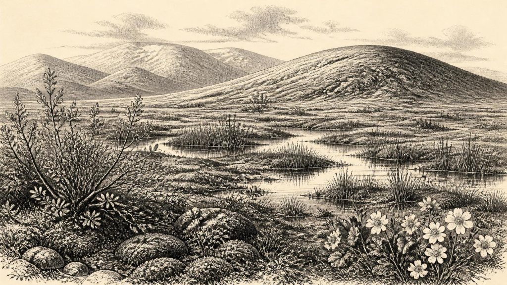
The strongest local window is Derryvree, near Maguiresbridge in County Fermanagh. Roadworks in 1969 cut through a drumlin and revealed silts, fine sands and organic deposits trapped between two distinct layers of glacial till. This was an exceptional discovery: the lower till testified to an earlier ice advance, while the upper till showed that ice later returned and overrode the landscape. Between them lay evidence for a period when freshwater accumulated in a hollow and life persisted in, beside and above it.
The principal radiocarbon measurement from Derryvree was 30,500 radiocarbon years BP, with a quoted uncertainty of roughly a thousand years. It is not a calendar date and should not be mechanically equated with 30,500 BCE. Calibration is necessary because atmospheric carbon-14 has varied through time; modern calibration curves extend to 55,000 calibrated years BP, but their result at this antiquity is a probability distribution rather than a date on a single day or year. Derryvree is consequently evidence for a broad cold-stage interval relevant to 30,960 BCE, not proof that its pond existed in that exact year.
Its fossils make the point vividly. Mosses, sedges and herbaceous pollen, together with macrofossils including mountain avens, dwarf willow and bogbean, indicate open, cold vegetation. Aquatic evidence, including water-milfoil, demonstrates that shallow freshwater was available locally. Insects reinforced the picture of a northern, full-glacial fauna. The careful conclusion is not that every part of Fermanagh was identical, but that a periglacial wetland existed within an exposed tundra-like landscape. Periglacial means shaped by intense frost, seasonal freezing and thawing, and sparse plant cover near ice; it does not mean that the site lay permanently under glacier ice.
Open Ground, Moving Ice
The Derryvree record corrects an easy misconception about Ice-Age Ireland. Cold conditions did not make the whole island biologically empty. Wet hollows could support aquatic plants and mosses, while sedges, grasses, low shrubs and Arctic-alpine herbs occupied surrounding ground. Yet this was not the wooded Ireland familiar from later prehistory. The few tree-pollen grains recovered from such deposits cannot securely demonstrate nearby woodland: pollen can travel far on the wind or be redeposited. The more robust inference is a generally open landscape, with localised water and vegetation providing small ecological refuges amid severe conditions.
Other Fermanagh deposits at Hollymount and Greenagho likewise show that parts of northern Ireland experienced cold, non-glacial intervals during the Middle Midlandian. Their chronological limits differ and are imperfect, so they should not be combined into an imaginary island-wide scene for a single year. Together, however, they show that Ireland’s interior contained episodes of exposed land and freshwater habitats before later ice advances buried or eroded much of that evidence.
The physical geography was also unlike that of the modern republic and Northern Ireland. Sea level was lower globally because enormous volumes of water were locked in continental ice, and coastlines lay farther out in many places. But lower sea level alone cannot prove a particular route for humans or animals into Ireland at this time. The character, timing and duration of possible connections or crossings in the Irish Sea region remain subjects requiring local evidence. A fossil animal in Ireland demonstrates that an animal reached the island; it does not by itself reveal whether it came over land, sea ice, a short water crossing or a route now destroyed by later glaciation and rising seas.
Animals Before the Maximum
Cave collections, especially those from southern Ireland, indicate a richer pre-Last Glacial Maximum mammal community than later Ireland possessed. Castlepook Cave near Doneraile, County Cork, is especially important. Its old excavations produced remains attributed to reindeer, giant deer, mammoth, brown bear, wolf, Arctic fox, lemming and spotted hyaena. Such a list evokes an open, cold-steppe or tundra-margin ecosystem in which herds and predators could range across suitable terrain.
It must nevertheless be read cautiously. Caves are complicated archives. They can be dens used by carnivores, natural traps, conduits for water and sediment, shelters, and places disturbed by earlier excavation. Bones recovered from different chambers or depths may not belong to one moment, one habitat or even one intact deposit. Improved ultrafiltration methods have also shown that several older Irish cave radiocarbon determinations were too young, underlining the need to reassess collections rather than repeat inherited chronologies.
Direct calibrated dates provide firmer but still limited anchors. Two pre-Last Glacial Maximum red-deer specimens from caves in County Waterford were dated to 32,930–31,280 and 30,297–29,594 calibrated years BP. The earlier range overlaps the modern label represented by 30,960 BCE. These finds demonstrate that cervids were present in southern Ireland during the broad period, but they do not establish a continuous population, migration route or an annual hunting season. Reindeer and other cold-adapted mammals are more frequently represented in the wider Irish Pleistocene cave record, though each specimen requires its own dating and contextual assessment.
The Castlepook Human Question
This period has acquired special significance because of a reindeer femur from Castlepook. County Cork heritage material reports that the bone, held in the National Museum of Ireland’s Natural History collections, was dated to about 33,000 years ago and bears a deep mark interpreted by zooarchaeologist Ruth Carden as a sharp stone-tool mark made while the bone was fresh. If that diagnosis and association are sustained, it would be a remarkable indication that a person handled a reindeer in Ireland long before the Last Glacial Maximum.
That is an important possibility, but not a licence to invent an Irish Palaeolithic community. The dated object is an animal bone, not an excavated occupation floor. No securely associated hearth, stone-tool assemblage, dwelling, burial, workshop or repeated food-processing area of comparable age has yet been identified at Castlepook. A cut mark could indicate carcass processing, but cannot tell us whether people killed the animal, found it dead, removed meat or hide, visited once or lived nearby. Nor can it establish political groups, kinship, language, art, ritual, trade or a permanent settlement.
The contrast with later evidence is useful. A butchered brown-bear patella from Alice and Gwendoline Cave in County Clare has two independent calibrated dates of 12,810–12,590 and 12,810–12,685 cal BP, making it the published, securely dated evidence for Late Upper Palaeolithic human activity in Ireland. It is nearly twenty millennia later than the horizon considered here. The distinction matters: established evidence for a brief later human presence should not be projected backwards to fill the silence at 30,960 BCE.
Society Beyond Recovery
There are therefore no recoverable political affairs, conflicts, diplomatic contacts, named peoples or religious institutions for Ireland around this point. There is no evidence for agriculture, domestic animals, metalworking, pottery, writing, exchange networks or a settled economy. If people were present, their subsistence would most plausibly have depended upon highly mobile foraging and the opportunistic use of animal and plant resources; that is an inference from the broader Upper Palaeolithic world, not an established description of an Irish society.
The most meaningful history of Ireland at this horizon is environmental and evidential. Freshwater silts beneath a Fermanagh drumlin record a cold wetland capable of supporting hardy plants and insects. Cave bones in Cork attest to mammals that later vanished from the island. A marked reindeer femur raises a serious question about human activity but does not yet answer it. Above all, advancing ice would later scour, bury and rearrange much of the landscape, helping to explain why the archive is so fragmentary. Ireland at 30,960 BCE is not a blank past, but it is a past known in traces: pollen, seeds, mosses, insects, sediment, bone and the disciplined uncertainty that connects them.
Primary Sources
- A Middle Midlandian Freshwater Series at Derryvree, Maguiresbridge, County Fermanagh, Northern Ireland
- Early Midlandian–Middle Midlandian, Pleistocene, Northern Ireland
- Palaeoecology: Quaternary Environmental Change in Northern Ireland
- Dryas octopetala
- Salix herbacea
- Menyanthes trifoliata
- Myriophyllum alterniflorum
- A reconsideration of the radiocarbon dating of the Marine Isotope Stage 3 fauna from southern Ireland
- The Irish Quaternary Fauna Project
- Phylogeographic, Ancient DNA, Fossil and Morphometric Analyses Reveal Ancient and Modern Introductions of a Large Mammal: the Complex Case of Red Deer (Cervus elaphus) in Ireland
- The IntCal20 Northern Hemisphere Radiocarbon Age Calibration Curve (0–55 cal kBP)
- Growth and Retreat of the Last British–Irish Ice Sheet, 31,000 to 15,000 Years Ago: the BRITICE-CHRONO Reconstruction
- Pattern, Style and Timing of British–Irish Ice Sheet Advance and Retreat Over the Last 45,000 Years: Evidence from NW Scotland and the Adjacent Continental Shelf
- First Evidence of a Late Upper Palaeolithic Human Presence in Ireland
- The Mesolithic in Ireland: When Was It?
- New Insights on the Fauna of Ireland’s Younger Dryas and Early Holocene from Alice & Gwendoline Cave
- Heritage Artefacts of County Cork 2021
- 2022:564 – Castlepook Cave, Castlepook South, Cork
- Freshwater Organic Deposits and Stratified Sediments Between Early and Late Midlandian (Devensian) Till Sheets, at Aghnadarragh, County Antrim, Northern Ireland
- Dimensions and Chronology of the Last Ice Sheet in Western Ireland
