
BIRM-166’s Bogbean Waters30801 BCE
30,801 BCE is a modern label within Marine Isotope Stage 3, not a precisely recoverable Irish year. At Derryvree, County Fermanagh, BIRM-166 organic sediments, dated broadly to 36,900–31,700 calendar years BP, record a cold freshwater wetland between glacial advances, with bogbean, dwarf willow, sedges and insects. They indicate local ice-free conditions, not an ice-free island. Castlepook Cave, County Cork, preserves faunal remains accumulated over many episodes, showing habitats supporting mammoth, deer, predators and later cold-adapted species. A possibly cut-marked reindeer bone suggests fleeting human presence, but lacks contextual confirmation. Evidence supports a variable, severe landscape, not settled society or events.
Dateline
30,801 BCE is a modern calendar label, not a recoverable Irish year. No written calendar, settlement sequence or archaeological deposit can identify an event, individual or season in Ireland at this precision. Counted back from the conventional radiocarbon reference year of AD 1950, the label sits roughly 32,750 years before present. It belongs to the Late Pleistocene, within Marine Isotope Stage 3 (MIS 3), a long and climatically unstable part of the last Ice Age. The responsible history is therefore a history of ranges, deposits and probabilities rather than an imagined annual chronicle.
The most informative Irish evidence near this horizon is the Derryvree freshwater series, exposed in a road cutting through a drumlin near Maguiresbridge, County Fermanagh, in 1969. Organic silts and fine sands lay between two thick sheets of glacial till. Their order records a sequence rather than a single occasion: glacier ice deposited the lower till; an interval then allowed freshwater sediment, plants and insects to accumulate locally; later ice deposited an upper till and sealed the deposit. The organic material, BIRM-166, gave a conventional radiocarbon age of 30,500 +1,170/−1,030 radiocarbon years BP. When calibrated, published discussion places it broadly at about 36,900–31,700 calendar years BP—approximately 34,950–29,750 BCE. The requested date falls within that wide interval, but cannot be pinned to a particular layer, pool or living creature.
Fresh Water Between Ice Advances
Derryvree is important because most evidence from this age has been erased, reworked or buried by later glaciers. It demonstrates that at least one part of Fermanagh was free of overriding ice for long enough to sustain standing or slow-moving fresh water and a wetland margin. It does not demonstrate that the whole island was ice-free at the same time. Ireland’s ice cover changed from region to region, while the wider British–Irish Ice Sheet was capable of repeated growth, retreat and reorganisation during MIS 3. The much more extensive Last Glacial Maximum ice cover came later: evidence places maximum Irish and shelf-edge glaciation principally around 27,000–23,000 calibrated years BP, although individual sectors did not behave in unison.
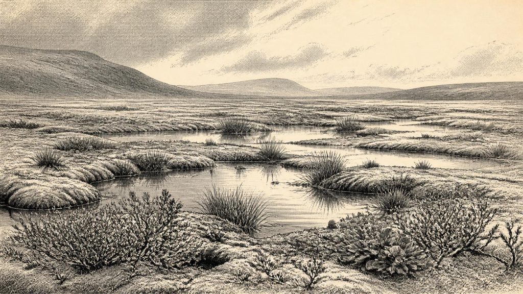
The Derryvree succession has traditionally been described as an open, treeless muskeg or tundra wetland. Its plant and insect remains point to cold, saturated ground, pools with aquatic vegetation, mossy edges, sedges and low herbaceous cover rather than forest. Fossils include bogbean (Menyanthes trifoliata) and dwarf willow (Salix herbacea), plants well suited to cool, wet settings; the broader assemblage includes grasses, sedges, juniper and herbs. This was a seasonal environment in which shallow water, thawed surface sediment and plant growth could flourish during favourable months, even though winters were severe and frost strongly shaped the terrain. The palaeoecological evidence supports that local picture; it cannot supply a precise annual temperature, a complete island-wide vegetation map or a fixed climate for 30,801 BCE.
A Changing Ice-Age Landscape
At this depth of time, Ireland should not be pictured as a static white wilderness. MIS 3 was marked across the North Atlantic by abrupt climatic swings. In south-west Ireland, uranium-thorium dates from broken and reworked speleothems in Crag Cave show that cave calcite formed episodically through much of the last glacial period, in phases broadly corresponding to warmer Greenland interstadials. Such records reinforce the central lesson of Derryvree: conditions could change sharply over centuries or millennia. Yet the broad calibrated age of BIRM-166 overlaps several Greenland climate phases, so it would be overconfident to assign the nominal year to one exact Greenland stadial or interstadial.
Ice, permafrost-like ground conditions, meltwater and erosion governed regional change more decisively than any human institution. Rivers and ponds shifted; plants colonised newly available wet ground; later glacial movement truncated or covered earlier surfaces. The drumlin which preserved Derryvree was itself part of this palimpsest. Its sediments convey both opportunity and destruction: a viable freshwater niche existed, but the later ice advance protected the evidence only by burying it. For this reason, absence of a camp, tool scatter or hearth from the period is not proof that no people ever reached Ireland. It is, however, a powerful reason not to invent a population, a territory or a settled landscape.
Castlepook’s Long Faunal Record
Far to the south, Castlepook Cave near Doneraile in north County Cork provides a different kind of evidence. The limestone cave, also known as Mammoth Cave, has produced more than 2,000 bones and is Ireland’s richest known archive for vertebrate fauna before the Last Glacial Maximum. Its dated bones span a long portion of the middle and later Ice Age, rather than a single occupation horizon. Woolly mammoth, giant deer, reindeer, brown bear and spotted hyaena occur among the earlier Ice-Age fauna; Arctic fox, wolf and lemmings appear in later cold-phase material. These finds establish that Irish landscapes at various times in this broad period could sustain large herbivores and their predators. They do not establish that all these species met at one place, in one season or precisely in 30,801 BCE.
The cave is also a warning about how fossil evidence forms. Carnivores could carry bones into chambers, animals might die in fissures, water could move remains, and early excavations did not document deposits to modern standards. Re-dating has shown that some 1990s radiocarbon determinations from southern Irish caves underestimated the true ages of specimens by thousands of years. Castlepook is consequently invaluable, but it is a repository assembled through many processes and episodes, not a ready-made snapshot of an Ice-Age community. Its chief historical value here is to demonstrate ecological possibility: open country and varied refuges could support mobile animals even as climate and ice margins shifted.
The Reindeer Femur Question
A reindeer femur from Castlepook gives this period exceptional, but very limited, human significance. Ruth Carden has interpreted a deep surface mark as made by a sharp stone implement during carcass processing; County Cork’s heritage publication presents the bone as Palaeolithic and approximately 31,000 BC. If that interpretation is confirmed, it would be evidence that one or more people handled a reindeer in Ireland during MIS 3—far earlier than the formerly accepted evidence for human activity on the island. It is an important proposition, not a licence to write a story of established hunters, named groups or an Irish Upper Palaeolithic culture.
The limitations are unusually important. The femur comes from an old cave collection rather than a newly excavated, sealed occupation floor. No securely associated stone-tool assemblage, hearth, dwelling, burial, human bone, durable food store or substantial butchered bone concentration of comparable age has yet been identified. Recent excavation at Castlepook was undertaken partly to establish whether undisturbed Pleistocene deposits survive; the site record itself notes that its earlier archaeological designation was made redundant because evidence for human occupation had not been established. The marked bone may represent a brief visit, an episode of carcass processing elsewhere followed by scavenger transport, or an interpretation that future microscopic and contextual study may alter.
Society Beyond the Evidence
There is no direct evidence from Ireland around this date for political authority, warfare between communities, diplomacy, farming, trade routes, permanent houses, ritual monuments, formal religion, art or writing. Nor can archaeology identify families, languages, beliefs or learned traditions from a single possible cut-marked bone. If people did enter Ireland, comparison with contemporary Upper Palaeolithic hunter-gatherers elsewhere in north-west Europe makes small, mobile groups following seasonal resources a reasonable interpretation. It is not a demonstrated Irish social history. Their practical knowledge—of animal movement, weather, shelter, stone and fire—would have been essential, but no Irish tool kit of this age has yet been recovered to show how that knowledge was materially expressed.
Likewise, low global sea levels should not be simplified into a claim that Ireland was easily joined to Britain or continental Europe by a walkable land bridge. Glacial loading, changing sea level, ice margins and now-submerged terrain make the geography complicated, while reliable palaeogeographic reconstructions are stronger for the much later post-Last Glacial Maximum world than for this date. Any human arrival route in MIS 3 remains unknown. What is secure is more modest and more revealing: Ireland retained cold, locally productive habitats; large mammals and carnivores moved through some of them; and a small body of evidence raises the possibility of a human encounter within that changing world.
Thus 30,801 BCE is best understood not as a year of kings, conflict or settlement, but as a point inside a broad environmental interval. BIRM-166 preserves freshwater life between ice advances in Fermanagh. Castlepook preserves the bones of animals that occupied very different Irish landscapes across the Ice Age, and perhaps one trace of human action. Together they show an Ireland that was neither empty of life nor knowable in the neat calendar terms demanded by later history: a severe, open and changeable land whose most eloquent records were sealed beneath ice.
Primary Sources
- A Middle Midlandian Freshwater Series at Derryvree, Maguiresbridge, County Fermanagh, Northern Ireland
- A Reconsideration of the Radiocarbon Dating of the Marine Isotope Stage 3 Fauna from Southern Ireland
- The Irish Quaternary Fauna Project
- Castlepook Cave, County Geological Site Report
- Heritage Artefacts of County Cork
- The Quaternary of Northern Ireland: Guide 16
- The Subdivision of the Quaternary Period in Ireland
- Quaternary Site Descriptions: Ireland Map
- Menyanthes trifoliata L.
- Salix herbacea L.
- The IntCal20 Northern Hemisphere Radiocarbon Age Calibration Curve (0–55 cal kBP)
- Episodic Speleothem Deposition Tracks the Terrestrial Impact of Millennial-Scale Last Glacial Climate Variability in SW Ireland
- The Timing and Magnitude of the British–Irish Ice Sheet Between Marine Isotope Stages 5d and 2
- Exploring Controls of the Early and Stepped Deglaciation on the Western Margin of the British–Irish Ice Sheet
- Ireland: Submerged Prehistoric Sites and Landscapes
- The Colonization of Ireland: A Human Ecology Perspective
- New Insights on the Fauna of Ireland's Younger Dryas and Early Holocene from Alice & Gwendoline Cave
- 2022:564 – Castlepook Cave, Castlepook South, Cork
- Oscillating Retreat of the Last British-Irish Ice Sheet on the Continental Shelf Offshore Galway Bay, Western Ireland
- Trimlines, Blockfields and the Vertical Extent of the Last Ice Sheet in Southern Ireland
