Maguirebridge Juniper Interval30789 BCE
The modern label 30,789 BCE denotes a broad Marine Isotope Stage 3 interval, not a documented Irish year. Derryvree, near Maguiresbridge, preserves wetland deposits dated within a calibrated range, indicating ice-free, treeless tundra with sedges, grasses, juniper, dwarf willow, freshwater pools and insects between glacial advances. Castlepook Cave’s mixed faunal assemblage, including mammoth, reindeer, giant deer, predators and cold-adapted mammals, demonstrates changing ecological links with north-west Europe, but cannot form a single snapshot. Possible early human evidence remains uncertain; secure activity is far later. Ice, erosion, shifting sea levels and imprecise dating require cautious interpretation of Ireland’s Ice Age environments.
Dateline
The label “30,789 BCE” is a modern way of locating an immensely remote part of the Ice Age, not a year for which Ireland possesses a historical record. No event, person, community or season can responsibly be assigned to that calendar year. In radiocarbon and environmental terms, it sits broadly around 32,700 calibrated years before present, within Marine Isotope Stage 3, a long and climatically unstable phase before the Last Glacial Maximum. The nearest relevant Irish evidence consists of dated deposits and animal remains with ranges measured in centuries or millennia, not annual precision.
The most informative record is not a settlement but a buried wetland at Derryvree near Maguiresbridge, County Fermanagh. Organic silts and fine sands, sealed between two glacial tills in a drumlin, produced a conventional radiocarbon determination of 30,500 BP, with wide uncertainty. Subsequent calibration places the deposit broadly in the range of about 36,900–31,700 calibrated years BP. The nominated year lies within that broad span, but it must not be mistaken for the date of a single layer, landscape episode or human visit.
A Date Without a Chronicle
There were no written records, named peoples, political institutions or calendrical systems in Ireland at this time. It is therefore impossible to describe rulers, laws, alliances, diplomacy or wars in the ordinary historical sense. Nor is there evidence for villages, houses, burials, monuments, art, ritual places, trade goods or a securely dated stone-tool assemblage from Ireland specifically around this point. These absences are not merely gaps awaiting a simple answer: later glaciers eroded, redeposited and concealed much of the older landscape, while early cave excavations often disturbed deposits before modern recording standards existed.
The proper subject is consequently an Ice Age environment, reconstructed from pollen, plant macrofossils, insects, sediments, animal bones and the sequence of ice advances. Each source answers a different question. A pollen grain may indicate nearby vegetation; a beetle or midge can indicate water, ground conditions or temperature; a bone shows that an animal died or was deposited at a site; a radiocarbon measurement dates surviving organic carbon within a statistical range. None, by itself, creates a complete picture of one year.
The Derryvree Wetland
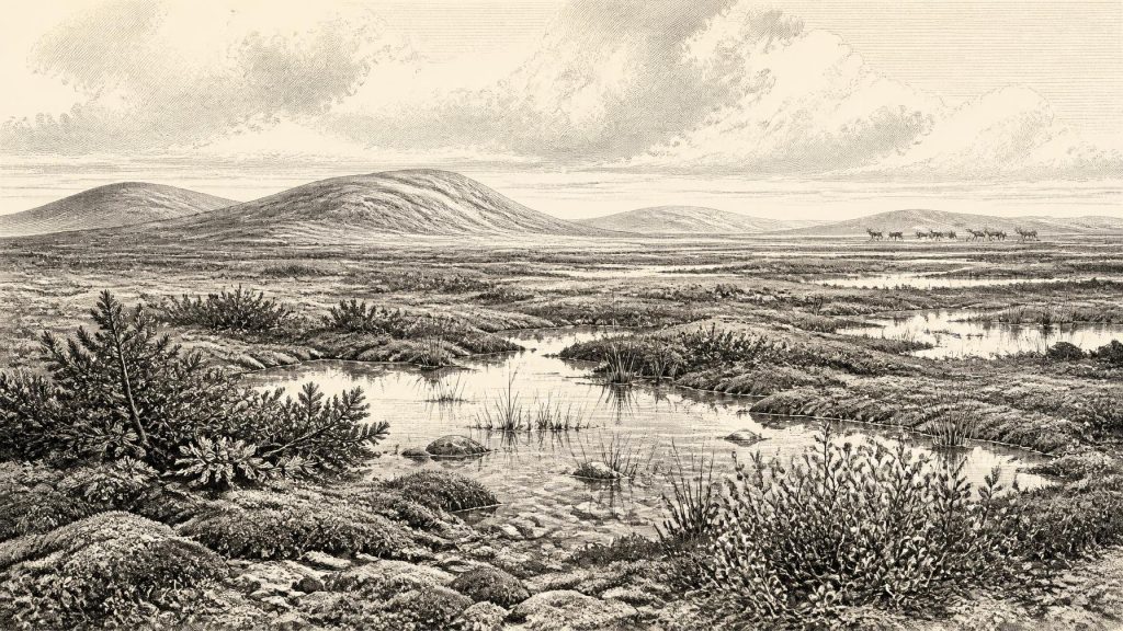
At Derryvree, the deposits point to a treeless, open and cold landscape rather than the wooded Ireland familiar today. Grasses and sedges were prominent. Juniper and dwarf willow occurred alongside herbs, mosses and plants adapted to wet, exposed ground. Finds of bogbean, or Menyanthes trifoliata, and aquatic plant remains show that shallow freshwater persisted locally. The insect evidence likewise suggests open pools with abundant decaying vegetation, surrounded by mossy ground. Researchers described this as a muskeg-like tundra wetland: waterlogged, uneven and productive in small patches, but set within a severe periglacial climate.
That setting should not be imagined as a uniform white desert. Even in a cold phase, local hollows could hold ponds and sedge beds; low vegetation could shelter insects and small animals; summer light could briefly drive plant growth. Yet winters were harsh, trees absent, and frost action important. Freeze-thaw processes, seasonally frozen ground and sparse plant cover shaped soils and slopes. The organic bed’s position between two tills is crucial: it records a time when this part of Fermanagh was ice-free enough for freshwater and vegetation to develop, after an earlier glacial episode and before later ice again overran or influenced the area.
This is evidence for local environmental conditions, not proof that every part of Ireland looked identical. Ice extent during the earlier and middle phases of the last glaciation remains an active problem in Quaternary research. Southern Ireland, northern Ireland, uplands, lowlands and offshore basins did not necessarily experience the same conditions at the same moment. Nonetheless, Derryvree establishes that an Irish landscape capable of sustaining cold-stage wetland communities existed within the broad chronological horizon relevant to 30,789 BCE.
Animals in the Southern Caves
County Cork supplies a complementary, though more complicated, record. Castlepook Cave, near Doneraile in the Awbeg valley below the Ballyhoura Hills, has yielded one of Ireland’s richest Late Pleistocene faunal assemblages. Its remains include woolly mammoth, reindeer, giant deer, brown bear, wolf, Arctic fox, lemmings and spotted hyaena. These animals demonstrate that Ireland belonged, at different moments before the Last Glacial Maximum, to a wider north-west European ecological world rather than being biologically isolated.
But Castlepook is not a snapshot. Its deposits accumulated over repeated episodes; carnivores altered bones; water and sediment moved material; and much of the assemblage was excavated more than a century ago. Improved radiocarbon pretreatment has shown that some older dates were too young, while the re-dated material spans a very long interval. A mammoth, hyaena and reindeer bone from the cave need not have been contemporary with one another, still less with the Derryvree wetland. The responsible conclusion is that cold-adapted herbivores and predators occupied, or intermittently reached, Irish landscapes during Marine Isotope Stage 3.
The food web implied by the caves was formidable. Large herbivores could exploit open grass- and herb-rich terrain; wolves and hyaenas could scavenge or hunt among them; Arctic foxes and lemmings point towards cold conditions. Hyaena activity is especially important for interpretation, because a den can accumulate and modify bones. Such evidence reveals animal behaviour and ecological opportunity, not a human camp. It also warns against turning every broken or marked bone into proof of hunting.
People: Possibility and Limits
Ireland’s evidence for people at roughly this age remains exceptionally slight and uncertain. A reindeer femur from Castlepook has been reported as approximately 33,000 years old and as bearing an incision interpreted by some researchers as a stone-tool cut made during butchery. If future publication, dating detail and microscopic analysis uphold that interpretation, it would indicate that people handled a reindeer in Ireland during the wider period. It would still not demonstrate a permanent population, a named culture, a settlement or descent into later Irish communities.
For 30,789 BCE itself, no securely associated hearth, occupation floor, dwelling, burial, stone-tool collection or food-processing area is known. The most securely published evidence for Palaeolithic human activity in Ireland remains much later: a butchered brown-bear bone from Alice and Gwendoline Cave, County Clare, dated to the terminal Pleistocene around 12,800–12,600 calibrated years BP. That later find proves that people reached Ireland under very different late-glacial conditions; it cannot be projected backwards to create an inhabited Ireland twenty millennia earlier.
Connections Across a Changing North-West
Animal dispersal nevertheless implies that routes into Ireland existed at some stages, whether through changing coastal configurations, short crossings, temporary connections or combinations of these. Sea level was lower than today during much of the last glacial period, but lower sea level did not automatically create a simple, dry land bridge from Ireland to Britain. Ice sheets, relative sea level, marine channels and local topography changed repeatedly. The precise routes by which particular animals, and any people, travelled remain unresolved.
There is no evidence for commerce or regular exchange in the economic sense. If small human groups did visit, they may have moved through a wider hunter-gatherer world in which knowledge of animals, seasonal resources, weather and routes mattered greatly. That is an inference from contemporary Upper Palaeolithic societies elsewhere in north-west Europe, not a demonstrated social description of Ireland. Similarly, no evidence permits statements about language, religion, kinship, leadership, diplomacy or organised conflict on the island.
An Archive Under Ice
The principal historical significance of this horizon is environmental. Around the broad time represented by 30,789 BCE, parts of Ireland supported open tundra wetland and a changing Ice Age fauna, while ice expansion and climatic instability repeatedly threatened to erase their traces. Derryvree preserves the intimate scale of sedges, mosses, insects and freshwater pools; Castlepook preserves the larger scale of mammals and carnivore activity. Together they show an Ireland that was neither timelessly frozen nor recognisably modern, but a dynamic northern landscape whose surviving evidence must be read with care.
Its story is necessarily one of calibrated ranges rather than dates in a chronicle. The real achievement of the evidence is not to fill an invented day in 30,789 BCE. It is to establish, with appropriate caution, that Ireland formed part of the ecological and geographical transformations of Ice Age Europe long before sustained, archaeologically visible settlement emerged after the final retreat of the great ice sheets.
Primary Sources
- A Middle Midlandian Freshwater Series at Derryvree, Maguiresbridge, County Fermanagh, Northern Ireland
- Irish Pleistocene Biostratigraphy
- The Irish Quaternary Fauna Project
- A Reconsideration of the Radiocarbon Dating of the Marine Isotope Stage 3 Fauna from Southern Ireland
- Figure 6.— The Subdivision of the Quaternary Period in Ireland
- Late Pleistocene Chronostratigraphy and Ice Sheet Limits, Southern Ireland
- The Timing and Magnitude of the British–Irish Ice Sheet Between Marine Isotope Stages 5d and 2
- British–Irish Ice Sheet and Polar Front History of the Goban Spur, Offshore Southwest Ireland Over the Last 250,000 Years
- The IntCal20 Northern Hemisphere Radiocarbon Age Calibration Curve (0–55 cal kBP)
- A Stratigraphic Framework for Abrupt Climatic Changes During the Last Glacial Period Based on Three Synchronized Greenland Ice-Core Records
- The Problem of a Late Quaternary Landbridge Between Britain and Ireland
- Deglaciation, Earth Crustal Behaviour and Sea-Level Changes in the Determination of Insularity: A Perspective from Ireland
- Castlepook Caves
- 2022:564 – Castlepook Cave, Castlepook South, Cork
- Occurrence of Mammalia Relicts at Site Castlepook Cave
- Archaeology Research Excavation Grant 2022
- Sedimentary Ancient DNA Reveals Late Pleistocene Faunal Connectivity Between Ireland and Eurasia
- First Evidence of a Late Upper Palaeolithic Human Presence in Ireland
- New Insights on the Fauna of Ireland's Younger Dryas and Early Holocene from Alice & Gwendoline Cave
- A Palaeo-Glaciological Reconstruction of the British-Irish Ice Sheet During the Last Glaciation
