
Derryvree’s Hidden Lakebed30766 BCE
Around 30,766 BCE, Ireland lay within the unstable Late Pleistocene MIS 3 interval, not a precisely datable historical year. Derryvree, County Fermanagh, preserves freshwater sediments between glacial tills, indicating an ice-free episode with cold, treeless wetlands, plants and insects. Castlepook Cave, County Cork, yielded remains of mammoth, reindeer, hyaena and other cold-stage fauna, demonstrating open habitats and ecological links with north-west Europe. A possibly cut-marked reindeer bone may suggest very early human activity, but cannot prove settlement. Glacial advances, changing sea levels and uncertain travel routes shaped the island. Evidence supports environmental reconstruction, not accounts of societies, politics or events.
Dateline
The label 30,766 BCE cannot be treated as a date in the ordinary historical sense. No written record, calendar, named community or securely dated human event allows Ireland to be described at the resolution of a single year so deep in the past. In relation to the radiocarbon reference year of AD 1950, it falls roughly 32,700 calendar years ago, within the Late Pleistocene and Marine Isotope Stage 3 (MIS 3): a long, unstable interval of the last Ice Age. What can responsibly be reconstructed is a wider environmental and archaeological setting, using deposits and fossils whose dates are expressed as ranges, often with substantial uncertainty.
The most revealing Irish evidence near this notional point is not a settlement or grave but a buried wetland at Derryvree, near Maguiresbridge in County Fermanagh. Animal remains from caves, especially Castlepook near Doneraile in County Cork, broaden the picture. Together they indicate that parts of Ireland could support cold-adapted vegetation and large mammals during portions of MIS 3, while glaciers repeatedly advanced and altered the landscape. They do not yield a year-by-year narrative of people, politics or events.
A Date Within a Range
The principal chronological difficulty is fundamental. Radiocarbon determinations measure the remaining radioactive carbon in once-living material and are reported in radiocarbon years before present, where “present” conventionally means AD 1950. They are not straightforward calendar dates. Atmospheric carbon-14 levels changed through time, especially during the Late Pleistocene, so results require calibration against independently dated records. IntCal20 extends this calibration framework to 55,000 calendar years before present, but it retains broad uncertainty at this antiquity.
Consequently, 30,766 BCE should be understood as an artificial point within a much wider chronological window, not as the day on which a particular Irish scene is known to have existed. The relevant Irish sequences often accumulated over generations or centuries; their dated organic matter may represent only one part of a deposit. Later ice movement also eroded, redeposited or buried earlier evidence. The discipline’s honest achievement is therefore to identify changing environments and possible episodes of animal or human movement, rather than to manufacture precise events.
The Derryvree Sequence
Derryvree is exceptionally valuable because its stratigraphy records change in the right order. Roadworks cut through a drumlin and exposed freshwater silts, sands and organic sediments lying between two bodies of till. Till is the unsorted clay, stones and debris left directly by glacier ice. The sequence shows that ice had occupied the locality; an ice-free interval then allowed water and organic material to accumulate; and a later glacial advance sealed the deposit beneath another till sheet.
Organic material from the freshwater sediments produced the well-known radiocarbon determination Birm-166, conventionally reported as about 30,500 radiocarbon years before present with a large error margin. That result has long made Derryvree a key reference point for Ireland’s Middle Midlandian, or MIS 3, environment. It must not, however, be converted uncritically into a particular calendar year. Calibration produces a broad late-Pleistocene range, and the deposit itself represents an interval rather than an instant. The numbered year in this article lies within the sort of timespan for which Derryvree is relevant, not upon a precisely identifiable surface in its sediments.
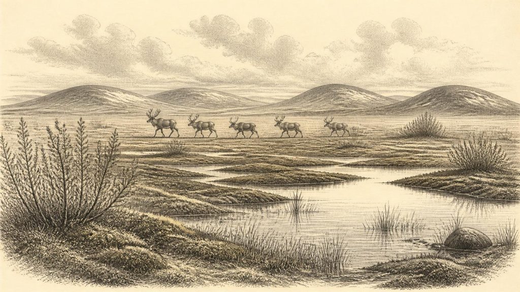
Its evidence is nevertheless vivid. Plant macrofossils, pollen, mosses and insect remains point to a cold, treeless, waterlogged setting. Shallow pools, sedges, wet-ground herbs and mossy vegetation occupied a local basin amid a wider periglacial landscape. This was no temperate Irish bog or woodland. The vegetation suggests low summer warmth, prolonged winters and open ground, yet it also proves that the landscape was not simply lifeless ice. Fresh water, plants and invertebrates persisted where local conditions permitted.
Ice, Open Ground and Water
Derryvree should not be mistaken for a complete map of Ireland. It records one protected locality in what is now Fermanagh. Elsewhere, the extent and timing of ice remained variable, and recent work on the British–Irish Ice Sheet stresses dynamic advances and retreats before the better documented Last Glacial Maximum. Around this broad period the ice sheet was growing towards its later maximum, but its margins did not necessarily behave alike in every region. Some areas were glaciated, some lay close to ice, and others may have been open, cold terrain for a time.
The broader North Atlantic climate was also far from steady. Greenland ice-core records show repeated abrupt shifts between colder stadials and relatively milder interstadials during MIS 3. Irish deposits cannot always be matched securely to one named Greenland event, because their dates and environmental records are less precise. Still, they make clear that people and animals, if present, faced a climate defined by rapid change as much as by cold: altered drainage, shifting vegetation, snow cover, frozen ground and the advancing or retreating edge of ice.
Castlepook’s Animal Evidence
At Castlepook Cave in north Cork, antiquarian excavations recovered a remarkable collection of Pleistocene animal bones. The assemblage has included mammoth, spotted hyaena, reindeer, brown bear, wolf, mountain hare and other species. Such animals indicate that Ireland was, at overlapping points in the Late Pleistocene, connected ecologically to the wider north-west European world. Large grazing mammals and their predators could reach and use parts of the island, although each bone’s age, context and route of arrival require separate assessment.
The cave material offers an arresting image of the landscape: open country capable of supporting herds, carcass-scavengers and major predators, rather than an uninterrupted forest. Mammoths and reindeer are especially suggestive of grass-, herb- and shrub-rich terrain, while hyaenas signal a predator and scavenger guild now entirely absent from Ireland. Yet the cave was not a census station. Bones may have been carried in by carnivores, accumulated over long periods, moved by water or disturbed during early excavation. They cannot prove that all these species met one another in the same valley or the same generation.
Dating adds another caution. Earlier Irish cave-bone radiocarbon programmes were transformative, but later advances in collagen preparation and ultrafiltration have shown that many pre-1990s Pleistocene determinations require reassessment. Castlepook remains indispensable evidence for the importance of Ireland’s fossil archives, but its old collections do not license an exact reconstruction for 30,766 BCE. The strongest conclusion is that varied cold-stage fauna occupied Ireland during broad portions of MIS 3 and that the archive deserves renewed direct dating and taphonomic study.
The Human Question
A reindeer femur from Castlepook has been publicised as carrying a deep mark consistent with cutting or chopping by a sharp stone tool, and has been associated in public reporting with an age of roughly 33,000 years. If the mark was made by people while the bone was fresh, it could represent extraordinarily early Upper Palaeolithic human activity in Ireland: the handling or processing of a reindeer long before the secure post-glacial settlement record.
That possibility is important, but it is not the same as proof of a resident population. There is no securely associated house, hearth, stone-tool assemblage, burial, human bone or intact butchery floor of this age at Castlepook. A single modified bone cannot establish who made the mark, where the animal was killed, how many people were involved, whether they travelled repeatedly, or whether they stayed overnight. It certainly cannot identify a tribe, language, religion or political community. The better-attested evidence for human presence in Ireland belongs much later, towards the end of the Pleistocene and the opening of the Holocene.
Society Without States
There can therefore be no responsible account of political affairs, diplomacy, warfare or government for Ireland at this date. States, chiefs, formal boundaries and documented alliances belong to far later archaeological worlds. If people did reach Ireland during the broad MIS 3 interval, they would have been small, highly mobile hunter-gatherer groups operating within an Upper Palaeolithic north-west European setting. That is an interpretation drawn from comparable societies elsewhere, not a fact demonstrated by an Irish camp.
Similarly, there is no direct Irish evidence for domestic life, ritual, art, formal learning, trade networks or deliberate long-distance exchange around 30,766 BCE. The nearest meaningful economic evidence is ecological: wild animals moved through available habitats; predators and scavengers exploited carcasses; plants colonised wet ground; and any humans would have depended on knowledge of weather, terrain, animal behaviour and seasonal resources. Such practical knowledge would have been sophisticated, but it leaves little durable trace.
Routes and Regional Change
Sea level was lower than today during glacial conditions, exposing parts of the surrounding continental shelf. That does not settle the question of access to Ireland. Research has challenged the older, simple image of a continuous land bridge across the Irish Sea, and possible routes varied with local sea level, ice extent and topography. Animal fossils demonstrate that dispersal occurred at some stages, but they do not by themselves reveal whether movement involved dry land, seasonal ice, short water crossings or changing island chains.
The defining development around this notional year was environmental, not political: Ireland was a shifting northern landscape in which wetlands could briefly flourish between episodes of glaciation, while open habitats supported an unusual Pleistocene fauna. Derryvree’s buried lakebed and Castlepook’s bones preserve fragments of that world. Their real value lies precisely in their restraint. They show an Ireland with water, plants and animals, perhaps visited by people, but they also mark the boundary between evidence and an attractive story that archaeology cannot yet prove.
Primary Sources
- The Irish Quaternary Fauna Project
- Pleistocene Vertebrates in the British Isles
- Arizona Radiocarbon Dates X
- Birmingham University Radiocarbon Dates VII
- First Evidence of a Late Upper Palaeolithic Human Presence in Ireland
- New Insights on the Fauna of Ireland's Younger Dryas and Early Holocene from Alice & Gwendoline Cave
- Growth and Retreat of the Last British–Irish Ice Sheet, 31,000 to 15,000 Years Ago: the BRITICE-CHRONO Reconstruction
- The Timing and Magnitude of the British–Irish Ice Sheet Between Marine Isotope Stages 5d and 2
- Trimlines, Blockfields and the Vertical Extent of the Last Ice Sheet in Southern Ireland
- Dimensions and Chronology of the Last Ice Sheet in Western Ireland
- New Data for the Last Glacial Maximum in Great Britain and Ireland
- The Problem of a Late Quaternary Landbridge Between Britain and Ireland
- Deglaciation, Earth Crustal Behaviour and Sea-Level Changes in the Determination of Insularity: A Perspective from Ireland
- The Island of Ireland: Drowning the Myth of an Irish Land-Bridge?
- The IntCal20 Northern Hemisphere Radiocarbon Age Calibration Curve (0–55 cal kBP)
- IntCal Publications
- A Stratigraphic Framework for Abrupt Climatic Changes During the Last Glacial Period Based on Three Synchronized Greenland Ice-Core Records
- Temperature Reconstruction from 10 to 120 kyr b2k from the NGRIP Ice Core
- Figure 6: The Subdivision of the Quaternary Period in Ireland
- Quaternary Geology
- Ireland Through Geological Time
- Geology of Ireland
- Archaeological Heritage of County Cork
- Castlepook Cave, Castlepook South, County Cork
- The Colonization of Ireland: A Human Ecology Perspective
