The Maguiresbridge Cold Pool30765 BCE
30,765 BCE is a modern label within a Late Pleistocene range, not a recoverable Irish year. At Derryvree near Maguiresbridge, Fermanagh, freshwater silts and organic deposits between two glacier-laid tills record an ice-free interval, broadly dated to 36,900–31,700 cal BP. Mosses, sedges, grasses, wetland plants and northern insects indicate a treeless, periglacial tundra with shallow water and seasonal frost. Castlepook Cave, Cork, preserves evidence of MIS 3 fauna, but disturbed deposits prevent a single contemporary reconstruction. No secure human occupation is known; a possibly modified reindeer bone suggests only tentative, intermittent hunter-gatherer visits. Ireland remained a dynamic, intermittently habitable environment.
Dateline
“30,765 BCE” is a modern calendar label, not a date that can be recovered from Ireland’s Late Pleistocene past. No people in Ireland kept a written calendar, and no sediment, bone or artefact can be assigned responsibly to that single year. Mechanically converted to the radiocarbon convention of ‘before present’ (where present is AD 1950), it lies roughly 32,700 years ago. Archaeology instead works with broad probability ranges. The closest Irish environmental record, at Derryvree near Maguiresbridge in County Fermanagh, has been calibrated broadly to c. 36,900–31,700 cal BP, or approximately 34,950–29,750 BCE. The numbered year therefore falls within a long span of evidence, rather than identifying a particular event.
A Cold-Stage Ireland
This was the later part of Marine Isotope Stage 3, a climatically unstable interval of the last Ice Age, known in Irish and British geology as part of the Midlandian or Devensian cold stage. Ireland was not a uniformly frozen, unchanging white landscape. Ice cover expanded and contracted regionally over very long periods; temperatures, moisture and vegetation changed with it. The fullest development of the last British–Irish Ice Sheet still lay ahead. Yet the growing ice mass, altered drainage and severe seasonal cold already made the island a difficult and shifting environment.
Modern reconstructions of the British–Irish Ice Sheet rightly underline uncertainty at this depth in time. They show major ice growth in the wider region around and after 31,000 years ago, but they do not license a simple map of every Irish valley for any one year. What can be said is that deposits in Fermanagh preserve an interval in which water, plants and insects occupied ground that had previously been glaciated and would later be buried by ice again. That sequence is the most valuable starting point for understanding Ireland around this nominal date.
Silts Between Two Tills
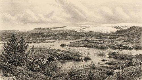
Roadworks at Derryvree in 1969 cut through a drumlin about two kilometres north-east of Maguiresbridge. Investigators found two substantial tills, the unsorted stony debris laid down by glacier ice, separated by freshwater silts, fine sands and organic-rich material. The order of the layers is unusually eloquent. First ice affected the locality and deposited the lower till. Later, conditions allowed standing or slowly moving fresh water, sediment and organic remains to accumulate. Finally, a renewed advance of ice laid down the upper till and sealed the older landscape beneath it.
The organic deposit produced radiocarbon determination BIRM-166: 30,500 radiocarbon years BP, with a large uncertainty of +1,170/−1,030 years. Radiocarbon years are not calendar years. Atmospheric carbon-14 has varied through time, so a measurement must be calibrated against independently dated records; at more than thirty millennia ago, the resulting calendar ranges are necessarily wide. The range, not a falsely precise converted date, is the historical evidence. Derryvree demonstrates an ice-free freshwater interval in this part of Fermanagh. It does not prove that all Ireland was ice-free at once, nor that its wetland existed unchanged throughout the whole calibrated span.
Moss, Sedge and Shallow Water
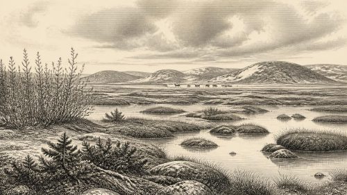
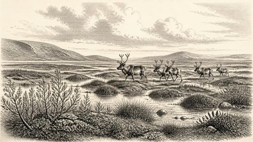
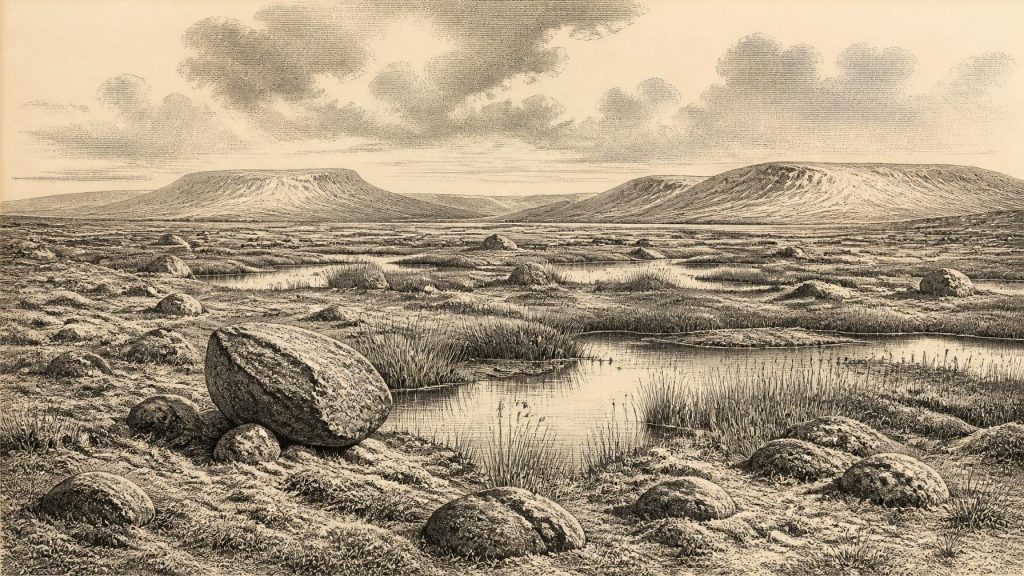
Within those silts lay the remains of a cold, open ecosystem. Pollen was dominated by herbaceous plants, while plant macrofossils included a remarkable assemblage of mosses. Sedges, grasses and low herb vegetation, together with aquatic and wetland plants, point to a largely treeless tundra or muskeg-like setting. Insects of northern affinity reinforce that interpretation. There were pools, wet ground rich in decaying plant matter and mossy margins, not woodland, fields or a settled agricultural landscape.
This evidence supports a picture of periglacial country: ground subject to hard frosts and seasonal thaw, with short growing seasons and sparse vegetation away from wet hollows. It should not be turned into a modern-style weather forecast. A plant assemblage records local habitats accumulated over time, not the temperature on a particular morning in 30,765 BCE. Nevertheless, Derryvree is decisive against the old assumption that Ice Age Ireland was everywhere permanently under ice. For part of this broad period, northern Ireland contained living freshwater habitats between episodes of glaciation.
Caves and Animal Ranges
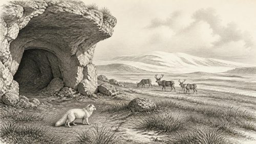
South-western Ireland provides a second, more fragmentary kind of evidence. Castlepook Cave near Doneraile, County Cork, is the island’s best-known repository of pre-Last Glacial Maximum vertebrate remains. Historic excavations recovered bones and teeth attributed to woolly mammoth, reindeer, giant deer, brown bear, wolf, fox, Arctic fox, mountain hare, lemmings and spotted hyaena. Such a list evokes a cold, open landscape inhabited by large herbivores, smaller mammals and formidable predators or scavengers.
It would be irresponsible, however, to paint every one of those species into a single herd beside the Derryvree pool. Castle deposits were excavated chiefly in the late nineteenth and early twentieth centuries, when recording standards were uneven; sediments were disturbed, and bones may have entered caves in separate episodes. More recent radiocarbon work has also shown that several earlier dates were too young. The revised evidence suggests that giant deer and spotted hyaena may have disappeared locally before about 40,000 cal BP, well before the nominal date considered here. Castlepook is therefore strong evidence for the ecological range of MIS 3 Ireland, but not a census of Fermanagh wildlife in one year.
The cave record also shows why natural history and human history cannot be separated neatly in this era. Caves were places where carnivores sheltered, scavenged or dragged material; running water and gravity could move bones; later excavators could mix deposits. A tooth-marked mammoth bone or a cluster of reindeer remains may reveal animal behaviour, but it may equally reflect a long chain of deaths, scavenging and redeposition. Archaeologists must first establish how the assemblage formed before using it to reconstruct food, seasonality or human action.
People: Possibility, Not Chronicle
There is no securely excavated settlement, hearth, tool assemblage, grave or human skeleton from Ireland that can be placed at 30,765 BCE. Accordingly, no named people, communities, leaders or political territories can be recovered. There were no demonstrable states, diplomacy, warfare, laws or institutions on the island. Nor is there evidence for farming, livestock, metalworking, pottery, long-distance commerce, monuments, formal religion or literacy. Their absence from the record should not be romanticised into proof that none existed anywhere; rather, the surviving evidence is far too thin to make such claims.
A reindeer femur from Castlepook has been reported as bearing a deep modification interpreted by some researchers as a fresh-bone cut or chop mark, and it has been presented as possible evidence of Upper Palaeolithic butchery around 33,000 years ago. If that interpretation survives fuller publication and independent scrutiny, it would suggest that hunter-gatherers intermittently reached Ireland during MIS 3. But a single marked bone, particularly from an old and complicated cave collection, cannot establish a resident population, a camp, a hunting party’s route or its cultural identity. The responsible conclusion for this date remains that human presence is possible and under investigation, not that Ireland possessed a documented human society.
Routes, Resources and Change
Lower global sea levels altered coastlines and the geography of the Irish Sea, but the availability of a dry, continuous route between Ireland and Britain or continental Europe cannot be assumed for this particular interval. Ice, sea level, isostatic movement and local topography changed together. Animals clearly reached Ireland during suitable phases, and any human visitors would have faced the same variable geography. Mobility, if people were present, would have depended on season, terrain, animal movements and access to stone, shelter and freshwater—not on a stable national landscape.
The central development around this date was therefore environmental rather than political: an Irish landscape repeatedly remade by ice, frost, water and biological recolonisation. Derryvree’s freshwater beds preserve a brief but real world of mosses, sedges, shallow pools and northern insects between glacial episodes. Cork cave bones broaden the picture into a wider Ice Age fauna, while also warning how easily time and context can be confused. Ireland at 30,765 BCE cannot be narrated year by year. It can, however, be understood as part of a cold, dynamic and intermittently habitable north-western edge of Europe.
Primary Sources
- A Middle Midlandian Freshwater Series at Derryvree, Maguiresbridge, County Fermanagh, Northern Ireland
- Early Midlandian–Middle Midlandian, Pleistocene, Northern Ireland
- Palaeoecology: Irish Quaternary Association Field Guide
- Exploring Controls of the Early and Stepped Deglaciation on the Western Margin of the British-Irish Ice Sheet
- A Reconsideration of the Radiocarbon Dating of the Marine Isotope Stage 3 Fauna from Southern Ireland
- The Irish Quaternary Fauna Project
- The Exploration of Castlepook Cave, County Cork
- Occurrence of Mammalia Relicts at Site Castlepook Cave
- Castlepook Cave, County Cork, 2022
- Archaeology Research Excavation Grant 2022: Final Report
- The IntCal20 Northern Hemisphere Radiocarbon Age Calibration Curve (0–55 cal kBP)
- Growth and Retreat of the Last British–Irish Ice Sheet, 31,000 to 15,000 Years Ago: the BRITICE-CHRONO Reconstruction
- The Timing and Magnitude of the British–Irish Ice Sheet Between Marine Isotope Stages 5d and 2
- Character of Advance and Retreat of the Southwest Sector of the British-Irish Ice Sheet During the Last Glaciation
- Growth and Decay of a Marine Terminating Sector of the Last British-Irish Ice Sheet: a Geomorphological Reconstruction
- The Problem of a Late Quaternary Landbridge Between Britain and Ireland
- Deglaciation, Earth Crustal Behaviour and Sea-Level Changes in the Determination of Insularity: A Perspective from Ireland
- Freshwater Organic Deposits and Stratified Sediments Between Early and Late Midlandian Till Sheets, at Aghnadarragh, County Antrim, Northern Ireland
- Phylogeographic, Ancient DNA, Fossil and Morphometric Analyses Reveal Ancient and Modern Introductions of a Large Mammal: the Complex Case of Red Deer (Cervus elaphus) in Ireland
- New Insights on the Fauna of Ireland's Younger Dryas and Early Holocene from Alice & Gwendoline Cave