

Irish Roads
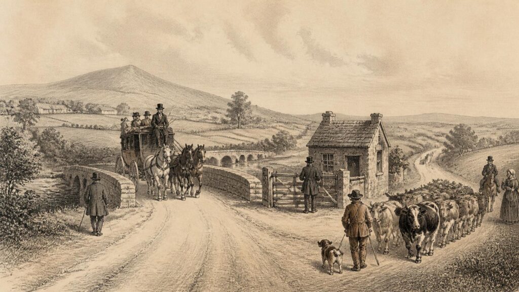
AI generated historical illustration, not a contemporary photograph.
At a Glance
A road is never only a strip of ground between two destinations. In Ireland it has been a negotiated passage through difficult terrain, a public work paid for unequally, a channel for trade and migration, an instrument of state authority, and a repository of older names and stories. The history of Irish roads is therefore not a simple march from rough tracks to tarmac. It is a history of changing needs, materials, institutions and landscapes, in which ancient pathways sometimes survived beside ambitious new engineering.
Earliest Passage
The first routes across Ireland cannot usually be assigned precise dates, nor should every hollow way or modern lane be treated as prehistoric. People and animals naturally favoured ridges, fords, coastal margins and the firmer ground beside rivers. Repeated movement could create paths without formal construction. Such paths rarely leave unambiguous archaeological remains, particularly where later cultivation, drainage, road building and settlement have altered the ground. Yet the practical problem of moving through wet country produced one of Ireland’s most remarkable classes of surviving routeway: the timber trackway or tóchar laid across bog.
Bogs preserved wood that would normally decay, making them unusually eloquent archaeological archives. A timber trackway might consist of brushwood, roundwood, split planks or substantial oak beams, laid so that people, animals or loads could cross unstable ground. Their purposes need not have been identical. Some gave access to resources within a bog; some may have connected relatively dry islands of ground; some may have been used for local traffic; and others may have carried meanings that were social, political or ritual as well as practical. Construction itself could demand organised labour and command over woodland resources. A road through a bog was consequently a public statement as much as a technical solution.
The Corlea Trackway in County Longford supplies particularly strong evidence. Dendrochronological work dates its oak construction to 148 BC, rather than to a vague and undifferentiated prehistoric past. It was an imposing planked structure, approximately a kilometre in length, built across a raised bog. Its builders used large oak planks and rails in a form that could not have been casual or improvised. The roadway soon became unusable as it subsided into the peat, but that failure helped preserve it. An eighteen-metre section is now displayed at the Corlea visitor centre, while the wider bog has yielded evidence for numerous other trackways.
Corlea also demonstrates the limits of certainty. Its scale indicates that it mattered greatly to those who commissioned or built it, but archaeological evidence does not conclusively identify its users or purpose. It is reasonable to infer that a work of this scale belonged to a significant route or undertaking. It is not demonstrable that it was a royal road, a route between particular ceremonial centres, or the physical counterpart of a named road in later literature. Those ideas are important as interpretations and local traditions, but should not be confused with proof. The distinction matters because Ireland’s early roads have often accumulated attractive stories precisely where the material record is fragmentary.
Landscape Choices
Irish terrain directed movement long before central government possessed the means to impose a uniform network. Mountains, bogs, lakes, estuaries and rivers created obstacles but also funnels. A ford, a pass or a bridgehead could become strategically important because it concentrated travellers onto a limited line. Roads therefore developed through local geography rather than over it. In lowland areas, routeways often followed drier gravel ridges or the edges of floodplains. In upland districts, travellers selected valleys, saddles and older drove routes. Along coasts, the shore could offer a comparatively open corridor, although tides and river mouths made it unreliable.
Many surviving roads have deep histories because their alignments remain sensible. That does not mean that every winding country road is ancient. Later estate improvements, eighteenth-century turnpikes, nineteenth-century relief works and twentieth-century widening all changed alignments. Nevertheless, a modern road may preserve an older preference for a particular crossing-point or ridge. Historical investigation must separate the enduring logic of a landscape from claims of uninterrupted physical survival. Old maps, estate papers, place-names, field boundaries, aerial photographs and archaeological surveys can together make a strong case; any one form of evidence alone may not.
Irish road terminology preserves something of this varied geography. The word bóthar, now the ordinary Irish word for road, is associated in legal and linguistic tradition with a cattle way. Other terms distinguished major roads, local routes, side roads, paths and crossings. Their exact meanings changed over time and across texts, so they should not be treated as a modern engineering classification. They do, however, show that movement was understood in degrees of scale and access. A route fit for carts, a path for pedestrians, a droveway for cattle and a passage to water were different things, carrying different rights and obligations.
Place-names can be useful evidence but require caution. Names incorporating words for road, ford, bridge, causeway or pass may preserve an older feature or pattern of travel. They may also have been applied later, altered in translation, or transferred from one local feature to another. The same warning applies to stories of great ancient highways. Oral tradition can retain a valuable sense that a route mattered locally, but a remembered “king’s road” need not date from a king, and a supposed Roman road in Ireland is particularly suspect. Ireland was never incorporated into the Roman Empire, and straightness alone is not evidence of Roman engineering.
Medieval Movement
Early medieval Ireland was not roadless. Kings, clerics, poets, messengers, traders, pilgrims, cattle drovers and armed retinues all moved through the island, and the written record assumes recognisable routes. Law texts distinguish categories of road and discuss responsibilities associated with access, trespass and obstruction. Annals and saints’ lives recount journeys between royal, ecclesiastical and provincial centres. Such texts cannot be read as maps, and some are preserved in manuscripts written centuries after the events they describe. Even so, they establish that roads and routeways were meaningful institutions, not merely accidental tracks.
The famous slighe, usually translated as a highway or great road, belongs partly to this documentary world and partly to later historical imagination. Medieval and early modern writers described major roads radiating from Tara or connecting important regions. These accounts are useful witnesses to ideas of political geography: a powerful centre was imagined as linked to the wider island by great routes. They do not demonstrate that every named slighe existed as a continuously engineered highway of a single date. A medieval road could be a corridor made of successive tracks, fords, causeways and open ground rather than a fixed surfaced strip comparable to a modern trunk road.
Churches and monasteries created their own demands for movement. They were religious centres, but also places of learning, hospitality, craft production, landholding and exchange. Pilgrimage routes developed around holy wells, island churches, mountains and saints’ foundations. Some are still walked and promoted today. Their present form often combines documented older routes, later devotional practices and recent recreational arrangements. The historical value of a pilgrimage road may lie less in proving an unaltered medieval path than in tracing the enduring act of journeying to a sacred landscape.
Markets and seasonal fairs also depended on routes that could carry people and animals. Cattle were a central form of wealth in early Irish society, and droving required broad passages, grazing access and water. The movement of livestock could produce a road that was intermittent in use yet conspicuous in effect. A route used heavily at particular times of year did not necessarily require a permanent paved surface. This helps explain why the historical road landscape cannot be reduced to visible carriageways. It included green lanes, mountain passes, trackways over common land and paths whose legal status was contested or forgotten.
Medieval lordship altered roads unevenly. Anglo-Norman settlement brought new towns, castles, manors and markets, particularly in the east and south-east, and these sharpened the importance of roads leading to ports and boroughs. Bridges could transform a route by making a river crossing dependable, while a castle or walled town could control the approach. Yet much of the island continued to rely on local trackways and seasonal crossings. The distinction between an English-style road system and an Irish landscape of tracks is too crude. Roads were shaped by political power, but their use remained conditioned by terrain, local custom and the practical limits of maintenance.
Stories Survive
Roads generate folklore because they are places of meeting, departure and danger. A traveller is exposed on a road: away from home, crossing boundaries, dependent on weather and hospitality, and liable to encounter strangers. Irish traditions accordingly attach fairies, apparitions, cursed places, holy figures and legendary warriors to lanes, bridges, fords and passes. Such material is historically valuable as evidence of belief, memory and local attachment. It is not automatically evidence for the age or original function of the road itself.
One recurring pattern is the attribution of old roads to heroic or supernatural builders. Another is the association of a route with Saint Patrick, a local saint or an early king. These stories may have developed because a striking earthwork, raised causeway or abandoned alignment demanded explanation. They may also preserve a genuine recognition that the route was older than living memory. Yet the point at which a story was first recorded can be much later than the feature it describes. Historians must therefore ask who collected the tradition, when it was written down, whether similar stories occur elsewhere, and what independent evidence exists.
The Corlea roadway is locally known as the Danes’ Road, a name that illustrates this process. “Danes” has often functioned in Irish folklore as a convenient label for ancient or mysterious remains, rather than as a reliable identification of Scandinavian builders. The trackway predates the Viking Age by many centuries. The local name remains part of the site’s cultural history, but archaeology corrects the literal claim. This is not a dismissal of folklore; it is a recognition that folklore and excavation answer different questions.
Old roads also became mnemonic devices. A community might remember that a particular boreen led to a fair, a mass rock, a school, a forge, a landlord’s demesne or an emigrant port. Such memories illuminate how roads were used in relatively recent generations, even where they cannot establish medieval origins. The history of a road should thus admit several layers of truth. Material evidence may establish construction; documentary evidence may reveal administration; oral testimony may convey use and meaning. The strongest accounts do not force one kind of evidence to do another’s work.
Improving Routes
By the late seventeenth and eighteenth centuries, roads acquired a more prominent place in schemes of commerce, administration and improvement. The political settlement following the Williamite wars, together with expanding trade and the growth of Dublin, encouraged efforts to make travel more regular. Ireland’s road network was still uneven and often difficult. Wet weather could turn an earth road into mud; steep hills exhausted horses; poorly drained surfaces deteriorated quickly; and bridges remained costly points of failure. The objective was not only speed. Better roads were expected to move agricultural produce, support markets, carry mail, enable official travel and connect estates to towns and ports.
Improvement was neither universal nor neutral. A new line could shorten a journey for a coach while bypassing an older settlement. It could make a landlord’s estate more accessible, but it could also impose obligations on local inhabitants. Road building involved land, drainage, gravel pits, labour and disputes about who should pay. The rhetoric of improvement often described roads as a shared public good, but the benefits and burdens were distributed according to wealth, property and political influence.
Turnpike roads became a conspicuous answer to the problem of funding. A turnpike was a toll road administered by a trust empowered by legislation. Travellers paid at gates or barriers, and the proceeds were intended to maintain the route. The arrangement followed British models but took distinct Irish forms. Turnpike trusts were established along important lines, including routes from Dublin into Leinster and connections between provincial market towns. Tolls made road improvement more financially plausible, while also making a public route a place where access was measured, priced and enforced.
The toll house became the visible emblem of this system. It stood beside the road, often on a small plot, where a keeper collected charges from coaches, carts, horses, livestock and other users according to prescribed rates. The system made differences among travellers explicit. Local exemptions might apply; vehicle wheels could be rated differently; and a commercial wagon bore a different burden from a person on foot. Tolls could be resented as an inconvenience or as an unfair charge, especially where the road remained poor. Nevertheless, turnpikes helped establish the expectation that major routes required regular maintenance rather than occasional emergency repair.
Mapped Networks
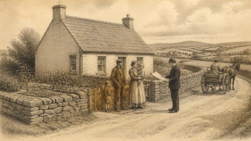
Mapping made the eighteenth-century road system more legible to administrators, travellers and investors. George Taylor and Andrew Skinner’s Maps of the Roads of Ireland, surveyed in 1777 and published shortly afterwards, is among the most important records of this transformation. It did more than show lines between towns. It listed routes, distances, toll information and the seats of subscribers, presenting the island as a traversable network. The project itself depended on patronage from noblemen and gentlemen, a reminder that road knowledge was connected to landed power as well as public convenience.
The maps are indispensable, but they are not neutral photographs of movement. Their accuracy was impressive for the period, yet their emphasis reflected the interests of those who funded, used and valued the survey. Major roads, towns and gentlemen’s seats receive prominence. Native Irish settlements and local paths could be overlooked or rendered less fully. A map of roads was therefore also a map of social hierarchy. It showed where an improving elite expected traffic to go, and which places mattered within its economic and political vision.
Contemporary travel writing confirms that conditions varied sharply. One traveller might praise a newly made stretch of road while another condemned the next route as stony, steep or neglected. Such apparent contradictions are not necessarily errors. Surfaces changed with weather, maintenance and local geology; some roads had recently been improved while others had not. Coaches and private carriages also experienced roads differently from pedestrians, horsemen, drovers and carts. The road system was a patchwork, not a uniform national machine.
Distances carried their own complications. Older Irish miles were longer than English statute miles, and eighteenth-century maps and guides could use conventions unfamiliar to later readers. Place-names likewise appeared in Irish, anglicised and variant forms. A careful use of road maps therefore requires attention to edition, scale, spelling and intended audience. Their great value lies not merely in identifying old alignments but in revealing a historical imagination of connectivity: Dublin as a hub, provincial towns as nodes, toll gates as points of regulation, and country houses as landmarks in an ordered landscape.
Public Burdens
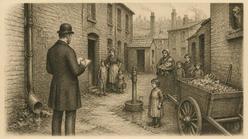
Turnpikes did not account for all Irish roads. Many were made and repaired through grand jury presentments. Grand juries were bodies of substantial property holders who exercised major county responsibilities before elected local government. At assizes they could authorise expenditure for roads, bridges, courthouses, prisons and other works. The system created a recognisable machinery of public works, including county surveyors, plans, contracts and local applications. It also concentrated decision-making in the hands of men who were not democratically chosen by the wider population.
The Grand Jury (Ireland) Act of 1836 shows the degree to which road administration had become formalised. It provided for presentments to widen, gravel, macadamise, pave, fence, drain and repair public roads, and it set parameters for new roads. A proposed route could require a map and notices to occupiers of affected land. The law addressed hills, hollows, bridges, drainage and dangerous ground beside the road. Such provisions reveal that a road was understood as an engineered system rather than simply a surface. Water had to be removed; slopes moderated; boundaries established; and bridges integrated with the route.
Macadamisation was especially important in this period. Named after the Scottish engineer John Loudon McAdam, the method used layers of broken stone, carefully graded and drained, to create a durable surface. It differed from simply spreading loose rubble. Proper drainage and traffic compression were essential. Irish roads were increasingly described and funded in terms of gravel, broken stone and maintenance contracts, though implementation varied. A technically sound specification did not guarantee good work, and a road could decline rapidly if drainage was blocked or repairs deferred.
Public finance remained contentious. A road may have served a barony, a county, a post route, an estate or a commercial interest extending beyond the district that paid for it. The 1836 legislation provided different arrangements for mail roads, reflecting the broader public importance attached to postal communication. It also allowed for complaints where grand juries repeatedly failed to provide necessary roads. Such clauses indicate that road provision was already understood as a matter of public grievance, not merely a favour bestowed by local elites.
The grand jury system left a rich documentary trail: presentment books, maps, specifications, contractor records and newspaper notices. These sources can identify a road’s cost, line and repair history, but they also expose social inequalities. Ratepayers could debate expenditure; tenants and labourers might be affected by a road without possessing equal influence over its making. The road was a common necessity administered through an unequal political structure.
Famine Works
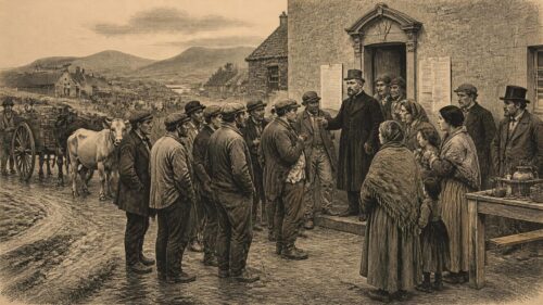
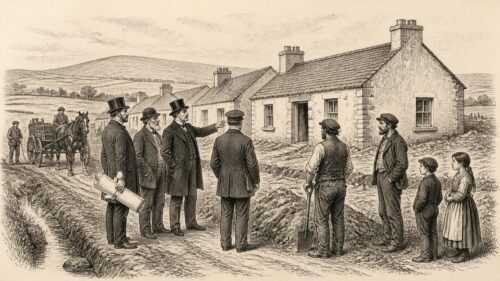
Road building acquired a tragic association during the Great Famine. From the mid 1840s, public works schemes were used to provide wages to people facing hunger and destitution. Roads, walls and other works were often selected because they could employ large numbers quickly. The result has sometimes been remembered through the phrase “famine roads”, suggesting uselessness or deliberate folly. That phrase captures something real about hardship, inadequate planning and the painful spectacle of labour performed amid catastrophe. Yet it should not flatten every relief road into the same story.
Some works addressed genuine local needs, including access to remote districts. Others were poorly conceived, badly timed or of limited long-term utility. The wider failure lay not simply in the quality of individual roads but in a relief system that tied subsistence to exhausting labour while food scarcity, disease and displacement intensified. A road made under such conditions cannot be judged only by whether it later served traffic. Its history includes the political assumptions that required starving people to earn assistance through public work.
The physical evidence can be difficult to identify securely. A rough mountain road may be popularly called a famine road because it appears old and seemingly purposeless, but documentary proof is needed to establish its date, funding and workforce. Presentment records, Board of Works material, estate papers and local newspapers can sometimes provide that proof. In other cases the label is a later commemoration of suffering, attached to a road whose chronology is uncertain. The distinction is not pedantic. Accurate identification honours those affected by the Famine more effectively than a generalised legend.
Famine relief works nevertheless changed landscapes and memories. Roads cut into hillsides, bridges over streams and widened approaches to settlements altered how later generations moved through rural districts. They became visible reminders of state intervention, labour and loss. Even where a road was later improved or absorbed into the ordinary network, the circumstances of its making could remain part of local historical consciousness.
Coach Travel
The improved roads of the eighteenth and nineteenth centuries supported stage coaches, mail coaches, carriers and the horse-drawn services associated with Charles Bianconi. These forms of travel connected towns more regularly than before, though they were not equally available to all. A coach journey demanded money, time, tolerance of discomfort and confidence in the route. Inns, posting houses, stables, smithies and toll houses formed part of the road economy. A road was not merely a line between terminals; it sustained stopping places and occupations along its length.
Bianconi’s car services became especially important in the nineteenth century because they extended road passenger transport beyond the principal coach corridors. His enterprise used light horse-drawn cars and developed a wide network. Its success depended on routes, changing horses, local agents, timetables and the willingness of passengers to use shared transport. It also illustrates the relationship between private initiative and public infrastructure. Entrepreneurs could exploit improved roads, but they did not create the entire physical and administrative framework upon which travel depended.
The arrival of railways altered the hierarchy of roads rather than simply replacing them. Rail offered faster long-distance movement along fixed corridors, but roads remained vital for reaching stations, carrying goods to and from railheads, and serving places bypassed by the tracks. In some districts rail competition weakened coaching; in others, road carriers adapted. Rural roads also continued to carry pedestrians, carts, livestock and local commerce that railways could not absorb. The nineteenth-century transport system was therefore interdependent, with road and rail continually reshaping one another.
Road travel also had a social dimension. Better access could bring newspapers, goods, seasonal workers, visitors and new political ideas into a district. It could assist migration by connecting a rural parish to a port or railway station. Conversely, the ability to leave could expose communities to depopulation and economic change. Roads enabled connection, but connection was not always experienced as progress.
Motor Change
The motor car, lorry and motor bus placed new demands on Irish roads during the twentieth century. Horse traffic could tolerate surfaces and gradients that motor vehicles found inefficient or dangerous. Dust, drainage, sightlines, bridges, road width and junction design acquired fresh importance. Early motoring was initially associated with wealth and novelty, but commercial vehicles and buses soon made road conditions a wider public concern. The motor age did not arrive uniformly. Remote counties could retain older patterns of walking, cycling, horse transport and infrequent services long after cars had become familiar in larger towns.
Motor buses transformed the relationship between roads and rail. Where rail lines were expensive to maintain or poorly aligned with dispersed settlement, buses offered flexibility. The history of road passenger transport was also shaped by regulation. In the Irish Free State and later Ireland, legislation and public transport policy affected private operators and the role of railway companies in bus services. The result was not a simple free market in mobility, but a regulated contest over routes, licences and public provision.
County councils, established through the Local Government (Ireland) Act 1898, gradually replaced grand juries as the principal local authorities responsible for roads. This change mattered politically as well as administratively. Road decisions moved into a more representative local-government framework, although resources remained uneven and central government retained influence over major routes. The older language of presentments gave way to modern budgeting, engineering departments and statutory road classifications.
Independence also gave roads symbolic importance. New governments needed to maintain a national territory, connect towns, support agriculture and demonstrate administrative capacity. Yet much of the inherited network required constant repair. Road improvement was expensive, and priorities could conflict between urban needs, rural isolation, industrial development and public transport. The motor road promised speed and modernity, but it also intensified debates about spending, land acquisition and the balance between local access and through traffic.
Modern Corridors
Later twentieth-century and twenty-first-century road schemes have created new motorways, bypasses and national routes while changing the role of many older roads. A bypass can remove heavy traffic from a town centre, improve safety and shorten journeys. It can also alter trade patterns, weaken passing custom for roadside businesses, and divide farmland or communities. These are not new dilemmas. They echo earlier disputes over turnpikes, estate roads and railway alignments, though the scale and speed of modern construction are different.
Major road building has also become a source of archaeological knowledge. Before construction proceeds, archaeological assessment and excavation can identify sites that are threatened by works. Transport Infrastructure Ireland and its predecessors have supported extensive investigation along national road schemes. Excavations have uncovered settlements, field systems, burial sites, industrial remains and evidence of former landscapes that would otherwise have remained unknown. The apparent paradox is important: a new road can endanger heritage, but the planning process can also reveal buried histories across a wide corridor.
That does not make every impact acceptable. Archaeology is a finite resource, and excavation is inherently destructive even when professionally recorded. The preferred approach is to avoid significant sites where possible, investigate what cannot be avoided, and preserve records and finds for future study. Road projects have encouraged more systematic archaeological practice, but they also remind us that development choices determine which parts of the past are encountered, excavated or left undisturbed.
Historic roads themselves deserve attention. Milestones, toll houses, old bridges, roadside forges, boundary walls, wells, fingerposts and former coaching inns can survive even where the carriageway has been widened beyond recognition. Their significance may be architectural, archaeological, social or local. A roadside object is rarely meaningful in isolation: a milestone speaks of measured distance and postal travel; a toll house of payment and regulation; a forge of horse transport and repair; a bridge of engineering and the crossing it made possible.
Continuing Paths
The history of Irish roads resists a story of clean replacement. Timber trackways, medieval corridors, boreens, turnpikes, coach roads, railway approaches and motorways belong to different technological worlds, but they often occupy related landscapes. A modern trunk route may pass near an ancient ford; an estate avenue may preserve a route to an older settlement; a greenway may reuse a railway alignment that once drew traffic away from the road. Continuity is frequently one of movement and place rather than of unchanged fabric.
For that reason, historical claims about roads should be made carefully. Documentary evidence can establish that a particular road was authorised, mapped, tolled or repaired. Archaeological evidence can establish that a trackway was constructed at a certain date, using particular materials. Cartographic and landscape evidence can suggest changing alignments. Folklore can reveal memory and meaning. None should be casually substituted for another. The most persuasive local road history combines them while admitting where the evidence stops.
Roads have also been stages for political action. They carried troops, police, processions, election campaigns, labourers, emigrants and mourners. They enabled the circulation of newspapers and ideas, but could be blocked, watched or controlled in moments of conflict. Their apparent ordinariness makes this easy to overlook. A road joins private life to public power: it reaches the cottage and the market, the school and the barracks, the farm and the port.
To study a road in Ireland is therefore to study more than transport. It is to examine the practical intelligence required by bog and mountain; the claims of landlords, trusts, grand juries and councils; the labour of builders and repairers; the experience of walkers, drovers and passengers; and the stories communities tell about the routes that formed their horizons. The road remains a historical document written across the landscape, though its text must be read with care.

The article’s treatment of roads as both physical infrastructure and social landscape is especially compelling. Corlea’s precisely dated timber trackway demonstrates impressive organised labour, yet its purpose remains uncertain; similarly, later turnpikes and grand jury works improved connectivity while distributing costs, access and influence unevenly. This invites comparison between archaeological traces, maps, legislation and local memory: each reveals different aspects of movement, authority and belonging, but none alone supplies a complete history. How should historians balance material evidence with folklore, place-names and administrative records when interpreting whether an Irish route primarily served commerce, ritual, political control, or everyday community life?