

Rising Waters
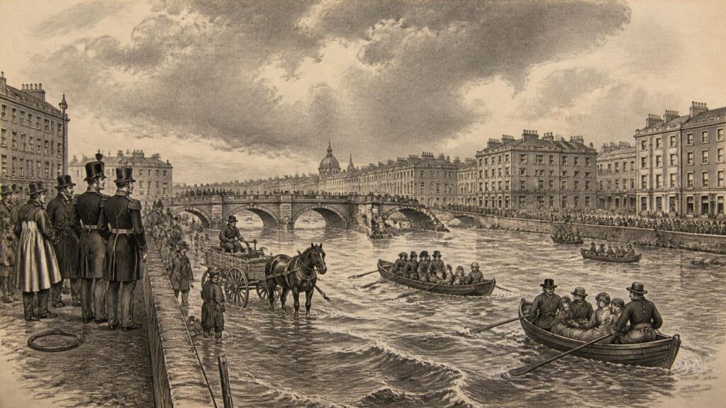
AI generated historical illustration, not a contemporary photograph.
At a Glance
Flooding is among the oldest recurring dangers in Irish life, but the means by which communities have understood and faced it have changed profoundly. Rivers, estuaries, boglands and low-lying streets have always carried water beyond their ordinary bounds; what altered over time was the density of settlement, the value placed upon reclaimed land, the strength of public institutions and the expectation that the State might prevent, predict or relieve disaster. Ireland’s history of flooding is therefore also a history of public safety: of bridges and embankments, official surveys and local memory, rescue and evacuation, landownership and planning, and the difficult recognition that no defence removes all risk.
Living Rivers
Ireland’s rivers have never been merely channels carrying water from upland to sea. They have been routes of travel, fisheries, sources of power, boundaries, drainage outlets and, in wet weather, agents of disruption. The Shannon, the country’s largest river system, flows through a broad lowland landscape in which lakes, callows, bogs and floodplains absorb, delay and redistribute water. Other catchments are shorter and sharper: the Lee reaches Cork through steep valleys; the Dodder descends towards Dublin with speed; the Tolka, Camac, Poddle and Liffey have long connected the capital’s built fabric to its surrounding hills and fields. On the coast, high tides, storm surge and powerful Atlantic seas have introduced a different but related danger.
For earlier communities, seasonal inundation was not necessarily an aberration. Floodplains could provide rich meadow, while wetlands supplied fish, wildfowl, reeds and turf. Yet their usefulness depended on access, timing and an intimate knowledge of water. A route that was passable in summer might disappear in winter; a ford might become fatal after sustained rain; a bridge, mill-race, weir or bank could redirect water in ways that protected one place while worsening conditions elsewhere. Such knowledge was usually local, practical and cumulative. It was passed through experience, observation and stories rather than through national flood maps.
The documentary record becomes fuller only gradually. Medieval Irish annals preserve notices of storms, hard winters, famine, disease and other exceptional conditions, but they are not systematic hydrological logs. They were compiled for religious, political and historical purposes, and their survival is uneven. It would be unsafe to treat every terse entry as a precise scientific measurement, or to infer an exact chronology of floods from scattered notices. Nevertheless, the annals demonstrate that extreme weather and abnormal water conditions were memorable events worthy of record. Their evidence should be read as historical testimony, not as a modern dataset.
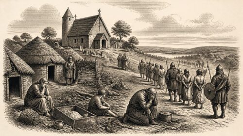
Folklore has also attached itself to Irish waters. Lakes that rise over drowned settlements, holy wells that punish disrespect, bells heard beneath flooded ground and stories of lost roads beneath bog or river are familiar motifs. Such tales may preserve a sense of landscape change or hazard, but they cannot by themselves establish when a particular flood occurred or what caused it. Their historical value lies elsewhere: they show how communities gave moral, religious or imaginative form to dangerous environments. The distinction matters. Documentary evidence can identify a bridge collapse or a rainstorm; folklore can illuminate the fears and memories that endured after the water receded.
Public safety, in this older setting, depended heavily upon adaptation. Buildings were placed where possible above known high-water marks. Roads and bridges were maintained, though often imperfectly. Wet ground was used in ways suited to its limits. People learned which fields flooded first, where a river cut across a lane, and when animals needed to be moved. These measures were not evidence of indifference to flood danger. Rather, they reflect a society in which floodwater was expected to return and in which security rested on labour, local judgement and the capacity to recover.
Recorded Disaster
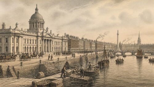
The growth of towns made flooding more visibly a matter of collective safety. Dense housing, bridges, quays, mills, warehouses and paved streets created concentrations of people and property that could be damaged in a single event. Dublin offered the clearest example. Its development beside the Liffey, and around tributaries including the Poddle and Dodder, brought commercial advantage but also exposure. By the late eighteenth and early nineteenth centuries, drainage, river crossings and quay improvement had become central civic concerns.
The Dublin flood of December 1802 remains one of the most striking recorded Irish urban disasters. Met Éireann’s historical account, drawing upon contemporary newspapers and journals, describes exceptionally heavy rain falling after a wet summer and autumn. The Liffey, Poddle and Dodder overflowed. Ships sank at the North Wall, and debris carried along the Liffey reportedly included livestock, household materials, mill equipment and vehicles. A young man was swept away and drowned at Leixlip. The account records that much of central Dublin was under water and that boats were used in parts of the city to rescue people.
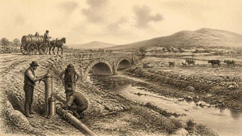
The event also exposed the vulnerability of supposedly permanent infrastructure. Ormond Bridge was washed away on the day after the rainfall, while bridges at Celbridge, Lucan and Ringsend were also reported lost. Flooding is often described through damaged homes, but bridge failure demonstrates why public safety cannot be reduced to the safety of buildings. A broken crossing can isolate neighbourhoods, impede rescue, interrupt commerce, prevent medical assistance and endanger those attempting to traverse swollen water. It can also create a new obstruction that compounds flooding upstream.
The 1802 flood was not simply a natural occurrence happening beside a city. It was a disaster shaped by weather, existing saturation, river engineering, settlement and the limited emergency resources available. Its timing was notable: on the same day, the Wide Street Commissioners had decided to improve quays and adjoining buildings near the Liffey. That coincidence should not be made to imply that the proposed works caused the flood. It does, however, reveal a city already preoccupied with the condition of its riverfront. Floodwater made the consequences of urban design immediate and visible.
Accounts of exceptional events can have a distorting effect on memory. The drama of a washed-away bridge or a rescue by boat tends to survive, while recurring smaller floods disappear from grand narratives. Yet minor and moderate inundations often shape daily safety more persistently. They damage floors and walls, interrupt school or work, spoil fuel and food, isolate farms, close roads and make sanitation difficult. A historical approach must therefore attend both to catastrophe and to repetition. The spectacular flood reveals the limits of existing arrangements; the ordinary flood reveals how routinely those arrangements were tested.
During the nineteenth century, newspapers, official reports and engineering records increasingly gave administrators a language for describing such risks. Rainfall could be compared, channels surveyed, bridges inspected, costs estimated and schemes debated. This did not make floods predictable in the modern sense. It did, however, make them more governable on paper. Water became an object of maps, calculations, contracts and legislation, as well as of local fear.
Famine Drainage
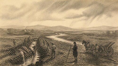
The nineteenth century transformed the scale at which Irish flooding and drainage were addressed. The Board of Works, later associated with the Office of Public Works, had responsibilities for drainage from its early years. The Drainage (Ireland) Act of 1842 gave it a clearer role in arterial drainage, subject to substantial local consent. The National Archives’ account of the Board’s records explains that this requirement proved difficult in practice. Drainage involved competing interests: proprietors might expect agricultural gain, but they also faced surveys, repayment obligations and the uncertainty of whether engineering works would deliver the promised benefit.
The language of improvement dominated these schemes. Rivers and channels could be deepened or widened; weirs could be removed; banks could be raised; bridges could be altered; marshy land could be made more productive. In this framework, reducing waterlogging and flood frequency were closely linked to increasing agricultural value. Flood safety mattered, but it was commonly joined to the interests of landownership, rent and rural production. It would be misleading to describe all nineteenth-century drainage as a humanitarian safety programme in the modern sense. Its purposes were mixed, and the distribution of benefit was unequal.
The Great Famine intensified the relationship between public works and drainage. The crisis brought urgent pressure to provide paid employment and to organise works believed to have lasting utility. New statutory powers in 1846 enabled the government to undertake drainage projects more directly. The Board of Works supervised extensive schemes, and drainage was attractive to administrators because it was labour-intensive and could be represented as productive improvement. The National Archives’ historical survey records that arterial works were pursued on a scale far beyond what had preceded them.
That history requires moral caution. Famine relief works cannot be judged solely by the channels cut, banks raised or acres claimed to have benefited. They existed amid mass hunger, eviction, disease and death. Some works may have offered wages or improved local access; others were criticised as badly chosen, delayed or inadequate to the need. Drainage did not solve the political and social causes of the Famine. Nor did the creation of public works automatically make labourers safe. A ditch or embankment could be technically useful while the wider system of relief remained grievously unequal.
Still, the physical legacy was considerable. Official records identify drainage districts established from the 1840s through the early twentieth century. The works commonly involved the straightening or enlargement of channels, alteration of lakes and weirs, construction of embankments and adaptation of bridges. The result was a landscape in which water moved through increasingly engineered routes. In places this reduced local inundation and enabled cultivation. In other places it changed flows, altered wetland habitats and created a continuing need for maintenance. Engineering does not end with construction; every channel and bank becomes part of a long administrative obligation.
The archive itself is part of this history. The Office of Public Works collections held by the National Archives include drainage correspondence, engineers’ reports, maps, plans and material relating to proposed arterial schemes. These sources allow historians to compare stated aims with actual works and to see how officials imagined the landscape. They also caution against treating a completed plan as proof of success. A survey may record intention; an annual report may record expenditure; a local petition may reveal unmet need. Together, they show that public safety was negotiated among engineers, officials, landowners, local authorities and residents.
Drainage also brought environmental trade-offs that were less fully recognised at the time. Wetlands and seasonally flooded grasslands had ecological functions, and large interventions could change sediment movement, water storage and the character of river valleys. It would be anachronistic to expect nineteenth-century engineers to have used present-day ecological terminology. Yet it is equally mistaken to imagine that every straightened channel represented uncomplicated progress. The historical record supports a more careful interpretation: drainage often produced agricultural and local flood-management benefits, while also remaking landscapes whose water systems remained complex.
National Schemes
After independence, drainage continued to be understood principally through land improvement, but the scale and administrative structure changed. The Arterial Drainage Act of 1945 created the statutory basis for a national programme of arterial drainage. It authorised the Commissioners of Public Works to prepare and execute schemes, to maintain works and to make associated changes to rivers, lakes, weirs, bridges and roads. The legislation placed drainage within the machinery of the State and made maintenance, at least in principle, a continuing responsibility rather than an afterthought.
The first major scheme under the post-war programme was the Brosna scheme, begun in 1947. Over subsequent decades, projects were carried out across many catchments. The official flood-information service explains that these schemes sought to improve agricultural land and mitigate flooding, particularly by lowering water levels during the growing season and keeping the relatively frequent three-year flood within bank. This detail is important. The objective was not the elimination of all floods. It was a defined level of drainage and protection for particular land uses.
That distinction has major consequences for public understanding. A channel designed to contain a common flood is not a promise against a rarer and larger event. Nor is an embankment proof that land behind it has ceased to be a floodplain. The history of flood defence is filled with this tension between technical standards and public expectation. People naturally treat a visible wall, widened river or repaired bridge as reassurance. Engineers, however, work with probabilities, design events, budgets, maintenance and residual risk.
The national drainage programme changed the landscape over large areas. Official information indicates that arterial drainage schemes cover roughly one fifth of the State, especially flatter land, while older drainage districts cover a further portion. Such figures should be read as broad administrative descriptions rather than evidence that every part of those areas receives equal protection. Their significance is historical: flood management became embedded in land use, agricultural policy, local government responsibilities and the maintenance of a large network of engineered watercourses.
The December 1954 floods demonstrated the continuing limits of such intervention. Met Éireann recorded an exceptionally wet late autumn followed by further heavy rainfall in early December. In Dublin, the swollen Tolka undermined the railway bridge at Fairview. When the bridge collapsed, it obstructed the river and contributed to water spreading widely. About 1,500 houses, containing some 2,000 families, were affected, and several hundred people had to leave their homes. Elsewhere, the Shannon reached its highest level since 1925 and extensive farmland was inundated.
Fairview illustrated a central public-safety lesson: infrastructure can change a flood from a hydrological event into a cascading emergency. Railways, roads, culverts, bridges and utility networks are not passive features in a floodplain. If they fail, become blocked or are poorly maintained, they may obstruct flows, sever transport and magnify danger. Conversely, when designed, inspected and operated well, they can preserve access for emergency services and provide routes for evacuation. Flood policy is therefore inseparable from the history of transport, housing and public works.
Urban Exposure
By the later twentieth century, Ireland’s flood problem was increasingly urban as well as rural. Expanding towns and suburbs placed more homes, businesses and public services near rivers, streams and estuaries. Impermeable surfaces accelerated runoff; smaller culverted watercourses became easy to forget; development sometimes proceeded where historic inundation had once been accepted as a feature of the landscape. Urban flooding could arise from rivers, intense rainfall overwhelming drainage systems, tides and storm surge, groundwater, or the interaction of several causes.
Hurricane Charley in August 1986 was a defining reminder of the danger of extreme rainfall. The storm brought destructive flooding, particularly in parts of the east and south-east, and remains an important reference point in Irish flood-risk discussion. It is tempting to call such an event a once-in-a-century occurrence and leave it at that. Yet a return period is a statistical expression of likelihood, not a timetable. A flood described as having a one per cent annual probability is not due only after a hundred years, nor is a second severe event impossible soon afterwards. Historical memory often prefers a simple interval; public safety requires a more exact understanding of uncertainty.
The severe flooding of November 2009 reinforced this point on a national scale. Met Éireann’s rainfall report found that November totals were the highest on record at most stations, including Valentia Observatory, where 360 millimetres fell during the month. The report drew on around 440 rainfall stations and found that 79 per cent of the stations with records longer than ten years had their wettest November. It also showed that the event’s significance lay not only in dramatic daily falls but in persistent rain over long periods, leaving catchments saturated and rivers unable to absorb further water.
Such episodes changed public debate. Flooding was no longer discussed only in terms of dredging a channel or raising a wall. Questions of warning, insurance, emergency accommodation, local authority preparedness, reservoir operation, planning permission, data collection and communication became more prominent. Residents whose homes had never before flooded found themselves confronting a hazard that was both personal and difficult to explain. Older residents’ memories became valuable evidence, but memory also required checking against maps, levels, photographs and contemporary records.
The Gort lowlands, spanning parts of Counties Galway and Clare, demonstrate why a single engineering answer is not always possible. Research by Daniel Tubridy and Mick Lennon describes the severe and prolonged flooding there in 1995, when exceptional winter rainfall inundated extensive agricultural land, flooded homes and left others inaccessible for weeks. The area’s karst geology contributes to periodic groundwater and river flooding that is difficult to predict or prevent through conventional river works alone. A later study concluded that an engineering solution was not feasible at acceptable financial and environmental cost.
That conclusion is historically important because it challenges the belief that every risk can be solved by building more. In some locations, relocation, property adaptation, emergency access and realistic land-use decisions may offer more durable safety than an enormous structure. This is not an argument for withdrawing public responsibility. On the contrary, it requires careful public support, fair compensation where appropriate, transparent assessment and attention to those least able to bear loss. The question is not whether the State should act, but what kind of action genuinely reduces danger.
Risk Records
Modern flood management rests heavily on recording. This has a deep historical logic. The loss of a bridge in 1802, the Fairview collapse in 1954, a remembered inundation in a village or a photograph of water crossing a road all contribute to an archive of hazard. Without records, each event can be dismissed as unprecedented, and planners may build without recognising what the landscape has already revealed. With records, past water levels, flood extents and points of failure can inform future decisions.
Ireland’s national flood-risk framework has increasingly formalised this practice. The Office of Public Works became the lead coordinating body for flood-risk management following the Government’s 2004 Flood Policy Review. Its stated approach rests on prevention, protection and preparedness: avoiding inappropriate development in flood-prone places; taking practicable protective measures; and planning to reduce the consequences when flooding occurs. The language marks a significant development from the older emphasis on drainage alone. It recognises that public safety begins before the storm, in decisions about where and how people live.
The Preliminary Flood Risk Assessment process combines historic analysis, predictive analysis and consultation. This combination deserves emphasis. Historical evidence identifies what has happened; models estimate what may happen under defined scenarios; local knowledge supplies information that formal datasets may miss. None is sufficient on its own. Old maps can show former channels but not every change in surface drainage. Models can estimate depths but depend on assumptions. Residents may recall water accurately but may also merge events across decades. Good flood history tests each form of evidence against the others.
Mapping has made this knowledge more publicly accessible. Flood maps can display recorded events, modelled river and coastal extents, groundwater susceptibility and other sources of risk. They do not predict the precise path of every future flood, and a mapped boundary should not be treated as a magical line between danger and safety. Their purpose is more practical: to make risk visible in planning, property decisions, emergency preparation and public discussion. They are tools for reducing surprise, not instruments for abolishing uncertainty.
The recording of flood events also honours the social dimension of disaster. A flood is not adequately measured by depth alone. It affects health, mobility, work, schooling, electricity, transport, cultural heritage and mental wellbeing. It may force people from homes, interrupt care for older or disabled residents, damage family records and create months of cleaning and repair. The public record must therefore capture consequences as well as water levels. A technically accurate map can still understate the human burden if it omits who was isolated, displaced or unable to recover quickly.
Public Memory
Flood history is kept not only in official files but in households and neighbourhoods. Marks on walls, photographs, altered doorsteps, rebuilt bridges and stories of boats in streets are forms of evidence. They can warn newcomers that a seemingly harmless stream has a larger history. In rural districts, memory may preserve the route taken by floodwater across fields or the point at which a road becomes impassable. In cities, it may preserve the location of a culverted watercourse forgotten beneath later development.
Yet memory should neither be romanticised nor ignored. It is strongest when brought into conversation with documentary sources. The National Archives’ Office of Public Works collections, local authority records, meteorological reports, newspapers, engineering plans and flood-event databases make it possible to test recollection and recover details that no single witness could retain. The historian’s task is not to choose between lived memory and official evidence, but to understand what each can establish.
There is also a danger in the phrase “unprecedented”. It can be necessary when a measurement truly exceeds previous records, but it is often used loosely. A flood may be unprecedented in one instrument series while resembling an older event recorded in newspapers; unprecedented at one gauge while familiar in a nearby valley; unprecedented in its economic cost because development has increased exposure, rather than because the rainfall itself is without parallel. Precision in language is a form of public safety. It helps communities understand whether the lesson is to build higher, maintain better, move away, warn earlier or investigate further.
Practical Lessons
The long history of Irish flooding yields no single remedy, but it offers several firm lessons. First, water follows landscape as well as weather. Building on a floodplain, over a culverted stream or behind an ageing embankment does not erase the underlying geography. Secondly, maintenance is as important as construction. Channels silt, screens block, bridges scour, pumps fail and banks weaken. A neglected defence can provide false reassurance until the moment it is most needed.
Thirdly, flood safety requires attention to unequal vulnerability. A household with savings, insurance, transport and family support may recover from inundation more quickly than a tenant, older person, farmer, small trader or family with limited means. Historical drainage schemes were shaped by ownership and agricultural value; modern policy must avoid repeating a narrow definition of benefit. Protecting a town centre matters, but so do safe access routes, emergency accommodation, communications, health services and support after water has gone.
Fourthly, engineering remains indispensable but must be matched to place. Walls, storage areas, culverts, bridges, river restoration, tidal barriers and drainage works can all reduce risk when properly designed and maintained. However, the evidence from karst landscapes, coastal zones and densely built urban catchments shows that structural works have limits. Prevention through planning, property resilience, reliable warning and carefully managed relocation may sometimes provide the greater margin of safety. A defence is not a guarantee; it is one layer in a wider system.
Finally, history should encourage neither fatalism nor complacency. Ireland has endured destructive floods before, and communities have repeatedly rebuilt, adapted and learned. But resilience is not simply a national characteristic or a private virtue. It depends upon public investment, accessible information, accountable planning and a willingness to hear inconvenient evidence from maps, archives and residents. The essential historical truth is plain: rising water becomes a disaster where exposure, neglect and inequality allow it to do so. Public safety begins long before the rain falls.
The article highlights a persistent tension: drainage and flood-defence works can reduce frequent inundation while also encouraging settlement and confidence in places that remain vulnerable during rarer events. From nineteenth-century schemes linked to agricultural improvement to the Fairview bridge collapse of 1954, the account suggests that infrastructure, maintenance and land use can shape hazards as much as rainfall does. Its emphasis on local memory alongside maps and engineering also raises questions about whose knowledge informs planning decisions. How might Ireland combine community knowledge, wetland functions and modern risk modelling to guide safer housing, transport and emergency planning in flood-prone areas?