Pery Square

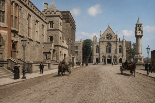
Around 1900, Pery Square presented one of Limerick’s most elegant urban settings, facing the newly opened People’s Park and framed by distinctive Georgian terraces. The celebrated Tontine Buildings, built between 1835 and 1838 as a speculative venture, gave the square a story as unusual as its architecture. Their shares, tied to named lives in the so-called Life and Death Lottery, were still gaining value as horse-drawn traffic, pedestrians, gas lamps, and civic buildings animated the street. The tontine was finally won in 1913 by Sophia Vanderkiste, closing a remarkable chapter in Limerick’s local social and architectural history.
Pery Square

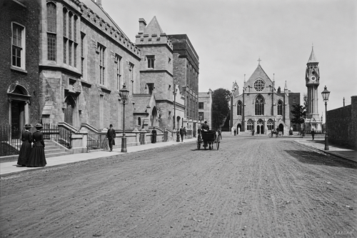
Around 1900, Pery Square presented one of Limerick’s most elegant urban settings, facing the newly opened People’s Park and framed by distinctive Georgian terraces. The celebrated Tontine Buildings, built between 1835 and 1838 as a speculative venture, gave the square a story as unusual as its architecture. Their shares, tied to named lives in the so-called Life and Death Lottery, were still gaining value as horse-drawn traffic, pedestrians, gas lamps, and civic buildings animated the street. The tontine was finally won in 1913 by Sophia Vanderkiste, closing a remarkable chapter in Limerick’s local social and architectural history.
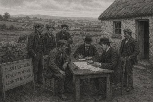
Purchase Delayed

Tenant purchase continues under the existing Irish Land Acts, allowing some farmers to replace rent payments with annual instalments towards ownership of their holdings. The principle has won broad support among tenants who believe possession of the soil would provide greater independence, security and confidence in improving their farms. Yet the number of completed sales remains insufficient to satisfy many rural communities. In County Limerick, farmers continue to wait upon negotiations between landlords, tenants, the Irish Land Commission and the Treasury, while political organisers argue that a reform intended to settle the land question is proceeding far too slowly.

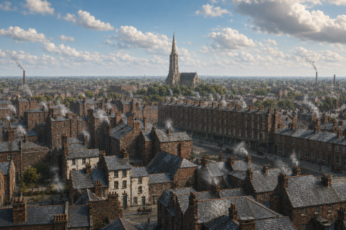
Aerial View Of Limerick (c.1920s)

A hazy bird’s-eye view of Limerick in the 1920s stretches across rooftops, chimneys, lanes, and terraces fading into mist. Smoke rises from houses and workshops, softening the city skyline and giving the scene a wintery industrial atmosphere. A tall church spire dominates the distance, standing above packed streets and modest dwellings, while long rows of buildings suggest dense urban life along the Shannon. The elevated perspective captures Limerick as a working city of faith, labour, and close-knit neighbourhoods. Though blurred by age and weather, the photograph preserves a rare panoramic impression of everyday Limerick between war, industry, and memory.

Baker Place, Limerick c.1900

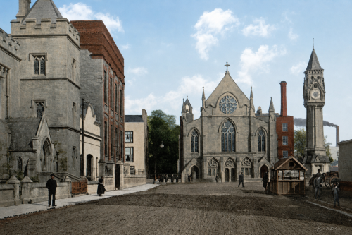
At Baker Place in early twentieth-century Limerick, Saint Saviour’s Dominican Church stands at the centre of a broad cobbled streetscape, its Gothic stone façade, rose window, pointed arches, and carved doorways giving the scene a strong ecclesiastical presence. To the right, Tait’s Clock rises above the roadway as a civic landmark, balanced by red-brick industrial buildings and smoking chimneys behind it. Period pedestrians, a horse-drawn cart, street lamps, and a small wooden kiosk add everyday activity. The view captures a city shaped by faith, industry, commerce, public memory, and the architectural confidence of Edwardian urban life in Limerick’s historic core.

St Mary’s Church

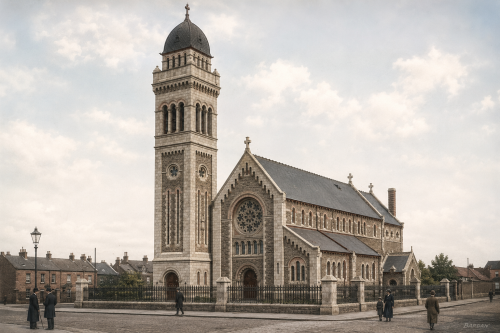
St Mary’s Church stands on Athlunkard Street in Limerick, occupying a site associated with Catholic worship since the eighteenth century. The present church opened in 1932, replacing an earlier chapel where Mass was first celebrated on December 10, 1749. Designed by Ashlin and Coleman of Dublin, the building reflects the scale and ambition of parish church architecture in early twentieth-century Limerick. Its tower, façade, railings and street setting mark an important local landmark, while the surviving holy water font from the former chapel links the modern church with the long religious history of St Mary’s parish community today.

O’Connell Street, 1937

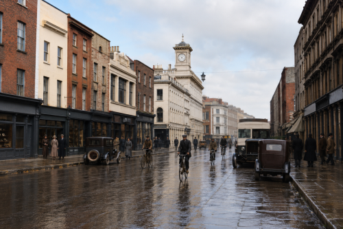
This 1937 view of O’Connell Street, historically known as George’s Street, captures Limerick’s principal commercial thoroughfare during a period of urban transition. Georgian façades, prominent shopfronts and the landmark clock tower frame a busy scene of pedestrians, cyclists, motorcars and public transport. Heavy coats and formal dress reflect everyday life before the Second World War, while traditional businesses line both sides of the street. Several buildings and upper storeys shown here were later altered or demolished during redevelopment. Despite extensive modernisation and pedestrianisation, O’Connell Street remains central to Limerick’s commercial, architectural and social identity within the changing modern city today.

Limerick’s Industrial Waterfront

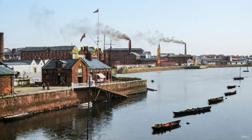
This view of Limerick City’s waterfront captures a busy industrial landscape beside the River Shannon. Factory buildings, warehouses and tall smoking chimneys dominate the skyline, reflecting the city’s long history of manufacturing and riverside commerce. In the foreground, timber buildings and a landing stage stand along the quay, while several small rowing boats move across the calm water. The scene combines industry, transport and recreation, illustrating the importance of the river to everyday life in Limerick. Smoke rising above the rooftops conveys the energy of a working city shaped by its factories, docks and waterways.

A Busy Day On George Street

George Street, now O’Connell Street, formed the bustling commercial and social heart of Limerick around 1900. Elegant Georgian and Victorian façades lined the thoroughfare, their ornate shopfronts illuminated by gaslight and filled with goods for local shoppers. Horse-drawn carriages, jaunting cars and merchant carts crowded the roadway, while pedestrians in heavy coats and hats moved between businesses and hotels. The grand Cruises Royal Hotel stood among the street’s most prominent landmarks, welcoming merchants, travellers and visitors. This scene reflects the energy of late-Victorian Limerick before motor traffic transformed the city’s principal shopping street and historic urban centre during a changing era.

Route Endorsed

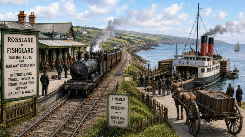
Limerick County Council looked towards the Irish Sea in 1900 when it supported proposals for the developing railway and steamship connection between Rosslare in County Wexford and Fishguard in Wales. The surviving account mistakenly calls the Irish port “Roeselare,” the name of a Belgian city, but the intended destination was Rosslare. Although both harbours lay far from County Limerick, councillors recognised that a through route from the Shannon region towards Waterford and the south-eastern coast might improve passenger travel, commercial communication and access to markets in Britain.

Now Sharing: Articles (154) | Images (196) | Total Items Archived (350)
Our Mission: 100,000 Items | Total Percentage Achieved (0.35%)