Baker Place, Limerick c.1900

At Baker Place in early twentieth-century Limerick, Saint Saviour’s Dominican Church stands at the centre of a broad cobbled streetscape, its Gothic stone façade, rose window, pointed arches, and carved doorways giving the scene a strong ecclesiastical presence. To the right, Tait’s Clock rises above the roadway as a civic landmark, balanced by red-brick industrial buildings and smoking chimneys behind it. Period pedestrians, a horse-drawn cart, street lamps, and a small wooden kiosk add everyday activity. The view captures a city shaped by faith, industry, commerce, public memory, and the architectural confidence of Edwardian urban life in Limerick’s historic core.
Grazing Dominance

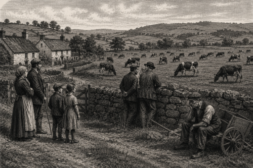
Cattle grazing remains more profitable than tillage in many Irish districts, encouraging landowners and substantial occupiers to devote extensive farms to livestock rather than labour-intensive cultivation. The difference is keenly felt in County Limerick, where broad grasslands can support valuable cattle while requiring comparatively few permanent workers. Families dependent upon agricultural wages find fewer opportunities wherever ploughing, sowing, weeding and harvesting give way to grazing. Supporters of the existing system point to dependable livestock markets and lower operating costs, but critics argue that profitable land is failing to sustain the number of people it once employed.

Barricades In Limerick

At Thomond Bridge in Limerick in 1923, a soldier stands guard beside a rough barricade near the Treaty Stone, a symbolic landmark now overshadowed by civil conflict. The scene evokes the tense aftermath of the Treaty split, when Anti-Treaty IRA forces and pro-Treaty National Army troops fought for control of the city. Sandbags, timber, stone, and street debris suggest hurried urban fortification, while the soldier’s watchful posture conveys danger and uncertainty. The bridge becomes both military checkpoint and historic threshold, linking Limerick’s medieval memory with the bitter street warfare that marked the Irish Civil War in the city that summer.

Treaty Stone

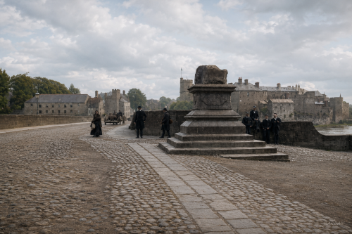
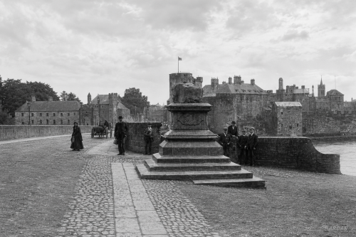
AI-assisted archival reconstruction showing the Treaty Stone on Thomond Bridge, Limerick, with the riverside castle buildings and historic bridge approach in the background. The scene presents the monument, cobbled roadway, bridge parapet, pedestrians, and horse-drawn traffic in a restored early twentieth-century setting, preserving the atmosphere of the original historical source image.

Dairy Expansion

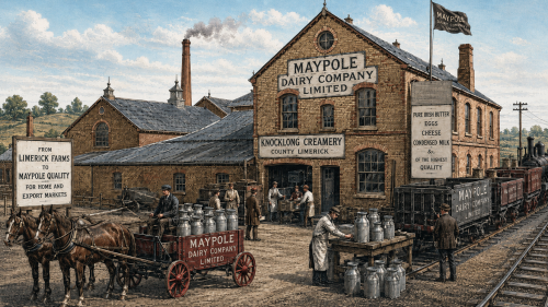
County Limerick’s dairy economy was changing rapidly around 1900 as the Maypole Dairy Company strengthened the connection between rural milk production and large-scale commercial retailing. At Knocklong, where the company had built a creamery during the mid-1890s, farmers delivered milk for mechanical separation and butter-making rather than producing every finished article within their own homes. The operation linked surrounding farms with a business selling provisions across Britain. For local suppliers, the creamery offered regular access to a wider market, while the company gained a dependable source of Irish butter for an expanding network of urban shops.

Thatched Cottages of Adare

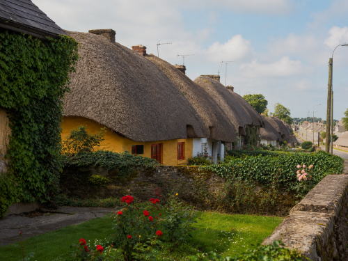
In July 1981, a row of traditional thatched cottages lends Adare its distinctive old-world character. Whitewashed walls, steep straw roofs and small windows line the roadside, reflecting a style once common throughout rural Ireland. The cottages appear carefully maintained, their simple façades softened by flowers, hedges and mature trees. Passing traffic and summer light place the scene firmly in everyday village life rather than a staged historical setting. The image preserves a familiar view of Adare at a time when its architectural heritage was becoming central to the village’s identity and appeal for visitors to County Limerick and beyond worldwide.

Wellesly Bridge, Limerick (c.1840s)

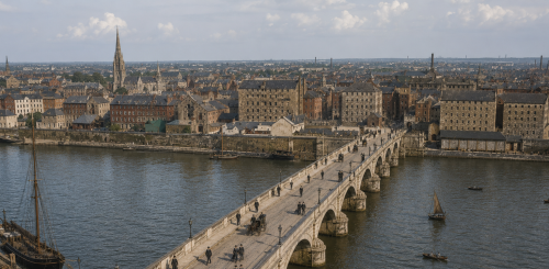
A sweeping view of Wellesley Bridge, now Sarsfield Bridge, crossing the River Shannon in Limerick City. The elegant 1835 structure rises with restrained neoclassical grace, its stone arches carrying traffic between the historic city centre and Thomondgate on the northern shore. Calm river water reflects the bridge’s pale masonry, while quays, rooftops, and distant activity suggest a city expanding beyond its old boundaries. Maritime details, mooring points, and riverside movement evoke Limerick’s trading past. The scene should feel dignified, atmospheric, and historically grounded, presenting the bridge as both active crossing and enduring architectural landmark.

Route Endorsed

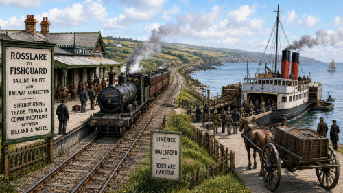
Limerick County Council looked towards the Irish Sea in 1900 when it supported proposals for the developing railway and steamship connection between Rosslare in County Wexford and Fishguard in Wales. The surviving account mistakenly calls the Irish port “Roeselare,” the name of a Belgian city, but the intended destination was Rosslare. Although both harbours lay far from County Limerick, councillors recognised that a through route from the Shannon region towards Waterford and the south-eastern coast might improve passenger travel, commercial communication and access to markets in Britain.

1916 Memorial, c.1940s

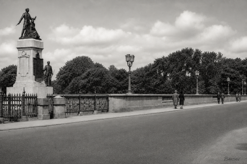
On Sarsfield Bridge in 1940s Limerick, the 1916 Memorial rises proudly beside the roadway, enclosed by green iron railings and watched over by elegant lamps. Its pale stone pedestal supports bronze figures commemorating the Rising, their solemn poses lending dignity to the riverside setting. Trees line the background, softening the urban scene and framing the monument against a bright open sky. Pedestrians in period dress walk along the bridge, suggesting ordinary city life continuing around a place of remembrance. The image captures civic pride, republican memory, and the enduring presence of national history within Limerick’s daily landscape and local identity.

Treaty Stone

AI-assisted archival reconstruction showing the Treaty Stone on Thomond Bridge, Limerick, with the riverside castle buildings and historic bridge approach in the background. The scene presents the monument, cobbled roadway, bridge parapet, pedestrians, and horse-drawn traffic in a restored early twentieth-century setting, preserving the atmosphere of the original historical source image.

Now Sharing: Articles (154) | Images (196) | Total Items Archived (350)
Our Mission: 100,000 Items | Total Percentage Achieved (0.35%)