Now Sharing: Articles: 202 Images: 642 Total Items Archived: 844

William Street, Limerick

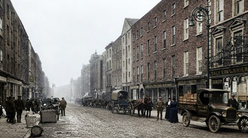
William Street has served as one of Limerick City’s principal commercial streets since its creation within the Newtown Pery development in 1789. Extending from O’Connell Street towards Mulgrave Street, it was named after William Cecil Pery, brother of Edmund Pery, who promoted the city’s Georgian expansion. Its red-brick terraces, fanlights, sash windows and underground vaulted cellars reflect ambitious eighteenth-century planning. Over time, the street witnessed destructive fires, overcrowded tenements and major changes in transport and retail. Shops, drapers, chemists and public houses later made William Street a busy commercial route that remains central to city life today in modern Limerick.
Shannon Defence

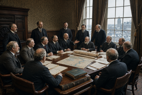
On 2 January 1900, the Limerick Fishery Conservators unanimously opposed the scheme promoted by the Shannon Water and Electric Power Company. Meeting under Lord Massy’s chairmanship, the members viewed the proposed parliamentary bill as a direct threat to interests dependent upon the river. Their objections extended beyond salmon fishing to navigation, milling and the public water supply of Limerick. The Conservators feared that private promoters seeking to harness the Shannon for electricity might secure broad powers before the consequences for existing river users had been fully investigated or adequately protected.

Elm Hill, Co Limerick

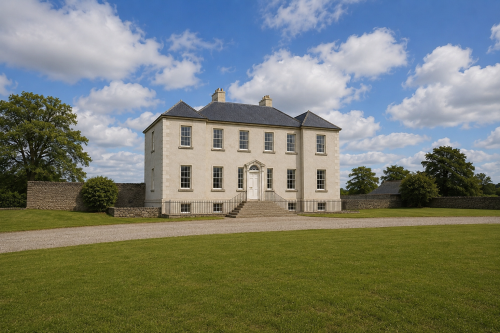
Elm Hill, County Limerick, was built around 1790 for the Studdert family as an elegant Georgian country residence. The six-bay, two-storey house stood over a raised basement and contained spacious reception rooms, nine bedrooms, servants’ quarters, kitchens, cellars and service rooms. Following the Great Famine, it was offered for sale and described as being in excellent repair. The property remained substantial for generations but gradually fell vacant and deteriorated. A 2008 architectural survey praised its limestone doorcase, carved timber entrance, slate-hung elevations, fireplaces and decorative plasterwork. Its recognised importance led to designation as a protected structure under Irish planning legislation.

King John’s Castle (1922)

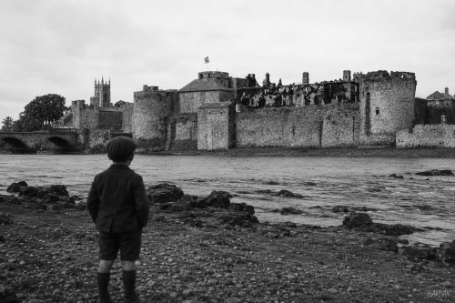
King John’s Castle stands beside the River Shannon at Curragower Falls, with broken water, river rocks and the castle’s stone frontage visible across the scene. The round towers, curtain walls and riverside defences remain central, while the burned Castle Barracks appears roofless and blackened within the enclosure. Thomond Bridge is visible to the left, with nearby trees, older buildings and a church tower rising beyond the castle walls. The river surface shows ripples, reflections and shallow movement below the fortifications. The image presents the castle after damage, set within the wider early twentieth century Limerick urban riverside landscape after 1922.

Thomond Bridge and Castle, 1881

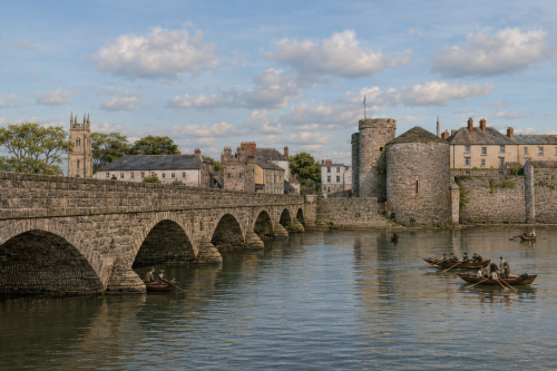
This 1881 reconstructed image is based on an engraving and depicts Thomond Bridge and King John’s Castle overlooking the River Shannon in Limerick, County Limerick. The original was published in Élisée Reclus’s geographical work The Earth and Its Inhabitants, the image presents one of the city’s most recognisable historic views. The medieval castle dominates the riverbank, while the bridge connects the city across the Shannon. Boats, buildings, and figures add detail to the busy riverside setting. The engraving reflects both the architectural importance of the castle and the strategic role of the crossing, preserving a valuable nineteenth-century representation of Limerick’s urban landscape and historic waterfront for future generations to appreciate.

A Busy Day On George Street

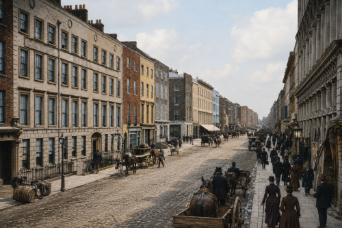
George Street, now O’Connell Street, formed the bustling commercial and social heart of Limerick around 1900. Elegant Georgian and Victorian façades lined the thoroughfare, their ornate shopfronts illuminated by gaslight and filled with goods for local shoppers. Horse-drawn carriages, jaunting cars and merchant carts crowded the roadway, while pedestrians in heavy coats and hats moved between businesses and hotels. The grand Cruises Royal Hotel stood among the street’s most prominent landmarks, welcoming merchants, travellers and visitors. This scene reflects the energy of late-Victorian Limerick before motor traffic transformed the city’s principal shopping street and historic urban centre during a changing era.

Shannon Bridge Under Construction (1987)

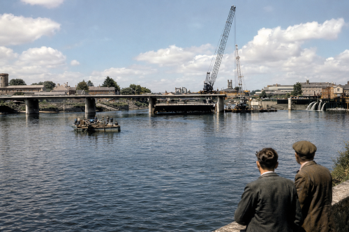
Shannon Bridge, opened on 30 May 1988, remains widely known in Limerick as the “New Bridge”, despite now being several decades old. This four-lane concrete girder crossing connects the Dock Road and Mallow Street area with the North Circular Road and Clancy Strand, providing an important inner-city relief route across the River Shannon. Soon after opening, it acquired another memorable nickname, the “Whistling Bridge”. Strong winds travelling up the Shannon Estuary passed through gaps in the original railings, producing a loud, eerie shrill sound. The problem was later reduced by fitting mesh grilles over the railings along the exposed crossing.

Tait’s Clock, Limerick

Tait’s Clock has stood in Baker Place since 1867, honouring Sir Peter Tait, the Scottish-born industrialist and three-time Mayor of Limerick. Rising 65 feet above the street, the Gothic-style limestone tower was designed by local architect William Edward Corbett and financed through public subscription. Its four clock faces, ornamental iron finial and coloured marble colonnettes make it a distinctive landmark. Tait founded the Limerick Clothing Factory, which supplied military uniforms during the Crimean War and American Civil War. Positioned near St. Saviour’s Church, Pery Square and Colbert Station, the tower remains an enduring symbol of Limerick’s industrial and civic heritage.

Shannon Rowing Club

Shannon Rowing Club is Limerick City’s oldest sporting institution. Founded in 1866 by entrepreneur and mayor Sir Peter Tait, the club has long been identified by its royal blue and white colours. Its historic headquarters on Wellesley Pier beside Sarsfield Bridge opened in 1905. Designed by William Clifford Smith, the listed Edwardian Arts and Crafts building remains one of the city’s most distinctive sporting landmarks. The clubhouse supports dry training through gym equipment, static bicycles and rowing machines, while also providing space for snooker and chess. It continues to represent Limerick’s rowing tradition and community spirit.

William Street, Limerick

William Street has served as one of Limerick City’s principal commercial streets since its creation within the Newtown Pery development in 1789. Extending from O’Connell Street towards Mulgrave Street, it was named after William Cecil Pery, brother of Edmund Pery, who promoted the city’s Georgian expansion. Its red-brick terraces, fanlights, sash windows and underground vaulted cellars reflect ambitious eighteenth-century planning. Over time, the street witnessed destructive fires, overcrowded tenements and major changes in transport and retail. Shops, drapers, chemists and public houses later made William Street a busy commercial route that remains central to city life today in modern Limerick.