Effin Parish
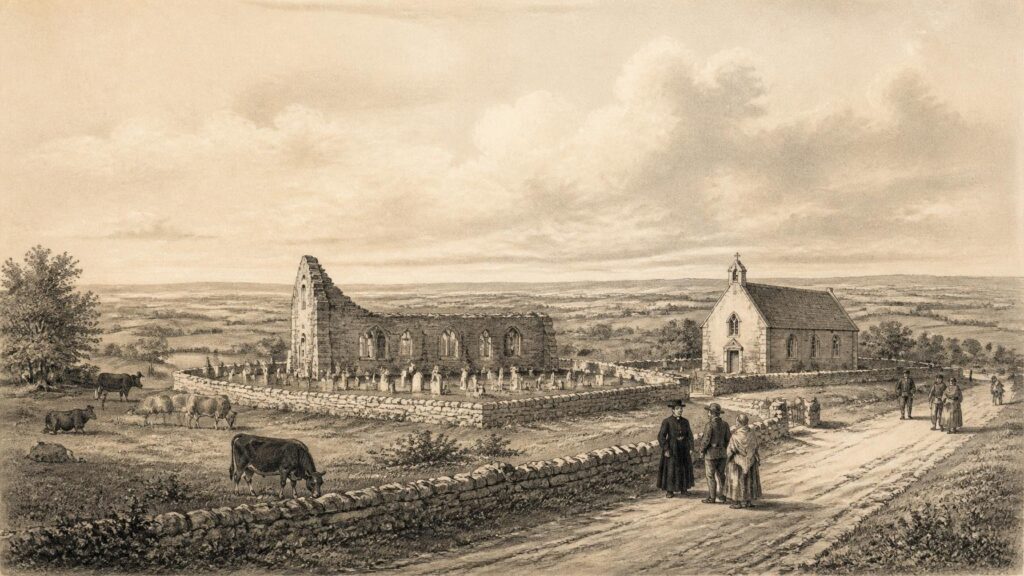
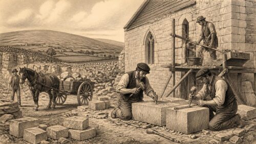
AI generated historical illustration, not a contemporary photograph.
At a Glance
Effin is a small south-Limerick parish whose historical importance is out of all proportion to its modern scale. Near Kilmallock, on the old route towards Charleville, it preserves the traces of a medieval manor and borough, a church recorded in diocesan sources from the early thirteenth century, a graveyard holding the remains of that ecclesiastical world, and a later Catholic community whose material record extends from a seventeenth-century chalice to nineteenth-century churches and parish registers. Its story is necessarily fragmentary. The evidence does not permit a continuous narrative, but it does permit a close reading of how place, lordship, worship, landholding and local memory accumulated in one modest Irish parish.
Place Names
The subject is not a passing modern usage or a jocular coincidence: Effin is a historical place in County Limerick. The official Irish form recorded in the Gazetteer of Ireland is Eifinn. That form matters, not because a name by itself supplies a full history, but because it establishes the settlement within the older Irish linguistic landscape of south Limerick. A place-name can be an unusually durable historical document. It may survive changes in ownership, religion, administration, language and local settlement, while its original meaning becomes uncertain.
Uncertainty must be admitted here. Local parish material has proposed that the name may derive from a church or temple associated with a saint called Effin. The archaeological record also preserves the local names ‘Temple’ and ‘Kill Eifinn’ for the old church site. These traditions make an ecclesiastical association plausible, yet plausibility is not proof of an early saint’s biography, nor of a particular foundation date. The official gazetteer confirms the Irish name; it does not resolve its etymology. A careful account should therefore distinguish the documented name, Eifinn, from later interpretations of what it may once have meant.
Effin lies in the southern part of County Limerick, south-west of Kilmallock. Historically, the civil parish extended across the baronial division between Costlea and Coshma, though chiefly in Coshma. Such overlapping geographical descriptions are typical of Irish local history. A parish could be at once a religious territory, a civil unit, an assemblage of townlands, a valuation district and an address used in everyday speech. None of those categories should be treated as identical. The village or settlement called Effin, the townland of Effin and the civil parish of Effin are connected, but they represent different scales of historical geography.
The townland framework is especially important. Townlands long pre-date the modern county system in many cases, and they became the practical vocabulary of land, residence and record-keeping. Around Effin, names such as Kilbreedy, Garrynderk, Gortacrank, Tobernea, Graiganster and Leagane preserve references to churches, gardens, fields, wells, a hamlet and a standing stone. Their meanings should not be forced into a single chronological scheme. A name referring to a well does not date the well; a name recalling a church does not prove that the present visible fabric belongs to the moment when the name first arose. Yet the density of such names tells us that the parish’s landscape was read through recognisable local features.
Effin’s position also explains why it should not be imagined as isolated. It stood near Kilmallock, one of medieval Munster’s significant walled towns, and on a route southwards towards Charleville and Cork. Rural parishes near market towns participated in wider commercial, ecclesiastical and administrative networks even when their surviving buildings were few. Roads, fairs, rents, church dues, marriages and seasonal labour connected households to places beyond the parish boundary. The survival of a borough reference in the fourteenth century, discussed below, is intelligible in that regional setting.
Medieval Traces
The earliest secure documentary thread is medieval and ecclesiastical. The State archaeological survey for County Limerick records that the church at Effin was first mentioned as a church of the Diocese of Limerick in 1201. It further notes that the church appears repeatedly in medieval rentals preserved in the Black Book of Limerick. Those entries are important, but their limitations are equally important: they establish institutional notice and economic connection, rather than providing a full description of the building or a narrative of parish life.
Documents of this kind are reminders that a medieval parish church was not merely a spiritual landmark. It stood within systems of dues, rights, endowments and diocesan administration. A church could be a focus of baptism, burial, marriage, feast-day observance and local identity, while also generating income and appearing in accounts. The Black Book references show that Effin belonged to that wider diocesan economy. They do not tell us how ordinary parishioners spoke, dressed, farmed or worshipped on a given day. The archive is strongest where institutions needed records, and often quietest where ordinary people left none.
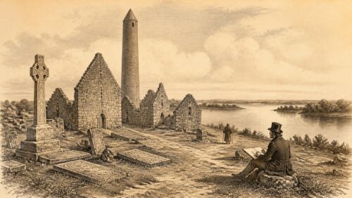
The archaeological survey identifies the old church as the parish church of the Blessed Virgin Mary. It survives in a graveyard west of the modern Roman Catholic church. Though now ruined and overgrown, the building is more than a picturesque remnant. Its coursed rubble limestone walls, surviving openings and bellcote are physical evidence that can be examined separately from later descriptions and local recollections. The survey records narrow round-arched windows, chamfered jambs, a wall cupboard, blocked doorways and openings associated with a western loft or gallery. These details indicate a building altered and used over time, not a frozen monument belonging to one simple date.
Architecture can suggest sequence, but it requires restraint. The rounded openings and masonry may be consistent with medieval construction traditions; they do not license a precise foundation year. The dedication to the Blessed Virgin Mary, the early thirteenth-century documentary notice, and the physical survival of the ruined church together establish a medieval ecclesiastical presence. Beyond that, the history of building campaigns, repair and later adaptation remains incomplete. The old church should therefore be understood as a surviving witness rather than a complete architectural text.
Lewis, writing in the nineteenth century, reported two ‘ancient crosses’ in the graveyard. The archaeological survey states that they are no longer visible. This is a small but revealing instance of historical loss. Local antiquities may disappear through weathering, clearance, rebuilding, reuse of stone, vegetation or simple failure to record their precise location. The absence of a feature today does not prove that a nineteenth-century observer was wrong. Equally, an old report alone cannot recover its form, date or original position. In Effin as elsewhere, local history must hold together what survives on the ground with what earlier observers said they saw.
Manor Records
Effin also appears in the history of medieval lordship. The archaeological survey cites two documents in the Black Book of Limerick indicating that the manor of Effin belonged to Maurice de Rochfort, or Rupefort, in 1287. The spelling itself reflects the instability of medieval record-keeping across Latin, Anglo-Norman French, English and Irish contexts. Names varied because scribes wrote phonetically, according to convention, or within the language of the document. Variation should not automatically be mistaken for uncertainty about the place.
A manor was an estate-centred unit of lordship. It could comprise demesne land, tenant holdings, rents, services, milling rights, woodland, pasture and other assets, though the evidence presently available does not allow each of those components to be reconstructed for Effin. What the 1287 evidence securely shows is that Effin formed part of a seigneurial landscape. It was not merely an anonymous farming district. It had sufficient economic and administrative identity to be named in records of property and revenue.
The Rochfort connection places Effin within the post-conquest world of Anglo-Norman expansion and accommodation in Munster. That world was neither uniform nor static. Lords, ecclesiastical institutions, Irish landholders, tenants and townspeople interacted through alliances, inheritance, rent, conflict and law. It would be misleading to cast the parish as simply ‘English’ or simply ‘Irish’. Medieval south Limerick was shaped by overlapping languages, jurisdictions and cultural practices. The surviving documents tend to preserve the view from lordship and church administration; they offer far less direct access to the majority who cultivated the land.
The record of a manor is not proof of a grand house standing at the modern village, nor does it establish the size of the population. It does, however, make clear that Effin’s agricultural resources were of recognised value. Its location near Kilmallock and near routes into north Cork would have made its land and rents legible within regional networks. In historical interpretation, the safest conclusion is modest but significant: by the late thirteenth century Effin was a named manor under documented lordship.
That conclusion also changes how the church is viewed. The manor and parish church should not be separated into unrelated stories. Medieval communities were organised through both land and worship; lords dealt with rents and jurisdiction while ecclesiastical institutions received dues and exercised pastoral authority. The surviving sources do not disclose every relationship between Rochfort lordship and the church of Effin, but their near-contemporary appearance in the record suggests a locality embedded in the normal structures of medieval settlement rather than a marginal or unformed outpost.
Borough Memory
Effin’s most intriguing medieval reference concerns a borough. According to the County Limerick archaeological survey, the Red Book of Kildare records that in 1372 four marks and six pence in rents were returned to the wife of John Rochford for the burgagery of ‘Effyn’. The term burgagery is consequential. It refers to a tenure or property associated with a borough, and the entry is the documentary basis for identifying Effin as the site of a medieval borough.
That statement needs to be read exactly. The record is evidence for borough status or borough-related holdings; it is not evidence for an extensive surviving town, a charter whose text has been recovered, or a detailed plan of streets and plots. The survey is frank that the subsequent history of the borough is unknown. It further says that no surface trace survives and that the likely location was in the vicinity of the parish church. This is a case where the archive reveals an unexpected historical status while the landscape withholds much of the physical corroboration historians would like to have.
Small medieval boroughs were not necessarily towns in the modern sense. Some had modest populations, limited trading functions or short institutional lives. Their fortunes depended on lordship, regional markets, political security, transport and competition from stronger neighbours. Kilmallock’s prominence in the wider district provides a useful caution. A smaller place close to such a centre might possess borough rights or burgage holdings without developing into a substantial enduring urban settlement. Effin’s borough may have been economically modest, or it may have declined before later maps and descriptions could preserve its form. At present, the evidence does not decide between those possibilities.
The term ‘borough’ should therefore be treated as historical evidence, not local ornament. It offers a glimpse of Effin’s place within a late medieval economy where rents from burgage plots could be calculated and returned. It implies an organised settlement pattern of some kind, perhaps close to the church, but it does not entitle us to draw a street plan. The absence of visible remains can reflect later cultivation, rebuilding, abandonment or the slightness of original structures. Archaeology, rather than assertion, would be required to clarify the settlement’s extent.
There is a wider lesson in this. Irish local history is often written around what is monumental: castles, abbeys, town walls and great houses. Effin’s borough is historically valuable precisely because it is elusive. It shows that documentary traces can preserve the existence of places whose material expression has almost vanished. The parish’s medieval past is not exhausted by its ruined church. It includes a lost settlement form, remembered in rent rather than masonry.
Sacred Ground
The old churchyard is the central surviving historical landscape of Effin. It contains the ruins of the medieval parish church and continued to function as a place of burial long after the building’s principal liturgical use had changed. Such continuity is common in Ireland but should never be treated as automatic. Burial grounds were places where memory accumulated through kinship, inscription, ritual and repeated return. They connected the parishioners of the nineteenth and twentieth centuries with an ecclesiastical site older than any family recollection.
Local diocesan heritage material records that the ruined church consisted of nave and chancel, although much of it had been reduced to foundations or low remains by the nineteenth-century surveyors. The difference between that description and the archaeological survey’s more architectural account illustrates the value of using several kinds of evidence. One source records the broad plan and visible state at a particular time; another examines masonry and openings. Neither alone supplies a complete history, but together they show a building that had already undergone decay while remaining an intelligible local landmark.
The churchyard also held memorials whose survival is uncertain. Local heritage material, drawing on Maurice Lenihan’s nineteenth-century history of Limerick, reports ancient tombstones bearing inscriptions in Irish characters, though few traces were said to remain by the time the parish account was compiled. Such reports deserve neither uncritical repetition nor dismissal. They indicate that observers believed the site retained older Gaelic-inscribed grave markers. Without secure surviving stones, photographs or full transcriptions, however, one cannot assign dates, names or meanings to them.
There are other documentary memorials. The parish history records the burial at Glenogra graveyard of Edward Lee, parish priest of Effin, who died in 1834. It also records that Father David Nagle, builder of the present church, was buried there after his death in 1847. These facts locate nineteenth-century clergy within the same landscape of parish remembrance, though in different burial contexts. Clerical graves mattered because they fixed institutional succession in the local terrain: the priest who served the people did not disappear from the parish story but remained named in stone and memory.
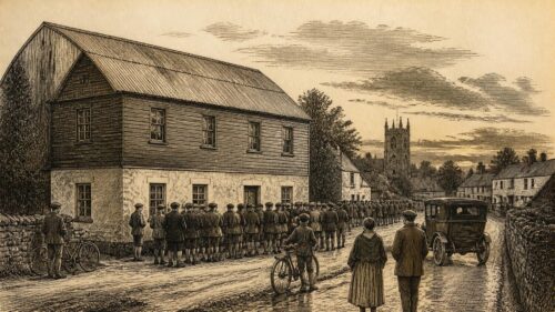
The present Catholic church in Effin was built in 1835–36 by Father David Nagle, according to the diocesan heritage project. Its construction must be seen in the context of nineteenth-century Catholic parish life, when many communities replaced smaller chapels or older arrangements with more substantial churches. This was not simply an architectural transition. It marked changing expectations of worship, parish organisation and public visibility. Yet the new church did not erase the old one. The medieval ruin beside it retained the authority of age, burial and place-name.
A silver chalice still used in Effin bears a Latin inscription dated 1633 and naming Aegidius Hiffernane, Eleanora Gibbon and Cornelius Hiffernane. The object is unusually tangible evidence of post-medieval Catholic continuity. It should not be made to bear more weight than it can carry: it does not explain all religious practice in the parish during the seventeenth century. But it demonstrates patronage, material devotion and the survival of a liturgical object across centuries of political and ecclesiastical change. In a locality where so much evidence is fragmentary, such an object is especially eloquent.
Wells Tradition
Holy wells bring another layer of evidence and another need for caution. The parish heritage project identifies St Bridget’s Well in Kilbreedy townland and notes that it was no longer a pattern site in 1840. It describes a small clear pool, roughly lined with stones, with a large upright stone beside it, and records the local belief that it had been especially popular for curing sore eyes. A well was never merely water. It could be a place of prayer, healing, social gathering and seasonal pilgrimage, but the precise balance of those functions changed over time.
The word ‘pattern’ is itself historically revealing. In Ireland it commonly referred to a devotional gathering associated with a saint’s feast or holy place, often combining religious observance with visiting, trading and recreation. The statement that St Bridget’s Well was no longer a pattern site by 1840 does not mean that all devotion had ceased, only that the particular public custom was reported as discontinued. Practices could diminish, revive or continue privately. The absence of a pattern at one recorded moment should not be turned into a sweeping verdict on local faith.
The parish record also mentions Toberacran in Gortacrank, interpreted as the Well of the Tree, and records traditions of wells called Toberreendoney, Tobernea and Toberbansha. The location of Toberreendoney was already unknown to the compilers, while two of the others were not thought to be holy wells by folklorist Kevin Danaher. This variety is instructive. Not every well-name denotes an active shrine; not every remembered well can be located; and local categories were more nuanced than a modern list of ‘holy wells’ may imply.
Wells are often used to project an imagined unbroken line from remote antiquity to present custom. That approach is unsound. A well may have had practical, religious and folkloric significance at different periods, and evidence for one period does not automatically establish the same function in another. In Effin, the historical record securely supports the existence of named wells, the former pattern association of St Bridget’s Well, and remembered healing practice. It does not permit a precise prehistoric origin or a complete chronology of ritual.
Nevertheless, these places show how the parish was mapped through stories as well as boundaries. A churchyard concentrated the burial of the dead; a well could draw those seeking health; a named tree or stone gave an ordinary patch of ground a distinctive local identity. Such sites did not form a separate world from everyday rural life. They were woven into routes, farms, household knowledge and the social memory of the parish.
Parish Change
The nineteenth century brought new forms of documentation that make Effin more visible, even if not wholly transparent. Samuel Lewis’s topographical account, as preserved in local heritage material, placed the parish partly in Costlea and chiefly in Coshma and stated that in Roman Catholic divisions it was united with Kilbreedy Minor and Kilquane in 1837. Such wording reminds us that parish organisation was subject to administrative adjustment. A civil parish, a Church of Ireland parish and a Roman Catholic parish could have related but non-identical boundaries and histories.
Ordnance Survey work in the first half of the nineteenth century was especially consequential for local historical research. Surveyors mapped townlands at six inches to the mile and created Name Books and correspondence recording variant names, buildings, antiquities and landscape observations. These sources do not speak without mediation: they were produced by state surveyors working within particular administrative aims and linguistic conventions. Yet they are essential because they preserve a snapshot of the parish before later road works, consolidation, demolition and agricultural change altered the landscape further.
Griffith’s Valuation, compiled in the mid nineteenth century, supplies another layer. It was a valuation of property for local taxation, not a census and not a complete social history. It identifies occupiers, immediate lessors, land and buildings for valuation purposes. Used with maps, parish registers and later census returns, it can illuminate the settlement pattern of Effin’s townlands. Used alone, it can mislead. The name of an occupier does not necessarily reveal ownership, wealth, family structure or the full complexity of a tenancy.
The Great Famine forms the unavoidable background to this period, but the evidence consulted for this article does not justify an invented parish-specific narrative of eviction, mortality or emigration. Effin was part of a county and region profoundly affected by the catastrophe, and its rural households lived through the same national crisis of food failure, disease, relief, migration and changing land relations. To state more about particular families or townlands would require direct local evidence from poor-law records, estate papers, newspapers, graveyards, parish registers or correspondence. Historical honesty is more useful than dramatic embellishment.
The extant Catholic parish register for Effin and Garrienderk begins in 1843 and runs through 1881 in the National Library of Ireland’s digitised register catalogue. It was microfilmed from an original held in parish custody. Its starting date is significant. It gives researchers a substantial record of baptisms and marriages through the later famine years and into the era of post-Famine migration, but it cannot serve as a comprehensive register of the parish’s earlier generations. Silence before 1843 is an archival limit, not evidence that families or religious life were absent.
Living Records
Parish registers transform a place from a general landscape into a network of individual lives. In Effin and Garrienderk they can reveal repeated surnames, godparent relationships, marriage connections and patterns of residence, though each entry must be interpreted in its own context. A baptism records a sacramental event, not necessarily a birth on the same day. A marriage register names those present in a formal act, not every relative or household member. Spellings fluctuate, ages can be inaccurate and townland addresses may be omitted or abbreviated.
Even with those cautions, the registers testify to continuity. They show that Effin was not a ruined medieval site observed only by antiquarians. It was a functioning Catholic community with regular rites of passage, shared clergy and connections to Garrienderk. The date range also allows family historians to connect local evidence with civil registration, valuation records, graveyard inscriptions, newspapers and emigration sources. The parish becomes legible as a community of households rather than merely a point on a map.
The National Folklore Collection’s Schools’ Collection adds a different kind of record. In the 1930s, schoolchildren in Effin recorded stories and beliefs received from older people. One story places a fairy woman’s leap between Newtown in County Cork and Sporry in Effin, leaving the supposed outline of a cup and saucer upon a stone. Another relates a tale of an emigrant expected home from America. These are folklore texts, not factual reports that can verify a supernatural encounter or reconstruct a particular voyage.
That distinction does not make them historically worthless. Folklore records the imaginative and moral world in which people understood roads, stones, migration, absence and the supernatural. The tale of the returning emigrant is especially suggestive of the emotional reality of transatlantic separation, even though it cannot identify a named emigrant or establish an event. The fairy story attaches wonder to a local route and landmark, making geography memorable through narrative. In both cases, the historical value lies in the act of remembering and telling.
The Schools’ Collection must also be read critically. It was gathered through a school-based project, filtered through children, teachers, informants, transcription and later cataloguing. The language is often English, even where Irish words and older traditions may underlie the story. A text is not a transparent recording of an ancient belief. It is evidence that a story was current, or at least communicable, in a particular community during the 1930s. For Effin, that is already a valuable record of local cultural life.
Material Continuity
Effin’s history is best understood through material continuity without assuming permanence. The old church, graveyard, chalice, wells, townland names, parish registers and schoolchildren’s stories each survive by different means. Stone endures but erodes. Metal can remain in liturgical use. Names persist while their origins become obscure. Manuscript registers preserve names but leave out much of what families felt and knew. Folklore transcribes stories but not the full performance of their telling. The historian’s task is to recognise each kind of survival on its own terms.
The ruined church and the modern church provide the clearest visual example. One is medieval, fragmentary and enclosed by a burial ground; the other belongs to the nineteenth-century Catholic parish. Their proximity is not merely convenient. It expresses a local continuity in which worship shifted buildings without wholly abandoning the older sacred site. The later church is not a replacement in the sense of obliteration. It is a successor standing beside evidence of earlier parish life.
The same caution applies to the medieval borough. Its lack of visible surface remains should not lead to a romantic claim that an entire lost town lies intact beneath the fields. Nor should it be discarded as an irrelevant documentary curiosity. The 1372 rent reference is a firm indication of borough-related tenure. The appropriate conclusion is that Effin held a more complex medieval status than its present appearance might suggest, while the physical character and duration of that settlement remain questions for future archaeological work.
Local history often faces the temptation to convert every clue into certainty. Effin resists that temptation. Its surviving sources are strongest when they are allowed to remain partial: the Diocese of Limerick’s early church record, the Rochfort manor in 1287, the burgagery rent in 1372, the seventeenth-century chalice, the 1835–36 church, the register beginning in 1843, and the twentieth-century folklore collection. Together they do not create an unbroken chronicle. They create something more credible: a layered record of a place continually inhabited, organised and remembered.
Historical Meaning
Effin matters because it illustrates how much Irish history resides in places that appear small on modern maps. Its past does not depend on a famous battle, a great estate or a celebrated national figure. Instead, it emerges through the ordinary but durable institutions of the Irish countryside: parish church, townland, graveyard, well, road, rent, register and story. These are not lesser subjects. They are the framework through which generations encountered authority, faith, kinship and locality.
The medieval evidence establishes that Effin had recognised ecclesiastical and manorial standing, and that its name was associated with a borough by the later fourteenth century. The early modern chalice supplies a rare object of devotional continuity. Nineteenth-century records reveal reorganisation, rebuilding and the documentary apparatus of a changing rural society. Twentieth-century folklore demonstrates that local people still populated the parish landscape with remembered marvels and the emotional traces of migration. Each layer changes the meaning of the others.
There are gaps that research should not disguise. The origins of the name remain unsettled. The medieval borough’s plan, population and lifespan are unknown. The reported ancient crosses and Irish-inscribed stones have not been recovered in the evidence consulted here. The records do not yet support a detailed account of every household during the Famine, nor a complete history of landownership from the Rochforts to the modern era. These limits are invitations to further work in estate papers, diocesan archives, maps, excavation records and family collections.
For now, the most defensible portrait is of a parish where historical depth is concentrated in a small area: beside the road from Kilmallock, around a ruined church and graveyard, and across townlands whose names preserve older ways of seeing the land. Effin is not merely a locality with an unusual English spelling. It is Eifinn, a documented Limerick parish in which medieval lordship, Christian worship, rural administration and folklore have left traces still capable of being read.

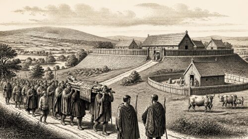
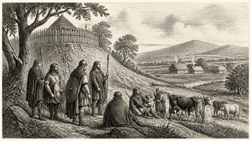
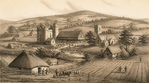
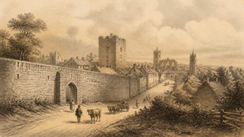
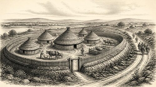
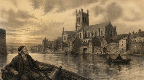
Effin’s possible medieval borough is especially compelling because a 1372 burgagery rent suggests an organised settlement, yet no street plan, charter or surface remains survive. This contrast between documentary status and archaeological invisibility complicates assumptions that boroughs must resemble later towns. Its proximity to Kilmallock may indicate competition, dependence, or a short-lived local function, while the churchyard hints at where such activity may once have clustered. The article’s careful distinction between evidence and inference makes the loss itself historically meaningful. How should historians interpret Effin’s borough: a modest market community, a lordly administrative device, or a settlement requiring archaeological investigation?