
Walled Kilmallock
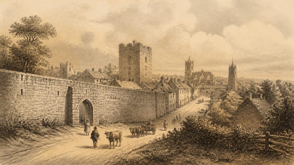
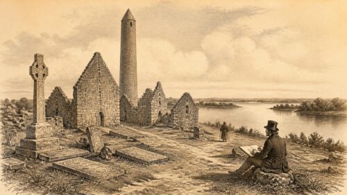
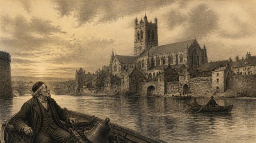
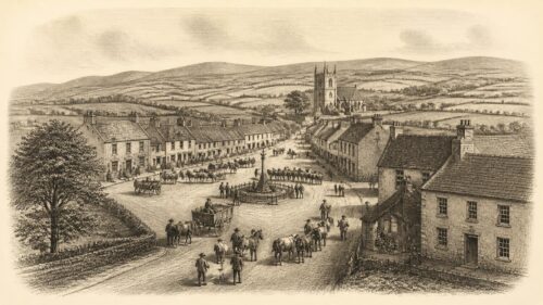
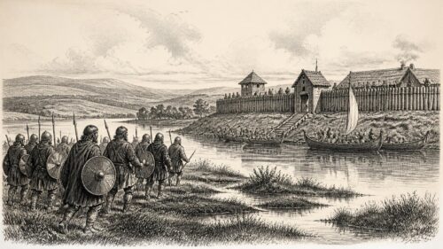
AI generated historical illustration, not a contemporary photograph.
At a Glance
Kilmallock, in south County Limerick, is one of Ireland’s most legible historic towns: a place where the line of a medieval enclosure, the broad course of the principal street, a fortified gate, church towers, friary ruins and fragments of merchant houses still disclose the making and unmaking of an urban community. Its importance did not arise from a single castle or family. It grew from the conjunction of an early religious settlement, a strategic route between Limerick and Cork, ecclesiastical lordship, Anglo-Norman borough building, trade and repeated warfare. The surviving fabric is therefore not merely picturesque ruin. It is evidence of a town whose medieval plan remained unusually durable through later destruction, economic competition and modern change.
Place Names
The name Kilmallock is the English form of Cill Mocheallóg, usually understood as the church of Mocheallóg or Ceallóg. It carries the memory of a religious foundation that predates the walled town by centuries. The historical sequence matters. Kilmallock was not simply an Anglo-Norman creation imposed upon an empty landscape after the late twelfth-century invasion. Rather, the later borough took shape beside an older Christian centre and inherited both its name and its location within a settled district.
The evidence summarised in the Kilmallock Town Walls Conservation and Management Plan places the district in the early medieval territory of Uí Fidgente, later divided into smaller political units. Ringforts and other defended settlement sites in the wider area indicate activity, but they do not entitle historians to give the town itself an exact prehistoric foundation date. Modern accounts sometimes compress the long human history of the district into a claim that Kilmallock is several millennia old. That may be a useful statement about its hinterland, but it should not be confused with proof that the present urban settlement existed in prehistoric times.
Documented tradition associates Mocheallóg with the late sixth or early seventh century and places his monastery on a hill north-west of the modern town. The saint’s life belongs partly to the world of ecclesiastical tradition, in which memories of founders were preserved and reshaped over generations. Yet the place-name, the local association and the later documentary record make the early church connection more than simple folklore. A monastic settlement is the most credible explanation for why a later town developed here rather than at an arbitrary point on the road.
The first surviving written notices are also a reminder that early Kilmallock belonged to the contested political geography of Munster. The annalistic material records a defeat of Vikings from Waterford at Kilmallock in 927. Another entry records the sacking of the monastery in 1015. Such entries are terse; they do not provide a full portrait of ordinary life, population or the shape of buildings. They nevertheless establish that Kilmallock was known as a religious place and a site of conflict before the borough, walls and street-front architecture for which it is now celebrated.
Monastic Origins
At some point, probably in the tenth or eleventh century, the monastic focus moved from the hill into the Loobagh valley. The reason remains uncertain. The conservation plan cautiously suggests possibilities rather than facts: need for expansion, or a response to the attack recorded in 1015. This is a useful model for treating local history. The relocation is credible, and the lower courses of an earlier round tower are incorporated in the later belfry of the Collegiate Church of Saints Peter and Paul; but a single dramatic explanation for the move has not been demonstrated.
The valley site had practical advantages. The River Loobagh gave water, power and a natural feature around which settlement could grow. The later town stood on the route linking Limerick and Cork, while Ash Hill Lough, then lying west of the settlement, added another element of natural defence. Medieval urban success often depended upon this combination of communication, lordship, market access and defensible terrain. Kilmallock’s subsequent story cannot be understood solely as a matter of military architecture. It was a town positioned to collect movement, goods, labour and authority.
Following the twelfth-century reform of the Irish church, the early settlement appears to have become associated with the property of the bishop of Limerick. That relationship is important because episcopal interests gave continuity to a place whose older monastic identity was being adapted to new diocesan arrangements. The transition from early church site to a planned borough was not an abrupt replacement of one civilisation by another. It was, rather, a reorganisation in which ecclesiastical landholding, incoming lordship and local geography could be brought into a new urban framework.
The Collegiate Church provides a visible bridge between those periods. Documentary evidence refers to the great church by 1251, while the fabric incorporates the earlier tower base. The building should be read as a layered monument: it represents the institutional church of the mature medieval town but also materially preserves something of the earlier religious landscape. Its survival, even as a partial ruin, makes Kilmallock unusual in allowing a visitor to see the close physical relationship between early Christian inheritance and later medieval ambition.
Borough Foundations
By 1206, a castle at Kilmallock was being mentioned in official correspondence. King John sought clarification as to whether the castle belonged to the kingdom of Cork or Limerick, an administrative question that reveals Kilmallock’s place within the unsettled workings of Anglo-Norman rule. The surviving building now called King’s Castle was remodelled in the fifteenth century, so its present appearance should not be used as a straightforward image of the early thirteenth-century structure. The site, however, speaks to the early arrival of royal or lordly power in the developing town.
The borough was laid out in a form still readily intelligible. A long, broad principal street—now represented chiefly by Sheares Street and Sarsfield Street—ran through the settlement. Shorter streets led from it, including the lines now known as Orr Street, Lord Edward Street, Emmet Street and Wolfe Tone Street. The survival of this arrangement is not an accident of romantic memory. Archaeological reporting and medieval deeds preserved in the Black Book of Limerick indicate that the essential street plan had been established by the thirteenth century.
Burgage plots, fairs and recorded rents reveal the town’s commercial character. A burgage was not simply a house plot; it was part of a legal and economic system linking occupiers to the borough and its lord. The long, narrow plots extending back from a street frontage were suited to dwelling, workshop, storage, yards and access. Fairs gave periodic intensity to a settlement whose economy also depended on regular market exchange. These are documentary signs of a working town, not merely a military outpost.
Records show fairs being granted in 1221 and burgages being assigned in the decades that followed. By 1251 the great church is documented, and the Dominican friary was founded in 1291. Taken together, these facts show remarkable institutional density. Kilmallock had a parish or collegiate church, a religious house, commercial privileges, burgesses and defences either in place or developing. It became a significant urban centre within the lordship of Munster, though later claims that it was definitively Ireland’s ‘third city’ should be treated as descriptive tradition rather than as a precise, continuously applicable ranking.
Stone Defences
The town walls were not created in one moment. Their history is a process of enclosure, repair, extension and adaptation. The earliest documented defence was a communal fosse, or ditch, in the 1280s. Archaeological and documentary evidence suggests that an earthen bank and perhaps a timber palisade first marked and protected the town. A ditch and bank survive in places outside the west wall, while excavations have identified ditches within the town that may relate to earlier boundaries or drainage. This is an important corrective to the instinct to see stone as the beginning of defence.
Murage—the levy or grant intended to fund town walls—provides firmer documentary anchors. A financial record of 1301–02 implies an earlier murage obligation, and a grant of 1308 was made to the burgesses for enclosing and strengthening the town. Further grants followed in 1374, 1409, 1482, 1550 and 1584. These repeated provisions show that fortification was an ongoing civic expense. Walls required money, labour, quarrying, cartage, maintenance and repair. They were not merely symbols of status; they were costly municipal infrastructure.
The surviving circuit enclosed roughly thirteen hectares and originally measured about 1,700 metres. Much has vanished or is incorporated into later property boundaries, but nearly 1,200 metres remains visible. The extant masonry is generally assigned to the late fourteenth and early fifteenth centuries, with walls around 1.2 to 1.5 metres thick and surviving in places to about five metres high. Excavation at Wolfe Tone Street recorded several phases in a boundary thought to include medieval fabric, illustrating that what appears to be one continuous wall can contain medieval, post-medieval and modern interventions.
Five principal gates gave access: the northern St John’s Gate, Water Gate, Friars’ Gate, Ivy Gate and Blossom Gate. Of these, Blossom Gate survives. It was formerly called Blae Gate and also acquired names such as Mallow or Pigeon Castle. The current form is regarded as a sixteenth-century rebuilding or strengthening, perhaps in response to danger on the south-western side. The other gates disappeared over time, several being dismantled in the nineteenth century. Their loss makes the survival of Blossom Gate all the more valuable, but it should be understood as one remnant in an originally more complex system of entry, surveillance, taxation and defence.
Mercantile Streets
Kilmallock’s medieval landscape was never confined to its perimeter. The walls protected a town of houses, plots, churches, stores and lanes. At its centre, King’s Castle stands across the principal street, creating a powerful visual threshold. Nearby remains of stone-built houses demonstrate the town’s mercantile prosperity, especially in the sixteenth century. Local interpretation commonly describes merchants living above and trading below. That arrangement is consistent with the form of urban commercial property, although every surviving fragment cannot be assigned a fully documented household history.
The stone houses are especially significant because they complicate the image of Kilmallock as an isolated stronghold. They point to a town with capital, craft, exchange and social distinctions. Later surveys help make that world more concrete. The Civil Survey of the 1650s recorded six tower houses, twenty-nine three-storey stone houses, four two-storey stone houses and 130 thatched houses fronting the principal streets. It is an extraordinary record of a town where substantial masonry residences existed alongside much humbler dwellings.
Such figures should not be read as a neat social map. A thatched house could be occupied by people of varying means, while a stone house might contain tenants, kin, servants, goods and workshops rather than one nuclear family. Even so, the contrast makes clear that Kilmallock combined elite and ordinary urban life. Its prosperity was not distributed evenly, and its architectural survival is uneven too. Prestigious fragments have a greater chance of becoming protected heritage than the temporary materials and domestic arrangements of poorer inhabitants.
The ‘Medieval Mansion’ on Sarsfield Street and the remnants within later commercial premises testify to the persistence of old fabric beneath adaptation. This is one reason the town needs to be approached as an archaeological whole rather than as a collection of isolated monuments. The street pattern, plot boundaries and reused walls can retain evidence even where a medieval elevation has gone. The town walls conservation plan explicitly identifies the potential for further study of buildings that may contain early material, a reminder that the historical record is still incomplete.
Dominican Presence
St Saviour’s Dominican Priory, founded in 1291, lies across the Loobagh from the enclosed borough. Its position was meaningful. The friars were close enough to serve and draw support from the town, yet their precinct had a distinct setting. Friars’ Gate connected the walled settlement towards the priory, and the route across the river joined the commercial town to a community shaped by mendicant religious ideals. The priory is today a state-owned National Monument in the care of the Office of Public Works.
The Dominican friars were not monks in the older, secluded sense. Their order was associated with preaching, teaching and ministry among lay populations. A flourishing borough offered an ideal setting. The friary’s church, cloister and domestic ranges were built and altered over time in response to devotion, patronage and practical requirements. Architectural analysis presented by the Discovery Programme identifies an initial aisle-less church and ranges around a cloister soon after the foundation, the later addition of a transept and aisle in the first half of the fourteenth century, and insertion of a tower between choir and nave in the fifteenth century.
Those phases are interpretations based on architectural study, not a complete sequence proved by excavation of every wall. The same study usefully argues that ‘piecemeal’ construction need not mean haphazard construction. Medieval builders could work with proportional systems and long-term planning even where buildings were added as funds became available. At Kilmallock, the analysis proposes that the cloister and church may have been laid out through coherent geometrical relationships. This is an attractive and plausible reading, but the authors appropriately describe some conclusions as suggestions that require fuller on-site investigation.
The priory’s present ruined state should not be confused with insignificance or failure. Its standing walls preserve the spatial drama of nave, choir, tower and cloister. More importantly, the precinct retains an unusually open relationship with the town and river. The combination of priory, collegiate church, defensive circuit, gate and merchant houses explains why Kilmallock is so important to the study of Irish medieval urbanism. Few places preserve so many different institutions within a compact, comprehensible setting.
Desmond Power
From the later Middle Ages into the sixteenth century, Kilmallock’s fortunes were tied to the FitzGerald world of Desmond, including the branch known as the White Knights. The town became an important stronghold and administrative point in north Munster. This did not mean that it stood outside royal government; rather, it was often a place where competing claims of crown, local lordship, church and borough authority met. Its position on the Limerick–Cork route gave it strategic weight during recurrent conflict.
The sixteenth century brought destructive pressure. In March 1571 James FitzMaurice FitzGerald burned Kilmallock during the first Desmond rebellion. The event is well established in historical accounts, but its full human cost cannot be reconstructed from the surviving summaries. The language of destruction—houses burned, walls repaired, inhabitants displaced—can sometimes obscure the fact that a town consisted of many unequal households. The rebuilding associated with Sir John Perrott shows that Kilmallock was sufficiently valuable to the administration to merit restoration.
A charter of 1584 recognised the municipal body as the Sovereign and Burgesses of the Town of Kilmallock, and the town obtained parliamentary representation in the following year. The corporate seal bearing the date 1585 belongs to this moment of renewed civic definition, although the surviving seal itself was commissioned much later, in the eighteenth century. That distinction between date and object is small but significant: civic memory frequently materialises after the event it commemorates.
What survived from this period was shaped as much by rebuilding as by original construction. Blossom Gate’s sixteenth-century form, merchant houses along the main street and repairs to the circuit all tell of a community seeking security and continuity in a violent age. Kilmallock’s architectural richness should therefore not be imagined as the untouched residue of a tranquil medieval golden age. It is the outcome of endurance, reconstruction and repeated negotiation with political crisis.
Siege Warfare
The seventeenth century imposed further trials. Kilmallock changed hands amid the Confederate and Cromwellian wars. In 1642, Irish forces associated with Lord Mountgarrett and Garret Barry seized the town. It was besieged in 1643 and again in 1648 by Lord Inchiquin. In 1650 it surrendered to Cromwellian forces under Henry Ireton, after which the walls were dismantled. The corporation restored them in 1652, demonstrating again that defences were practical assets as well as emblems of municipal pride.
Earthwork defences also belonged to this phase. A bastion north-west of the town is assigned to the Cromwellian period, while further ramparts once existed south of the town. Unlike the romantic silhouette of a stone gate, earthworks can be easily overlooked or levelled; yet they reveal adaptation to the artillery warfare of the seventeenth century. Kilmallock’s defensive history was not frozen in medieval masonry. It changed with military technology, political allegiance and immediate fear.
During the Williamite conflict of 1690–91, Jacobite and Williamite troops were stationed in the town at different times. Later local narratives sometimes present the town as wholly destroyed in 1690, but such formulations require care. Kilmallock undoubtedly suffered from war and its walls were damaged again, yet its decline was prolonged rather than reducible to one catastrophic day. War damaged buildings, disrupted commerce and weakened institutions; changing transport routes and the rise of a rival town also altered its prospects.
The foundation of Charleville in 1662, six miles south-west, proved especially consequential. When the principal Cork–Limerick route was redirected through Charleville, Kilmallock lost some of the advantage conferred by its older road position. This is an important historical lesson: towns can be diminished not only by conquest but by infrastructure. A changing road could redistribute traffic, market opportunity and political attention without physically demolishing a wall.
Later Transformations
By the eighteenth century, Kilmallock’s former grandeur was visible in decay. In 1777, the traveller John Campbell called it the ‘Irish Baalbek’, comparing its ruins to the celebrated remains of the ancient Near East. The phrase is evocative, but it should be read as an outsider’s antiquarian response, not as an exact diagnosis of the town’s condition. It has endured because Kilmallock’s mixture of standing walls, churches and ruined houses made the past unusually conspicuous.
Its political role also changed. Kilmallock continued to return members to Parliament until the Act of Union of 1800, but the older borough economy did not regain its previous regional standing. Nineteenth-century views by George Petrie and John Mulvany recorded a town in which ruins and inhabited streets coexisted. These images are valuable sources, though they too were shaped by the period’s taste for picturesque antiquity. They should be placed beside maps, surveys and archaeological evidence rather than treated as transparent records.
The nineteenth century brought institutions characteristic of modern poor relief and state administration. A workhouse opened at Kilmallock, and people who died during the Great Famine were buried in its cemetery, known locally as Bully’s Acre. The town walls plan dates these burials to 1845–51. Here the narrative of medieval stone must yield to a more painful social history. The town was not only a relic of former prosperity; it was a place in which hunger, institutionalisation and mass death entered the local landscape.
Political violence also continued. In 1867, three Fenians were killed in a raid on the Royal Irish Constabulary barracks. In 1920, during the War of Independence, the barracks was attacked by the IRA. These incidents belong to different movements and contexts, and they should not be collapsed into a single undifferentiated story of rebellion. They show, however, that Kilmallock remained connected to the national political conflicts of nineteenth- and twentieth-century Ireland.
Living Legacy
Kilmallock’s strongest historical quality is continuity of form. It has not expanded far beyond its medieval boundary except notably to the south. In places, the old wall still determines later property lines, while the principal streets continue to follow their medieval courses. This does not mean the town has remained unchanged. Buildings have been removed, gates dismantled, streets resurfaced, houses adapted and commercial uses altered. Continuity here is structural rather than static: the old urban framework has continued to organise later life.
Conservation depends on recognising this complexity. The surviving walls face the ordinary risks of masonry monuments—vegetation growth, loose stone, inappropriate repair and uncertain responsibilities where walls form private boundaries. The Heritage Council plan stresses the need for coherent management, survey, archaeological research and public interpretation. It also notes the potential value of examining the Loobagh for evidence of bridges, mills, weirs and fish traps, and of studying buried deposits and surviving buildings. These are not minor technical matters; they are routes to recovering aspects of economic and domestic life that monuments alone do not reveal.
Folklore and civic pride remain part of Kilmallock’s heritage, but they need clear labels. Stories of saints, sieges, hidden survivals and lost splendour can express genuine local attachment. They do not automatically carry the same evidential weight as annals, charters, excavation reports or architectural recording. The most respectful approach is not to dismiss tradition, but to distinguish it from documentary proof and to ask how, when and why a particular story became meaningful.
That distinction makes the town more, not less, compelling. Kilmallock does not need invented antiquity or exaggerated ranking. Its documented history is already extraordinary: a place named for an early Irish saint; a monastic centre recorded in annals; a thirteenth-century borough with fairs and burgages; a walled market town repeatedly rebuilt; a Dominican precinct of national importance; a stage for Desmond, Confederate, Cromwellian and Williamite conflict; and a community marked by famine, political struggle and adaptation. In its walls and streets, Irish history remains unusually close to the surface.
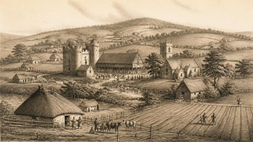
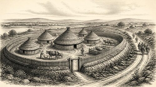
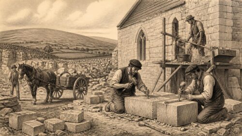


Kilmallock’s remarkably legible plan raises an intriguing question about how towns preserve identity through disruption. The article shows that walls, gates, churches and merchant properties were repeatedly repaired, repurposed and interpreted, while less durable homes and everyday lives remain harder to recover. This contrast suggests that conservation can privilege the visible achievements of civic and religious institutions over ordinary experience. The uncertain relocation of the early monastic focus likewise links landscape change to incomplete evidence. How might future archaeology and conservation present Kilmallock as both a fortified commercial centre and a lived community whose lost domestic spaces deserve greater attention?