Irish Floods
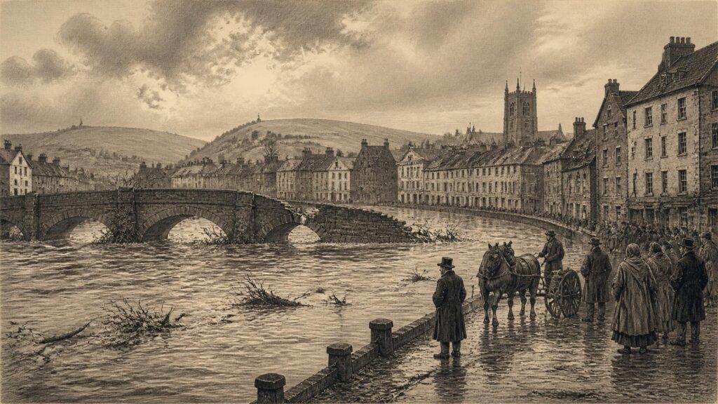
AI generated historical illustration, not a contemporary photograph.
At a Glance
Flooding has never been an exceptional visitor to Ireland. Rivers, estuaries, low-lying callows, karst plains and Atlantic-facing towns have long made water both a source of livelihood and a recurrent agent of disruption. What has changed is not merely the weather, but the density of settlement, the engineering of rivers, the value placed upon exposed property, and the scientific means by which risk is understood. Ireland’s flood history is therefore neither a simple tale of nature’s violence nor a straightforward prelude to climate change. It is a history of water meeting landscape, society and decision.
Island Waters
Ireland’s physical character has always encouraged local variety in flooding. The island receives weather systems from the Atlantic, while its western uplands, broad central lowlands, lakes, bogs and enclosed estuaries create markedly different hydrological worlds. A short, steep river can rise with alarming speed after concentrated rain. A great lowland river may spread slowly across meadows and roads after weeks of wet weather. In limestone country, water may appear not as an overflowing river but through springs, swallow holes and ground already saturated beneath people’s feet. On coasts, high tide and storm surge can prevent rivers from escaping to sea just when rainfall has swollen them.
These distinctions matter historically. A flood is not a single thing. It may be fluvial, when a river exceeds its banks; pluvial, when intense rain overwhelms streets, drains and soils; coastal, when sea water crosses defences or low ground; or groundwater flooding, when the water table rises to the surface. The categories sometimes converge. Cork, lying on the Lee estuary, has repeatedly experienced the difficult combination of river discharge, tide and wind-driven surge. The Shannon’s floodplains have a different rhythm: their seasonal inundation has been destructive when it reaches homes, roads or farmland at the wrong time, but it has also been an expected feature of the river landscape.
That older expectation should not be mistaken for indifference. Communities learned where water travelled, which bridges were vulnerable, which fields became impassable and which quays needed repair. Place-names and local memory often preserve this practical geography. Yet oral tradition is not the same as measured evidence. A remembered “great flood” may accurately convey fear and disruption while offering uncertain information about its height, date or geographical extent. The historical task is to value such memory without allowing it to become a substitute for documentary proof.
The modern language of risk can obscure this older intimacy with water. Risk is often presented as an equation of hazard, exposure and vulnerability. In simpler historical terms, severe rain or tide became a disaster when people, animals, buildings, bridges, roads and crops stood in its path, and when recovery was difficult. The same quantity of water could enrich floodplain grass, interrupt a market town, carry away a bridge, contaminate a water supply or leave little visible trace. Flood history is therefore also social history.
Early Testimony
The written record for early Ireland is uneven. Medieval annals and later local chronicles preserve notices of storms, inundations, drowning, ruined bridges and exceptionally wet seasons, but they were not hydrological registers. Their authors did not measure discharge, calculate return periods or survey inundation with modern instruments. They selected events that appeared providential, politically significant, socially disruptive or morally meaningful. The evidence is valuable, but it must be read with restraint.
The Environmental Protection Agency’s study of extreme weather and natural disasters drew upon the Gaelic annals, alongside proxy and observational material, to examine climatic extremes from the fifth to the seventeenth centuries. Such work is important because it treats the annals neither as folklore nor as infallible data. Repeated accounts of severe weather can indicate episodes of stress; they can also reveal what contemporaries considered extraordinary. But silence does not prove calm weather, and a dramatic description cannot by itself establish an island-wide event.
Records associated with Cork illustrate both the promise and the limitation of historical testimony. A local chronology identifies an inundation in April 1510 that reportedly overturned trees, houses and bridges. Later entries describe severe flooding in the Lee valley and a major Cork inundation in 1727. These accounts suggest a city accustomed to watery disruption long before systematic meteorological observation. They cannot, however, tell us with the precision now expected whether rain fell over the whole catchment, whether a tide compounded the flood, or how far water reached through every street.
What can be said securely is that early and early-modern Irish communities encountered climatic volatility. Wet summers could damage crops and communications; hard winters could freeze rivers; prolonged rainfall could weaken slopes, fill channels and render routes impassable. Floods formed part of that volatile pattern. It would be wrong to assign individual medieval floods to modern human-caused warming. The documentary evidence does not permit that conclusion, and the climate system has always produced severe wet periods. Their historical significance lies elsewhere: they show that Irish society was never outside the reach of hydrological extremes.
Folklore belongs beside, rather than inside, the documentary record. Stories of drowned valleys, submerged settlements, saints controlling waters or lakes that appeared after transgression occur in Irish tradition. Such narratives may preserve memories of landscape change or local hazard, but they are not literal flood chronologies. Their importance is cultural. They show how water was imagined: sometimes as boundary, punishment, mystery or latent power. A historical article must distinguish that imaginative inheritance from records capable of demonstrating a particular event.
Urban Exposure
As Irish towns expanded, flood damage acquired new forms. Streets, warehouses, mills, bridges, drainage systems and densely occupied housing concentrated value in places often chosen precisely because they stood beside navigable water. Quays and river crossings promoted trade, but they also narrowed channels, constrained floodplains and placed costly infrastructure close to danger. Urban flooding was therefore not simply imposed upon towns from outside. Towns developed through continuing bargains with rivers and tides.
Cork provides the clearest long-term case. A scholarly chronology compiled by John G. Tyrrell and Kieran R. Hickey records 292 reported floods in the city between 1841 and 1988. The number must not be read as a complete count of every inundation, for reporting practices, newspaper coverage and urban growth all changed during those years. Nevertheless, the study demonstrates remarkable persistence. Its classification of flood types shows that excessive rainfall was the principal cause, while high tides, particularly when accompanied by storm surges, had considerable significance. Cork’s flood history was consequently neither solely riverine nor solely coastal.
The floods of November 1853 remain vivid because they damaged the city severely and destroyed the first Saint Patrick’s Bridge. The event was represented in contemporary illustration and later preserved in library collections. Its force was practical as well as symbolic: a bridge was not merely masonry but a route for commerce, labour, social connection and civic authority. When flood water destroyed it, the event exposed the fragility of a growing Victorian city’s infrastructure.
Saint Patrick’s Bridge had already suffered from water. A flood swept away a partially completed earlier bridge in January 1789. The replacement opened later that year, only to be destroyed in 1853. Such episodes complicate the comforting idea that older communities lacked awareness of danger. Cork Corporation and its engineers knew the river could be destructive. But knowledge of risk does not abolish the economic and geographical reasons for building at a crossing point. Each rebuilding was a decision to persist with the city’s relation to the Lee.
Kilkenny offers another instructive example. Local historical material records destructive Nore floods affecting bridges in 1487 and 1584, while an October 1763 flood was remembered as especially severe. Again, the evidence is local and should not be treated as a national climatic index. It does demonstrate, however, that recurring flood vulnerability was embedded in the history of inland towns as well as estuarine cities. Bridges were particularly revealing markers because their destruction was conspicuous, expensive and likely to enter the record.
Urbanisation also altered the meaning of rain. Water that might once have dispersed over fields increasingly met roofs, paving, culverts and drains. This did not create every flood, but it could accelerate runoff and raise the consequences of intense rainfall. Later twentieth-century and twenty-first-century flood studies repeatedly returned to this problem: a catchment is never merely a natural basin. It is a landscape altered by roads, housing, embankments, channels, reservoirs, drainage and land management.
Engineered Rivers
Nineteenth-century governments and landowners responded to wet ground principally through drainage, navigation works and river improvement. The objectives were often agricultural and economic rather than the comprehensive protection of towns. The state’s later mapping records show drainage districts established under a succession of nineteenth- and early twentieth-century measures. Their purpose was to improve land and, in many instances, mitigate flooding. They also transformed channels and floodplain relationships that had developed over centuries.
This history matters because drainage has never been a neutral technical act. Deepening or widening a channel may move water more rapidly through one reach, reduce waterlogging in particular lands and lessen the duration of local inundation. It can also change habitats, sediment movement and the timing of flows elsewhere. A scheme designed around agricultural productivity was not necessarily designed for the needs of later suburban development, biodiversity conservation or climate adaptation. The language of “reclaiming” land reflected the priorities of its time; it did not mean that floodplains had ceased to be floodplains.
The Arterial Drainage Act of 1945 gave this approach a new national scale. The Office of Public Works subsequently carried out major schemes across numerous catchments, including the Brosna, Feale, Corrib, Moy, Boyne, Maigue and Shannon systems. Official listings show works extending from the late 1940s into the early 1990s and covering hundreds of thousands of acres of benefitting land. The programme belongs to the history of post-war rural development: it sought to improve the productive capacity of land, reduce waterlogging and curtail the incidence or duration of flooding in affected areas.
It is tempting to describe this era as a failed attempt to conquer nature. That would be too simple. Drainage schemes delivered real local benefits and responded to genuine agricultural constraints. Yet official assessments have also been explicit that arterial drainage cannot eliminate flood risk. A river system has limits. When rain is prolonged, soils are saturated, lakes are high, tributaries are full or tides impede outflow, larger volumes must go somewhere. Embankments and enlarged channels can alter where that somewhere is; they cannot promise permanent immunity.
The Shannon basin makes the point vividly. Its scale, lakes and extensive callows create a slow-moving flood regime unlike the rapid urban rises of smaller rivers. Floodplain storage has long been part of the system. Efforts to reduce flooding have involved drainage, maintenance, regulation, local defences and continuing political debate. Historical conflict often arose because what protected one interest could shift costs to another: farmers sought drier ground, towns sought defended streets, navigation required particular water levels, and wetland habitats depended upon periodic inundation.
By the late twentieth century, flood management was beginning to move beyond the older expectation that channel engineering alone could solve the problem. The change was gradual, and it did not mean abandoning structural defences. Rather, it introduced a more difficult proposition: living with water requires a combination of warning, planning, property-level protection, catchment management, carefully designed defences and acceptance that residual risk remains.
Measured Evidence
Modern flood history has the advantage of gauges, rainfall records, aerial photography, hydraulic modelling, insurance data and mapped flood extents. These sources permit comparisons unavailable to annalists or nineteenth-century newspaper readers. They also create their own cautions. Records may be short relative to rare extremes; stations are unevenly distributed; measurement methods evolve; and economic losses rise as populations and property values rise. A costly modern flood is not automatically meteorologically greater than an older one.
That is why event attribution requires care. Rainfall, river flow and damage are related but not identical. Heavy rainfall may not produce exceptional river flooding if soils and reservoirs have storage capacity. Conversely, a modest additional rainfall event can produce serious inundation after a very wet month has saturated the ground. Coastal flood risk similarly depends upon the interaction of sea level, storm surge, wind, wave action, tide and local defences. An event may therefore have several causes, natural and human, operating at different scales.
The Irish experience of November 2009 demonstrates this complexity. Exceptionally heavy and prolonged rainfall caused widespread flooding, and Cork’s Lee catchment became a focus of national attention. At the city level, the event involved not only rainfall but reservoir operation, river conditions, vulnerable infrastructure and an urban landscape long shaped by development. University College Cork’s account of the disaster recorded extensive campus flooding and the disruption of essential services. Research on the event has likewise stressed the challenge of separating the contribution of greenhouse-gas-driven climatic change from land-use change and the management of a modified catchment.
This is not evasiveness. It is the proper discipline of flood science. A responsible account may say that climate change can influence the likelihood or intensity of heavy rainfall while also recognising that the damaging flood outcome depends on exposure, infrastructure and local hydrology. It should not claim that every Irish flood has a single modern cause. Historical experience offers a warning against such simplicity: severe floods occurred before industrial warming, while contemporary exposure makes severe events more consequential.
The official national record also demonstrates the variety of damaging events. The Office of Public Works lists major episodes including the March 1947 Nore floods, record Shannon levels in 1954, extensive Slaney flooding in 1965, and many more recent river, coastal and surface-water events. This chronology is not a complete history of all Irish flooding. It is a managed record of notable events, and its real value lies in showing continuity across regions and flood mechanisms.
The difference between recurrence and trend is crucial. A sequence of severe events can make a changing climate plausible, but it does not by itself prove a long-term trend. Conversely, the absence of recent disaster in a particular town does not prove that risk has disappeared. Historical research is strongest when it joins long records, local knowledge, physical evidence and transparent uncertainty rather than searching for a single dramatic event that will settle every question.
Changing Climate
The scientific evidence now available for Ireland establishes a different context from that of the older flood record. The Environmental Protection Agency’s State of the Environment report identifies observed warming, altered precipitation patterns, sea-level rise and changing extremes. It reports that heavy rainfall events have become more intense over the last three decades when compared with the preceding three decades. Met Éireann material likewise indicates that the country has become wetter in the more recent climatological baseline than in the earlier one, with especially marked increases in western areas.
These findings do not mean that all places will experience the same future. Climate projections contain uncertainty, particularly in the precise regional expression of rainfall. The broad direction is nonetheless serious: Ireland is expected to face heavier precipitation events alongside longer dry periods, while rising sea level increases the baseline upon which tides and surges act. In flood terms, that combination means that the nation must prepare for apparently contradictory water problems—too much at times, too little at others.
Sea-level rise deserves particular historical attention. Irish towns have long faced storm tides, but a higher mean sea level changes the starting point of coastal risk. A tide or surge that once fell short of a quay, road or drainage outfall may become more damaging without any change in the storm itself. Coastal flooding, erosion and river flooding near estuaries can therefore become increasingly entangled. The danger is not confined to spectacular waves; it also concerns the quiet loss of drainage capacity and the more frequent crossing of familiar thresholds.
The National Climate Change Risk Assessment, published by the EPA in 2025, places flooding within a much larger web of risk. It identifies climate threats to buildings, transport, communications, energy, water, health, food production and ecosystems. Its significance lies partly in this systems view. A flood can close a road, interrupt electricity, damage a school, contaminate a water source, isolate vulnerable residents and prevent emergency workers from reaching those in need. The historical image of a flooded street captures only one part of the event.
Current assessment also recognises groundwater flooding, particularly in karst limestone landscapes in the western lowlands. Here conventional images of rivers overtopping their banks are inadequate. Water may rise through the ground after long periods of recharge and remain for weeks. The available national evidence is less developed for projecting future groundwater flood extent than for some other hazards. That uncertainty should be stated plainly. Absence of a precise projection is not absence of risk; it is a reason for better observation and cautious planning.
Climate change therefore intensifies an old Irish question rather than replacing it. How should people inhabit a wet island whose waters are useful, necessary and periodically destructive? The answer cannot be to treat the past as irrelevant. Historic floods show where water has travelled before, reveal the endurance of local exposure and test claims that a place has always been safe. But the past is not a complete design standard for the future, because the climate, sea level, urban fabric and social consequences are changing.
Public Choices
The history of flood risk is ultimately a history of public choices. Settlement on floodplains, building behind embankments, paving urban catchments, straightening channels, maintaining drains, preserving wetlands and locating critical infrastructure are decisions made over generations. Some were reasonable in their own circumstances. Some created benefits while passing risks onward. Many were made when neither detailed flood mapping nor modern climate science was available.
Modern Irish flood policy has increasingly embraced risk management rather than a promise of absolute control. That language is more honest, though less comforting. It accepts that defences are necessary in many communities, but that planning decisions must avoid adding exposure where possible. It values flood forecasting and warning, yet recognises that warnings cannot compensate for homes, hospitals or transport links placed in highly vulnerable locations. It also restores attention to catchments, wetlands and natural storage, not as romantic alternatives to engineering but as parts of a wider system.
There is a historical lesson in the old floodplain. For centuries it was often treated as marginal land: wet in winter, rich in summer, useful for grazing yet unsuitable for certain forms of permanent occupation. When modern development converts it into valuable housing or infrastructure, the water does not forget the route. The consequence is not fate—good design and protection can reduce harm—but it is a warning against pretending that the landscape has been permanently remade.
Justice must also be central. Flood impacts are not evenly distributed. Those with savings, insurance, alternative accommodation, flexible work and political influence can recover more readily than those without them. Elderly people, tenants, small businesses, rural households, people with disabilities and communities dependent on a single road or utility may face disproportionate consequences. Older historical accounts often preserve the drama of collapsed bridges and damaged public works; future histories should record who bore the long aftermath.
Irish flood history should therefore encourage neither fatalism nor overconfidence. It shows that severe inundation is deeply rooted in the island’s environmental past. It also shows that society repeatedly adapts: by rebuilding bridges, revising drainage, mapping danger, improving warnings and reconsidering where and how to build. Climate change makes that work more urgent, while historical evidence supplies humility. Water has always shaped Ireland. The task now is to shape public choices so that its inevitable presence does less harm.

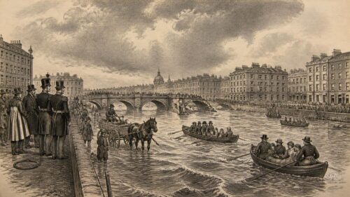
The article’s distinction between recurring historical floods and a changing future is especially significant. Medieval annals, local memory and bridge failures reveal longstanding vulnerability, yet they cannot predict risks shaped by denser settlement, altered catchments, reservoir management, heavier rainfall and sea-level rise. Cork’s experience, where river discharge, tides and urban infrastructure interact, illustrates why neither climate nor engineering alone explains disaster. The Shannon shows that floodplain water can be both damaging and ecologically expected. How should Ireland combine historical knowledge of water behaviour with climate projections when deciding whether to defend, adapt, relocate, or restore floodplain space in vulnerable communities?