Derryvree’s Intertill Reedland31475 BCE
31,475 BCE is a modern label for an unrecorded MIS 3 interval, when Ireland experienced fluctuating cold conditions before the Last Glacial Maximum. Derryvree, County Fermanagh, preserves freshwater sediments between tills, indicating treeless, waterlogged tundra supporting mosses, sedges, aquatic plants and insects. Castlepook Cave, County Cork, contains MIS 3 fauna including reindeer, mammoth, giant deer and predators, demonstrating connections with north-west Europe despite uncertain routes. A marked reindeer bone may indicate human butchery, but its context is disputed and proves neither settlement nor society. Later glaciation transformed landscapes and destroyed evidence, leaving a fragmentary record of wetlands, animals and visitors.
Dateline
31,475 BCE is a modern chronological label, not a date that could have been recognised or recorded in prehistoric Ireland. There was no Irish calendar, writing system or named polity from which a year-specific event might be recovered. On the modern BCE/BP convention, the label lies about 33,424 calendar years before AD 1950, the reference point used for radiocarbon dating; but that arithmetic conversion does not turn it into an archaeological anniversary. At this depth of time, evidence is dated in radiocarbon determinations, calibrated ranges and broad climatic phases. Ireland’s history at this point is therefore a history of ice, water, plants, animals and—perhaps—rare human visits, rather than kings, wars or institutions.
A Changing Ice-Age Island
The appropriate setting is the later part of the Last Glacial period, conventionally placed within Marine Isotope Stage 3 (MIS 3). This was not one uniform age of permanent cold. Climate in the North Atlantic region shifted repeatedly between colder stadials and relatively milder interstadials, with consequences for vegetation, animal movement, sea level and the growth of ice. Ireland was on Europe’s far north-western edge: a place whose accessible land, coasts and links to neighbouring Britain changed as ice expanded and contracted. The great British–Irish Ice Sheet had not yet reached its later maximum extent. Reconstructions generally place the principal build-up of the final ice sheet after roughly 35,000–32,000 years ago, with maximum conditions much later, around 27,000–21,000 years ago.
That chronology matters because it rules out two misleading images. Ireland was neither a familiar green island nor simply a single, featureless sheet of ice in 31,475 BCE. Some ground was capable of supporting terrestrial and freshwater ecosystems, although the extent and continuity of ice-free country remain debated and altered through time. The landscape was exposed, seasonally severe and vulnerable to permafrost, wind action and sudden changes in drainage. In many places, later glaciers eroded, buried or rearranged earlier deposits. The absence of surviving traces in a district consequently cannot prove that it was empty of life; it may instead show the destructive power of later ice.
Water Beneath the Drumlin
The most illuminating Irish evidence for a broadly comparable interval comes from Derryvree, near Maguiresbridge in County Fermanagh. Roadworks in 1969 cut through a drumlin and exposed silts and fine sands lying between two substantial till sheets: sediment left by one glacial episode, then a freshwater interval, then renewed glaciation. The intervening deposit preserved organic material, plant remains, insects and other biological evidence. Its radiocarbon determination, BIRM-166, was reported as 30,500 radiocarbon years BP, with a large uncertainty of +1,170/−1,030 years. Such a legacy determination must not be treated as an exact match for 31,475 BCE; modern calibration produces a broad calendar-age probability range rather than a single year.
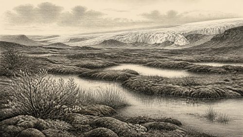
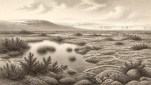
Even so, Derryvree offers an unusually vivid environmental window. Its plant remains point to open tundra or muskeg: wet, peaty ground with pools and slow water, surrounded by mosses, sedges, grasses, dwarf shrubs and cold-tolerant herbs rather than woodland. Finds included aquatic and wetland plants such as bogbean and water-milfoil, while the moss flora and insect assemblages indicate ground that was waterlogged in places but subject to a harsh, periglacial climate. This was not a bare polar desert. It was a low, treeless wetland landscape, productive in a limited seasonal way and structured by water, frost and short growing seasons.
Derryvree also provides a lesson in scale. It is a local deposit, not a map of the whole island. Fermanagh’s enclosed basins, watercourses and drumlin terrain cannot simply be projected onto north Cork, the western seaboard or upland Ireland. Yet the site demonstrates that, before later ice sealed the sequence, at least part of Ireland contained liquid freshwater, vegetation and insect life. The sediments register regional environmental change more securely than they reveal human activity. They tell us what a small portion of the island could sustain, not who lived there or how people, if present, organised themselves.
Castlepook and the Animal World
For the animal world, Castlepook Cave—also called Mammoth Cave—near Doneraile in north County Cork is central. Excavated principally in the early twentieth century, it yielded a rich but complicated cave fauna. Reindeer were especially numerous, and the wider assemblage included remains attributed to woolly mammoth, giant deer, brown bear, wolf, spotted hyaena, Arctic fox, mountain hare and lemmings. These animals do not all necessarily belong to one moment or one ecological community: cave deposits accumulated over long periods, and carnivores could transport bones from the surrounding landscape into their dens. Nevertheless, direct re-dating has confirmed that important parts of the southern Irish fauna belong to MIS 3, well before the Last Glacial Maximum.
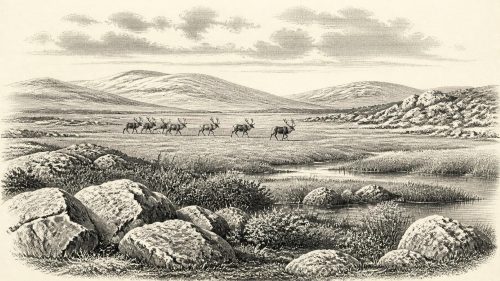
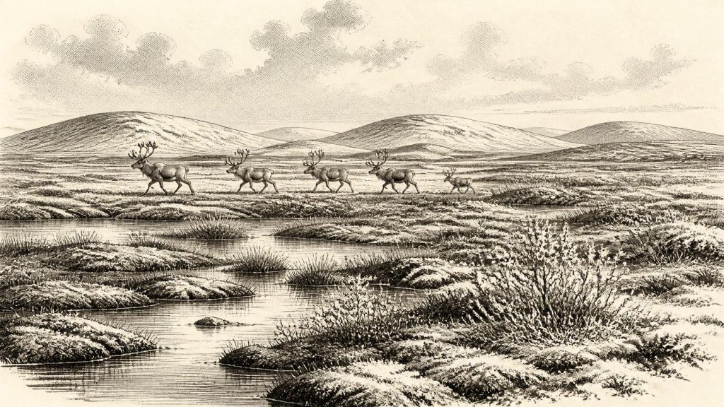
The evidence supports a picture of open country able to sustain grazing and browsing herbivores, with large predators and scavengers moving through it. Reindeer are especially compatible with cold, open habitats and seasonal mobility. Mammoth and giant deer suggest a broader mosaic of grassland, herb-rich ground, wet places and sheltered feeding areas, though their presence does not mean that every part of Ireland was occupied by the same fauna at once. Hyaenas are important because they were active agents in the formation of cave assemblages: a bone in a cave may record a scavenger’s meal rather than the place where an animal died. Castlepook is therefore an archive of ecological connections and animal behaviour, not a straightforward kill-site or settlement.
Animals plainly reached Ireland during suitable phases, but the route is less certain than older popular accounts suggest. Lower sea levels exposed more continental shelf than today, while ice, shallow seas and changing shorelines shaped possible crossings between Ireland, Britain and mainland Europe. A continuous, dry land bridge should not be casually assumed. For particular species and particular moments, movement may have involved exposed terrain, ice connections, short water gaps or combinations of these. The key historical point is that Ireland was not biologically isolated in the modern sense: its Pleistocene fauna shows repeated connection with the wider north-west European world.
The Unsettled Human Question
One Castlepook reindeer femur has made this period exceptionally significant for Irish prehistory. It has been reported as approximately 33,000 years old and bears a deep mark interpreted by zooarchaeologist Ruth Carden as stone-tool damage made during butchery. If that interpretation is upheld, it may represent evidence that Upper Palaeolithic people processed a reindeer in Ireland during a broadly comparable MIS 3 interval. It would be an important sign of human activity far earlier than the island’s securely demonstrated terminal-Pleistocene evidence. But it cannot responsibly be converted into a claim of settled occupation in 31,475 BCE.
The caution is substantial. The femur came from an old cave collection rather than a modern excavation of an intact living floor; the radiocarbon result dates the animal’s death, not automatically the making of the mark; and the cave contains material accumulated by natural processes and carnivores over a long span. No securely associated stone-tool assemblage, hearth, house structure, burial, artwork or occupation surface has yet identified a resident Upper Palaeolithic community in Ireland at this time. Recent work at Irish caves has underlined how strongly antiquarian digging, water movement and re-deposition can complicate the original context of bones.
Consequently, there is no evidential basis for describing Irish political affairs, diplomacy, warfare, named peoples, languages, religious practice, learning or trade institutions in this notional year. Terms such as Gaelic, Celtic and Irish belong to vastly later cultural and historical contexts and must not be projected backwards. If people did reach the island, the most defensible interpretation is of a small, mobile party operating within the wider Upper Palaeolithic world of north-western Europe—perhaps exploiting an animal carcass, perhaps travelling through an accessible cold landscape. That is a possibility grounded in one contested object, not a recovered social system.
Life Without a Recorded Society
Economy, in the narrow sense appropriate to the evidence, was ecological. Herbivores converted sparse seasonal vegetation into meat, hides, bone and antler; carnivores and scavengers competed for carcasses; wetlands offered water and plant growth during the brief productive season. Were humans present, reindeer would have been a valuable resource, but no Irish find of this age securely shows how meat was shared, hides worked, tools made or camps supplied. There is likewise no evidence for farming, domesticated animals, pottery, metalworking or long-distance exchange networks. Those developments belong many millennia in Ireland’s future.
The most important development around 31,475 BCE was therefore not an event but a precarious environmental interval. Derryvree’s freshwater sediments preserve a cold wetland between episodes of glaciation. Castlepook’s bones reveal an island visited or inhabited by a striking Ice-Age fauna and raise, without yet conclusively settling, the possibility of human presence. Subsequent ice growth would transform and often erase these landscapes. The surviving record is fragmentary, but it is enough to replace the old image of an utterly lifeless Ireland with a more compelling one: a changing western margin of Europe where tundra water, grazing herds and advancing ice set the terms of existence.
Primary Sources
- A Middle Midlandian Freshwater Series at Derryvree, Maguiresbridge, County Fermanagh, Northern Ireland
- A Reconsideration of the Radiocarbon Dating of the Marine Isotope Stage 3 Fauna from Southern Ireland
- The Irish Quaternary Fauna Project
- The Exploration of Castlepook Cave, Co. Cork. With 3 Plates.
- Occurrence of Mammalia Relicts at Site Castlepook Cave
- New Insights on the Fauna of Ireland's Younger Dryas and Early Holocene from Alice & Gwendoline Cave
- The IntCal20 Northern Hemisphere Radiocarbon Age Calibration Curve (0–55 cal kBP)
- Extent and Timing of the Last Glacial Maximum (LGM) in Britain and Ireland: A Review
- Growth and Retreat of the Last British–Irish Ice Sheet, 31,000 to 15,000 Years Ago: the BRITICE-CHRONO Reconstruction
- Stratigraphic and Palaeo-Geomorphological Evidence for the Glacial-Deglacial History of the Last British-Irish Ice Sheet in the North-Western Irish Sea
- The Timing and Magnitude of the British–Irish Ice Sheet Between Marine Isotope Stages 5d and 2
- Exploring Controls of the Early and Stepped Deglaciation of the Western Sector of the British–Irish Ice Sheet
- Early Deglaciation of the British-Irish Ice Sheet on the Atlantic Margin
- Trimlines, Blockfields and the Vertical Extent of the Last Ice Sheet in Southern Ireland
- Could Brown Bears (Ursus arctos) Have Survived in Ireland During the Last Glacial Maximum?
- Stoats (Mustela erminea) Provide Evidence of Natural Overland Colonization of Ireland
- Anthropogenic Changes to the Holocene Nitrogen Cycle in Ireland
- Figure 6.—The Subdivision of the Quaternary Period in Ireland
- 32564: Castlepook Cave, County Cork
- Heritage Artefacts of County Cork