

Bogbean Between the Drumlins31236 BCE
31,236 BCE is a label for broad Late Pleistocene MIS 3 horizon, not a recorded Irish year. Derryvree, County Fermanagh, preserves freshwater sands, silts and organic beds between tills, proving a non-glacial interval before renewed ice-sheet growth. Its bogbean, dwarf willow, mountain-avens, pollen and insects indicate treeless, cold, wet, ecologically varied tundra. Southern caves, especially Castlepook, contain MIS 3 remains of reindeer, mammoth and other cold-adapted fauna, demonstrating intermittent connectivity with north-west Europe. A cut-marked reindeer femur may indicate brief human activity, but cannot prove settlement. No evidence supports polities, continuous population or cultural ancestry; environmental change defines this period.
Dateline
31,236 BCE is a modern chronological label, not a date that can be matched to a recorded Irish event. No people in Ireland counted years in this fashion, and neither archaeology nor Quaternary science can identify a particular hunt, journey or season at such depth in time. In radiocarbon convention, the label falls roughly 33,185 years before AD 1950. That places it within the Late Pleistocene, in Marine Isotope Stage 3 (MIS 3), a highly variable part of the last Ice Age. The responsible subject is therefore an environmental and archaeological horizon, not an annual chronicle.
The evidence closest to this notional year is fragmentary but valuable. It comes chiefly from sediments exposed at Derryvree near Maguiresbridge in County Fermanagh, from animal remains preserved in southern limestone caves, and from wider reconstructions of the British–Irish Ice Sheet. Together they show that parts of Ireland experienced cold, open and locally waterlogged conditions before the fullest expansion of the last ice sheet. They do not supply evidence for a state, a tribe, named leaders, settlements or a continuous resident population.
A Date Within Broad Ranges
The key difficulty is chronological precision. Organic material from Derryvree produced the legacy radiocarbon determination BIRM-166, conventionally reported as 30,500 ± 1,100 radiocarbon years BP. A radiocarbon age is not itself a calendar age: atmospheric carbon-14 has fluctuated, so measurements must be calibrated against independently dated records. At more than 30,000 years ago, the calibration curve and the sizeable error on the original assay yield a broad probability range, not a single date. One published calibration places the Derryvree material broadly between about 36,900 and 31,700 calibrated years BP, or approximately 34,950–29,750 BCE.
That range overlaps the general horizon represented by 31,236 BCE, but it does not mean that the Derryvree pool existed in that exact year. Nor does it turn the numbered year into a historical anniversary. It permits a narrower and more useful conclusion: Derryvree provides direct evidence for an Irish cold-stage freshwater environment during the later part of MIS 3. The sequence is especially important because later glacial erosion destroyed or disturbed much of the island’s older landscape record.
Freshwater Under Future Ice
Roadworks in 1969 cut through a drumlin at Derryvree and revealed a striking sequence. Fine sands, freshwater silts and organic sediments lay trapped between two layers of till, the unsorted mixture of clay, stones and debris laid down by glacier ice. The order of deposition establishes an essential point. Ice crossed the locality before the organic beds formed; later, a non-glacial interval allowed water, sediment, plants and small animal remains to accumulate; then another ice advance sealed the deposit beneath fresh till.
This is evidence for change rather than for a uniformly frozen island. Derryvree cannot serve as a weather station for every Irish region, and the ice histories of uplands, lowlands, coasts and the continental shelf need not have been identical. Yet the freshwater deposits rule out the simplest picture of Ireland as continuously buried beneath ice throughout the last Ice Age. Around the broad period in question, at least one Fermanagh basin supported standing or slow-moving water and vegetation before it was incorporated into the longer story of renewed glaciation.
The subsequent Last Glacial Maximum came later. Modern reconstructions of the British–Irish Ice Sheet indicate substantial growth from roughly 31,000 to 26,000 years ago, with maximum ice volume around 23,000 years ago; particular Irish sectors reached shelf-edge positions at different times. Thus 31,236 BCE belongs near the onset of a major phase of ice-sheet expansion, not securely within the island-wide maximum. It was a world in motion, where local ice margins, frozen ground, meltwater and changing drainage could alter the usable landscape over long human timescales.
Tundra, Wet Ground and Short Summers
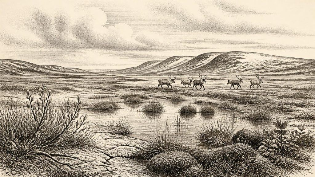
Plant macrofossils, pollen and insect evidence from Derryvree describe a largely treeless, periglacial landscape. The old term muskeg, used in the original discussion, conveys the likely character of parts of the site: wet, peaty, moss-rich ground, with sedges and shallow pools. Fossils include plants associated with cold environments, among them bogbean, dwarf willow and mountain-avens. These are not decorative details. They demonstrate that hardy vegetation could occupy sheltered, wet or seasonally thawed places even in a severe climatic regime.
The wider ground was probably open rather than forested. Grasses, sedges, herbs, mosses and low shrubs would have made a patchwork determined by drainage, soil, exposure and snow cover. Long winters, frost action and short growing seasons limited tree growth. It would be wrong, however, to imagine a featureless white desert. The Derryvree evidence instead suggests ecological variation: open water, saturated margins, vegetated patches and mineral ground, all within a cold landscape. The exact annual temperatures, snowfall and seasonal calendar cannot be recovered for 31,236 BCE.
MIS 3 was climatically unstable across the North Atlantic world. Greenland ice cores register repeated abrupt shifts between colder stadials and relatively milder interstadials. Irish deposits do not possess the annual resolution needed to match Derryvree confidently to one of those individual shifts. They do show why a static reconstruction is misleading. A landscape that could support freshwater plants and insects during one interval might later be overridden by ice or reshaped by permafrost and meltwater.
Animals on the Western Margin
Southern Irish caves provide the principal evidence for larger animals in this deeper past, especially Castlepook Cave near Doneraile in north County Cork, once known as Mammoth Cave. Collections from the cave include remains assigned to reindeer, woolly mammoth, giant deer, brown bear, wolf, Arctic fox, mountain hare, lemmings and spotted hyaena. Re-dating has confirmed that important elements of the Castlepook fauna belong to MIS 3, well before the Last Glacial Maximum.
These bones establish that Ireland was accessible to a changing range of mammals during parts of the period. Reindeer in particular fit an open, cold-country environment in which grazing and browsing were available. Carnivores and scavengers show that carcasses and caves belonged to complex food webs rather than to an untouched wilderness. But the assemblage must not be read as a single photograph of one day. Cave deposits can mix material accumulated over millennia, while water, animal activity and early excavation have disturbed their original contexts. Not every listed species necessarily met at Castlepook, much less in 31,236 BCE.
Nor should the presence of mammoths or hyaenas be used to claim a simple land bridge, a fixed migration corridor or a known coastline. Sea level was lower than today and the geography of the Irish Sea region was profoundly different, but routes changed with ice, sea, rivers and terrain. Faunal evidence supports connectivity with the wider north-west European world; it cannot map a precise route across landscapes now submerged or altered.
The Human Question
The most provocative evidence is a reindeer femur from Castlepook carrying a deep mark interpreted by zooarchaeologist Ruth Carden as a stone-tool cut made during carcass processing. Public reporting and County Cork heritage material associate the specimen with an age of about 33,000 years. If the mark is genuinely anthropogenic and contemporary with the bone, it would indicate that one or more Upper Palaeolithic people handled a reindeer in Ireland during MIS 3.
That possibility matters, but it remains far short of proof of settlement. The bone derives from an old cave collection rather than a securely excavated occupation floor. No associated hearth, lithic assemblage, dwelling, burial, food store or concentrated butchery area of comparable age has yet demonstrated an established community at Castlepook. Modern excavation has sought undisturbed deposits precisely because the older collection cannot answer all these questions. The National Museum of Ireland’s long-standing caution that clear Palaeolithic occupation has not yet been demonstrated remains an important counterweight to dramatic claims.
The safest distinction is between evidence and interpretation. A dated reindeer bone is evidence for a reindeer. A surface incision judged consistent with stone-tool use is evidence requiring specialist taphonomic assessment. From it, scholars may reasonably propose a brief human encounter with an animal, but cannot establish the size, language, ancestry, duration or fate of any visiting group. It certainly cannot demonstrate an unbroken human population leading to later Irish communities.
No Polities, No Recorded Beliefs
There is no evidence from Ireland around this horizon for political institutions, diplomacy, warfare, territorial lordship, formal trade networks, religious monuments, writing or named cultural groups. It would be misleading to populate this date with chieftains, clans or “Celtic” ancestors. Those categories belong to vastly later periods. Even the existence of people on the island at this moment remains possible rather than securely established.
If small Upper Palaeolithic parties did reach Ireland, comparison with better-documented groups elsewhere in Europe suggests mobile foraging rather than villages or farming. Such an inference should remain external context, not a description of a proven Irish society. Elsewhere, people made sophisticated stone and organic tools, wore tailored clothing, maintained long-distance social ties and sometimes created ornaments and art. Ireland has not yielded an assemblage of this date that allows those practices to be claimed locally.
What can responsibly be said is both more modest and more remarkable. At the western edge of Ice Age Europe, freshwater life persisted between episodes of glaciation; tundra plants rooted in wet ground; cold-adapted animals ranged across open country; and one cave collection raises the unresolved possibility of human presence. The chief historical development around 31,236 BCE was not political change but environmental instability. Derryvree’s bogbean and the sediments enclosing it preserve that deep history: life briefly recorded between the movements of ice.
Primary Sources
- A Middle Midlandian Freshwater Series at Derryvree, Maguiresbridge, County Fermanagh, Northern Ireland
- The Irish Quaternary Fauna Project
- A Reconsideration of the Radiocarbon Dating of the Marine Isotope Stage 3 Fauna from Southern Ireland
- Growth and Retreat of the Last British–Irish Ice Sheet, 31,000 to 15,000 Years Ago: The BRITICE-CHRONO Reconstruction
- New Data for the Last Glacial Maximum in Great Britain and Ireland
- Pattern and Timing of Retreat of the Last British-Irish Ice Sheet
- Stratigraphic and Palaeo-Geomorphological Evidence for the Glacial-Deglacial History of the Last British-Irish Ice Sheet in the North-Western Irish Sea
- Exploring Controls of the Early and Stepped Deglaciation on the Western Margin of the British Irish Ice Sheet
- Early Deglaciation of the British-Irish Ice Sheet on the Atlantic Shelf Northwest of Ireland Driven by Glacioisostatic Depression and High Relative Sea Level
- Trimlines, Blockfields and the Vertical Extent of the Last Ice Sheet in Southern Ireland
- Extent and Deglacial Chronology of the Last British–Irish Ice Sheet: Implications of Exposure Dating Using Cosmogenic Isotopes
- Quaternary Deposits and Glacial Stratigraphy in Ireland
- Figure 6.— The Subdivision of the Quaternary Period in Ireland
- Fermanagh’s Ice Age Landscapes
- Menyanthes trifoliata
- Salix herbacea
- Dryas octopetala
- The IntCal20 Northern Hemisphere Radiocarbon Age Calibration Curve (0–55 cal kBP)
- IntCal Publications
- Dansgaard–Oeschger Events in Climate Models: Review and Baseline Marine Isotope Stage 3 Protocol
- Archaeology Research Excavation Grant 2022: Castlepook Cave Final Report
- 2022:564 – Castlepook Cave, Castlepook South, Cork
- Prehistoric Details: Mell Flint Flake
- Archaeological Heritage of County Cork
- Heritage Artefacts of County Cork
- The Archaeology of Caves in Ireland
- First Evidence of a Late Upper Palaeolithic Human Presence in Ireland
- New Insights on the Fauna of Ireland’s Younger Dryas and Early Holocene from Alice & Gwendoline Cave