

Maguirebridge’s Ice-Free Waters31257 BCE
At 31,257 BCE, Ireland was experiencing an unstable Late Pleistocene climate before the Last Glacial Maximum, rather than a recoverable historical year. Freshwater sediments at Derryvree, County Fermanagh, dated broadly to this period, show a locally ice-free, treeless tundra wetland later overridden by ice. Castlepook Cave, County Cork, preserves evidence of a diverse cold-adapted fauna, including mammoth, reindeer, giant deer, predators and small mammals, accumulated over time. A cut-marked reindeer bone may indicate brief human activity, but no settlement evidence exists. Growing ice sheets subsequently reshaped landscapes, obscuring earlier remains and leaving deep-time history necessarily uncertain in Ireland’s geological record.
Dateline
31,257 BCE is a modern chronological label, not a recoverable Irish calendar year. It corresponds to approximately 33,206 years before the conventional radiocarbon baseline of AD 1950. No written record, annual chronology, named community or dated event allows historians to describe a particular season—or even a particular generation—on the island at this point. The responsible subject is therefore Ireland during a broad Late Pleistocene interval, not an invented episode of national history. The most relevant evidence places parts of Ireland in Marine Isotope Stage 3, before the Last Glacial Maximum, when climates, ice margins, coastlines and animal populations could change greatly over centuries and millennia.
A Date Within a Range
The strongest directly relevant Irish environmental evidence comes from Derryvree, near Maguiresbridge in County Fermanagh. Road works in 1969 cut through a drumlin and exposed freshwater silts and fine sands sealed between two thick layers of glacial till. Till is the unsorted sediment deposited by ice; the sequence therefore records a simple but important order of events. Ice had covered the locality, an interval of non-glacial sediment accumulation followed, and ice later returned or expanded across it. The deposits do not provide a diary of one year, but they show that the landscape at Derryvree was locally ice-free when the organic layer formed.
Organic material from this layer, laboratory sample BIRM-166, produced a conventional radiocarbon age of 30,500 with an uncertainty of roughly 1,100 radiocarbon years before present. Earlier published calibrations place the deposit broadly at about 36,900–31,700 calibrated years before present. The notional date of 31,257 BCE, about 33,200 calibrated years before present, falls within that broad span. That is meaningful, but limited: it supports using Derryvree to illuminate the period, not assigning every sediment, plant, animal or weather event there to this numbered year. Modern calibration curves also make clear why a conventional radiocarbon age cannot simply be subtracted from AD 1950 to yield an exact calendar date.
A Treeless Wetland Landscape
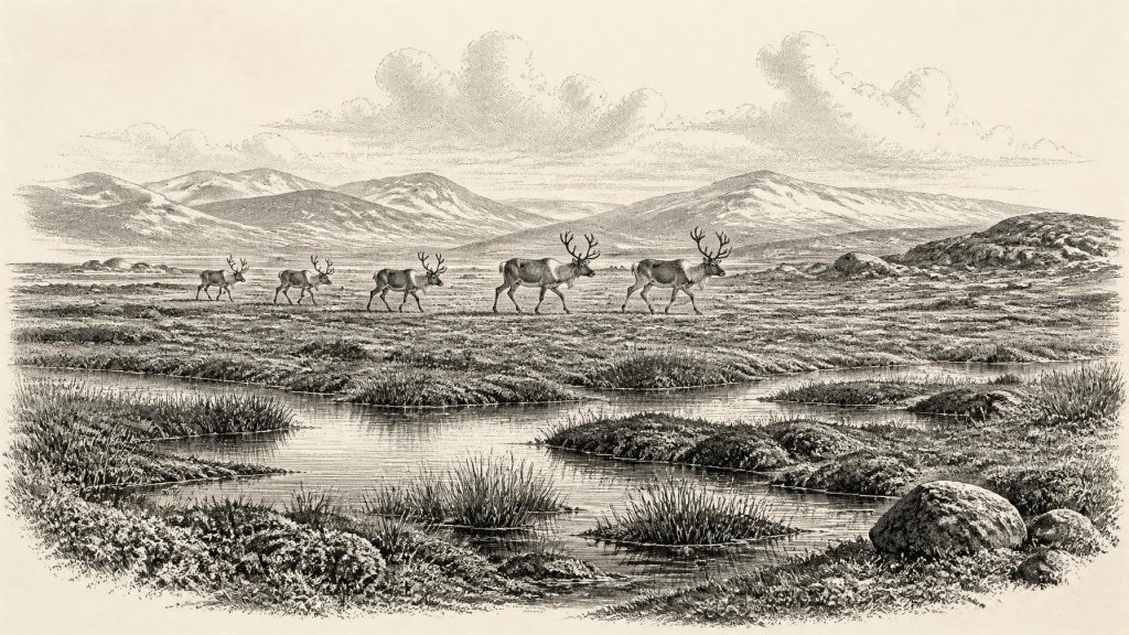
The Derryvree flora and fauna point to open tundra vegetation and a periglacial regime: an environment shaped by intense cold, seasonal freezing and thawing, and ground conditions unlike those of wooded modern Ireland. The evidence comes from minute biological remains preserved in wet sediment—plant macrofossils, pollen and invertebrate material—rather than from a surviving surface landscape. It indicates freshwater or waterlogged conditions, with pools and wet ground within an open, largely treeless setting. This was not a timeless sheet of ice, nor a familiar green island of hedgerows, pasture and forest.
Such evidence should not be exaggerated into a complete map. Derryvree represents one basin in what is now County Fermanagh, not every coast, valley and upland across the island. Nonetheless, it is exceptionally valuable because later ice advance eroded, redeposited and buried so much older ground. The organic bed survived because it was enclosed beneath glacial deposits. Its preservation gives a rare glimpse of a short-lived environmental interval within a much longer sequence of cold-stage instability.
The wider glaciological record confirms the importance of regional variation. At around 33,200 calibrated years ago, the British–Irish Ice Sheet was growing, but had not yet reached the maximum volume and extent associated with the later Last Glacial Maximum. Recent reconstructions show an extended period of ice-sheet build-up from about 31,000 years ago, with maximum total volume around 23,000 years ago. Other evidence indicates that north-central Ireland had remained ice-free until at least roughly 34,000 years ago. The best interpretation for this horizon is consequently one of changing margins: ice in some areas, ice-free land and freshwater habitats in others, and no basis for treating the entire island as either uniformly glaciated or uniformly habitable.
Castlepook’s Animal Archive
At the opposite end of the island, Castlepook Cave—also called Mammoth Cave or Doneraile Cave—in north County Cork provides the principal record of large vertebrates from the period leading towards the Last Glacial Maximum. Excavations undertaken in the early twentieth century recovered more than 2,000 bones. The cave deposits include remains attributed to woolly mammoth, reindeer, giant deer, brown bear, wolf, Arctic fox, mountain hare, lemmings and spotted hyaena. A mammoth bone has produced a radiocarbon date around 33,500 radiocarbon years before present; dates across the overall assemblage demonstrate that the cave accumulated remains over a long period rather than during one single occupation or season.
This distinction matters. Castlepook was a repository affected by animal activity, water movement, cave processes and early excavation methods. Its animal list is evidence that these species reached Ireland during the wider cold-stage period; it is not proof that every species stood together outside the cave in 31,257 BCE. Nor should the cave be imagined simply as a human hunting camp. Spotted hyaenas were capable of carrying and modifying bones, while carnivores, scavengers and natural deaths all contributed to cave assemblages. The presence of both prey and predators instead reveals an ecological community more varied than Ireland’s later, isolated fauna.
For ordinary life among animals, seasonality must have been decisive. Grazers and browsers depended on sparse, cold-adapted vegetation; carnivores followed opportunities created by living prey and carrion; shelter was scarce on exposed ground. Mammoth, reindeer and giant deer demonstrate that large herbivores could use Irish landscapes during suitable phases, while lemmings and Arctic fox indicate cold-open habitats. This is secure environmental and faunal evidence. It does not establish population sizes, migration routes in a given year, or a stable “mammoth-steppe” stretching unchanged across all Ireland.
The Unsettled Human Question
One reindeer femur from Castlepook has made this period unusually important for Irish archaeology. The bone was radiocarbon dated to roughly 33,000 years ago and has been interpreted as bearing a modification made by a sharp stone tool while the bone was fresh. If that assessment is sustained, it would indicate that people processed an animal in Ireland during the pre-Last Glacial Maximum period—far earlier than the securely established post-glacial settlement record. It would be evidence for an encounter or brief visit, rather than evidence for a settled population.
The limits are equally important. There is no securely dated Irish hearth, dwelling, burial, stone-tool assemblage, occupation surface or human skeleton from around 31,257 BCE. Archaeological work at Castlepook in 2022 sought surviving Pleistocene deposits and found no cultural artefacts. The cut-marked-bone interpretation is therefore a significant possibility, not a licence to invent Palaeolithic villages, named hunter bands or a continuous ancestry linking any visitors to later Irish populations. Perishable equipment—wood, hide, fibre and much food waste—would rarely survive, but absence of durable evidence still requires caution.
If people did reach Ireland, comparison with Upper Palaeolithic groups elsewhere in north-west Europe suggests that mobility, hunting knowledge, shelter-making, fire and close attention to weather would have been essential. That is a reasoned inference from comparable societies, not direct evidence from Derryvree or Castlepook. No language, kinship system, leadership structure or social identity can be recovered. “Ireland”, “Fermanagh” and “Cork” are modern geographical terms, useful for locating the evidence but not names used by people then.
Politics, Belief and Exchange
There is no evidence for political affairs in the usual sense: no states, rulers, territories, assemblies, diplomacy, treaties or warfare can be identified. Predation and competition among animals should not be confused with human conflict. Equally, there is no Irish evidence from this horizon for shrines, formal burial, imagery, music, writing, ritual deposits or teaching institutions. People, if present, undoubtedly had knowledge and social practices, but archaeology cannot responsibly specify their beliefs or learning from the available Irish material.
Trade is similarly unrecoverable. Low sea levels altered the geography of the Irish Sea region and could have facilitated animal movement across landscapes now submerged, but the precise nature and persistence of routes to Ireland remain debated. No demonstrable exchange network, imported tool assemblage or maritime economy belongs to this date. The economy most securely visible is ecological: plants converting short growing seasons into biomass; herbivores using that vegetation; predators and scavengers exploiting animal remains; and freshwater wetlands preserving traces that later scientists can read.
Approaching Greater Ice
The long-term significance of this period lies in transition. The Derryvree sediment is testimony to an ice-free local interval, but its upper till shows that this condition did not endure. As the last British–Irish Ice Sheet enlarged, it transformed drainage, coastlines and habitats, eventually covering much of Ireland and its surrounding shelf. Ice erosion also helps explain the fragmentary nature of the earlier archaeological record: a potential campsite on exposed ground may have been removed, buried offshore, or never existed.
For 31,257 BCE, then, the most defensible Irish history is one of cold-water wetlands, open tundra, large mammals and an unstable glacial frontier. Derryvree offers the clearest local environmental testimony; Castlepook shows that a striking cold-stage fauna reached the island; the reindeer bone raises, but does not settle, the possibility of human activity. Beyond these findings lie interpretation and uncertainty. Respecting that boundary is not a failure of history. It is the way deep time can be described faithfully.
Primary Sources
- A Middle Midlandian Freshwater Series at Derryvree, Maguiresbridge, County Fermanagh, Northern Ireland
- Growth and Retreat of the Last British–Irish Ice Sheet, 31,000 to 15,000 Years Ago: The BRITICE-CHRONO Reconstruction
- Trimlines, Blockfields and the Vertical Extent of the Last Ice Sheet in Southern Ireland
- Exploring the Chronology of the Last British-Irish Ice Sheet: A Review of Evidence and New Data
- The Irish Quaternary Fauna Project
- Pleistocene Vertebrates in the British Isles
- Occurrence of Mammalia Relicts at Site Castlepook Cave
- Cork County Geological Site Report: Castlepook Cave
- Castlepook Caves
- 2022:564 – Castlepook Cave, Castlepook South, Cork
- The Exploration of Castlepook Cave, Co. Cork
- Figure 6: The Subdivision of the Quaternary Period in Ireland
- Publications
- Introduction to the Late Quaternary and Holocene of Northern Ireland
- The IntCal20 Northern Hemisphere Radiocarbon Age Calibration Curve (0–55 cal kBP)
- IntCal20 Northern Hemisphere Radiocarbon Age Calibration Curve (0–55 cal kBP)
- IntCal
- Composition and Consequences of the IntCal20 Radiocarbon Calibration Curve
- Spotted Hyena Skull
- Ice Age Ireland: Cool Fossils!
- Learn About: The Ice Age
- Irish Caves Database: Mammoth Cave