Derryvree’s Thirty-Thousand-Year Mud31171 BCE
Labelled 31,171 BCE, this period cannot be identified as a precise Irish historical year, but falls within unstable Marine Isotope Stage 3. Derryvree, County Fermanagh, preserves organic freshwater sediments between glacial tills, dated broadly to 36,900–31,700 calibrated years BP. Its fossils reveal cold, open wet tundra supporting plants, insects and seasonal grazing. Castlepook Cave, County Cork, records mammoth, reindeer, giant deer, hyaena and other fauna, demonstrating changing access from neighbouring lands. A possibly cut-marked reindeer femur may indicate early human carcass processing, but remains unproven. Subsequent glaciation buried landscapes, leaving environmental evidence but no record of settlement, society or politics.
Dateline
“31,171 BCE” is a modern calendar label, not a year that can be recovered from the Irish archaeological record. No chronicle, ruler, settlement plan or securely dated human episode belongs to that particular twelve-month interval. Expressed in the archaeological convention of years before AD 1950, it lies roughly 33,120 years before present. At this depth of time, the responsible evidence consists of radiocarbon determinations with margins of error, calibrated ranges, sediment layers and fossil assemblages. The best Irish comparison is therefore not a supposed event in 31,171 BCE, but the later part of Marine Isotope Stage 3: an unstable interval of the last Ice Age before the fullest expansion of the British–Irish Ice Sheet.
For Ireland, this is chiefly an environmental history, with one important but unresolved human question. The island was not a political community, nor can archaeology identify tribes, leaders, diplomatic relationships, religious beliefs, languages or named places. There is no evidence for farming, livestock, permanent villages, trade networks, monuments or a continuous population. What can be described is a cold and changing landscape in which freshwater wetlands, sparse vegetation and large mammals survived locally, and in which a cave in north Cork preserves a disputed-looking but potentially momentous trace of human handling of an animal carcass.
A Date Within a Range
The closest securely relevant dated sequence is at Derryvree, near Maguiresbridge in County Fermanagh. Roadworks exposed a drumlin section containing organic-rich freshwater sediment between two tills: dense, unsorted deposits left by glacier ice. This simple arrangement is exceptionally valuable. It establishes that ice had covered the locality, that an interval of ice-free freshwater conditions followed, and that later ice again laid down till over the wetland deposits. The organic bed produced the conventional radiocarbon result BIRM-166, 30,500 ± 1,100 radiocarbon years BP. Later calibration has placed the material broadly at about 36,900–31,700 calibrated years BP.
That wide range overlaps the modern label 31,171 BCE, but it emphatically does not date a day, season or event in that year. The sample was bulk organic material, rather than a precisely short-lived object such as a single seed, and both radiocarbon uncertainty and calibration matter greatly at this age. Derryvree is best understood as a time-window spanning millennia. Its strength lies in showing what existed in one Fermanagh locality during a cold phase, not in providing a calendar for all Ireland.
Wet Ground Between the Ice
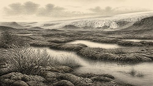
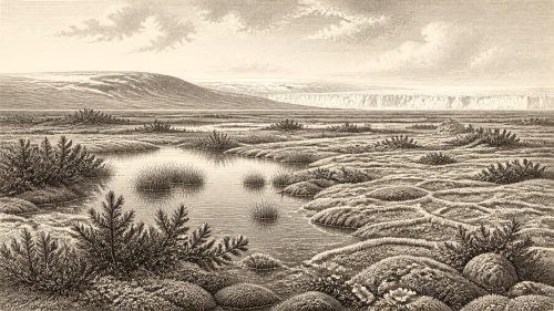
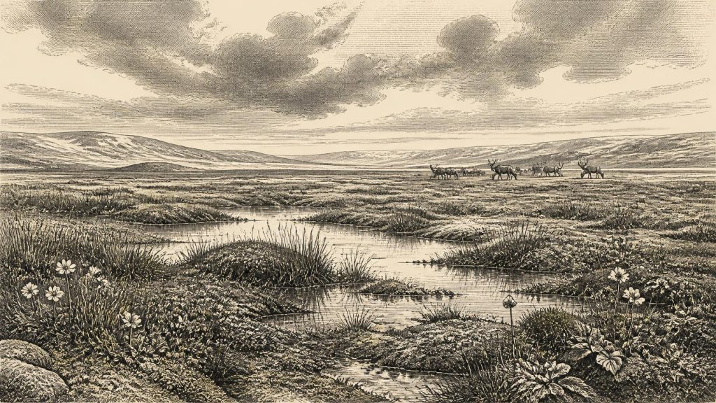
Derryvree’s sediment contained a remarkably varied fossil record. Pollen, plant macrofossils, mosses and insects indicate cold, open and largely treeless conditions, but not lifelessness. The site supported shallow freshwater, wet mossy ground and marsh margins. Sedges and aquatic plants are part of the picture; reported remains include bogbean and water-milfoil. Mountain-avens and other cold-adapted plants point towards tundra-like vegetation. Such evidence is often described as muskeg or wet tundra: waterlogged ground with pools, low vegetation and a short productive season, rather than forest or modern blanket bog.
This does not mean that every part of Ireland was identical. A wetland beneath what later became a drumlin cannot stand in for every coast, valley or upland. Nevertheless, it overturns the easy image of a universally sterile frozen island. At least in some ice-free areas, water remained available for much of the year, plants completed their life cycles, insects lived around the margins and organic material accumulated. Frost, snow, wind and seasonal thaw shaped that ecology. Summer growth may have briefly made particular hollows and lake edges attractive to grazing animals; winter conditions would have made the same places far harsher.
The broader geological setting was unsettled. Ireland was in the Midlandian cold stage, part of the wider glacial history of Britain and north-west Europe. Recent reconstructions indicate that the main late-stage expansion of the Irish Ice Sheet and the wider British–Irish Ice Sheet occurred after this broad period, with maximum ice extent reached much later, around the Last Glacial Maximum. Evidence from Derryvree and other pre-maximum deposits supports the conclusion that north-central Ireland retained ice-free ground until at least approximately 34,000 years ago, although ice conditions varied greatly by region and over time. The later advance buried, reworked and destroyed much of this older landscape.
Castlepook’s Animal World
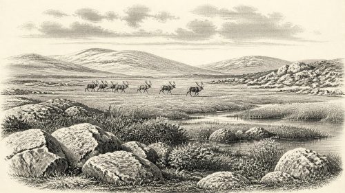
County Cork provides the other major line of evidence. Castlepook Cave, near Doneraile, is Ireland’s richest known pre-Last Glacial Maximum vertebrate site. Excavations in the early twentieth century recovered more than 2,000 bones from its maze-like limestone passages. The assemblage includes woolly mammoth, giant deer, reindeer, brown bear and spotted hyaena, alongside wolf, Arctic fox and lemmings. Individual bones come from a very long span, and the cave was repeatedly used or entered by animals, water and sediment. It is therefore an archive, not a single momentary scene.
The fauna nevertheless reveals an Irish landscape capable of sustaining large herbivores and their predators during parts of the middle and late Ice Age. Reindeer imply open country with seasonal forage; mammoth and giant deer likewise belong to a world unlike later wooded Ireland. Spotted hyaena is especially striking. Its presence does not prove a hyaena den in every cave passage, but it helps explain why bones accumulated and were modified, moved or scattered. Carnivore activity, natural death, flooding and antiquarian excavation have all complicated the deposits. A bone found in Castlepook cannot automatically be treated as evidence that the animal died where it was found, still less that people lived there.
These animals also show Ireland’s changing physical connections with neighbouring lands. Lower global sea levels exposed extensive continental shelves, and animals reached the island during phases when routes across the Irish Sea region were viable. The precise geography of those routes remains difficult because changing sea level, local ice loading and ice margins altered coastlines and passages. The faunal record demonstrates movement into Ireland; it does not map a fixed land bridge, establish regular traffic or identify an organised trade route. There was no evidence of exchange in the economic sense: no imported tools, ornaments, stored goods or settlements are known from this approximate time.
The Reindeer Femur Question
One Castlepook object makes this era unusually important for Irish prehistory: a reindeer femur reported as bearing a mark consistent with cutting by a sharp stone tool. Radiocarbon dating of the bone has been publicised as about 33,000 years old, close to the period represented by 31,171 BCE. If the mark was made while the bone was fresh, and if the interpretation is sustained by further analysis, it would indicate that a person or people processed a reindeer carcass in Ireland far earlier than the island’s previously accepted evidence for human activity.
That possibility must be separated from what the object cannot show. The radiocarbon determination dates the animal’s death, not necessarily the incision. A solitary modified bone does not identify the maker’s species, sex, age, language or cultural tradition. It does not prove a camp, family group, permanent settlement, hunting territory or a lasting colonisation. Nor has a diagnostic lithic tool assemblage been recovered in association with it. Castlepook’s old excavations also removed much of the original context, while later disturbance has blurred the cave’s stratigraphy. The proper conclusion is that the femur is evidence requiring continued specialist scrutiny, rather than a licence to populate the island with an imagined Ice-Age society.
This caution is strengthened by the wider history of Irish cave dating. Improved radiocarbon pretreatment has shown that several older dates on Irish Pleistocene animal bones were unreliable or substantially too young. Recent work at Alice and Gwendoline Cave in County Clare has demonstrated the value of re-dating museum collections and of revisiting early excavations with modern methods. It has also shown how much interpretation can depend upon the condition of a single bone and the precise circumstances of its recovery. The older the claim, the more important it is to distinguish observation from inference.
People, Society and Silence
Accordingly, political affairs, conflict and diplomacy cannot be reconstructed for Ireland around this date. There are no chiefs, territories, alliances or battles in the evidence. Nor can religion, art, learning or social organisation be responsibly described. The possible cut mark is compatible with a practical act of carcass processing, perhaps by highly mobile visitors following animal movements, but even that is an interpretation rather than a documented occupation. It is not evidence for reindeer domestication, ritual hunting or a settled Palaeolithic community.
Everyday life is better approached through constraints than inventions. Any humans present would have faced a severe seasonal environment with limited shelter, short-lived food opportunities and a landscape capable of changing rapidly as climate and ice margins shifted. Caves might offer temporary protection or preserve remains, but Castlepook’s deposits do not prove that people occupied its chambers. The known animal assemblage suggests potential resources—meat, hides, bone, antler and fat—but there is no direct Irish evidence at this date for how any people used them.
An Island Becoming Harder to Reach
The leading historical development was environmental, not political: the approach of more extensive glaciation. As ice accumulated and expanded in later millennia, habitats were compressed, rerouted or overwhelmed. Large mammals disappeared from particular districts; freshwater beds such as Derryvree were sealed beneath new deposits; and former land surfaces were scoured or buried. This explains both why the surviving record is so fragmentary and why Derryvree and Castlepook matter disproportionately. One preserves a cold wetland between two glacial episodes; the other preserves a time-depth of animal remains from a changing Ice-Age fauna.
Ireland around the point labelled 31,171 BCE was therefore neither an empty white expanse nor a knowable human homeland. The firm record is of a severe but ecologically varied Ice-Age island: open ground, freshwater hollows, cold-adapted plants and mammals ranging from lemmings to mammoths. Derryvree provides the strongest local environmental testimony, while Castlepook preserves the tantalising question of human presence. The difference between those forms of evidence is the essential historical fact. Ireland’s landscape and fauna can be described with confidence; its human story at this date remains possible, significant and unproven.
Primary Sources
- A Middle Midlandian Freshwater Series at Derryvree, Maguiresbridge, County Fermanagh, Northern Ireland
- New Insights on the Fauna of Ireland's Younger Dryas and Early Holocene from Alice & Gwendoline Cave
- New Insights on the Fauna of Ireland's Younger Dryas and Early Holocene from Alice & Gwendoline Cave (PDF)
- Castlepook Cave, County Geological Site Report
- 2022:564 – Castlepook Cave, Castlepook South, Cork
- 2019:148 – Alice & Gwendoline Cave, Clare
- Prehistoric Details: Stone Age Collections
- Quaternary Geology of Ireland
- The Subdivision of the Quaternary Period in Ireland
- The Quaternary of the Irish Midlands
- Field Guides
- Publications
- Irish Pleistocene Biostratigraphy
- The Irish Quaternary Fauna Project
- Dimensions and Chronology of the Last Ice Sheet in Western Ireland
- Trimlines, Blockfields and the Vertical Extent of the Last Ice Sheet in Southern Ireland
- Deglaciation Chronology of the Donegal Ice Centre, North-West Ireland
- Maximum Extent and Dynamic Behaviour of the Last British–Irish Ice Sheet West of Ireland
- Sedimentology and Chronology of the Advance and Retreat of the Last British-Irish Ice Sheet on the Continental Shelf West of Ireland
- Late Quaternary Stratigraphy and Glacial History of Southern Ireland – INQUA Field Guide
- The Late Quaternary History of East-Central Ireland
- Revisiting Alice and Gwendoline Cave, Co. Clare: New Light on the 1902 Excavations