BIRM-166’s Fossil Pool30887 BCE
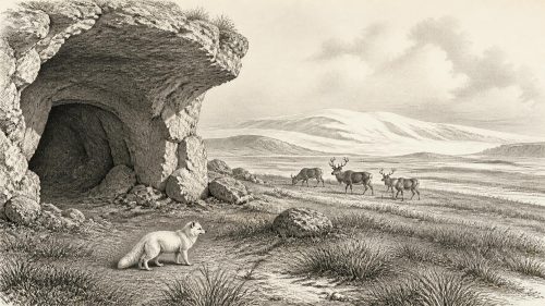
At 30,887 BCE, Ireland’s history can only be reconstructed through environmental evidence, not annual events. Derryvree, County Fermanagh, preserves freshwater sediments between glacial tills, dated broadly to an interval encompassing this year. Its pollen, plants and insects reveal open, cold tundra-like wetlands with sedges, mosses, bogbean, dwarf willow and seasonal meltwater. Castlepook Cave, County Cork, documents a wider MIS 3 fauna including mammoth, reindeer, giant deer, wolves, hyaenas and Arctic foxes, though its deposits are chronologically mixed. A potentially cut-marked reindeer bone suggests human presence, but no secure contemporary settlement exists. Ice conditions, habitats and connections changed continually over millennia.

Dateline
30,887 BCE is a modern chronological label, not a year that can be recovered from an Irish record. No calendar, settlement sequence or event horizon lets historians isolate a particular season, journey or generation at this depth of time. In the conventional archaeological system it lies roughly 32,836 years before AD 1950, within the Late Pleistocene and Marine Isotope Stage 3 (MIS 3), a climatically unstable phase of the last Ice Age. The responsible history of Ireland at this point is therefore not an annual chronicle. It is a reconstruction from buried sediments, fossil plants and insects, cave bones, radiocarbon measurements and the landforms left by moving ice.
The most useful evidence comes from deposits dated in wide ranges. It can show what environments existed during a broad interval and what animals reached the island; it cannot prove that a particular plant, animal or person was present in the numbered year 30,887 BCE. That distinction is central. Around this time, Ireland’s history was principally one of climate, water, vegetation, animal movement and changing ice cover, rather than of recorded rulers, wars, diplomacy or institutions.
A Date Within a Range
The closest exceptionally informative Irish archive is at Derryvree, near Maguiresbridge in County Fermanagh. Road works in 1969 cut through a drumlin and exposed freshwater silts and fine sands between two layers of till, the unsorted sediment deposited by glacier ice. The sequence establishes an important relative order: ice had occupied the locality; a period without local glacier cover allowed water, plants and sediment to accumulate; then a later glacial advance sealed the deposit beneath another till. It is a rare survival because subsequent ice repeatedly scoured, buried or disturbed older Irish landscapes.
Organic material from the Derryvree freshwater series, sample BIRM-166, produced a conventional radiocarbon determination of 30,500 years BP, with a substantial published error range. Calibration, which accounts for past variation in atmospheric carbon-14, converts such results into broad and uneven calendar ranges rather than a single date. The deposit has commonly been placed at approximately 36,900–31,700 calibrated years BP, or about 34,950–29,750 BCE. The requested date falls within that span. Yet this overlap must not be overstated: it does not mean that one can identify the precise water level, weather or inhabitants of Derryvree in 30,887 BCE.
This caution matters especially because Irish glacial chronology has been revised repeatedly as dating methods and ice-sheet models improve. MIS 3 was not one uniform climatic episode. Conditions changed markedly over centuries and millennia, while lowlands, mountains, coasts and areas close to ice margins could differ greatly at the same broad time. Derryvree provides a local window into an interval; it is not a weather station for the whole of Ireland.
Wet Ground Beneath the Drumlin
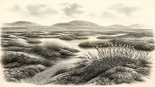
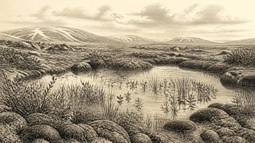
Within those limits, Derryvree is vivid evidence that part of Fermanagh supported freshwater and wetland life during a cold stage. Pollen, plant macrofossils, mosses and invertebrate remains indicate open tundra vegetation and a periglacial climate: ground strongly shaped by freezing and thawing, with short growing seasons and little or no woodland. The record includes herbs, grasses, sedges and mosses, alongside plants associated with wet places. A fossil seed of bogbean, Menyanthes trifoliata, is particularly evocative evidence for freshwater margins. Other finds, including mountain avens and dwarf willow, reinforce the picture of cold-adapted vegetation.
The resulting landscape should not be imagined as an unbroken white wilderness. While winters were severe and exposed ground probably sparsely vegetated, pools, sedgy edges, mossy hollows and channels could support biological activity when conditions allowed. Meltwater and persistent shallow water enabled aquatic and wetland plants to grow and organic sediment to collect. Insects recorded from the deposit support an environment with northern, cold-climate affinities. The old descriptive term “muskeg” conveys something of its wet, organic-rich ground and pools, though no modern landscape is a perfect equivalent.
Everyday life is best documented here not for people but for ecosystems. Frost could break soils and shift sediment; wind would have mattered on open ground; plant growth would have been sharply seasonal. Small changes in temperature, snow cover and meltwater could alter which places were usable by plants and animals. The freshwater series therefore preserves an environmental history of resilience as well as cold: life persisted in favourable niches between episodes of ice occupation.
Ice, Land and Regional Change
Ireland was moving towards a major glacial reorganisation, but 30,887 BCE should not be treated as the fully developed Last Glacial Maximum. The maximum expansion of the later British–Irish Ice Sheet occurred much later, principally around 27,000–19,000 years ago, though its growth, flow and margins varied by sector. Modern reconstructions beginning at about 31,000 years ago acknowledge considerable uncertainty in the earliest stages. They indicate that ice could have accumulated in northern Ireland and on high ground while other parts of the island retained ice-free or ice-marginal terrain.
Derryvree’s position between tills is direct evidence that local ice had retreated or thinned sufficiently for freshwater sediment to form there before returning. It does not demonstrate that all Ireland was simultaneously open, nor does it identify a fixed shoreline or overland route at the requested date. Lower global sea levels altered the geography of the Irish Sea region, but the detailed accessibility of Ireland changed through time and remains an active subject of research. The defensible conclusion is that the island’s habitats and connections with neighbouring north-west Europe were changing, not static.
Cork’s Cold-Stage Fauna
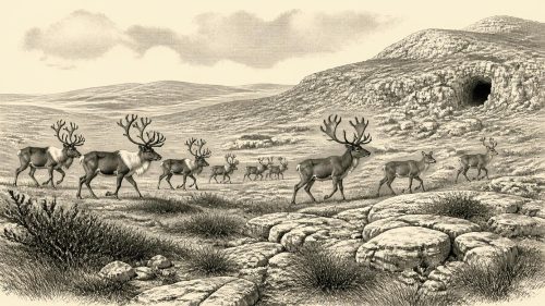
County Cork provides a different kind of evidence. Castlepook Cave, near Doneraile in the Awbeg valley, has produced Ireland’s most important assemblage of pre-Last Glacial Maximum mammal remains. Material recovered from its complex cave deposits includes woolly mammoth, reindeer, giant deer, brown bear, wolf, fox, Arctic fox, mountain hare, lemmings and spotted hyaena. This assemblage shows that Ireland was, at intervals during the Late Pleistocene, part of a wider north-west European ecological world capable of supporting both grazers and formidable predators.
It would nevertheless be wrong to turn the cave list into a single imagined herd crossing Cork in 30,887 BCE. Castlepook was excavated largely in the early twentieth century; its deposits were disturbed, the finds derive from more than one context, and some associations are chronologically mixed. Re-dating has shown that several earlier bone dates underestimated the age of important MIS 3 material, while suggesting that giant deer and spotted hyaena may have disappeared locally before the later glacial maximum. The cave is powerful evidence for regional faunal history, but not a snapshot of one day or even one century.
The fauna allows cautious interpretation of the food web. Reindeer and mammoth imply open country with substantial forage; wolves and hyaenas indicate predators and scavengers able to exploit large carcasses. Lemmings and Arctic fox point towards cold conditions. Cave deposits, however, are also shaped by carnivore activity, water movement, collapse and the collecting practices of excavators. Bones demonstrate animal presence more securely than they reveal exact population sizes, migration routes or ecological balance.
People: A Possibility, Not a Population
The question of people is the most consequential and the least settled part of this story. A reindeer femur from Castlepook, held in the National Museum of Ireland’s natural-history collections, has been publicised as bearing a deep mark consistent with cutting or chopping by a stone tool. It has also been reported as dating to roughly 33,000 years ago. If the mark is confirmed as human-made, it would show that a person or party processed a reindeer in Ireland during the Upper Palaeolithic, far earlier than the formerly accepted record of human activity.
But the finding cannot support more than that narrow proposition. The bone lacks the secure, modern excavation context that would link it to a hearth, stone tools, living floor or repeat occupation. The 2022 re-examination of Castlepook located surviving sediments but found no cultural artefacts. Nor have archaeologists identified a contemporary Irish camp, house, burial, tool-making site or human remains. The strongest securely dated evidence for human activity in Ireland remains much later: a butchered brown-bear bone from Alice and Gwendoline Cave in County Clare, dated to about 12,810–12,590 calibrated years BP.
It is therefore not responsible to describe a settled Palaeolithic community in Ireland in 30,887 BCE. At most, the Castlepook femur permits the possibility of a brief human incursion by mobile hunter-gatherers, perhaps connected with the wider Upper Palaeolithic populations of Britain or continental Europe. Even that remains an interpretation awaiting fuller publication, contextual evidence and further finds. No evidence identifies their language, kinship system, beliefs, artistic traditions or political organisation.
What Cannot Be Written
There is no basis for accounts of Irish kingship, territorial government, diplomacy, organised warfare, formal religion, trade institutions or learning at this date. Farming, permanent villages, livestock, pottery and monumental construction all belong to vastly later chapters of Irish prehistory. Nor can archaeologists responsibly infer a local market economy from animal bones. If people visited, their subsistence may have involved hunting, scavenging and the movement of small groups across seasonal landscapes, but this is an inference from wider European comparison, not a demonstrated Irish social system.
The great development around 30,887 BCE was environmental. Fermanagh’s buried freshwater sediments show that wet, open and cold habitats existed between glacial episodes. Cork’s cave fauna shows that large mammals and predators reached Ireland during the broader MIS 3 interval. The advancing and retreating ice shaped what could live, travel and survive. This is not a silent history: it is a history written in silt, moss, bone and till. Its lesson is that Ice Age Ireland was neither timeless nor uniformly frozen, but rapidly changing—and that the precision of a modern year must yield to the wider, carefully calibrated timescales of the evidence.
Primary Sources
- A Middle Midlandian Freshwater Series at Derryvree, Maguiresbridge, County Fermanagh, Northern Ireland
- Palaeoecology
- Figure 6.— The Subdivision of the Quaternary Period in Ireland
- A Reconsideration of the Radiocarbon Dating of the Marine Isotope Stage 3 Fauna from Southern Ireland
- First Evidence of a Late Upper Palaeolithic Human Presence in Ireland
- The Archaeology of Caves in Ireland
- New Insights on the Fauna of Ireland's Younger Dryas and Early Holocene from Alice & Gwendoline Cave
- Growth and Retreat of the Last British–Irish Ice Sheet, 31,000 to 15,000 Years Ago: the BRITICE-CHRONO Reconstruction
- The Timing and Magnitude of the British–Irish Ice Sheet Between Marine Isotope Stages 5d and 2
- Maximum Extent and Dynamic Behaviour of the Last British–Irish Ice Sheet West of Ireland
- Stratigraphic and Palaeo-Geomorphological Evidence for the Glacial-Deglacial History of the Last British-Irish Ice Sheet in the North-Western Irish Sea
- Sedimentology and Chronology of the Advance and Retreat of the Last British-Irish Ice Sheet on the Continental Shelf West of Ireland
- Pattern and Timing of Retreat of the Last British-Irish Ice Sheet
- The IntCal20 Northern Hemisphere Radiocarbon Age Calibration Curve (0–55 cal kBP)
- OxCal
- Heritage Artefacts of County Cork
- 2022:564 – Castlepook Cave, Castlepook South, Cork
- Mammoth Cave
- Occurrence of Mammalia Relicts at Site Castlepook Cave
- Pleistocene Vertebrates in the British Isles