

Maguirebridge’s Muskeg Window30816 BCE
Ireland around 30,816 BCE was a fluctuating Late Pleistocene environment, not a society. At Derryvree near Maguiresbridge, organic sediments between glacial tills preserve evidence of a cold, treeless freshwater muskeg, with sedges, mosses and tundra-adapted plants. The sequence demonstrates changing conditions between ice advances, rather than a fixed landscape or precise annual date. Castlepook Cave in Cork contains time-averaged remains of mammals including reindeer, giant deer, mammoth, predators and cold-adapted species, indicating intermittent ecological access. A possibly cut-marked reindeer bone may suggest early human contact, but cannot prove settlement. Evidence supports environmental change, while politics, culture and population remain unknown.
Dateline
The label 30,816 BCE does not identify a recoverable Irish year. There was no written calendar in Ireland, no named ruler, and no dated event to which archaeology can attach that number. It is a modern point on a deep-time scale. The responsible approach is to place it within a broad Late Pleistocene setting: the later part of Marine Isotope Stage 3, during the Midlandian cold stage, long before the Last Glacial Maximum reached its fullest extent in Ireland.
Even this placement requires caution. Radiocarbon results are expressed in years before AD 1950 and must be calibrated against changing atmospheric carbon levels; they do not convert into ancient calendar dates by simple subtraction. The most useful Irish environmental evidence near this horizon comes from deposits at Derryvree, near Maguiresbridge in County Fermanagh. An older conventional radiocarbon determination of 30,500 ± 1,100 radiocarbon years BP from its organic sediments calibrates only to a wide interval, broadly about 36,900–31,700 calendar years BP. That range encompasses 30,816 BCE, but it does not establish that the Derryvree wetland existed, unchanged, in that particular year.
An Ice-Age Landscape in Motion
Ireland was neither the familiar green island of later history nor necessarily a single, uniformly frozen landmass. The climate oscillated sharply over centuries and millennia. Ice sheets advanced and withdrew; permafrost and severe seasonal frost affected exposed ground; and the shape of coasts, river valleys and lakes differed greatly from today. The maximum expansion of the last British–Irish Ice Sheet came later, principally after about 28,000 calendar years BP. Around the date represented here, evidence instead points to a changing mosaic of ice-covered areas, periglacial ground and locally ice-free terrain.
That distinction matters because older accounts sometimes portrayed the island as simply buried beneath continuous ice for the whole later Ice Age. Geological work has complicated that picture. In southern Ireland, marine and glacial sequences show that ice limits changed over time. In Fermanagh, the deposits at Derryvree demonstrate that a cold, freshwater environment developed between episodes represented by two layers of glacial till. Till is unsorted debris laid down by moving or melting ice. The sequence therefore records an order of events: glacial occupation, a phase in which water and vegetation occupied the site, and a later renewal of ice-related deposition. It does not offer a complete map of Ireland at one instant, but it decisively shows environmental change.
The Derryvree Evidence
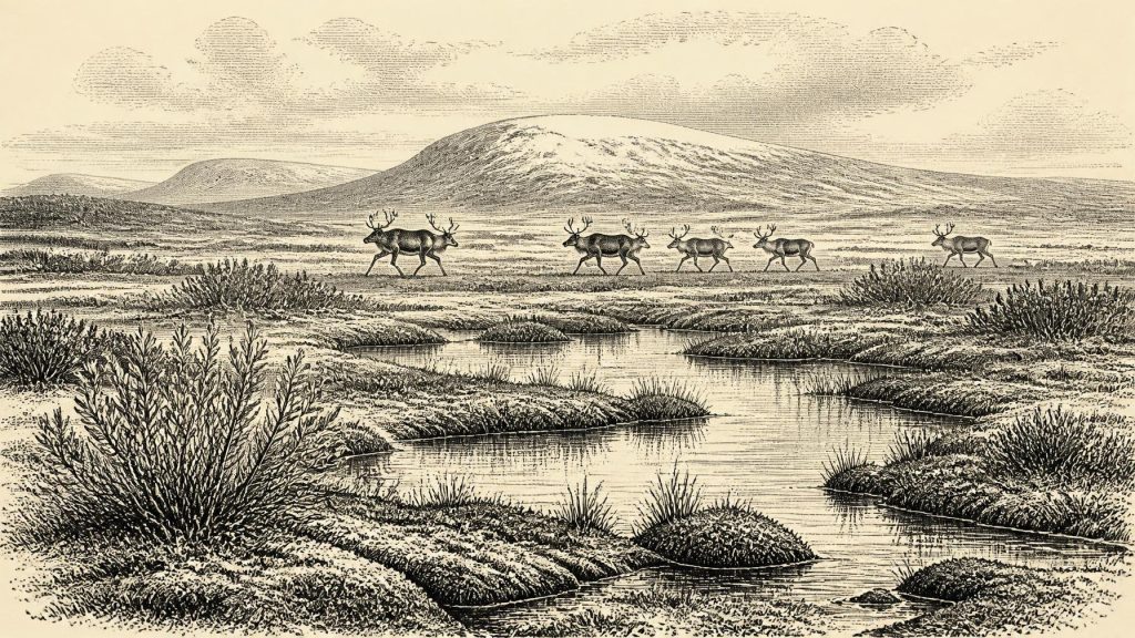
Road works exposed the Derryvree sequence in 1969 in a cut through a drumlin. Beneath a later till lay fine sands, freshwater silts and organic muds; below these lay an earlier till. Pollen, plant macrofossils, mosses and small animal remains preserved in the organic horizon give the deposit its exceptional value. They indicate a treeless, cold-climate wetland often described as muskeg: waterlogged ground with sedges, mosses and shallow pools rather than a forested bog of the modern Irish imagination.
The assemblage included plants suited to open, arctic-alpine or tundra-like conditions, among them dwarf willow, mountain-avens, lesser clubmoss and bogbean or three-leaved water-milfoil. Such finds are evidence for local or nearby vegetation, but they should not be inflated into a precise reconstruction of every hillside. Pollen may travel, plant remains may be redistributed by water, and a single basin has its own local ecology. Still, the combined record supports a landscape with very limited tree cover, cold freshwater, wet ground and sparse vegetation capable of surviving harsh conditions.
This was not a settled countryside. There are no houses, hearths, fields, roads, graves, pottery or tool assemblages from Derryvree that can be assigned to this period. The organic bed tells us much about climate and habitat, but nothing dependable about language, community organisation, ritual or social rank. It is environmental evidence, not a human archive.
Animals at the Western Edge
Far to the south, Castlepook Cave near Doneraile in north County Cork supplies a different kind of evidence. The limestone cave system is Ireland’s richest known archive of Pleistocene vertebrates. Its collections include remains attributed to mammoth, giant deer, reindeer, brown bear, wolf, Arctic fox, lemmings, mountain hare and spotted hyaena. Together they show that, over a long span before the Last Glacial Maximum, Ireland was accessible to a far broader range of mammals than survives on the island today.
Yet Castlepook must not be read as a single momentary ecosystem. Its bones accumulated in several galleries through natural deaths, carnivore activity, water movement and nineteenth- and early twentieth-century excavation. Animals represented in the cave did not necessarily live there at the same time, and the cave was not a sealed hunting camp. Radiocarbon dating by the Irish Quaternary Fauna Project established that Irish cave fauna could be much older than previously assumed, but more recent work has also shown that some early bone dates require reassessment using improved pretreatment methods. The assemblage is powerful evidence for long-term faunal presence and environmental possibility, not a census for 30,816 BCE.
At this broad horizon, reindeer and giant deer suggest open country with substantial grazing; lemmings and Arctic fox point towards severe cold conditions; and hyaena remains show that formidable scavengers and predators could reach Ireland. Mammoth remains are especially evocative, but they should not be used to picture herds in every valley. Their presence demonstrates that these animals occurred in Ireland during parts of the Late Pleistocene, while the dates and contexts of individual bones set limits on what can be claimed for a particular place or generation.
A Possible Human Trace
The most striking, and most uncertain, human question concerns a reindeer femur from Castlepook. It has been publicly reported as approximately 33,000 radiocarbon years old and as bearing a deep modification interpreted by palaeozoologist Ruth Carden as a fresh-bone cut or chop made with a sharp stone implement. If that interpretation is confirmed through continued microscopic, dating and contextual study, it may indicate that people processed a reindeer in Ireland far earlier than the previously secure terminal-Pleistocene evidence from Alice and Gwendoline Cave in County Clare.
For now, however, this is a possible episode of human activity rather than proof of an Irish population. No securely associated stone-tool assemblage, hearth, dwelling floor, human bone, burial, repeated occupation surface or extensive food-waste deposit of comparable age has been recovered. A date on an animal bone dates the death of that animal within a range; it cannot by itself date the surface mark, identify the person who may have made it, or establish whether people lived nearby. The careful conclusion is that Castlepook presents a promising but incomplete case for very early human contact with Ireland.
No Politics, No Trade, No Recorded Belief
It is therefore impossible to describe political affairs, warfare, diplomacy, institutions or leaders for Ireland at this date. There is no evidence for territorial polities or for organised conflict between human groups on the island. Equally, there is no basis for discussing trade routes, markets, farming, metalworking, seafaring networks or a named people. Animal movement across the wider north-west European world demonstrates ecological connectivity, not commerce.
Religion and culture are similarly beyond recovery here. A possible butchery mark would speak, at most, to practical treatment of an animal carcass. It cannot reveal a language, belief system, art tradition, kinship structure or ceremony. Any visitors, if they came, may have moved through a landscape of great ecological opportunity and danger, but the scale, duration and character of their presence remain unknown.
What Can Responsibly Be Said
Ireland around 30,816 BCE is best understood as a fluctuating Ice-Age environment rather than a historical society. The strongest evidence comes from deposits rather than narratives: cold freshwater silts and organic mud at Derryvree; fossil plants that indicate open, wet, treeless ground; cave-bone assemblages at Castlepook that attest to a rich but time-averaged Pleistocene fauna; and glacial sediments that reveal repeated advances and retreats of ice.
The central development was environmental instability. Local refuges of freshwater and tundra vegetation could exist between glacial episodes, while large mammals and predators intermittently occupied or traversed the island. Whether people briefly joined them remains an important research question, not an established chapter of continuous settlement. The absence of conventional history is not an absence of evidence: it is a reminder that, at this depth of time, Ireland’s past survives chiefly in mud, pollen, bone, stone and the careful limits of scientific interpretation.
Primary Sources
- A Middle Midlandian Freshwater Series at Derryvree, Maguiresbridge, County Fermanagh, Northern Ireland
- The Irish Quaternary Fauna Project
- Castlepook Cave: Cork County Geological Site Report
- The Exploration of Castlepook Cave, Co. Cork. With 3 Plates
- Occurrence of Mammalia Relicts at Site Castlepook Cave
- Exploring Controls on the Last British-Irish Ice Sheet's Deglaciation in the North Atlantic
- Late Pleistocene Chronostratigraphy and Ice Sheet Limits, Southern Ireland
- Radiocarbon Constraints on the Age of the Maximum Advance of the British-Irish Ice Sheet in the Celtic Sea
- Stratigraphic and Palaeo-Geomorphological Evidence for the Glacial-Deglacial History of the Last British-Irish Ice Sheet in the North-Western Irish Sea
- Dating Constraints on the Last British-Irish Ice Sheet: A Map and Database
- Maximum Extent and Readvance Dynamics of the Irish Sea Ice Stream and Irish Sea Glacier Since the Last Glacial Maximum
- Trimlines, Blockfields and the Vertical Extent of the Last Ice Sheet in Southern Ireland
- Quaternary Data and Maps
- Figure 6—The Subdivision of the Quaternary Period in Ireland
- New Insights on the Fauna of Ireland's Younger Dryas and Early Holocene from Alice & Gwendoline Cave
- The Mesolithic in Ireland: When Was It?
- Archaeology Research Excavation Grant 2022: Castlepook Cave Project Final Report
- Heritage Artefacts of County Cork
- The IntCal20 Northern Hemisphere Radiocarbon Age Calibration Curve (0–55 cal kBP)
- IntCal Publications