Derryvree Vegetation30623 BCE
Around 30,623 BCE, Ireland’s history can be reconstructed through environmental evidence, not yearly events. Derryvree, County Fermanagh, preserves a freshwater deposit between glacial tills, dated broadly to this period, indicating an ice-free periglacial wetland with bogbean, sedges, mosses and cold-adapted plants. Castlepook Cave in County Cork contains time-mixed remains of mammoth, reindeer, giant deer, predators and smaller fauna, demonstrating open habitats across intervals. A possibly cut-marked reindeer bone may signal human activity, but proves neither settlement nor continuity. Evidence supports no claims about communities, politics, farming, culture or identity. Changing ice, sea levels and landscapes defined this Late Pleistocene world.
Dateline
Modern calendar-year precision is not available for Ireland in 30,623 BCE. No written calendar, settlement sequence or datable event permits an historian to say what happened in that particular year. The label is a modern point on a timescale: in simple calendar arithmetic it lies about 32,572 years before AD 1950, the reference year conventionally used for radiocarbon dates. It belongs to the Late Pleistocene, within Marine Isotope Stage 3, a long and climatically unstable part of the last Ice Age. The responsible history of this moment must therefore be built from broad ranges, not from an invented hunt, migration or chiefdom.
The best Irish evidence does not come from a village or graveyard. It comes from sediments and bones: a buried freshwater deposit at Derryvree, near Maguiresbridge in County Fermanagh, and the much more time-mixed animal remains of Castlepook Cave near Doneraile in north County Cork. Together they show that parts of Ireland held cold-stage habitats and large mammals during this wider era. They do not show that the whole island shared one climate, that all recorded animals lived together, or that people occupied Ireland continuously.
A Wetland Under the Drumlin
Derryvree was exposed during road works in 1969, when a cutting passed through a drumlin. Beneath a later glacial till, and above an older one, lay freshwater silts and fine sands containing organic material. This sequence is exceptionally important because its order is clear: an ice-free basin supported water and vegetation between two episodes that left till, the compact sediment deposited by glacial ice. The deposit was assigned the radiocarbon determination BIRM-166, 30,500 ± roughly 1,100 radiocarbon years BP. Its calibrated calendar placement is necessarily broad—commonly expressed as approximately 36,900–31,700 calibrated years BP, with modelling assumptions affecting the precise range.
That range overlaps the chronological horizon represented by 30,623 BCE, but it does not date the notional year itself. A radiocarbon result dates carbon-bearing material, with uncertainty; calibration converts it into a probability range in calendar years. It cannot identify a particular winter, a succession of seasons, or a national episode. Derryvree is valuable precisely because it resists such false precision. It establishes an ice-free interval in one Fermanagh locality and preserves evidence for the living conditions of that interval, not a complete map of Ireland.
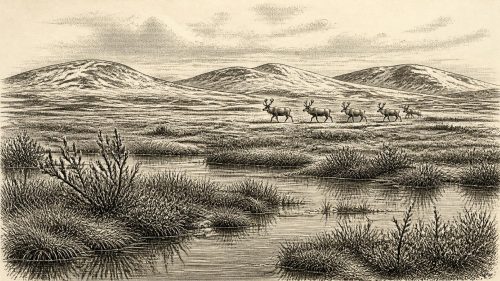
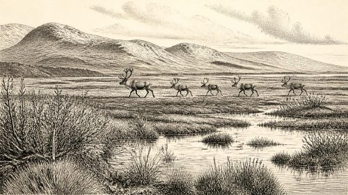
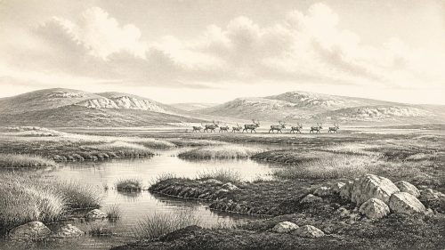
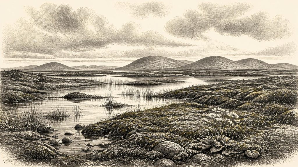
The plant and insect evidence points to open, treeless tundra or muskeg-like wetland under a severe periglacial climate. Pollen was poorly preserved, yet herbaceous taxa dominate. Macrofossils and spores include mosses, sedges and cold-adapted plants; identified remains include bogbean (Menyanthes trifoliata), mountain avens (Dryas octopetala) and lesser clubmoss (Selaginella selaginoides). Aquatic plants and moss-rich organic sediment indicate shallow freshwater, wet margins and pools with accumulated plant matter. The picture is not of a modern Irish bog transplanted backwards in time, but of a cold, open and seasonally demanding mosaic of water, mud, sparse ground cover and exposed mineral soils.
Ice, Water and Uneven Landscapes
Derryvree corrects the tempting but inaccurate image of an Ireland continuously sealed beneath ice throughout the last Ice Age. Ice cover advanced and retreated unevenly, and the extent of the British–Irish Ice Sheet before its fullest later expansion remains actively debated. The sediment lies between tills, demonstrating local environmental change, while other evidence suggests that ice-sheet margins and ice-free areas shifted on regional timescales. A wetland at Maguiresbridge is not proof that Cork, Donegal, the western uplands and the Irish Sea basin were simultaneously hospitable.
Nor should the later Last Glacial Maximum be projected wholesale onto this earlier horizon. Major growth of the British–Irish Ice Sheet occurred after about 35–32 thousand years ago, while its maximum extent is generally placed much later, around 27–21 thousand years ago; recent reconstructions emphasise that the timing differed between sectors. Around the date represented here, Ireland was entering a changing world in which cold phases, local ice, exposed ground, freshwater basins and animal corridors could all alter. Subsequent ice advances eroded, buried and rearranged earlier deposits, helping to explain why the evidence is so fragmentary.
Sea levels were lower than today because great quantities of water were held in continental ice. Coastlines and lowlands consequently differed greatly from modern ones. Yet lower sea level does not demonstrate a simple land bridge, an easy route from Britain, or a known crossing route for people. The Irish Sea basin, changing relative sea level and ice margins complicate the geography. The arrival of animals proves that dispersal was possible over the wider Pleistocene; it does not reveal exactly when, where or how each species reached the island.
Castlepook’s Long Animal Archive
Far to the south, Castlepook Cave—also known as Mammoth Cave—offers a complementary record. Antiquarian excavations recovered a remarkable collection of Pleistocene bones, later reassessed through the Irish Quaternary Fauna Project and more recent dating. Reindeer, woolly mammoth, giant deer, brown bear, wolf, Arctic fox, mountain hare, lemmings and spotted hyaena are among the animals represented in the cave’s wider assemblage. These finds demonstrate a far richer Ice Age fauna than survives in Ireland today and imply open habitats capable, at different times, of sustaining grazers, browsers, predators and scavengers.
The cave is not, however, a snapshot of 30,623 BCE. Its bones accumulated over many thousands of years, and direct radiocarbon dates from different galleries span from more than 45,000 radiocarbon years BP to around 20,000 BP. Carnivores may have carried in carcass parts; animals may have fallen in or used chambers as dens; water redistributed sediments and bones; and early excavation removed much contextual information. The dated remains of mammoth, reindeer, giant deer and hyaena cannot responsibly be assembled into one simultaneous herd scene outside the cave entrance.
That taphonomic complexity is historically significant. It explains why cave bone provides secure evidence for the presence of particular animals during broad intervals, but weak evidence for population size, seasonality or everyday human activity. Reindeer especially suit an open, cold landscape and may have moved seasonally across large territories. Mammoth and giant deer indicate that substantial food resources existed in parts of the wider landscape. Hyaenas and wolves remind us that caves were contested natural spaces, sometimes dens or scavenging locations rather than human shelters.
A Possible Human Trace
One Castlepook find has made this period especially provocative. A reindeer femur in the National Museum of Ireland’s natural-history collection bears a deep linear mark that zooarchaeologist Ruth Carden has interpreted as a fresh-bone cut made by a sharp stone tool during carcass processing. County Cork heritage material places the bone broadly at about 31,000 BC. If the mark is correctly identified and contemporary with the animal’s death, it could be Ireland’s earliest known indication of human action, vastly earlier than the better-established terminal-Pleistocene evidence from County Clare.
But this is a carefully limited claim. The femur was recovered from an old, complex cave assemblage rather than from a newly excavated and sealed camp floor. A date on the bone records when the animal died, not necessarily the instant of marking, the location of butchery, or the number of people involved. No securely associated stone-tool assemblage, hearth, dwelling, burial, human skeleton, workshop or concentrated food refuse of comparable age has been recovered at Castlepook. A brief visit by mobile hunter-gatherers is a reasonable interpretation if the cut-mark diagnosis stands; permanent settlement, continuous occupation and a named archaeological culture are not demonstrated.
What Cannot Yet Be Written
This severely limits any account of political affairs, conflict or diplomacy. There is no evidence for polities, leaders, territorial boundaries, organised warfare or negotiations in Ireland at this date. Nor is there evidence for farming, livestock, crop cultivation, markets, long-distance trade, seafaring networks or permanent built settlements. If people briefly reached the island, their survival would have rested on portable skills—knowledge of animals, weather, shelter, fire and cutting edges—but those capabilities are inferred from wider Upper Palaeolithic comparison, not recovered as a complete Irish toolkit.
Religion, art and learning must likewise remain unknown. No securely dated Irish cave art, ornament, burial, ritual structure, engraved object or symbolic deposit belongs to this horizon. Absence of such material cannot prove that visiting people lacked beliefs, stories or social rules; it means only that Ireland’s present record cannot reveal them. The same restraint applies to language, ancestry and identity. It is anachronistic to call any possible visitors Gaelic, Celtic or part of a later Irish people.
For Ireland around 30,623 BCE, the most meaningful development was environmental: a cold-stage island of changing ice margins and open habitats, where a freshwater wetland in Fermanagh supported hardy plants and where large mammals ranged through parts of the country over the wider period. Derryvree’s bogbean seed and Castlepook’s reindeer bone are small survivals from that world. They make the deep past tangible while setting a firm boundary on what can honestly be claimed.
Source References
Hover over a number to see the source. Select it to open the source.

- [1] A Middle Midlandian Freshwater Series at Derryvree, Maguiresbridge, County Fermanagh, Northern Ireland
- [2] Palaeoecology: IQUA Field Guide 16
- [3] Menyanthes trifoliata L. (Bogbean) – Fermanagh Flora
- [4] Dryas octopetala L. (Mountain Avens) – Fermanagh Flora
- [5] Selaginella selaginoides (L.) P. Beauv. ex Schrank & Mart. (Lesser Clubmoss) – Fermanagh Flora
- [6] A Reconsideration of the Radiocarbon Dating of the Marine Isotope Stage 3 Fauna from Southern Ireland
- [7] The Irish Quaternary Fauna Project
- [8] Heritage Artefacts of County Cork
- [9] 2022:564 – Castlepook Cave, Castlepook South, Cork
- [10] Growth and Retreat of the Last British–Irish Ice Sheet, 31,000 to 15,000 Years Ago: the BRITICE-CHRONO Reconstruction
- [11] The Timing and Magnitude of the British–Irish Ice Sheet Between Marine Isotope Stages 5d and 2
- [12] Extent and Timing of the Last Glacial Maximum (LGM) in Britain and Ireland: a Review
- [13] First Evidence of a Late Upper Palaeolithic Human Presence in Ireland
- [14] New Insights on the Fauna of Ireland’s Younger Dryas and Early Holocene from Alice & Gwendoline Cave
- [15] Quaternary – Geological Survey Ireland
- [16] Quaternary Deposits and Glacial Stratigraphy in Ireland
- [17] Stratigraphic and Palaeo-geomorphological Evidence for the Glacial-deglacial History of the Last British-Irish Ice Sheet in the North-western Irish Sea
- [18] Dimensions and Chronology of the Last Ice Sheet in Western Ireland
- [19] Information from Paleoclimate Archives — IPCC AR5 Working Group I, Chapter 5
- [20] The Colonization of Ireland: A Human Ecology Perspective
- [21] Irish Pleistocene Biostratigraphy
- [22] Figure 6: The Subdivision of the Quaternary Period in Ireland
Primary Sources
- A Middle Midlandian Freshwater Series at Derryvree, Maguiresbridge, County Fermanagh, Northern Ireland
- Palaeoecology: IQUA Field Guide 16
- Menyanthes trifoliata L. (Bogbean) – Fermanagh Flora
- Dryas octopetala L. (Mountain Avens) – Fermanagh Flora
- Selaginella selaginoides (L.) P. Beauv. ex Schrank & Mart. (Lesser Clubmoss) – Fermanagh Flora
- A Reconsideration of the Radiocarbon Dating of the Marine Isotope Stage 3 Fauna from Southern Ireland
- The Irish Quaternary Fauna Project
- Heritage Artefacts of County Cork
- 2022:564 – Castlepook Cave, Castlepook South, Cork
- Growth and Retreat of the Last British–Irish Ice Sheet, 31,000 to 15,000 Years Ago: the BRITICE-CHRONO Reconstruction
- The Timing and Magnitude of the British–Irish Ice Sheet Between Marine Isotope Stages 5d and 2
- Extent and Timing of the Last Glacial Maximum (LGM) in Britain and Ireland: a Review
- First Evidence of a Late Upper Palaeolithic Human Presence in Ireland
- New Insights on the Fauna of Ireland’s Younger Dryas and Early Holocene from Alice & Gwendoline Cave
- Quaternary – Geological Survey Ireland
- Quaternary Deposits and Glacial Stratigraphy in Ireland
- Stratigraphic and Palaeo-geomorphological Evidence for the Glacial-deglacial History of the Last British-Irish Ice Sheet in the North-western Irish Sea
- Dimensions and Chronology of the Last Ice Sheet in Western Ireland
- Information from Paleoclimate Archives — IPCC AR5 Working Group I, Chapter 5
- The Colonization of Ireland: A Human Ecology Perspective
- Irish Pleistocene Biostratigraphy
- Figure 6: The Subdivision of the Quaternary Period in Ireland