Derryvree’s Mossy Waterline30663 BCE
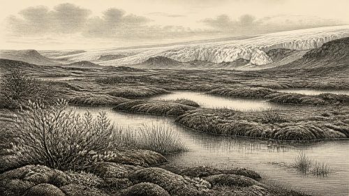
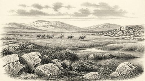
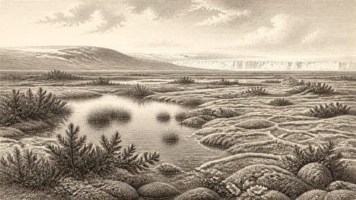
30,663 BCE is an imprecise modern label for an Irish Middle Ice Age environment, not a documented event. At Derryvree, County Fermanagh, freshwater silts between glacial tills record an ice-free interval within Marine Isotope Stage 3. Pollen, plants and insects indicate cold, open tundra-steppe, with mossy wetlands, shallow water and sparse vegetation. Castlepook Cave, County Cork, preserves a time-averaged fauna including mammoth, giant deer, reindeer, bear and hyaena, showing intermittent habitable landscapes. A cut-marked reindeer femur may indicate fleeting human activity, but cannot establish settlement. Evidence supports neither political society nor precise island-wide reconstruction, instead revealing a changing periglacial frontier.

Dateline
30,663 BCE is a modern calendar label, not a date at which an event in Ireland can be fixed. No Irish calendar, written record or archaeological sequence provides year-by-year precision at this depth of time. In archaeological convention it corresponds approximately to 32,613 years before present, with “present” defined as 1950. Even that conversion must not be mistaken for a precise ancient date. Radiocarbon measurements have statistical margins and must be calibrated; deposits also accumulate over periods rather than appearing in a single year.
The most responsible picture of Ireland around this notional point is therefore environmental rather than political. There were no documented rulers, peoples, settlements, battles, alliances, religions or trading communities. What survives is a scattered archive of sediments, fossils, cave bones and glacial landforms. Together these indicate an island on the north-western edge of Europe during Marine Isotope Stage 3, a volatile middle part of the last Ice Age, when ice margins and climates changed repeatedly.
A Freshwater Interval at Derryvree
The clearest Irish evidence relevant to this broad horizon comes from Derryvree townland near Maguiresbridge, County Fermanagh. Road-cutting through a drumlin in 1969 exposed fine sands and freshwater silts, including organic material, sealed between two substantial layers of glacial till. The stratigraphy is unusually informative. Ice deposited the lower till; an interval then followed in which this particular hollow was free of glacier ice and held standing or slow-moving fresh water; later ice covered the deposits with the upper till. The sediments survived precisely because they were entombed beneath that later advance.
An organic sample from the bed, BIRM-166, produced a conventional radiocarbon determination of 30,500 +1,170/−1,030 radiocarbon years BP. Subsequent calibration and chronological assessments have expressed its probable calendar age broadly as about 36,900–31,700 calibrated years BP, roughly 34,950–29,750 BCE. The label 30,663 BCE falls within that wide range, but this does not mean that the Derryvree wetland can be assigned to that year, season or generation. It means only that the deposit is one of the best surviving Irish records for the environmental world of this approximate era.
Its evidence is local, not a map of the entire island. Derryvree proves that its site was ice-free long enough for freshwater sediment, plants and small animals to accumulate. It cannot show that every coast, upland or valley in Ireland was simultaneously free of ice. Nor can a single exposure settle every question about the timing, thickness and extent of Irish ice during Marine Isotope Stage 3. Recent work on the British–Irish Ice Sheet continues to revise the scale and timing of advances before the Last Glacial Maximum.
Open Tundra, Shallow Water
At Derryvree, pollen, plant macrofossils and insect evidence point to open tundra or tundra-steppe rather than woodland. The flora included mosses and herbaceous plants associated with cold, exposed conditions. Finds reported from the deposit include bogbean (Menyanthes trifoliata), an aquatic or wet-ground plant, alongside species and plant communities compatible with sedgy, mossy margins, shallow pools and sparsely vegetated ground. Other records associated with the Fermanagh sequence include dwarf willow, mountain-avens, juniper and lesser clubmoss. Such evidence suggests a varied periglacial mosaic: wet hollows amid more open, drier ground, not an uninterrupted blanket of snow or bare gravel.
“Periglacial” is important here. It describes landscapes shaped by severe cold close to glaciers, where frost action, seasonal thaw and frozen ground influenced soils and water. Derryvree’s freshwater life shows that cold did not mean permanent sterility. During at least part of the year, open water and wet vegetation supported insects and plants. Yet the landscape was likely exposed, treeless or nearly so, and vulnerable to abrupt climatic change. The few tree pollen grains in the deposit are not good evidence for a Fermanagh forest: they may have travelled far, been redeposited, or represent vegetation beyond the immediate catchment.
This was also a changing world rather than a stable climatic zone. The global Last Glacial Maximum, when the British–Irish Ice Sheet reached its greatest late-stage extent, lay millennia ahead, broadly between about 26,500 and 19,000 years ago. Around the Derryvree interval, the direction of travel was towards stronger glaciation, but that development was neither simple nor uniform. Ice could grow, stagnate, retreat and advance again across different regions. The lower and upper tills at Derryvree preserve that essential lesson in miniature.
Castlepook’s Animal Archive
Far south in north County Cork, Castlepook Cave near Doneraile provides a different, complementary record. The limestone system, also called Mammoth Cave or Doneraile Cave, produced more than 2,000 Pleistocene bones during excavations undertaken chiefly between 1904 and 1918. It is Ireland’s richest known cave archive for vertebrate life leading up to the Last Glacial Maximum. Direct dates from individual bones span a long period, approximately 45,700 to 19,950 years BP. It is therefore not a single moment preserved underground, but a repository into which bones arrived over many thousands of years.
The assemblage establishes that large mammals reached Ireland during the middle and later Ice Age. Its fauna includes woolly mammoth, giant deer, reindeer, brown bear and spotted hyaena; other Ice Age remains include wolf, Arctic fox and lemmings. These species should not be arranged as though they all stood together on one day in a Cork valley. Different bones have different ages, and animal remains can enter caves through natural death, water movement, carnivore transport and human recovery. The presence of resident spotted hyaenas is especially significant: caves could function as carnivore dens, profoundly affecting which bones were carried in, chewed, broken or redistributed.
Nonetheless, Castlepook makes an important environmental point. Ireland was not invariably sealed beneath a uniform ice cover during this broad period. At different times, cold-adapted mammals moved through habitable landscapes on the island. Reindeer imply grazing opportunities in open terrain; mammoth and giant deer are further reminders that the Pleistocene animal world was unlike that of later historic Ireland. Their movements also demonstrate that sea level, coasts and routes across the wider Irish Sea region differed greatly from those of today. The precise shorelines and connections for one nominal year, however, cannot responsibly be reconstructed from the present evidence.
The Reindeer Femur Question
Castlepook also contains the most provocative possible evidence for people in Ireland at this early date. A reindeer femur in the old collection has been identified by zooarchaeologist Ruth Carden as bearing a deep mark interpreted as having been made by a sharp stone tool while a fresh carcass was butchered. County Cork heritage material assigns the object broadly to around 31,000 BCE. If that interpretation is confirmed, it would indicate that people handled a reindeer carcass in Ireland during the Upper Palaeolithic, vastly earlier than the better-established terminal Pleistocene evidence for human activity.
The claim must remain narrow. The bone is not a settlement floor excavated to modern standards. Castlepook’s deposits were disturbed by water and shaped by carnivores, while the principal excavations pre-dated modern recording methods. No securely associated hearth, stone-tool assemblage, dwelling, burial, human skeleton, art or repeated occupation sequence of this age has been published from the cave. A date for an animal bone does not automatically date the mark upon it, identify the person who made it, or show whether the carcass was hunted, scavenged or processed elsewhere before a carnivore brought part of it into the cave.
For those reasons, it would be wrong to describe a settled “first Irish” population in 30,663 BCE. At most, the marked femur offers a plausible indication of a fleeting human episode: perhaps one or more mobile hunter-gatherers using a sharp lithic edge to process a large animal. That inference concerns an action, not a known community. It cannot supply a language, ethnicity, kinship system, territory or ancestry for later inhabitants of Ireland.
No Politics, but an Economy of Survival
There is no evidence from Ireland at this date for political institutions, diplomacy, warfare, formal religion, monuments, farming, pottery, metalworking or long-distance trade. There are no demonstrated villages, houses, cemeteries or stores of food. These absences are not merely gaps in a written record: the archaeological evidence itself is too slight to support reconstructions of an Irish society.
If people did visit, the Castlepook femur suggests a subsistence practice centred on immediate survival in a cold, mobile landscape: the use of a cutting tool and the exploitation of animal resources. Comparisons with Upper Palaeolithic groups elsewhere in Europe may help archaeologists generate questions about hunting, seasonal movement and carcass processing, but they cannot be transferred wholesale to Ireland. A single modified bone cannot prove that reindeer were regularly hunted here, that people followed herds across a land bridge, or that an organised exchange network operated on the island.
The strongest history for this year is therefore the history of possibility constrained by evidence. Derryvree records a cold freshwater landscape between advances of ice. Castlepook records a rich but time-averaged fauna, and perhaps a humanly cut reindeer bone. Together they reveal Ireland as a dynamic Pleistocene frontier: sometimes hospitable to wetland plants and large mammals, repeatedly altered by frost and ice, and possibly visited by people whose presence remains barely visible in the surviving record.
Primary Sources
- A Middle Midlandian Freshwater Series at Derryvree, Maguiresbridge, County Fermanagh, Northern Ireland
- Exploring controls of the early and stepped deglaciation of the western sector of the British-Irish Ice Sheet
- A reconsideration of the radiocarbon dating of the Marine Isotope Stage 3 fauna from southern Ireland
- New Insights on the Fauna of Ireland’s Younger Dryas: Evidence from Alice and Gwendoline Cave, County Clare
- Castlepook Cave: County Geological Site Report
- Heritage Artefacts of County Cork
- 2022:564 – Castlepook Cave, Castlepook South, Cork
- Palaeoecology: Irish Quaternary Association Field Guide
- The Glacial Deposits of the Maguiresbridge Area
- The Timing and Magnitude of the British–Irish Ice Sheet Between Marine Isotope Stages 5d and 2
- Growth and Retreat of the Last British–Irish Ice Sheet, 31,000 to 15,000 Years Ago: the BRITICE-CHRONO Reconstruction
- Trimlines, Blockfields and the Vertical Extent of the Last Ice Sheet in Southern Ireland
- Dimensions and Chronology of the Last Ice Sheet in Western Ireland
- Oscillating Retreat of the Last British-Irish Ice Sheet on the Continental Shelf Offshore Galway Bay, Western Ireland
- Radiocarbon Constraints on the Age of the Maximum Advance of the British–Irish Ice Sheet in the Celtic Sea
- New Data for the Last Glacial Maximum in Great Britain and Ireland
- The Irish Quaternary Fauna Project
- Irish Pleistocene Biostratigraphy
- Menyanthes trifoliata: Fossil Record in Fermanagh
- Castlepook Caves
- Mammoth Cave (Castlepook Cave)
- Growth and Retreat of the Last British–Irish Ice Sheet, 31,000 to 15,000 Years Ago: British Antarctic Survey Record