

Derryvree’s Willow Tundra30489 BCE
Around 30,489 BCE, Ireland’s history is reconstructed from environmental evidence rather than precise dates or events. At Derryvree, County Fermanagh, freshwater sediments between glacial tills reveal an ice-free interval with shallow water, tundra vegetation, mosses and periglacial conditions. Cave finds, especially at Castlepook, show MIS 3 fauna including mammoth, reindeer, bear, hyaena, fox and hare, though cave deposits cannot prove simultaneous communities. A cut-marked reindeer bone may indicate exceptionally early human carcass processing, but confirms neither settlement nor permanent population. Growing ice sheets later transformed the island. Evidence supports a dynamic, cold landscape, while human and social histories remain uncertain.
Dateline
“30,489 BCE” is a modern chronological label, not a year that can be recovered from an Irish calendar, settlement sequence or historical event. At this depth in time, modern calendar-year precision is unavailable. The label falls roughly 32,439 years before AD 1950, within the Late Pleistocene and Marine Isotope Stage 3 (MIS 3), a climatically unstable part of the last Ice Age. Ireland can therefore be described only through dated ranges and material traces: layers of sediment, plant fossils, insect remains, animal bones, cave deposits and the changing reach of glacier ice.
The closest especially revealing Irish evidence is a freshwater deposit at Derryvree, near Maguiresbridge in County Fermanagh. Its conventional radiocarbon determination, Birm-166, was 30,500 years before present, with a substantial uncertainty of +1,170/−1,030 years. Calibration places it broadly within about 36,900–31,700 calibrated years before present. The modern label 30,489 BCE therefore falls within the wide chronological window relevant to this deposit, but cannot identify a particular season, generation, animal death or human act. What survives is an environmental archive of an interval, not a diary of a single year.
A Wetland Between Ice Advances
Derryvree became known when road works in 1969 cut through a drumlin, one of the streamlined hills formed beneath moving glacier ice. The exposed sequence was remarkable: freshwater silts and fine sands, including organic material, lay between two thick bodies of till. Till is the unsorted clay, stones and debris deposited directly by ice. The order of the layers is powerful evidence. Ice had occupied the site; then water accumulated in an ice-free landscape long enough to preserve sediments, plants and insects; later ice advanced again and sealed the deposit below the drumlin.
This does not prove that all Ireland was ice-free at once. It is evidence from one locality in south Fermanagh, and ice margins changed differently in different regions. Yet it decisively rejects a picture of Ireland as continuously buried beneath ice throughout the entire earlier part of the last glacial cycle. During the Derryvree interval, at least this part of the island supported shallow freshwater and wet ground. The landscape was not welcoming in a modern sense, but it was ecologically active.
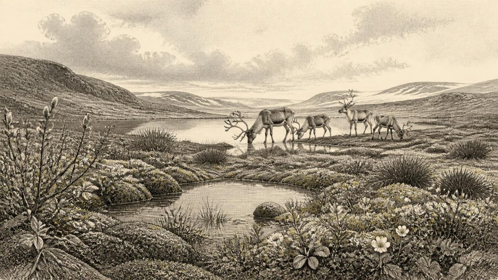
Plant macrofossils, pollen and spores indicate an open, treeless terrain. Mosses were abundant, while evidence includes bogbean (Menyanthes trifoliata), dwarf willow, mountain avens and lesser clubmoss. These were not necessarily growing together in one uniform plant community. Rather, they point to a mosaic of damp margins, pools, mossy ground, sedge-rich areas and better-drained patches of tundra-like vegetation. Sparse cover on exposed ground probably left soil and sediment vulnerable to wind, frost and seasonal runoff.
Cold Ground, Open Water
The Derryvree insects and plants support an interpretation of periglacial conditions: a cold climate in which seasonal freezing and thawing shaped the ground, without the locality necessarily being permanently ice-covered. Winters would have been severe, summers short, and tree growth constrained. In such an environment, a shallow pool or waterlogged hollow could be disproportionately important, concentrating plants, invertebrates and animals around available freshwater.
The broader glacial setting was dynamic rather than static. Ireland was moving towards the fuller expansion of the British–Irish Ice Sheet, whose greatest extent came later, around 27,000 to 24,000 years ago in different sectors. Modern reconstructions show considerable uncertainty over precisely when and where ice covered the island during the earlier stages of growth. At around 31,000 years ago, low sea level had exposed more continental shelf than today, but lowered sea level must not be mistaken for a simple land bridge joining Ireland to Britain or continental Europe. Coastlines, ice, estuaries and marine channels changed repeatedly, and the practical routes available to animals or people remain a matter for careful reconstruction rather than assumption.
Animals in a Changing Island
Irish cave collections show that large mammals inhabited, or at least reached, parts of Ireland during MIS 3. Castlepook Cave near Doneraile in north County Cork is particularly important. Its deposits and older collections include woolly mammoth, reindeer, brown bear, spotted hyaena, fox and hare. Revised radiocarbon work has shown that some earlier dates from southern Irish caves were substantially too young, pushing elements of the faunal record further back into MIS 3. The result is a stronger case for an Ice Age animal community in Ireland before the Last Glacial Maximum.
These animals should not be assembled into an imaginary parade across every Irish valley. Cave assemblages are selective archives. A cave might be a carnivore den, a place where bones accumulated through scavenging, a trap, a shelter, or a channel through which sediment and water moved remains. Mammoth and hyaena bones establish that those species occurred in the wider region at some point within their dated ranges; they do not demonstrate that they met at Castlepook on one day. Even so, the fauna conveys a landscape with grazing opportunities for herbivores and formidable predators able to exploit carcasses and shelter.
Reindeer are especially pertinent to the open, cold conditions indicated at Derryvree. Their presence need not mean immense migratory herds crossed every part of Ireland, but it is compatible with a northern, largely unwooded environment. Brown bears and hyaenas add another warning against romanticising the landscape: food, shelter and safe travel would have been uncertain for any human visitor, particularly in a place where weather, snow cover, frozen ground and animal movement changed seasonally.
The Castlepook Human Question
One object gives this remote period a possible human dimension: a reindeer femur from the historic Castlepook collection, reported to be about 33,000 years old and bearing a deep incision interpreted by zooarchaeologist Ruth Carden as a cut made with a sharp stone tool during carcass processing. If that interpretation is upheld, it would be Ireland’s earliest known indication of human activity, far earlier than the better-established Late Upper Palaeolithic evidence from Alice and Gwendoline Cave in County Clare.
Its significance should be neither dismissed nor overstated. The radiocarbon date establishes the age of the animal bone, not the identity of the agent who marked it, the precise date of the incision, the place where the animal died or the duration of a visit. The specimen derives from an old excavation rather than a modernly excavated occupation surface. No securely associated hearth, dwelling, stone-tool assemblage, burial or repeatedly used camp of comparable age has yet been found in Ireland. The most responsible conclusion is limited but important: the bone may preserve evidence that one or more people used a sharp lithic edge on a reindeer carcass during MIS 3.
That is not evidence for a permanent population. It cannot tell us whether people hunted the animal, found it already dead, removed meat, hide, sinew or marrow, or processed it elsewhere before scavengers carried the bone into the cave. Nor can it identify language, kinship, ancestry or a named archaeological culture. Archaeology is currently better able to illuminate the animal and landscape history of Ireland at this date than the social history of its possible human visitors.
Society Without States
There were no Irish kingdoms, borders, rulers, diplomatic relations or recorded conflicts that can responsibly be assigned to this time. There is likewise no direct Irish evidence for religion, formal learning, art, trade networks, farming, villages or territorial institutions in 30,489 BCE. Absence of evidence cannot prove that no person ever crossed this landscape, but it does rule out writing a political or cultural narrative as though one existed.
If the Castlepook incision is anthropogenic, the most modest social inference is mobility. A small party capable of carrying or making sharp stone edges could have entered a cold, open landscape while tracking game, exploiting a carcass or moving through a wider north-west European range. Such a possibility belongs to interpretation, not established fact. The evidence does not show a community settled beside the Derryvree water, regular exchange with Britain, or continuity into later Irish prehistory.
What This Date Can Mean
The central development around this notional year was environmental. Derryvree preserves a rare Irish glimpse of freshwater and tundra vegetation between glacial episodes; Castlepook and other caves document an Ice Age fauna whose chronology is still being refined; and the growing British–Irish Ice Sheet foreshadowed profound change. These archives show an Ireland of wet hollows, frost-scarred open ground, animals adapted to cold, and advancing or retreating ice margins—not the familiar green, wooded island of later millennia.
Future work may alter the picture. Renewed excavations at Castlepook, improved radiocarbon preparation, ancient biomolecular techniques and closer study of buried sediments may clarify both animal histories and the possibility of very early human presence. For now, the responsible history of Ireland around 30,489 BCE is a history of ranges rather than dates, landscapes rather than leaders, and carefully qualified evidence rather than invented events.
Primary Sources
- A Middle Midlandian Freshwater Series at Derryvree, Maguiresbridge, County Fermanagh, Northern Ireland
- Palaeoecology: The Middle Midlandian Palaeoenvironment of South Fermanagh
- Irish Pleistocene Biostratigraphy
- Menyanthes trifoliata
- Dryas octopetala
- Selaginella selaginoides
- A Reconsideration of the Radiocarbon Dating of the Marine Isotope Stage 3 Fauna from Southern Ireland
- The Irish Quaternary Fauna Project
- Red Deer in Ireland: Genetic Analysis and Radiocarbon Dating Evidence of a Population History with Two Phases of Reintroduction
- Castlepook Cave, Castlepook South, Cork: 2022 Excavation Report
- Archaeology Research Excavation Grant 2022: Castlepook Cave Final Report
- Heritage Artefacts of County Cork
- First Evidence of a Late Upper Palaeolithic Human Presence in Ireland
- Revisiting Alice and Gwendoline Cave, Co. Clare: New Light on the 1902 Excavations
- New Insights on the Fauna of Ireland's Younger Dryas and Early Holocene from Alice & Gwendoline Cave
- Pleistocene Glaciations in Ireland
- Growth and Retreat of the Last British–Irish Ice Sheet, 31,000 to 15,000 Years Ago: The BRITICE-CHRONO Reconstruction
- Deglaciation Chronology of the Donegal Ice Centre, North-West Ireland
- Timing and Pace of Ice-Sheet Withdrawal Across the Marine–Terrestrial Transition West of Ireland During the Last Glaciation
- Radiocarbon Constraints on the Age of the Maximum Advance of the British–Irish Ice Sheet in the Celtic Sea
- Trimlines, Blockfields and the Vertical Extent of the Last Ice Sheet in Southern Ireland
- Character of Advance and Retreat of the Southwest Sector of the British-Irish Ice Sheet During the Last Glaciation





