

BIRM-166’s Moss-and-Milfoil30464 BCE
30,464 BCE is a nominal date within a broad Late Pleistocene range, not a recorded Irish year. At Derryvree, County Fermanagh, freshwater silts and organic deposits sealed between glacial tills indicate an ice-free interval before the Last Glacial Maximum. Radiocarbon sample BIRM-166, though imprecise and legacy-dated, broadly encompasses this horizon. Mosses, bogbean, water-milfoil, dwarf willow and other remains reveal cold, wet tundra-like mosaics with pools and sparse vegetation. Cave finds show diverse mammals, but are chronologically and contextually complex. A cut-marked Castlepook reindeer bone suggests a possible human visit, not settlement. No political, social or cultural history can be reconstructed.
Dateline
The label 30,464 BCE is useful only as a modern point on a very long timescale. It cannot identify a recorded Irish year, season, event or generation. At this depth in time, no written chronology exists, and even scientific dating normally produces ranges rather than calendar-year precision. This nominal year falls within the Late Pleistocene, during Marine Isotope Stage 3, a climatically unstable part of the last Ice Age. The closest important Irish evidence is environmental rather than historical: a buried freshwater deposit at Derryvree, near Maguiresbridge in County Fermanagh.
That evidence allows a responsible picture of parts of Ireland around this broad horizon, but not an annual chronicle. There are no known Irish rulers, communities, battles, diplomatic contacts, farms, settlements or named peoples for this date. There is also no securely excavated house, hearth, cemetery or unequivocal tool assemblage that can be assigned to 30,464 BCE. What survives instead is a difficult but remarkable archive of silt, sand, seeds, mosses, pollen and glacial sediment.
A Date Within a Range
In 1969, road works cut through a drumlin at Derryvree. The exposure revealed two separate layers of till: unsorted debris laid down by glacier ice. Between them lay fine sands, freshwater silts and organic material. The sequence is crucial. An earlier advance of ice had deposited the lower till; later, water and vegetation occupied the locality long enough to leave a sedimentary record; a subsequent ice advance then buried and preserved that record beneath the upper till.
Organic material from this intervening layer produced the radiocarbon determination BIRM-166, reported as 30,500 radiocarbon years before present, with a substantial uncertainty of roughly a thousand years. A radiocarbon age is not the same as a calendar age. Atmospheric carbon-14 levels have changed over time, and calibration converts a laboratory measurement into a probability range on the calendar scale. Later scholarship has placed the Derryvree determination broadly between about 36,900 and 31,700 calibrated years before present, or approximately 34,950–29,750 BCE. The modern year used here sits within that wide interval; it is not the date on which a particular pond formed, plant flowered or animal passed by.
The old date also needs careful handling. It was obtained with techniques available in the early 1970s, and later ice-sheet studies assess legacy dates according to their context and reliability. Yet the stratigraphy remains powerful evidence: the freshwater layer was physically sealed between glacial deposits. The defensible conclusion is not that every detail of Derryvree belongs to one year, but that north-central Ireland included ice-free, cold environments during part of this wider pre-Last Glacial Maximum interval.
A Wetland Beneath the Drumlin
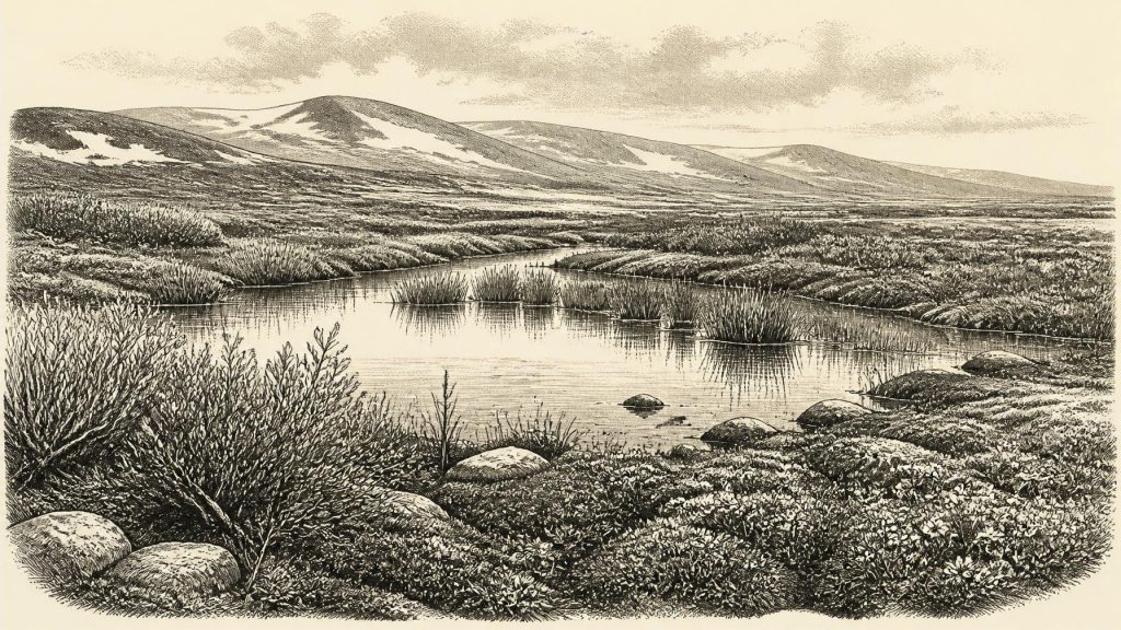
Derryvree was not an untouched modern landscape waiting to be discovered. It was a local basin, shaped by relief, drainage and shelter, in which water could collect between episodes of glaciation. Its deposits indicate fresh water and damp ground rather than an unbroken expanse of ice. Plant remains include mosses and cold-adapted taxa such as dwarf willow, mountain avens and lesser clubmoss. The finding of bogbean, a plant of wet places, and water-milfoil, an aquatic plant, shows that shallow or slow-moving freshwater habitats existed locally.
This combination is best read as a mosaic. Open tundra-like ground, wet margins, pools, mossy patches and sparse low vegetation could coexist over short distances. Summers may have allowed a brief but biologically active growing season, while winters were severe and the ground was influenced by frost. The evidence does not support woodland, cultivated land or a familiar modern Irish pasture. Nor should it be turned into a uniform map of the whole island. A small buried wetland records its own catchment more clearly than it records distant coasts, mountains or lowlands.
The landscape was therefore cold, but it was not lifeless. Mosses, herbs and dwarf shrubs captured sediment and built organic layers; standing water supported aquatic plants; insects and small animals would have formed part of the wider food web, though the Derryvree deposit does not provide a complete census. Its importance lies in demonstrating that a glacier-free interval could sustain ecological communities before later ice returned.
Ice, Water and Changing Ground
The Irish landscape around this period was changing on a scale that makes modern political geography irrelevant. Ireland lay within the wider region affected by the growth and reorganisation of the British–Irish Ice Sheet. The full Last Glacial Maximum still lay in the future: its greatest extent is generally placed much later, around 26,000–20,000 years ago. At the time represented by Derryvree, ice margins and ice thickness were not static. Some areas could carry ice, while other localities remained open long enough for lakes, wetlands and vegetation to develop.
The two tills at Derryvree make that regional instability tangible. They record glaciation before and after the freshwater interval, but do not prove that ice covered every part of Ireland at the same moment or moved in a single, simple advance. Modern reconstructions of the British–Irish Ice Sheet stress asynchronous growth, retreat and readvance in different sectors. The Derryvree sequence is one reason why Ireland’s Ice Age cannot be described merely as either wholly frozen or wholly habitable.
Coasts and sea routes also differed from those of the present. Global sea level was lower during the last glacial period, while crustal loading by ice affected relative sea levels around Ireland and Britain. However, the Derryvree evidence cannot tell us whether a particular crossing was open in 30,464 BCE, nor does it demonstrate regular movement of people or animals across one. It is safer to say that the physical geography of the Irish Sea region was in flux.
Animals in a Fragmentary Record
Irish cave collections provide the principal evidence for larger animals of this broad part of the Ice Age. Castlepook Cave, near Doneraile in County Cork, has yielded remains attributed to reindeer, brown bear, wolf, fox, mountain hare, lemmings, giant deer, woolly mammoth and spotted hyaena. The Irish Quaternary Fauna Project showed that a comparatively varied mammal fauna reached Ireland at some point between at least about 45,000 and 20,000 years ago.
That list must not be treated as a single living community photographed in one year. Cave deposits were often excavated long ago, many were disturbed, and bones may have accumulated through carnivore activity, water movement and later reworking. Recent re-dating has also shown that some earlier radiocarbon measurements from Castlepook were significantly too young, underlining the need to date individual specimens directly and to understand how they entered a deposit. A bone establishes the presence of an animal at some point; it does not automatically establish the date, season or character of a surrounding landscape.
Nevertheless, the fauna fits the picture of an open, cold country capable of supporting grazing or browsing animals and their predators. Reindeer are especially relevant to the broad environmental setting, since they are well adapted to northern, open habitats. Spotted hyaena remains from Castlepook also remind us that caves might be carnivore places rather than human shelters. Mammoth and giant-deer bones evoke a much richer Pleistocene animal world than later historic Ireland, but their association with one another, with any human group, or with Derryvree’s precise wetland phase cannot be assumed.
The Castlepook Human Question
The most striking possible evidence for people in Ireland during the wider period is a reindeer femur from Castlepook Cave. The bone was re-examined in recent years, directly dated to roughly 33,000 years ago in public reporting, and found to carry an incision interpreted as a cut mark made during carcass processing with a sharp stone edge. County Cork heritage material accordingly presents it as a potentially very early trace of Stone Age hunters.
Its significance is considerable, but the qualification is equally important. The date measures the death of the reindeer, not a documented calendar day of butchery. The bone was not recovered from a modern, intact excavation containing associated flint tools, a hearth, dwelling floor, human remains or food refuse. The mark’s interpretation requires continued specialist scrutiny, and Castlepook’s complex cave deposits counsel caution. Even if the cut mark is confirmed, it would demonstrate an encounter with a carcass, not a permanent settlement or continuous population.
It is therefore not responsible to write of an Irish tribe, migration, hunting territory or established community in 30,464 BCE. The most that can be said is that people may have reached Ireland, perhaps briefly, during the broader Upper Palaeolithic world of north-western Europe. No evidence identifies their language, kinship, beliefs, artistic practices or place of origin.
Society Beyond the Evidence
There is no basis for political history at this date. No chiefdom, boundary, alliance, war, diplomacy or legal custom can be recovered from the Irish record. Likewise, there is no direct evidence of trade: no imported stone toolkit, worked ornament, exchange network or transport route has been securely tied to this horizon in Ireland. Farming was still many millennia away. If people visited, their subsistence would have depended on wild resources, but the Irish evidence is too slight to reconstruct their meals, camps or seasonal movements.
Religion and learning are similarly beyond recovery. Caves can acquire powerful meanings in later societies, but Castlepook has supplied no securely dated Irish ritual deposit, art, burial or symbol from this period. The absence matters. It prevents an attractive Ice Age scene from becoming a fictional one. Archaeology can describe a cold wetland, a changing ice sheet and animal remains; it cannot honestly furnish those landscapes with ceremonies, leaders or legends for which no trace survives.
What This Horizon Means
The historical importance of this notional year lies in the survival of evidence rather than in an identifiable event. Derryvree preserves a rare glimpse of life between ice advances: freshwater, mosses, aquatic plants and low tundra vegetation under a cold periglacial climate. Castlepook and other cave collections show that sizeable mammals entered Ireland during the wider Late Pleistocene, while one marked reindeer bone raises, but does not settle, the question of an early human visit.
For Ireland around 30,464 BCE, then, the strongest account is environmental. It is a story of wetlands buried under later glacier debris, animals known through scattered bones, and a human possibility resting on a single exceptional object. The landscape had history, but not yet history in the written or annual sense. Its archive is measured in layers, calibrated ranges and carefully bounded conclusions.
Primary Sources
- A Middle Midlandian Freshwater Series at Derryvree, Maguiresbridge, County Fermanagh, Northern Ireland
- The Irish Quaternary Fauna Project
- A Reconsideration of the Radiocarbon Dating of the Marine Isotope Stage 3 Fauna from Southern Ireland
- Trimlines, Blockfields and the Vertical Extent of the Last Ice Sheet in Southern Ireland
- Growth and Retreat of the Last British–Irish Ice Sheet, 31,000 to 15,000 Years Ago: the BRITICE-CHRONO Reconstruction
- The Timing and Magnitude of the British–Irish Ice Sheet Between Marine Isotope Stages 5d and 2: Implications for Glacio-isostatic Adjustment, High Relative Sea Levels and ‘Giant Erratic’ Emplacement
- New Insights on the Fauna of Ireland’s Younger Dryas and Early Holocene from Alice & Gwendoline Cave
- The IntCal20 Northern Hemisphere Radiocarbon Age Calibration Curve (0–55 cal kBP)
- Pattern and Timing of Retreat of the Last British-Irish Ice Sheet
- BRITICE-CHRONO: Constraining the Retreat of the Last British-Irish Ice Sheet
- Geology of Ireland
- Quaternary
- Ireland Through Geological Time
- Figure 6.— The Subdivision of the Quaternary Period in Ireland
- Palaeoecology
- Heritage Artefacts of County Cork
- Ireland’s Palaeolithic Archaeology – Fleeting Footprints in a Frozen Land
- Menyanthes trifoliata
- Radiocarbon Constraints on the Age of the Maximum Advance of the British–Irish Ice Sheet in the Celtic Sea
- Maximum Extent and Dynamic Behaviour of the Last British–Irish Ice Sheet West of Ireland
- Stratigraphic and Palaeo-geomorphological Evidence for the Glacial-deglacial History of the Last British-Irish Ice Sheet in the North-western Irish Sea
- The Timing and Magnitude of the British–Irish Ice Sheet Between Marine Isotope Stages 5d and 2





