Maguirebridge’s Winter Pools30423 BCE
Around 30,423 BCE, Ireland’s evidence derives from environmental archives rather than recorded events. At Derryvree near Maguiresbridge, County Fermanagh, freshwater silts preserved between glacial tills indicate an ice-free interval, broadly dated to 36,900–31,700 calibrated years before present. Fossils reveal a cold, treeless tundra mosaic of pools, mosses, sedges, herbs and frost-affected ground. Castlepook Cave in County Cork documents cold-adapted mammals including mammoth, reindeer, giant deer, bear and hyaena across time. A cut-marked reindeer bone may suggest brief human activity, but permanent occupation remains unproven. Later ice expansion buried or destroyed much earlier evidence, leaving a fragmentary record of changing environments.

Dateline
The label 30,423 BCE is useful for placing this article on a modern timeline, but it must not be mistaken for a date known to the people, animals or landscapes of Ice Age Ireland. There were no calendars, written records or year-by-year events from which to reconstruct an Irish history for that single year. In scientific terms it falls about 32,372 years before AD 1950, within the Late Pleistocene and Marine Isotope Stage 3 (MIS 3), a climatically unsettled interval of the last Ice Age. The most responsible account is therefore built from dated deposits, fossils and landforms whose ranges extend across centuries or millennia, rather than from an imagined episode on one particular day.
The closest and most revealing Irish evidence is a buried freshwater sequence at Derryvree, near Maguiresbridge in County Fermanagh. It is this local archive, rather than any identifiable human community, that gives the period its substance. Its significance lies in the fact that it records an ice-free landscape in part of Ireland before later glacier ice crossed the area again.
A Date Within a Range
Derryvree was exposed during road works in 1969, when a cut through a drumlin revealed organic silts and fine sands lying between two thick layers of till. Till is unsorted debris deposited by glacier ice. The order of the layers therefore establishes an important sequence: ice occupied the locality; an interval followed in which fresh water, sediment and organic remains accumulated; then a later ice advance overrode and sealed the deposit. The intervening silts are not a settlement floor or a record of one season. They are an environmental archive formed over time.
Organic material from the sequence produced the radiocarbon determination Birm-166, conventionally dated to 30,500 radiocarbon years before present, with a large uncertainty of +1,170 and −1,030 years. Radiocarbon years are not calendar years. Because atmospheric carbon-14 levels changed through time, measurements must be calibrated, and uncertainty grows at such antiquity. Later treatments have placed the Derryvree evidence broadly at about 36,900–31,700 calibrated years before present. The modern notional date of 30,423 BCE falls within that wide span, but cannot be attached to a particular plant, pool, animal movement or visit by people.
This distinction is more than technical. It prevents a false picture of historical precision. Derryvree provides strong evidence that a locality in Fermanagh was ice-free during the formation of the freshwater deposits. It does not prove that the whole island was simultaneously free of ice, nor that conditions were uniform from Cork to Donegal. Ireland lay within the wider British–Irish Ice Sheet system, whose growth, retreat and separate ice-flow centres changed repeatedly across the last glacial cycle. Current research increasingly emphasises that this was a dynamic system, including earlier glacial phases before the later Last Glacial Maximum.
Fresh Water Beneath the Drumlin
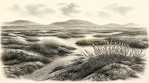
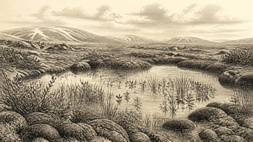
The Derryvree fossils indicate open tundra vegetation and a periglacial climate: ground affected by freezing and thawing, rather than a wooded version of modern Fermanagh. The original investigators identified a flora and fauna of full-glacial aspect. Pollen, plant macrofossils, mosses and insect remains together point to a wet, treeless mosaic rather than an empty frozen desert. Grasses, sedges and low-growing herbs could occupy exposed ground; wetter hollows supported moss-rich margins and freshwater vegetation. Insects indicate pools with abundant plant matter, while the silts and sands themselves show that water was moving or standing in the basin.
‘Tundra’ is a helpful shorthand, but it should not flatten the landscape into one unchanging white plain. The best interpretation is of local variety: shallow water and sodden vegetation in one place, sedgy banks and mosses in another, with thinly vegetated, frost-disturbed ground beyond. Seasonal contrasts were likely severe. The evidence supports cold winters and an exposed setting, but it does not provide a thermometer reading for 30,423 BCE or tell us precisely how long each pool remained open. It is also a record from a lowland hollow; it cannot be treated as a complete map of every Irish hill, coast and valley.
Derryvree matters because its organic bed survived between two tills. Most comparable landscapes were repeatedly eroded, buried or remodelled by later ice. The fact that this small freshwater world was sealed beneath a drumlin has preserved a rare glimpse of Ireland before the major late-glacial ice expansion. In that sense, the principal ‘development’ relevant to this date was environmental: the persistence, for a time, of an ice-free wetland ecosystem amid a changing glacial world.
Animals on an Unstable Island
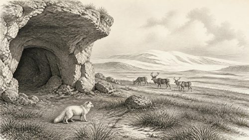
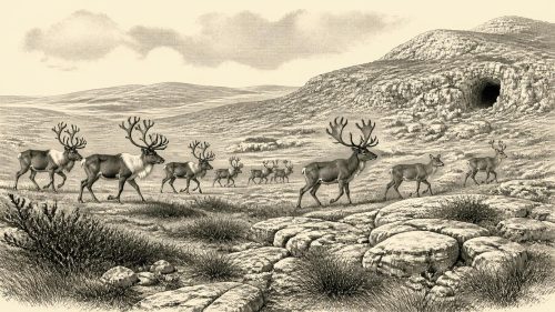
Animal bones from Irish caves provide a second, complementary line of evidence. Castlepook Cave, near Doneraile in north County Cork, is exceptionally important because it has yielded more than 2,000 vertebrate remains and is Ireland’s richest known cave site for fauna leading towards the Last Glacial Maximum. Its assemblage includes woolly mammoth, giant deer, reindeer, brown bear and spotted hyaena, followed in later Ice Age contexts by Arctic fox, wolf and lemmings. Direct dates show that the cave accumulated material over a very long interval, not in a single occupation or a single ecosystem.
That qualification is essential. A mammoth bone or hyaena tooth at Castlepook does not mean that these species were all present at one spot in 30,423 BCE. Cave deposits were disturbed by water, carnivores, scavenging and nineteenth- and early twentieth-century excavation. Individual bones may be far apart in age. Yet the overall record firmly demonstrates that pre-Last Glacial Maximum Ireland was connected, at intervals, to the wider north-west European world of cold-adapted and open-country mammals. Reindeer and mammoth imply landscapes capable of supporting large grazers; hyaenas and wolves indicate carnivores or scavengers able to exploit carcasses and prey.
The routes by which animals reached Ireland remain a question of changing geography rather than a simple answer about a permanent land bridge. Sea level was lower than today and the outlines of coasts, shelves and channels differed radically, but glacial ice, water barriers and climate repeatedly altered the practical possibilities of movement. The evidence supports intermittent ecological connections, not a claim that every species, or every human group, could freely cross at any chosen moment.
The Human Question
The possibility of people in Ireland around this broad period rests chiefly on a reindeer femur from Castlepook Cave. Re-examination identified a deep incision interpreted by zooarchaeologist Ruth Carden as a mark made by a sharp stone tool during carcass processing. County Cork’s heritage publication presents the object as a Palaeolithic reindeer bone of about 31,000 BC. If the interpretation is confirmed, it would move evidence for human activity in Ireland dramatically earlier than the well-established Mesolithic occupation of the island after the Ice Age.
But it is not evidence for a village, a population or an enduring Irish society. The bone comes from an old cave collection, not from a modern excavation of an intact surface containing hearths, stone tools, shelters, food debris and repeated activity. Its date concerns the death of the reindeer, while the cut-mark interpretation concerns damage to its bone. Those are related observations, but neither identifies who made the mark, how many people were involved, whether they lived locally, or whether they returned. No securely dated Upper Palaeolithic dwelling, cemetery, tool workshop or artistic site has yet been established in Ireland for this horizon.
The prudent conclusion is that brief human presence is possible and potentially supported by a remarkable object, but that permanent occupation is unproven. Upper Palaeolithic hunter-gatherers elsewhere in Europe possessed sophisticated knowledge of animal behaviour, stone technology, clothing, fuel and mobility. Such comparisons help explain what a short visit to Ireland might have required, but they are not direct evidence that every European practice occurred on the island. We cannot responsibly assign an ethnic name, language, kin group or cultural tradition to Ireland at this date.
No Polities, No Proven Trade
There is no evidence for political affairs, diplomacy, warfare, law, leadership or territorial states in Ireland around this point. Nor can archaeology demonstrate formal religion, public ritual, monuments, schools or systems of learning. These are not merely missing details awaiting recovery: the surviving record is overwhelmingly geological, botanical and zoological. It is better to recognise the limits of the evidence than to populate the landscape with imagined chiefs or tribes.
Likewise, there is no direct proof of farming, herding, managed land, long-distance trade or an Irish economy in the later historical sense. If people reached the island, their immediate material concerns may have included shelter, warmth, safe movement, tool maintenance and access to animal resources; that is a cautious inference from Ice Age hunter-gatherer life elsewhere, not an excavated Irish inventory. The economy that can actually be observed is ecological: plants colonised wet ground, herbivores fed in open habitats, predators and scavengers used animal carcasses, while frost, meltwater and glacier ice continually reshaped the terrain.
Before the Great Expansion of Ice
The Derryvree deposits pre-date the fullest later expansion of the Irish sector of the British–Irish Ice Sheet. Research on the Last Glacial Maximum shows that, much later, ice extended to the Atlantic shelf edge in the west and north-west, across the Celtic Sea shelf to the south, and into the Irish Sea system. That subsequent glaciation buried, eroded and rearranged much of the evidence from earlier landscapes.
For Ireland around 30,423 BCE, therefore, the most vivid and defensible image is not of a named historical event but of a vulnerable freshwater enclave: open pools, sedges, mosses and low tundra plants in a Fermanagh hollow, with large mammals known elsewhere on the island and renewed ice advance still to come. It is a history measured in deposits and calibrated ranges—a fragmentary but compelling record of life and environmental change on an Ice Age Ireland.
Primary Sources
- A Middle Midlandian Freshwater Series at Derryvree, Maguiresbridge, County Fermanagh, Northern Ireland
- Exploring Controls of the Early and Stepped Deglaciation on the Western Margin of the British Irish Ice Sheet
- A Reconsideration of the Radiocarbon Dating of the Marine Isotope Stage 3 Fauna from Southern Ireland
- Castlepook Cave: County Geological Site Report CK032
- Heritage Artefacts of County Cork
- The Irish Quaternary Fauna Project
- Episodic Speleothem Deposition Tracks the Terrestrial Impact of Millennial-Scale Last Glacial Climate Variability in SW Ireland
- Composition and Consequences of the IntCal20 Radiocarbon Calibration Curve
- The IntCal20 Approach to Radiocarbon Calibration Curve Construction: A New Methodology Using Bayesian Splines and Errors-in-Variables
- The Timing and Magnitude of the British–Irish Ice Sheet Between Marine Isotope Stages 5d and 2
- Trimlines, Blockfields and the Vertical Extent of the Last Ice Sheet in Southern Ireland
- Deglaciation Chronology of the Donegal Ice Centre, North-West Ireland
- Timing and Pace of Ice-Sheet Withdrawal Across the Marine–Terrestrial Transition West of Ireland During the Last Glaciation
- A Field Guide to Some Aspects of the Quaternary History of South Fermanagh
- Occurrence of Mammalia Relicts at Site Castlepook Cave
- New Insights on the Fauna of Ireland’s Younger Dryas and Early Holocene from Alice & Gwendoline Cave
- The Mesolithic in Ireland: When Was It?
- Pattern and Timing of Retreat of the Last British-Irish Ice Sheet
- Growth and Retreat of the Last British–Irish Ice Sheet, 31,000 to 15,000 Years Ago: The BRITICE-CHRONO Reconstruction
- Irish Quaternary Association Publications