Alternate Water-Milfoil Basin30386 BCE
30,386 BCE is a modern label within a broad, uncertain Late Pleistocene timeframe, not a recoverable Irish calendar year. Derryvree, County Fermanagh, preserves freshwater sediments between glacial deposits, radiocarbon dated broadly to 34,950–29,750 BCE. Its plants, pollen and insects indicate cold, treeless, wet tundra-like conditions with shallow water and hardy vegetation. Ireland experienced shifting ice, lower seas and changing regional connections, rather than uniform conditions. Castlepook Cave, County Cork, contains a complex, long-accumulated fauna including mammoth, reindeer and hyaena. A possible cut-marked reindeer bone may indicate intermittent Upper Palaeolithic human activity, but no contemporary settlement, society or institutions are established.
Dateline
30,386 BCE is a useful modern label, not a date that can be recovered from the Irish archaeological record with calendar-year precision. No community in prehistoric Ireland recorded years in a system comparable to the modern calendar, and no excavated event, person, settlement or object can responsibly be assigned to this single year. The appropriate setting is the later part of the Pleistocene, within Marine Isotope Stage 3: a long and climatically unstable phase of the last Ice Age before the Last Glacial Maximum.
In conventional calendar arithmetic, 30,386 BCE lies about 32,335 years before AD 1950, the reference point used for “before present” dating. But radiocarbon results from so far back carry substantial uncertainty and must be calibrated. Consequently, the best history of Ireland at this point is a history of dated ranges, buried sediments, animal remains and changing ice, rather than an annual chronicle. The strongest Irish evidence relevant to the date comes from a freshwater deposit at Derryvree near Maguiresbridge, County Fermanagh, and from the rich but complex animal-bone record of Castlepook Cave near Doneraile, County Cork.
A Wetland Between Ice Advances
Derryvree was exposed during road works in 1969, when a section through a drumlin revealed an unusual sequence. Beneath later glacial deposits lay freshwater silts, sands and organic material; below them was an earlier layer of till, the unsorted debris left directly by glacier ice. This arrangement is important. It establishes that ice had occupied the locality, that a period followed in which freshwater and wet ground developed, and that later ice or ice-derived deposits buried the evidence again. The sediment is therefore a rare survival of an ice-free interval in a landscape repeatedly transformed by glaciation.
Organic material from the deposit produced the radiocarbon determination BIRM-166, conventionally reported as 30,500 radiocarbon years before present, with a considerable error margin. Radiocarbon years are not calendar years: atmospheric carbon-14 levels have varied through time, so a laboratory age must be compared with independently dated calibration records. Modern calibration places the Derryvree material broadly within a range of roughly 36,900–31,700 calibrated years before present, approximately 34,950–29,750 BCE. The nominal year 30,386 BCE falls within that wide interval. It cannot, however, be attached to a particular season, pool level, plant generation or human action at Derryvree.
This distinction is more than a technical caution. The site proves that freshwater conditions existed at this Fermanagh locality during part of the relevant broad period; it does not prove that all Ireland looked the same at once, nor that the wetland was present unchanged throughout the entire calibrated range. Glaciers, meltwater, permafrost, vegetation and animal movements changed over centuries and millennia. A precisely numbered BCE year should therefore be treated as a point placed within a large scientific window.
Open Ground and Shallow Water
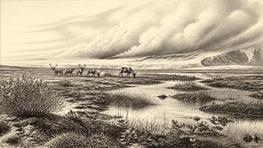
The Derryvree fossils offer a more vivid picture of environment than of human history. Pollen, plant macrofossils and insect remains indicate a cold, largely treeless landscape with freshwater pools and wet margins. The preserved flora includes sedges, mosses, dwarf willow, mountain-avens, bogbean, clubmosses and aquatic plants such as alternate water-milfoil. Such species do not provide a complete national inventory, and their preservation was shaped by the local basin. Yet together they support a reconstruction of open, wet, tundra-like ground rather than dense woodland.
Words such as “tundra” and “muskeg” should be used carefully. They are modern ecological comparisons, not claims that a present-day Arctic landscape stood unchanged in Fermanagh. The defensible conclusion is narrower and stronger: there were shallow or slow-moving fresh waters, waterlogged organic ground and hardy plant communities able to endure short growing seasons and severe winters. Mosses and sedges bound damp ground; low shrubs and herbs grew where conditions allowed; aquatic plants occupied water. Insects provide additional evidence for cold, open and wet habitats, although they cannot yield a daily temperature for 30,386 BCE.
This was not a barren white wilderness. Nor was it a familiar green Ireland. Local wetlands could be productive places within an otherwise demanding periglacial landscape, sustaining invertebrates and providing forage at their margins. The organic deposit records life persisting between phases of glaciation. It is precisely because later ice sealed the sediments that this fragile ecological evidence survives at all.
Ice, Coast and Regional Change
Ireland at this time was moving towards the more extensive glaciation of the Last Glacial Maximum, conventionally placed much later, broadly around 26,000–19,000 years ago. Recent reconstructions of the British–Irish Ice Sheet emphasise that ice growth and retreat were neither simple nor simultaneous across Ireland and Britain. Different sectors advanced, thickened or retreated at different times. At around 32,335 calibrated years before present, the island should be understood as part of a changing north-west European cold-stage region, not as a uniform block of ice or an entirely open refuge.
Sea levels were lower than today because large quantities of water were stored in continental ice sheets. Coastlines, shallow seas and possible routes through the Irish Sea region were consequently unlike those of modern maps. Yet lower sea level does not itself demonstrate a walkable route into Ireland at this exact point, nor does it establish regular movement of people or animals. The geometry of shorelines, channels, ice margins and exposed land altered through time. The responsible conclusion is that geography was changing and mobility was possible in principle, while the exact routes available in this notional year remain uncertain.
The Derryvree sequence also warns against assuming a single island-wide climate. A freshwater basin near Maguiresbridge documents conditions in one northern locality. It does not settle whether every upland, valley or coastal plain was ice-free, nor does it tell us the exact position of each glacier margin. Ireland’s later glacial landforms are evidence of powerful ice movement, but much of the earlier landscape was eroded, displaced or buried. The surviving archive is therefore unusually valuable, but intrinsically local.
Castlepook and the Animal Record
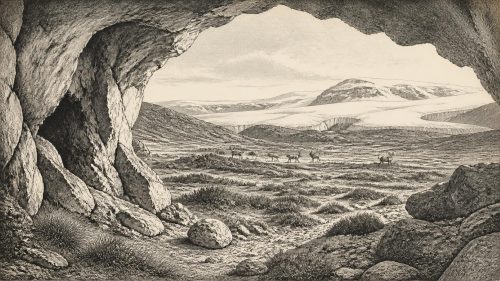
Far to the south, Castlepook Cave in north County Cork gives a different kind of evidence. The limestone cave system, also called Mammoth Cave, yielded more than two thousand Pleistocene bones in excavations undertaken mainly in the early twentieth century. Its fauna includes woolly mammoth, reindeer, giant deer, brown bear and spotted hyaena, with wolf, Arctic fox, mountain hare and lemmings represented among the wider assemblage. It is Ireland’s richest known cave archive for vertebrate life before and around the Last Glacial Maximum.
That list should not be converted into a single imagined herd moving across Cork in 30,386 BCE. Individual bones from Castlepook span a long period, and cave deposits were affected by carnivores, water movement, sediment mixing and the recording practices of earlier excavators. Spotted hyaenas may themselves have introduced some carcass remains. Modern re-dating has shown that several specimens are older than earlier determinations suggested, while other remains belong to later parts of the last glacial cycle. The cave demonstrates that an Ice Age fauna reached Ireland during this broad era; it does not demonstrate that all listed species were contemporaries at one place.
Nevertheless, the record makes ecological sense alongside Derryvree. Reindeer and giant deer required plant resources; mammoths, predators and scavengers belonged to wider food webs; small cold-adapted mammals signal severe conditions. Their presence shows that Ireland was connected to wider patterns of animal dispersal in north-west Europe over long timescales. Animal movement was not necessarily continuous, and the cave’s collection cannot reveal migration routes or population sizes. But it firmly overturns any idea that pre-Last Glacial Maximum Ireland was devoid of large mammals.
The Limited Human Question
One Castlepook specimen has made the human question especially important. A reindeer femur in the historic collection bears a deep surface incision which zooarchaeologist Ruth Carden has interpreted as a mark made by a sharp stone tool during butchery. Public heritage material associates the bone with an age of about 31,000 BCE. If the interpretation of the mark as human-made is sustained, it would indicate that people processed a reindeer in Ireland during the wider Upper Palaeolithic period, vastly earlier than the island’s well-established post-glacial settlement record.
Its importance should not be exaggerated. The bone dates the animal’s death, not automatically the moment of cutting; moreover, it was not recovered in a modern excavation from a sealed occupation floor with hearths, stone tools, refitting bones and a dwelling surface. There is no securely dated Irish camp, house, burial, workshop, art assemblage or cemetery that can be assigned to 30,386 BCE. A single possible cut mark is evidence for a narrowly defined action on a carcass, not proof of a resident population, a named people, a route of arrival or continuous occupation.
If people were present intermittently, comparison with documented Upper Palaeolithic hunter-gatherers elsewhere in north-west Europe suggests that knowledge of animal behaviour, stone-working and carcass processing would have been essential. Reindeer could offer meat, fat, marrow, hide, sinew and bone. That is a reasonable conditional inference, not a description of a proven Irish society. There is no evidence here for farming, livestock, pottery, permanent villages, boats, formal exchange networks or regular long-distance trade.
History Before Institutions
For the same reason, political affairs, diplomacy and warfare cannot be reconstructed. No leaders, polities, territorial boundaries or alliances are known. There is no direct evidence for religious observance, monuments, graves, ceremonial sites, language, teaching or artistic traditions. Absence of evidence does not mean that visitors, if any, lacked beliefs or social ties; it means that the Irish record has not preserved material capable of identifying them. To provide a detailed social or cultural narrative would be invention.
The most meaningful developments around this date are environmental. At Derryvree, water and hardy vegetation occupied a window between glacier advances. At Castlepook, a long-accumulated bone archive records a diverse cold-stage fauna and perhaps one exceptionally early trace of human carcass processing. These archives preserve an Ireland shaped by climatic instability: wetland and open ground in some places, animal dispersal across a changing region, and ice whose later advance would erase much of the evidence. The past accessible at 30,386 BCE is not a year of kings, battles or settlements. It is a deep-time landscape whose surviving sediments and bones set clear limits on what can responsibly be said.
Primary Sources
- A Middle Midlandian Freshwater Series at Derryvree, Maguiresbridge, County Fermanagh, Northern Ireland
- References and Recommended Reading
- A Reconsideration of the Radiocarbon Dating of the Marine Isotope Stage 3 Fauna from Southern Ireland
- Castlepook Cave: County Geological Site Report
- Heritage Artefacts of County Cork
- The Exploration of Castlepook Cave, Co. Cork. With 3 Plates.
- 2022:564 – Castlepook Cave, Castlepook South, Cork
- Pleistocene Vertebrates in the British Isles
- Growth and Retreat of the Last British–Irish Ice Sheet, 31,000 to 15,000 Years Ago: The BRITICE-CHRONO Reconstruction
- The IntCal20 Northern Hemisphere Radiocarbon Age Calibration Curve (0–55 cal kBP)
- The Timing and Magnitude of the British–Irish Ice Sheet Between Marine Isotope Stages 5d and 2
- Oscillating Retreat of the Last British-Irish Ice Sheet on the Continental Shelf Offshore Galway Bay, Western Ireland
- Maximum Extent and Dynamic Behaviour of the Last British–Irish Ice Sheet West of Ireland
- Last Glacial Maximum Cirque Glaciation in Ireland and Implications for Reconstructions of the Irish Ice Sheet
- Reconstructing the Last Irish Ice Sheet 2: A Geomorphologically-Driven Model of Ice Sheet Growth, Retreat and Dynamics
- Trimlines, Blockfields and the Vertical Extent of the Last Ice Sheet in Southern Ireland
- Radiocarbon Constraints on the Age of the Maximum Advance of the British–Irish Ice Sheet in the Celtic Sea
- Stratigraphic and Palaeo-Geomorphological Evidence for the Glacial-Deglacial History of the Last British-Irish Ice Sheet in the North-Western Irish Sea
- Investigating Seasonal Mobility in Irish Giant Deer, Megaloceros giganteus (Blumenbach)
- Ireland’s Palaeolithic Archaeology – Fleeting Footprints in a Frozen Land
- Mammoth Cave (Castlepook Cave), County Cork
- The Late Quaternary History of East-Central Ireland