Castlepook Faunal Menagerie30357 BCE
Around 30,357 BCE, Ireland cannot be described through a precise annual chronology, but as part of the unstable late Pleistocene before the local Last Glacial Maximum. Climate was deteriorating, while ice, sea levels and habitats changed unevenly. Treeless tundra, wetlands and seasonal forage supported cold-adapted animals, evidenced by deposits such as Derryvree and Castlepook Cave. Castlepook yielded mammoth, reindeer, giant deer and predators, though its disturbed bones cannot reconstruct a single moment. A cut-marked reindeer femur may indicate early human activity, but proves neither settlement nor population. Advancing ice subsequently reshaped Ireland’s landforms, leaving an incomplete archaeological record for millennia.

Dateline
“30,357 BCE” is a modern numerical label, not a date that can be assigned to an episode in Irish prehistory. No written calendar, settlement sequence or archaeological horizon allows an event in Ireland to be fixed to that particular year. In terms of simple calendar arithmetic it lies about 32,300 years before AD 1950, the conventional “present” used in radiocarbon reporting; that is not itself a radiocarbon or calibrated age. At this depth in time, responsible history works with broad, calibrated ranges, stratigraphy and environmental sequences. The closest useful frame is the later part of Marine Isotope Stage 3, before the local maximum of the last British–Irish Ice Sheet. Ireland was entering a period of profound climatic deterioration, but its precise conditions varied by region and changed sharply over generations.
A Date Without a Yearly Record
Radiocarbon years are not identical to calendar years, because atmospheric carbon-14 has varied through time. Modern calibration curves extend far enough to model many Late Pleistocene dates, yet their ranges remain substantial and depend on the material dated and the sample’s integrity. Nor is it safe to translate a date in “years ago” directly into BCE. The evidence relevant to this article comes from cave bones, buried sediments, pollen and plant macrofossils, glacial landforms, marine cores and ice-core climate chronologies. Each records a different process and has its own uncertainty. Together they illuminate a world around the requested date; none provides an Irish diary entry for it.
The broader climatic backdrop was unstable. Greenland ice cores identify abrupt alternations between relatively milder interstadials and colder stadials across the last glacial period. These North Atlantic shifts mattered greatly at Ireland’s Atlantic edge, influencing temperature, precipitation, sea ice, vegetation and the growth of land ice. But a Greenland signal is not a thermometer placed in Cork or Fermanagh. It provides a carefully dated regional framework within which Irish deposits must be compared, rather than a substitute for local evidence.
Before the Ice Sheet’s Maximum
By roughly 27,000–23,000 calibrated years BP, the last Irish Ice Sheet had expanded over all of Ireland and across the surrounding shelf to the Atlantic and Celtic Sea margins. This was the island’s local Last Glacial Maximum, though timing and ice thickness differed from one sector to another. The requested date, around 32,300 calendar years before 1950, predates that island-wide maximum. It belongs to the build-up towards it, not automatically to a wholly ice-covered Ireland.
That distinction is important. Older accounts often treated the last glaciation as a single, uniform blanket of ice. Current reconstructions instead show an ice sheet that grew, flowed and retreated asynchronously, with fast-flowing outlets and local topographic controls. Research on the Atlantic shelf indicates extensive ice reached the shelf edge by the later stages of the glacial maximum; work in southern mountains also suggests that some high ground may have experienced cold-based ice or more limited glaciation at particular times. For c. 30,357 BCE, the safe conclusion is not a map with a sharp coastline of ice, but a changing mosaic of glaciated terrain, periglacial ground and cold habitats whose distribution is incompletely known.
Sea level was lower globally because vast quantities of water were locked in ice sheets. Yet it does not follow that Ireland was joined to Britain by a simple, walkable land bridge. The Irish Sea basin, local crustal movements, marine channels and changing ice margins made palaeogeography complex. At some times ice itself was the more significant physical connection or barrier. For animals and any people approaching the island, movement may have involved ice, coast, short sea crossings or combinations of these; the evidence cannot specify a route in this particular period.
Open Ground and Wet Hollows
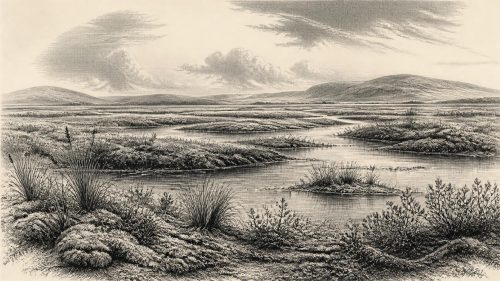
The most informative onshore environmental records are not exactly contemporary with 30,357 BCE, but they demonstrate the kinds of landscapes that could exist in ice-free intervals before the final advance. At Derryvree near Maguiresbridge in County Fermanagh, organic silts sealed between tills preserve a treeless, cold-climate wetland assemblage. Plant remains include sedges, mosses, dwarf willow, mountain avens, water-milfoil and bogbean. These are evidence for freshwater pools, marshy margins and open tundra or muskeg-like vegetation, not for forested Ireland.
The Derryvree sequence needs cautious use. Its sediments are buried beneath later glacial deposits and their precise correlation with global climate events has long been debated. It cannot be treated as an annual record or simply dated to this article’s numerical year. Nevertheless, it establishes an important possibility: even in a cold, largely treeless Ireland, sheltered basins could support aquatic plants, damp ground and a short but productive growing season. Such patches would have contrasted with exposed, wind-scoured slopes, frost-shattered rock and seasonally frozen soils.
This was not an agricultural landscape. There were no fields, livestock, houses, roads or villages demonstrated for Ireland at this time. Woodlands that later supplied fuel, timber, nuts and cover had no equivalent in the available pre-maximum evidence. Plant productivity would have been highly seasonal. Snow cover, frozen ground and severe winds could rapidly reduce accessible forage, while wetland margins may have concentrated plants and attracted herbivores during favourable months. These ecological constraints, rather than political frontiers, are the closest thing to a governing structure visible in the record.
Castlepook and the Animal World
Castlepook Cave, near Doneraile in north County Cork, is central to the discussion because its historic excavations recovered an unusually rich collection of Pleistocene animal remains. The recorded fauna includes woolly mammoth, reindeer, giant deer, wolf, fox, spotted hyaena, arctic fox, lemmings and other cold-stage animals. It shows that Ireland could, at least intermittently, sustain a far more varied large-mammal community than the island’s later historic fauna might suggest. Reindeer, in particular, evoke a mobile grazing species adapted to open country; mammoth and giant deer point to substantial feeding opportunities somewhere in the wider landscape.
Yet a cave bone assemblage is not a census of a living valley. Carnivores may have dragged carcass parts inside; animals may have died naturally in or near the cave; water and slope processes may have moved bones; and the early twentieth-century excavation removed much of the original sedimentary context. Castlepook’s assemblage accumulated over a long span, rather than during one season or one human visit. It therefore supports the presence of these species in Pleistocene Ireland, but cannot prove that mammoth, hyaena, reindeer and people all met at Castlepook in 30,357 BCE.
A reindeer femur from the cave has attracted particular attention because it bears an incision interpreted as consistent with cutting by a sharp stone edge. County Cork’s heritage record places it broadly around 31,000 BCE and presents it as possible evidence of Palaeolithic human activity. If that interpretation and broad age are sustained by future work, it would indicate that people handled a reindeer carcass in Ireland well before the ice sheet’s maximum. It would not demonstrate a permanent colony, a campsite, a tool industry or a community existing uninterruptedly through the glacial advance. No securely associated lithic assemblage, hearth, dwelling floor or human remains are presently available to fill in those gaps.
People: Possibility, Not Population History
The evidence for humans near this date is consequently suggestive but slender. A cut-marked bone is not the same as a settlement, and the Castlepook material deserves further direct dating, microscopic study and renewed contextual analysis. Archaeology must also reckon with preservation bias. Later ice repeatedly eroded and redeposited Irish landscapes; sea-level change submerged former coastal plains; and antiquarian cave excavations did not meet modern recording standards. The absence of a rich Palaeolithic archive is therefore not proof that no person ever reached Ireland. Equally, the evidence does not permit confident claims of a resident “first Irish” population.
Comparison with neighbouring regions gives context, not confirmation. Upper Palaeolithic people lived in parts of Britain and continental Europe during the wider period, using stone technologies, exploiting large game and adapting to cold environments. Such groups were highly mobile, socially connected beyond any single camp and capable of travelling through demanding terrain. If people visited Ireland before the glacial maximum, their social world was likely organised through small, flexible kin networks and seasonal decisions about risk, food and movement. That is an inference from hunter-gatherer archaeology elsewhere, not a directly observed Irish institution.
There is no responsible evidence for named leaders, territories, warfare, treaties, diplomatic exchange, formal religion or learned traditions in Ireland around this point. Nor is there evidence for trade in the later sense of regular exchange between identifiable communities. Stone, meat, hides, sinew, antler and bone may have been valuable practical materials to any visitors, but no Irish artefact assemblage demonstrates their procurement or circulation. It is better to recognise those silences than to invent a prehistoric polity from a single marked bone.
What the Landscape Bequeathed
The larger historical development was environmental transformation. Advancing ice reshaped bedrock and sediments, excavated basins, transported debris and helped create the raw physical inheritance of later Ireland: drumlin fields, moraines, eskers, outwash deposits and altered drainage. These landforms did not appear in a single year, and many were modified during later phases of advance and decay. But around the requested date the processes that would remake the island were intensifying.
For Ireland, then, c. 30,357 BCE is best understood as a threshold rather than an event: a time before full Last Glacial Maximum ice cover, when cold open environments and sizeable mammals are securely attested in the wider Late Pleistocene record, and when a controversial but important reindeer bone from Castlepook raises the possibility of an early human encounter. The historical picture is deliberately spare. It rests on things that survived—silt, seeds, bone, scratches, cave deposits and glacial landscapes—and on the discipline of saying where those things stop speaking.
Primary Sources
- First evidence of a Late Upper Palaeolithic human presence in Ireland
- First evidence of a Late Upper Palaeolithic human presence in Ireland (PDF)
- New insights on the fauna of Ireland’s Younger Dryas and Early Holocene from Alice & Gwendoline Cave
- Occurrence of mammalia relicts at site Castlepook Cave
- 2022:564 – Castlepook Cave, Castlepook South, Cork
- Heritage Artefacts of County Cork
- Growth and retreat of the last British–Irish Ice Sheet, 31,000 to 15,000 years ago: the BRITICE-CHRONO reconstruction
- Dimensions and chronology of the last ice sheet in Western Ireland
- Timing and pace of ice-sheet withdrawal across the marine–terrestrial transition west of Ireland during the last glaciation
- Early deglaciation of the British-Irish Ice Sheet on the Atlantic shelf northwest of Ireland driven by glacioisostatic depression and high relative sea level
- Deglaciation chronology of the Donegal Ice Centre, north-west Ireland
- Trimlines, blockfields and the vertical extent of the last ice sheet in southern Ireland
- Last Glacial Maximum cirque glaciation in Ireland and implications for reconstructions of the Irish Ice Sheet
- The Last Glacial Maximum British-Irish ice sheet: a reconstruction using digital terrain mapping
- Ireland: Submerged Prehistoric Sites and Landscapes
- Quaternary deposits and glacial stratigraphy in Ireland
- Figure 6.—The subdivision of the Quaternary Period in Ireland
- The IntCal20 Northern Hemisphere radiocarbon age calibration curve (0–55 cal kBP)
- A stratigraphic framework for abrupt climatic changes during the Last Glacial period based on three synchronized Greenland ice-core records: refining and extending the INTIMATE event stratigraphy
- The Mesolithic in Ireland: when was it?
- Irish Quaternary Association: Field Guides
- Irish Quaternary Association: Outreach Links, Events & Exhibitions