
Fermanagh’s Sealed Fen30341 BCE
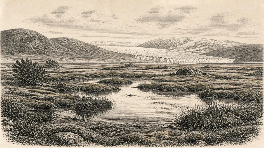
About 30,341 BCE, Ireland has no recoverable calendar history, only Pleistocene environmental evidence. At Derryvree, County Fermanagh, freshwater silts and organic deposits lay between two glacial tills, showing an ice-free wet tundra interval before renewed glaciation. Radiocarbon dating places this sequence broadly within 36,900–31,700 calibrated years BP, not a precise year. Plants and fossils indicate treeless, periglacial conditions. Castlepook Cave, County Cork, preserves remains of cold-adapted mammals, although their dates and associations are complex. A marked reindeer bone may indicate human butchery, yet no secure Palaeolithic settlement is known. The period is best understood as changing landscapes, not human history.
Dateline
30,341 BCE is a modern numerical label, not a year that can be recovered from an Irish calendar or historical record. No writing, named people, settlements, political communities or datable events are known from Ireland at this depth of time. In radiocarbon terms, the nominal date lies about 32,300 years before the conventional “present” of AD 1950, within the later Pleistocene and broadly within Marine Isotope Stage 3. The responsible way to approach it is through long calibrated ranges and stratified deposits, not through an imagined annual chronicle.
The nearest especially informative Irish evidence comes from Derryvree, near Maguiresbridge in County Fermanagh. There, roadworks in 1969 exposed an extraordinary sequence inside a drumlin: glacial till below, freshwater silts, sands and organic deposits in the middle, and later till above. The organic layer produced the radiocarbon determination BIRM-166, conventionally reported as 30,500 radiocarbon years BP, with a substantial uncertainty of +1,170 and −1,030 years. Modern calibration does not turn that measurement into one precise date. It places the deposit broadly within a span extending across several millennia, commonly expressed at roughly 36,900–31,700 calibrated years BP. The nominal date of 30,341 BCE therefore sits towards the younger part of a useful but very wide chronological window.
Freshwater Between Ice Advances
The Derryvree sequence establishes a secure order of events. Glacier ice had already occupied the locality and laid down the lower till. Afterwards, conditions allowed fresh water, fine sediment, plants and small animals to accumulate. Later ice again crossed or covered the site, depositing the upper till and sealing the older wetland beneath it. That order is evidence; the exact duration of each stage is not. The deposit cannot tell us what happened on a particular day, season or year, nor can it serve as a map of all Ireland.
Yet it decisively complicates any picture of an island uniformly entombed beneath ice throughout the last glacial cycle. Around the wider Derryvree interval, at least part of Fermanagh contained an ice-free freshwater setting. Its fossil assemblage has been interpreted as indicating open tundra vegetation and a periglacial regime: a landscape shaped by severe cold, frost action, short growing seasons and scant tree cover. Organic, moss-rich ground and shallow or slow-moving water gave the locality something of a wet tundra or muskeg character, though no ancient Irish environment was identical to a modern northern wetland.
An Exposed, Treeless Country
Plant remains, pollen and other biological traces are the closest thing available to a picture of everyday environmental conditions. They indicate that sedges, mosses and hardy waterside plants could occupy damp ground and pools, while low, cold-tolerant vegetation survived beyond the water’s edge. The original study identified a flora and fauna of full-glacial aspect. This supports an interpretation of open ground rather than woodland, with local wet refuges amid a wider landscape vulnerable to renewed ice expansion.
Climate was not stable. The period before the Last Glacial Maximum was marked by pronounced shifts in temperature, moisture, ice extent and sea level across north-west Europe. The later British–Irish Ice Sheet would reach far more extensive limits, but the growth of that ice mass was regionally uneven and asynchronous. Derryvree belongs to this changing pre-maximum world. Its buried freshwater bed records a local interruption in glaciation; the till above it records that such conditions did not last indefinitely. The most important regional change was therefore not a political revolution or migration known by name, but the recurring rearrangement of viable land, water and ice.
Cork’s Cave Fauna
The strongest complementary evidence comes from the limestone caves around Castlepook, near Doneraile in north County Cork. Castlepook Cave, also called Mammoth Cave, has yielded an important but complicated collection of Pleistocene animal remains. Woolly mammoth, giant deer, reindeer, brown bear, wolf, Arctic fox, lemmings and spotted hyena are among the animals represented in the wider cave archive. They show that Ireland, during parts of the Middle and Late Pleistocene, could support or receive a far richer cold-stage fauna than its later historic landscape.
Care is essential here. Cave deposits were accumulated over long periods through carnivore activity, natural deaths, water movement and the actions of early excavators. A species list is not a census from one season. Nor does the presence of a mammoth bone prove that mammoth stood beside the Derryvree wetland, or that every animal found at Castlepook lived in Ireland simultaneously. Improved radiocarbon pretreatment has also shown that several older Irish cave dates needed revision, in some cases making faunal remains thousands of years older than formerly thought. The broad conclusion is robust: cold-adapted mammals used Irish landscapes during Marine Isotope Stage 3. Fine-grained reconstructions remain provisional.
A Possible Human Trace
Human history at this date is still more uncertain. A reindeer femur from Castlepook has been publicised as bearing a deep mark consistent with cutting or chopping by a stone tool, possibly during carcass processing. If that interpretation is confirmed, it may represent evidence that Upper Palaeolithic people handled a reindeer in Ireland around this broad period, vastly earlier than the island’s long-established post-glacial settlement record. It would be a major discovery.
But a possible cut mark is not a discovered camp, house, hearth, burial, tool kit or continuously occupied territory. No securely excavated Upper Palaeolithic settlement is presently known in Ireland, and the National Museum of Ireland continues to state that clear evidence for Palaeolithic human presence has not yet emerged. The apparent tension reflects the proper caution of archaeology: the Castlepook bone is an intriguing object under investigation, whereas a settled human presence requires a stronger body of contextual evidence. At 30,341 BCE, it is safer to speak of a possible brief human encounter with an animal carcass than of colonisation.
What Cannot Be Written
There is no evidence for political affairs, diplomacy, formal warfare, rulers, tribal names or territorial boundaries in Ireland at this point. Nor is there evidence for agriculture, trade networks, permanent villages, monuments, religious structures or a recoverable system of belief. It would be misleading to project later Gaelic institutions, Celtic identities or even later Mesolithic lifeways back into this much earlier world.
If people did reach the island during this interval, their social world may have resembled that of mobile Upper Palaeolithic foragers elsewhere in north-west Europe: small groups making flexible use of seasonal resources and moving through landscapes whose routes could be altered by coastlines, ice margins and animal movements. That is an informed comparative interpretation, not direct evidence from Ireland. The Irish record does not presently identify their language, kinship, rituals, technology or duration of stay.
Evidence, Not an Annal
The historical significance of this date lies precisely in those limits. Derryvree provides a rare local archive of freshwater and tundra-like conditions between two episodes of glaciation. Castlepook preserves a longer, difficult but indispensable record of Ice Age animals in the south. Together they show that the land now called Ireland was neither a timeless frozen blank nor a known human homeland. It was a changing environment of open wet ground, frost, pools, grazing animals and advancing ice.
For 30,341 BCE, then, the best Irish “year by year” account is necessarily a landscape history. It records a Fermanagh wetland later sealed by glacier deposits, a fauna known chiefly from cave bones, and the possibility—still requiring confirmation—of a human hand cutting into reindeer bone in Cork. Beyond that, silence is not a gap to be filled with invention, but an important fact about the evidence itself.
Primary Sources
- A Middle Midlandian Freshwater Series at Derryvree, Maguiresbridge, County Fermanagh, Northern Ireland
- Middle Midlandian Freshwater Series at Derryvree, Maguiresbridge, County Fermanagh, Northern Ireland
- A Reconsideration of the Radiocarbon Dating of the Marine Isotope Stage 3 Fauna from Southern Ireland
- The Irish Quaternary Fauna Project
- Figure 6—The Subdivision of the Quaternary Period in Ireland
- Early Midlandian–Middle Midlandian, Pleistocene, Northern Ireland
- Ice Age Ireland
- Prehistoric Details
- Spotted Hyena Skull
- 2022:564 — Castlepook Cave, Castlepook South, Cork
- Archaeology Research Excavation Grant 2022: Castlepook Cave Final Report
- The IntCal20 Northern Hemisphere Radiocarbon Age Calibration Curve (0–55 cal kBP)
- Growth and Retreat of the Last British–Irish Ice Sheet, 31,000 to 15,000 Years Ago: the BRITICE-CHRONO Reconstruction
- Pattern and Timing of Retreat of the Last British–Irish Ice Sheet
- The Timing and Magnitude of the British–Irish Ice Sheet Between Marine Isotope Stages 5d and 2
- Early Deglaciation of the British-Irish Ice Sheet on the Atlantic Shelf Northwest of Ireland Driven by Glacioisostatic Depression and High Relative Sea Level
- Trimlines, Blockfields and the Vertical Extent of the Last Ice Sheet in Southern Ireland
- New Age Constraints for the Maximum Extent of the Last British-Irish Ice Sheet (NW Sector)
- The Colonization of Ireland: A Human Ecology Perspective
- New Insights on the Fauna of Ireland's Younger Dryas and Early Holocene from Alice & Gwendoline Cave
- A North-Western Habitat: the Paleoethology and Colonisation of a European Peninsula
