Mountain Avens at Derryvree30342 BCE
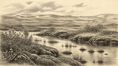
About 30,342 BCE, Ireland lay within the climatically unstable Marine Isotope Stage 3, rather than any recordable historical year. Derryvree, County Fermanagh, preserves freshwater silts between glacial tills, indicating an ice-free interval with cold, open tundra wetlands supporting mountain avens, bogbean and aquatic plants. Cave deposits at Castlepook, County Cork, document mammoth, reindeer, giant deer and predators, although their chronology and associations remain imperfect. A cut-marked reindeer femur may indicate human butchery around 31,000 BCE, but cannot demonstrate settlement. As ice expanded towards the Last Glacial Maximum, environmental evidence is reliable, whereas political, cultural and religious history remains wholly unknown.
Dateline
The label 30,342 BCE cannot identify a recorded Irish year in the modern sense. No calendar, written testimony, named person, settlement sequence or event can be assigned to it. At this depth of time, the responsible approach is to place the date within a broad Late Pleistocene horizon and ask what physical evidence can illuminate Ireland near it. The answer is necessarily uneven: a buried freshwater deposit in County Fermanagh, cave faunas in the south, traces of past ice and a single much-debated animal bone provide more secure knowledge than any conventional historical narrative.
A Date Within a Range
Thirty thousand three hundred and forty-two BCE is roughly 32,291 calendar years before AD 1950, the reference point conventionally used for “before present” dates. It falls within Marine Isotope Stage 3, a climatically unstable part of the last glacial cycle. But that conversion must not create false precision. Radiocarbon ages are not calendar dates; they need calibration against changing atmospheric carbon levels, and both laboratory uncertainty and the nature of the deposits widen the resulting ranges.
The closest major Irish environmental record is the Derryvree freshwater series near Maguiresbridge, County Fermanagh. Organic silts and fine sands there produced the radiocarbon determination BIRM-166: 30,500 radiocarbon years BP, with a large uncertainty. Subsequent ice-sheet modelling uses the deposit as evidence that this sector of Ireland was ice-free before a later advance, with a modelled ice-free constraint of 35.1 ± 3.2 thousand years BP. The nominal date of 30,342 BCE therefore belongs within the broad chronological world to which Derryvree is relevant, not to a single identifiable season in the deposit.
Water Beneath a Drumlin
Derryvree was exposed in road excavations in 1969, when a cutting passed through a drumlin about two kilometres north-east of Maguiresbridge. The section preserved an eloquent sequence: lower glacial till, then freshwater silts and fine sands rich in organic material, followed by an upper till. In plain terms, ice had previously deposited sediment; a local hollow later held water and vegetation; and renewed glacial activity eventually buried the evidence. The later burial is why the deposit survived at all.
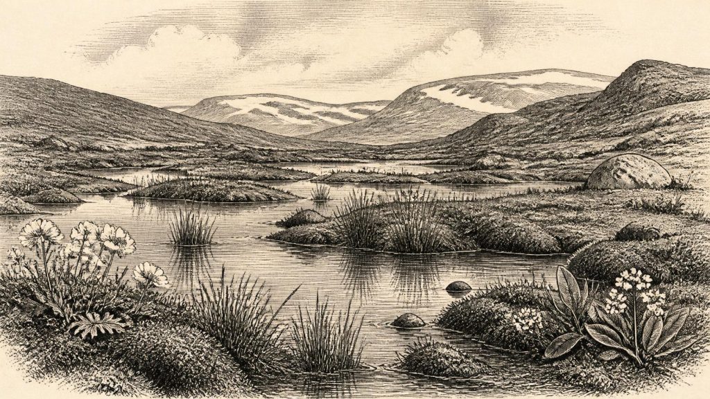
The organic layer does not describe a familiar Irish countryside. Its flora and fauna indicate open tundra vegetation and a periglacial regime: severe cold, frost action and seasonal thaw in country near ice, though not necessarily directly beneath a glacier. Fossil plant remains include bogbean (Menyanthes trifoliata), a wetland plant, and mountain avens (Dryas octopetala), now associated in Ireland with Arctic-alpine settings. Mosses, sedges and aquatic plants, including water-milfoil, point to shallow fresh water, saturated margins and low vegetation rather than forest.
This was not simply a frozen wasteland. In a sheltered depression, meltwater or groundwater could sustain pools and wet ground during the growing season. Plants adapted to cold conditions could take advantage of short summers and long daylight. Yet Derryvree supplies local evidence, not a national weather report. Its fossil assemblage cannot prove that every Irish valley, coast or upland looked alike in 30,342 BCE. The safest reconstruction is of a changing, geographically varied island in which open periglacial terrain and wetlands persisted in some places while ice and snowfields affected others.
Caves, Grazers and Carnivores
Southern Irish caves broaden the picture. Castlepook Cave, also known as Mammoth Cave, near Doneraile in north County Cork, has yielded one of Ireland’s most important Late Pleistocene faunal collections. Its remains include woolly mammoth, reindeer, giant deer, brown bear, wolf, fox, Arctic fox, spotted hyaena, hare and lemmings. These animals demonstrate that parts of Ireland were accessible to, and at times capable of supporting, a markedly different fauna from that of later millennia.
The assemblage should not be turned into a single illustrated scene. Cave deposits accumulate over long periods, and the historic excavations at Castlepook left imperfect contextual records. Re-dating has also shown that some earlier determinations underestimated the antiquity of specimens. A mammoth bone, reindeer bone and hyaena bone from the cave do not prove that those particular animals stood together on one Cork hillside, much less at the precise nominal year considered here. They nevertheless support an important wider conclusion: during parts of MIS 3, Ireland contained open, cold-stage habitats used by substantial herbivores, predators and scavengers.
The ecological implications are considerable. Reindeer and mammoth would have required extensive feeding grounds, while hyaenas and wolves depended on a prey base or carrion. Caves could serve as carnivore dens, traps, shelters or places where bones were moved and accumulated. That makes them precious archives of animal movement, but difficult evidence for reconstructing human camps. The animals tell us that food webs existed; they do not automatically reveal how, or whether, people organised themselves within them.
The Reindeer Femur Question
The possibility of very early human activity in Ireland rests largely on a reindeer femur from Castlepook. Ruth Carden’s examination identified a deep mark interpreted as the result of a sharp stone tool used in butchery. County Cork’s heritage publication associates the specimen with about 31,000 BCE, and the find has prompted renewed investigation of the cave and its collections. If the mark is correctly identified and securely related to the bone’s Ice Age age, it would be remarkable evidence that a person processed a reindeer in Ireland far earlier than the island’s well-established post-glacial settlement record.
That proposition must remain carefully limited. The object is one bone from an old cave assemblage, not a sealed occupation floor excavated with a group of tools, hearths, dwellings, human remains or a concentrated dump of food waste. Its date is the age of the animal material, not a calendar timestamp for the making of the incision. Nor can the femur show whether people killed the reindeer, scavenged it, stayed overnight, travelled in a larger party, or returned in later seasons. A possible episode of carcass processing is not evidence for a permanent population or continuous occupation.
No securely dated stone-tool assemblage of this age is known from Ireland. Nor is there direct evidence for boats, routes of arrival, exchange networks or links with communities in Britain or continental Europe. Lower sea levels and changing ice margins altered the geography around Ireland, but the evidence presently available cannot reconstruct a particular crossing or corridor for this date. The honest conclusion is that human presence is possible, even potentially supported by the Castlepook femur, while sustained settlement remains unproved.
No Polities, No Recorded Beliefs
Political affairs, diplomacy and warfare cannot responsibly be supplied for Ireland in 30,342 BCE. There are no rulers, tribes, territories, alliances, forts or battle sites in the evidence. It would be equally misleading to invent an economy of “Irish reindeer hunters”, a religion centred on caves, or a body of learning transmitted across generations. The archaeological record offers no graves, shrines, artworks, monuments, houses or structured deposits that can support such claims.
This absence is historically meaningful. Later Ireland is rich in visible human landscapes: Mesolithic camps, Neolithic tombs, Bronze Age fields and early medieval settlements. None belongs remotely close to this period. The National Museum of Ireland’s cave collections and the re-examination of sites such as Castlepook are valuable precisely because they may preserve rare evidence from a time when later ice, erosion and sea-level change destroyed or concealed much of the landscape in which any people might have travelled.
Approaching the Great Ice
Derryvree records an interval before the fullest expansion of the last British–Irish Ice Sheet. The Last Glacial Maximum is generally placed much later, broadly around 26,000 to 20,000 years BP, when ice covered most of Ireland and extended onto surrounding shelves. Growth and maximum extent varied from sector to sector, so it is wrong to imagine one instant when every margin advanced in unison. Still, the direction of long-term change was stark: the limited environments visible in the Fermanagh silts were vulnerable to renewed ice advance.
For this notional year, then, Ireland’s story is not one of kings, communities or recorded events. It is the story of a cold wetland briefly protected between episodes of glaciation; of mountain avens and bogbean growing where water persisted; of large mammals entering suitable landscapes; and of one cut-marked reindeer bone that may preserve a fleeting human action. Evidence is strongest for environment and animal life, weaker for people, and silent on institutions and belief. That hierarchy is not a gap to be filled with imagination, but the most truthful account of Ireland at this immense distance in time.
Primary Sources
- Middle Midlandian Freshwater Series at Derryvree, Maguiresbridge, County Fermanagh, Northern Ireland
- Middle Midlandian Freshwater Series at Derryvree, Maguiresbridge, County Fermanagh, Northern Ireland
- Exploring Controls of the Early and Stepped Deglaciation on the Western Margin of the British Irish Ice Sheet
- Growth and Retreat of the Last British–Irish Ice Sheet, 31,000 to 15,000 Years Ago: the BRITICE-CHRONO Reconstruction
- A Reconsideration of the Radiocarbon Dating of the Marine Isotope Stage 3 Fauna from Southern Ireland
- The Irish Quaternary Fauna Project
- Heritage Artefacts of County Cork
- 2022:564 – Castlepook Cave, Castlepook South, Cork
- Episodic Speleothem Deposition Tracks the Terrestrial Impact of Millennial-Scale Last Glacial Climate Variability in SW Ireland
- Spatio-Temporal Dynamics of Speleothem Growth and Glaciation in the British Isles
- The IntCal20 Northern Hemisphere Radiocarbon Age Calibration Curve (0–55 cal kBP)
- OxCal
- Early Midlandian–Middle Midlandian, Pleistocene, Northern Ireland
- BSBI: Menyanthes trifoliata
- BSBI: Dryas octopetala
- First Evidence of a Late Upper Palaeolithic Human Presence in Ireland
- The Colonization of Ireland: A Human Ecology Perspective
- Pleistocene Glaciations in Ireland
- New Insights on the Fauna of Ireland's Younger Dryas and Early Holocene from Alice & Gwendoline Cave
- Extent and Retreat History of the Barra Fan Ice Stream Offshore Western Scotland and Northern Ireland During the Last Glaciation
- Timing and Pace of Ice-Sheet Withdrawal Across the Marine–Terrestrial Transition West of Ireland During the Last Glaciation
- Deglaciation Chronology of the Donegal Ice Centre, North-West Ireland