

Derryvree’s Mossbound Interval30257 BCE
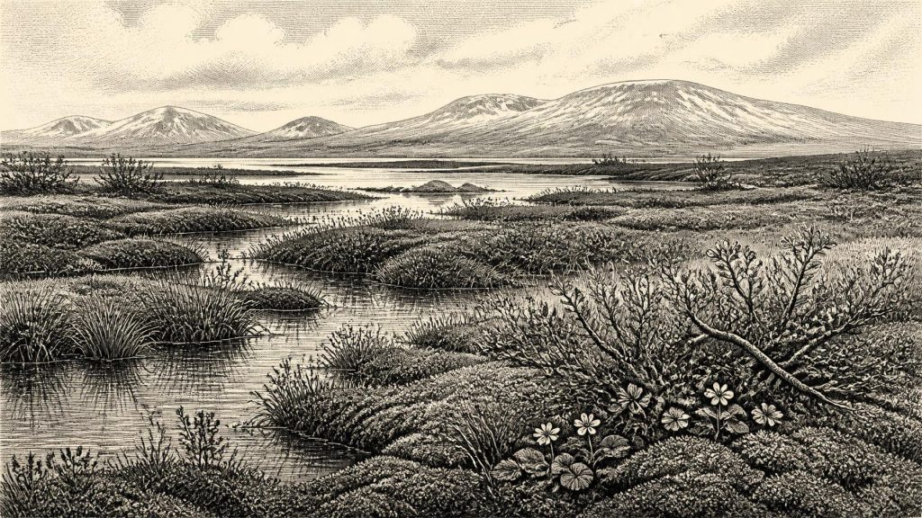
Labelled 30,257 BCE, this interval cannot be reconstructed as an annual Irish history. Derryvree’s buried freshwater sediments in County Fermanagh, dated broadly to 34,950–29,750 BCE, record a cold, largely treeless tundra-like landscape with mosses, sedges, hardy plants and shallow water, between glacial episodes. Castlepook Cave in Cork preserves time-averaged remains of mammoth, reindeer, giant deer and carnivores, demonstrating ecological connections but not a single contemporary fauna. A possibly tool-marked reindeer bone suggests fleeting human activity, yet no settlement, polity or culture can be established. Changing ice and sea levels shaped access; later glaciation erased much evidence, necessitating cautious environmental interpretation.
Dateline
“30,257 BCE” is a modern chronological label, not a date that can be recovered from an Irish event, ruler or settlement. No calendar, written record, monument or securely dated occupation surface allows history at annual resolution this far back. The responsible frame is the Late Pleistocene, broadly Marine Isotope Stage 3 (MIS 3), when Ireland’s landscapes were repeatedly altered by cold, ice and shifting sea levels. The nominal year falls within a broad calibrated range associated with a remarkable buried wetland at Derryvree near Maguiresbridge, County Fermanagh. Its organic sediments have a conventional radiocarbon determination of 30,500 +1,170/−1,030 radiocarbon years BP; calibration converts that result into a probability range rather than a single calendar year, broadly c. 36,900–31,700 calibrated years BP, or roughly 34,950–29,750 BCE.
A Wetland Beneath a Drumlin
Derryvree came to light in 1969, when roadworks cut through a drumlin about two kilometres north-east of Maguiresbridge. Drumlins are streamlined hills moulded beneath moving glacier ice. What made this exposure exceptional was its sequence: a lower glacial till, then freshwater silts, fine sands and organic material, followed by further glacial deposits above. The order of those layers is firm evidence for environmental change. Ice had occupied the locality; thereafter a basin or shallow hollow held freshwater long enough for sediment and plant remains to accumulate; later glacial activity buried and protected the deposit.
This does not mean that all Ireland was ice-free in 30,257 BCE, nor that the Derryvree basin can be treated as a map of the entire island. Ice margins, altitude, exposure to Atlantic weather, drainage and proximity to the Irish Sea made conditions highly local. The British–Irish Ice Sheet was dynamic during the last cold stage, and the scale of its pre-Last Glacial Maximum advances remains debated. Yet Derryvree decisively rules out a simplistic image of uninterrupted ice across every part of Ireland throughout the period. At least in south Fermanagh, during the broad span represented by its freshwater sediments, there was an exposed, cold landscape with water and vegetation.
Open Ground, Short Seasons
The evidence from Derryvree is environmental rather than narrative. Poorly preserved pollen, seeds, mosses and other plant macrofossils point to open tundra or tundra-like vegetation under severe periglacial conditions: long winters, repeated freezing and thawing, and short growing seasons. Sedges and grasses belonged to the local ground cover, while finds associated with cold, open habitats include bogbean, dwarf willow, mountain avens, juniper and lesser clubmoss. Water-milfoil indicates freshwater conditions in or beside the basin. Mosses are especially important because they preserve the presence of wet ground rather than merely distant airborne pollen.
This was not a modern Irish bog transposed into the Ice Age. The word “wetland” is useful only if it carries images of shallow water, mineral-rich silts, saturated margins and sparse vegetation rather than peatlands bordered by woodland. Trees were absent or extremely scarce locally. A few grains of pine or hazel pollen in such deposits need not prove nearby forest: pollen can travel far, and old material may be reworked into younger sediments. The best-supported reconstruction is an exposed, largely treeless mosaic of mossy ground, sedge margins, low herb-rich vegetation and freshwater pools.
Such a place could briefly be productive in summer. Plants would have supported insects and small animals, while the surrounding open country offered grazing and browsing to larger mammals. But productivity must not be mistaken for comfort. Frost disturbance could break and shift surface soils; snow cover, wind chill and a short season sharply constrained plant growth. The Derryvree flora tells us that life persisted in difficult conditions, not that Fermanagh enjoyed a mild interlude.
Cork’s Cave Fauna
County Cork provides the other major body of evidence relevant to this broad period. Castlepook Cave, near Doneraile and sometimes called Mammoth Cave, is Ireland’s richest known archive of vertebrate remains from before the Last Glacial Maximum. Excavations from the late nineteenth and early twentieth centuries, supplemented by later work, recovered a mixed assemblage including woolly mammoth, reindeer, giant deer, brown bear, wolf, Arctic fox, spotted hyaena and lemmings. Modern radiocarbon reassessment shows that the cave accumulated remains over a long interval, rather than preserving a single contemporaneous animal community or one frozen instant of time.
That distinction is crucial. The cave’s fauna demonstrates that cold-stage mammals reached Ireland during the wider later Pleistocene and that the island formed part of a larger north-west European ecological world. It does not permit a confident roll-call of animals standing together near Castlepook in this particular nominal year. Caves are also selective archives. Animals may have died naturally, fallen in, been carried by water, been dragged in by carnivores or been disturbed by later digging. At Castlepook, the presence of spotted hyaena is especially significant: carnivore activity offers a strong explanation for the accumulation and modification of many bones.
The most provocative object from the old collections is a reindeer femur with a deep linear mark interpreted by Ruth Carden as damage from a sharp stone tool on fresh bone. Radiocarbon work has placed the bone in the broad pre-Last Glacial Maximum period, close enough to make it relevant to the world considered here. If the identification is sustained by further research, it would be evidence that a person used a tool while processing a reindeer in Ireland far earlier than the formerly accepted human record. It would not, however, establish a village, a permanent population, a named people, or an event in 30,257 BCE. No associated hearth, lithic assemblage, dwelling, burial or securely stratified occupation horizon has yet transformed that isolated trace into a settlement narrative.
People: Possibility, Not Polity
For political affairs, conflict and diplomacy, the evidence is silent. There were no Irish states, chieftaincies, borders or institutions that archaeology can responsibly identify at this date. Nor is there evidence for a local population whose kinship, language or beliefs can be reconstructed. It is misleading to project later Gaelic communities, “Celtic” identities or even the social categories of the Mesolithic backwards into this much earlier Ice-Age setting.
The Castlepook femur allows a narrower possibility: one or more mobile hunter-gatherers may have reached the island or its then-different coastal landscape and handled a carcass. A successful cut-mark interpretation would indicate practical knowledge of animal anatomy, sharp stone technology and the immediate economic value of meat, hide, sinew or bone. Those are interpretations of a single act, not proof of regular hunting territories or trade routes. The absence of evidence for a camp may reflect later glacial erosion and the small number of surviving deposits as much as genuine absence of people. But absence cannot be converted into a populated Ireland without new discoveries.
There is likewise no Irish evidence from this date for religion, formal art, burial custom, ritual gathering or learning in the sense of transmitted traditions that can be archaeologically demonstrated. A person capable of butchery would certainly have possessed skills learned from others, yet the content of that knowledge is beyond recovery. The most honest account of culture here is negative in a useful sense: the archaeological record has not produced objects or contexts that justify claims about language, belief, music, clan politics or ceremonial practice.
Connections Across a Changing World
Ireland’s position was also unlike its modern insular one. Global sea levels were lower during the last glacial period because water was stored in large ice sheets, exposing more of the continental shelf. Nevertheless, the precise configuration, timing and usefulness of routes between Ireland, Britain and continental Europe changed as ice, sea and climate changed. It is unsafe to describe a permanent, simple land bridge at 30,257 BCE. Any human arrival, if it occurred, may have involved a temporary terrestrial route, crossings over narrow or seasonally hazardous waters, or movement through a complex coastal landscape now submerged or reshaped.
Animal distributions demonstrate connection more securely than they demonstrate human movement. Reindeer, mammoth and cold-adapted small mammals could enter suitable habitats during favourable windows. Their presence implies that Ireland was not ecologically sealed off for the whole cold stage. It does not identify the route, the season, herd size or the duration of residence. Mammoths and hyaenas, moreover, belong to different ecological histories and need not have overlapped in every locality or year.
There was no economy in the later agricultural sense: no farming, livestock management, cereal cultivation, metalwork, market exchange or settled craft production can be assigned to Ireland at this time. The relevant economy was ecological. Plants fixed energy during a short summer; herbivores moved through landscapes where forage was available; predators and scavengers followed opportunity. If people visited, their subsistence would have depended on mobility, social co-operation and the careful use of animal resources. These are reasonable inferences from Upper Palaeolithic lifeways elsewhere, but they must remain conditional in Ireland, where direct evidence is exceptionally slight.
Before the Great Advance
The full Last Glacial Maximum still lay ahead. Later, particularly around c. 26,500–19,000 years ago, the British–Irish Ice Sheet became far more extensive; research indicates major ice expansion across Ireland and the surrounding shelf seas, with the Irish Sea Ice Stream reaching towards the shelf edge at its maximum. That later glaciation destroyed, reworked and buried many earlier surfaces. It helps explain why the evidence for 30,257 BCE is so sparse and why Derryvree’s sealed freshwater layer and Castlepook’s cave collections carry disproportionate weight.
The year should therefore be remembered not as a recorded chapter of Irish political history but as a scientifically reconstructed environmental interval. Beneath what later became a Fermanagh drumlin, cold freshwater nurtured mosses, sedges and hardy arctic-alpine plants. Elsewhere, large mammals and carnivores moved through a changing Irish landscape, known most clearly from the time-averaged remains in a Cork cave. A possible tool mark on one reindeer bone raises the prospect of a fleeting human encounter. It does not yet provide a society. At this depth of time, the strength of Irish history lies precisely in maintaining that boundary between what sediments and bones show, and the much larger story they invite us to imagine.
Primary Sources
- A Middle Midlandian Freshwater Series at Derryvree, Maguiresbridge, County Fermanagh, Northern Ireland
- Palaeoecology
- The timing and magnitude of the British–Irish Ice Sheet between Marine Isotope Stages 5d and 2: implications for glacio-isostatic adjustment, high relative sea levels and ‘giant erratic’ emplacement
- Growth and retreat of the last British–Irish Ice Sheet, 31,000 to 15,000 years ago: the BRITICE-CHRONO reconstruction
- Stratigraphic and palaeo-geomorphological evidence for the glacial-deglacial history of the last British-Irish Ice Sheet in the north-western Irish Sea
- A reconsideration of the radiocarbon dating of the Marine Isotope Stage 3 fauna from southern Ireland
- The Irish quaternary fauna project
- Cork County Geological Site Report: Castlepook Cave
- Archaeology Research Excavation Grant 2022: Castlepook Cave, Co. Cork
- Occurrence of mammalia relicts at site Castlepook Cave
- The Exploration of Castlepook Cave, County Cork
- Pleistocene Vertebrates in the British Isles
- The Irish Quaternary Fauna Project
- New Insights on the Fauna of Ireland’s Younger Dryas and Early Holocene from Alice & Gwendoline Cave
- New Insights on the Fauna of Ireland’s Younger Dryas and Early Holocene from Alice & Gwendoline Cave
- Early Deglaciation of the British-Irish Ice Sheet on the Atlantic Margin
- New Age Constraints for the Limit of the British-Irish Ice Sheet on the Isles of Scilly
- Landscapes and Environments of the Last Glacial-Interglacial Transition: A Time of Amazingly Rapid Change in Ireland
- The Onset and Evolution of the Last Glaciation in the British Isles
- 32564: Castlepook Cave, Doneraile, County Cork





