

Maguirebridge’s Freshwater Pause30233 BCE
Around 30,233 BCE, Ireland’s history is reconstructed from environmental evidence rather than records. At Derryvree, County Fermanagh, freshwater organic deposits between glacial tills show a cold, open wetland interval between ice advances. Mosses, sedges, bogbean and aquatic plants indicate shallow water and seasonal life, not forest. Castlepook Cave, County Cork, preserves remains of cold-stage animals, including reindeer, giant deer, mammoth and predators, although these accumulated over long periods. A possibly cut-marked reindeer bone suggests an early human visit, but not settlement. Lower sea levels altered access routes. No evidence supports agriculture, polity, religion or permanent communities; ice repeatedly reshaped Ireland.
Dateline
“30,233 BCE” is a modern label, not a recoverable year in Irish history. No calendar, written record, ruler, settlement sequence or dated event allows Ireland’s past at this depth of time to be resolved to a particular season, let alone a day. In radiocarbon convention the label falls about 32,182 years before AD 1950, within the Late Pleistocene and Marine Isotope Stage 3, an unstable phase of the last Ice Age. The responsible account is therefore not a conventional annual chronicle. It is an account of what sediment, fossils, landforms and cautiously interpreted dates can say about Ireland around this broad point in time.
The strongest relevant evidence comes from Derryvree near Maguiresbridge, County Fermanagh. There, roadworks exposed freshwater silts, sands and organic material lying between two glacial tills: deposits made directly by ice. The sequence establishes an important order of events. Ice had occupied the locality; an interval followed in which water, plants and organic sediment accumulated; then ice returned and sealed the earlier wetland beneath later till. A radiocarbon determination from the organic layer, BIRM-166, was reported as 30,500 radiocarbon years BP, with a substantial uncertainty. When calibrated, it has commonly been expressed as a very broad range of roughly 36,900–31,700 cal BP, or about 34,950–29,750 BCE. That range encompasses 30,233 BCE, but it cannot make the deposit a snapshot of that notional year.
A Date Range, Not an Event
Radiocarbon years are not calendar years. The amount of radioactive carbon in the atmosphere has altered through time, and the calibration of very old samples carries wide statistical ranges. Nor does a date from an organic layer specify when every seed, insect fragment or grain of silt entered the deposit. The sensible conclusion is modest but significant: sometime within a long interval relevant to the thirty-first millennium BCE, the Derryvree locality was sufficiently free of overriding ice for a cold freshwater environment to form. It is evidence for local conditions, not a map of the entire island and not a proof that every region was ice-free simultaneously.
Older Irish Quaternary terminology called this kind of episode part of the Middle Midlandian or Derryvree cold phase; international studies place it within MIS 3. Both labels describe long climatic and stratigraphic intervals rather than a uniform Irish weather pattern. Conditions could differ sharply between a sheltered Fermanagh basin, exposed uplands, cave systems in Munster and the changing margins of ice in the Irish Sea. Later glaciation also destroyed, buried and reworked much of the evidence that might once have survived. This is why a road-cut through a drumlin in Fermanagh has such historical importance: it preserves a rare environmental archive from a period for which Ireland has no villages, graves, tools in secure settlement contexts or written testimony.
Cold Water in Fermanagh
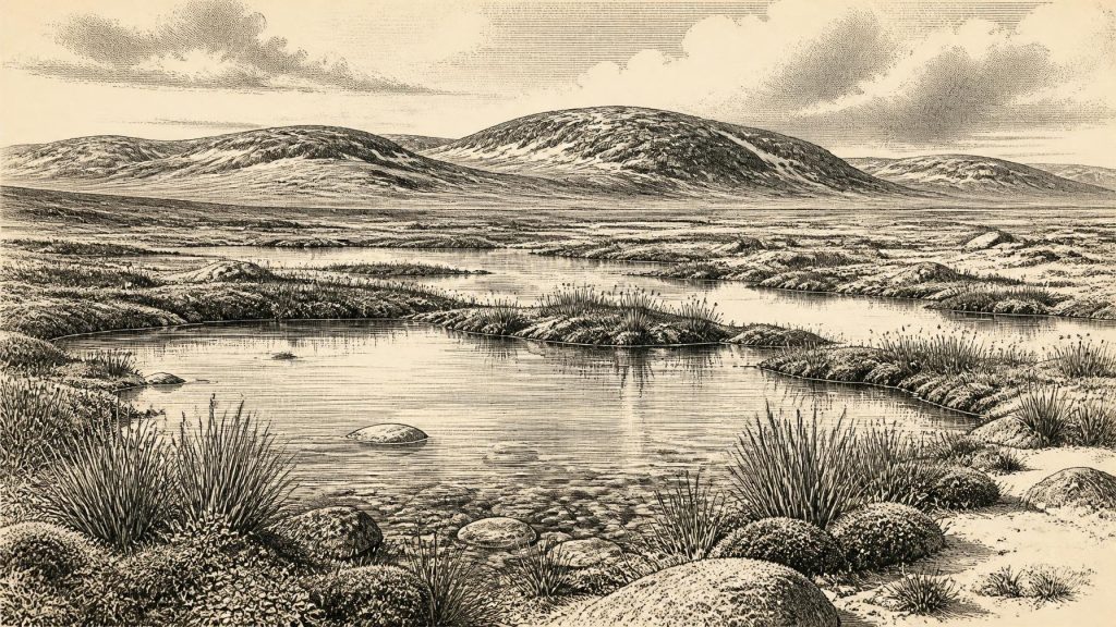
The Derryvree fossils do not show a wooded Ireland. They indicate open, severe and strongly seasonal conditions, often compared with tundra or muskeg. Such comparisons are ecological shorthand, not claims that a modern Arctic landscape was reproduced exactly in Fermanagh. Mosses, sedges, herbs and low-growing plants were better suited to the local evidence than dense forest. A seed of bogbean (Menyanthes trifoliata) is particularly informative: it points to shallow freshwater or wet margins. Other plant remains, including water-milfoil, together with pollen and invertebrate evidence, support the picture of pools or slow water amid waterlogged ground and open vegetation.
This was not a timeless frozen wilderness. Freshwater required seasonal melting, available water and vegetation during at least part of the year; the organic deposits themselves show that life persisted in the basin. Yet the treeless plant assemblage and cold-adapted ecological character point to constraints unfamiliar in modern Ireland: short growing seasons, frost, exposed ground and rapid changes in habitat as climate and ice margins shifted. The local landscape may have comprised shallow water, sedge-rich edges, patches of moss, mineral silt, bare ground and low vegetation. It would have been productive in particular places, but fragile and limited in extent.
The upper till is as important as the wetland beneath it. It demonstrates that the respite did not last indefinitely at Derryvree. A later ice advance overrode and protected the deposits, while also making them difficult to interpret. Around 30,233 BCE, Ireland should therefore be imagined as part of a changing glacial world rather than as wholly ice-bound or securely open. Modern reconstructions of the British–Irish Ice Sheet show major growth and reorganisation around this wider period, but they also stress uncertainties in the timing, thickness and regional margins of early ice. The full Last Glacial Maximum came later, conventionally placed broadly between about 26,500 and 19,000 years ago.
Animals, Caves and Lost Landscapes
County Cork’s Castlepook Cave gives a different, though equally incomplete, view of Late Pleistocene Ireland. Its old collections include bones of animals such as reindeer, giant deer, woolly mammoth, wolf, Arctic fox, lemming and spotted hyaena. Radiocarbon research has shown that the assemblage spans a long period rather than one single living community. The cave was used, visited or received carcass remains at different times; carnivores, water movement, collapse and early excavation practices further complicated the deposits. Consequently, the fauna demonstrates that Ireland could support, or at least be reached by, a varied cold-stage animal world. It does not prove that every listed species stood together near Derryvree, or even lived in Ireland at the same moment.
Nevertheless, the faunal record changes the scale on which the Fermanagh wetland should be understood. Reindeer and giant deer imply herbivore movement through open landscapes; predators and scavengers point to a food web in which caves could become dens, shelters or bone accumulators. Mammoth remains show that very large grazing animals were present in Ireland during parts of MIS 3. These animals did not inhabit an isolated modern island. Lower global sea levels exposed broad areas now submerged around the coasts, changing distances, shorelines and routes between Ireland, Britain and continental Europe. Whether a particular route was dry land, glacial terrain, coastal water or some combination cannot be securely specified for this exact date. Access was environmentally variable, not a documented road or trade corridor.
The Human Question
The possibility of human activity is the most tempting and the most restricted part of the evidence. A reindeer femur from Castlepook has been publicised as bearing a deep mark consistent with cutting by a sharp stone edge, and has been associated broadly with an age around 33,000 years ago. If that interpretation is upheld, it may record the processing of a reindeer carcass by people in Ireland far earlier than the formerly accepted post-glacial human record. It would be an important Upper Palaeolithic trace.
It is not, however, proof of an Irish settlement. Castlepook’s early excavations did not meet modern standards of stratigraphic recording, its deposits were disturbed, and no securely associated hearth, stone-tool assemblage, dwelling floor, burial, ornament or human bone establishes a resident community around 30,233 BCE. Even a genuine butcher’s mark cannot tell us whether people killed the animal, scavenged it, took meat, hide or sinew, or briefly visited the cave after processing elsewhere. It cannot reveal their numbers, language, identity, route of arrival or frequency of return. The interpretation is evidence for a possible episode of human action, not a licence to populate the island with an imagined society.
That distinction matters especially for economy. There is no evidence at this date for agriculture, herding, fields, pottery, metalworking, regular markets or an Irish trade system. A person using a stone edge on an animal would have practised subsistence, but the Irish record cannot yet identify a reliable hunting territory, a seasonal camp or even the tool itself. Comparisons with Upper Palaeolithic communities elsewhere in Europe can show what Homo sapiens were capable of—mobile hunting, fire, tailored clothing, sophisticated stone technology and long-distance social links—but none of those practices can be assigned to Ireland without Irish evidence.
No Polity, No Recorded Religion
Political affairs, diplomacy and organised conflict are beyond the evidence. There were no documented peoples, chiefs, borders, alliances or states in Ireland. Nor are there Irish monuments, deliberate graves, figurative art or ritual deposits securely dated to this interval from which to infer religious practice. Predators and humans may have competed for shelter or carcasses, but that is an ecological possibility, not evidence for warfare. The forces that governed opportunity were climate, seasonality, animal movement, water and advancing ice.
Culture and learning are similarly unrecoverable in their specifically Irish form. Knowledge of safe routes, animal behaviour, weather, fuel and workable stone would have been essential to any people who reached this northern Atlantic setting, but no material record can describe how such knowledge was transmitted. The real cultural achievement visible today is modern scientific reconstruction: palaeobotany identifies plants, zooarchaeology distinguishes species and bone modification, radiocarbon dating estimates age, and glacial geology reconstructs shifting ice and water. Each method has limits; together they replace an invented narrative with a more compelling one of survival, uncertainty and changing environments.
Around 30,233 BCE, then, the clearest Irish history is a freshwater pause recorded below a Fermanagh drumlin. Derryvree shows that, within a long and imprecisely dated cold-stage interval, open wetland life existed between episodes of glaciation. Castlepook shows that Ice Age mammals ranged through Ireland across a broader span of time and raises, cautiously, the prospect of a very early human visit. Neither site yields a year-by-year national history. Both preserve something more fundamental: evidence that Ireland’s deep past was dynamic, regionally varied and repeatedly remade by ice.
Primary Sources
- A Middle Midlandian Freshwater Series at Derryvree, Maguiresbridge, County Fermanagh, Northern Ireland
- Irish Pleistocene Biostratigraphy
- The Irish Quaternary Fauna Project
- A Reconsideration of the Radiocarbon Dating of the Marine Isotope Stage 3 Fauna from Southern Ireland
- Growth and Retreat of the Last British–Irish Ice Sheet, 31,000 to 15,000 Years Ago: The BRITICE-CHRONO Reconstruction
- The Timing and Magnitude of the British–Irish Ice Sheet Between Marine Isotope Stages 5d and 2
- Pattern and Timing of Retreat of the Last British-Irish Ice Sheet
- Freshwater Organic Deposits and Stratified Sediments Between Early and Late Midlandian (Devensian) Till Sheets, at Aghnadarragh, County Antrim, Northern Ireland
- Irish Quaternary Association: The Subdivision of the Quaternary Period in Ireland
- Irish Quaternary Association: References and Recommended Reading
- Menyanthes trifoliata: Bogbean in Fermanagh
- The Colonization of Ireland: A Human Ecology Perspective
- First Evidence of a Late Upper Palaeolithic Human Presence in Ireland
- New Insights on the Fauna of Ireland's Younger Dryas and Early Holocene from Alice & Gwendoline Cave
- Last Glacial Maximum Cirque Glaciation in Ireland and Implications for Reconstructions of the Irish Ice Sheet
- Trimlines, Blockfields and the Vertical Extent of the Last Ice Sheet in Southern Ireland
- Castlepook Cave: County Geological Site Report
- 2022:564 – Castlepook Cave, Castlepook South, Cork
- Heritage Artefacts of County Cork
- Irish Quaternary Association Publications
- BRITICE-CHRONO: Constraining the Retreat of the Last British-Irish Ice Sheet
- A High-Resolution Multiproxy Approach to Unravelling Complexities of Deglaciation
- The Last British-Irish Ice Sheet in Northeast Ireland





