
BIRM-166 and the Tundra Pool30234 BCE
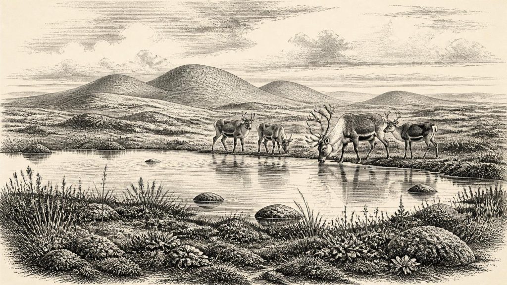
At 30,234 BCE, Ireland cannot be described through events or precise calendar dating. Derryvree, County Fermanagh, preserves organic freshwater sediments between glacial tills, dated broadly to Marine Isotope Stage 3 and demonstrating a temporary ice-free wetland. Its plants, mosses, insects and aquatic species indicate treeless tundra, pools and saturated ground amid severe, fluctuating conditions. Cave faunas, including mammoth, reindeer and hyaena, show connections with wider cold-stage ecosystems, but accumulated over long periods. A possibly butchered reindeer bone suggests earlier human visits, yet proves neither settlement nor presence in this year. Ireland’s record is changing ice, water, habitats and uncertainty alone.
Dateline
Modern calendar-year precision is not available for Ireland in 30,234 BCE. The number is a retrospective label, not a date known to any contemporary people, and no Irish settlement, person, political event or artefact can be assigned to that individual year. The responsible approach is to place it within the later part of the Pleistocene, broadly Marine Isotope Stage 3, and to use dated deposits as wide chronological windows. In that sense, the most important Irish evidence is not a monument or a settlement but a buried freshwater deposit exposed at Derryvree, near Maguiresbridge in County Fermanagh.
The requested year is about 32,200 calendar years before the radiocarbon convention of AD 1950. It falls within the broad calibrated range associated with Derryvree’s organic sediments: approximately 36,900–31,700 calibrated years before present, or roughly 34,950–29,750 BCE. That range is necessarily much wider than a single year. It covers a period during which climate, vegetation, animal movements and the margins of glacier ice could all have changed substantially. The evidence can illuminate a world around this date; it cannot narrate an event on it.
A Wetland Beneath a Drumlin
Derryvree was revealed by roadworks in 1969, when an excavation cut through a drumlin: the streamlined hill of glacial sediment characteristic of much of the Fermanagh landscape. The section contained a lower till, then freshwater silts, fine sands and organic muds, followed by an upper till. Till is unsorted debris laid down directly by glacier ice. The sequence is therefore unusually clear in its basic implication. Ice had occupied this locality; an interval then followed in which water, sediment and plants accumulated in an ice-free basin; ice subsequently returned and sealed the wetland under another layer of debris.
Organic material from the intervening bed produced the conventional radiocarbon determination BIRM-166, 30,500 radiocarbon years before present, with a large uncertainty of +1,170 and −1,030 years. A radiocarbon age is not a calendar age: the proportion of atmospheric carbon-14 has varied through time, and calibration converts a laboratory measurement into a probability range rather than a single certain date. Modern calibration curves reach this far back, but their uncertainties matter greatly. Derryvree consequently provides a dated environmental interval, not a precise timestamp for a pond, a plant or a generation of animals.
That modest distinction is central to the history of Ireland at this depth of time. The Derryvree deposits securely show that part of north-western Ireland supported freshwater conditions between glacial episodes. They do not prove that every region of the island was simultaneously free of ice, nor do they establish one fixed outline for an Irish ice sheet. Later glaciers repeatedly eroded, reworked and buried older ground. Much of the evidence needed to draw a complete map has therefore been lost.
Cold Ground, Open Water
The plants and small animals preserved at Derryvree point to an open, treeless and severe environment, conventionally described as tundra or muskeg. The latter term denotes waterlogged ground rich in mosses and organic material, with pools and slow-moving water rather than a modern Irish bog in every detail. Sedges, grasses, mosses and cold-tolerant herbs formed much of the vegetation. Fossil evidence includes aquatic and wetland plants, among them water-milfoil and buckbean, showing that sheltered fresh water persisted locally even when the wider climate was harsh.
This was not an Irish landscape of oak woods, fields or settled villages. Frost action, seasonal thaw and saturated sediment would have shaped the ground. Low vegetation could support insects and grazing animals, while pools and marshy margins offered distinct habitats within a wider cold landscape. The surviving fossils give a valuable ecological outline, but not a picturesque certainty. They tell us that these species or plant communities occurred in and around a particular basin over an extended interval. They cannot demonstrate the exact appearance of every valley, season or coastline in 30,234 BCE.
At a North Atlantic scale, the numerical date lies near Greenland Interstadial 5.2, a comparatively milder pulse within an otherwise volatile ice-age climate sequence. Cave formations at Crag Cave in County Kerry record episodes when liquid water could circulate underground during Marine Isotope Stage 3, supporting the broader conclusion that Irish conditions were not uniformly frozen throughout this period. Yet correlation should not be overstated. A Greenland ice-core event does not prove that Fermanagh experienced a matching temperature shift in the same calendar year, and neither record fixes the position of local ice margins.
Animals in a Fragmentary Record
Ireland’s caves provide the other principal body of evidence. Castlepook Cave, also called Mammoth Cave, near Doneraile in north County Cork yielded a notable Pleistocene fauna from antiquarian excavations. Its collections include remains attributed to woolly mammoth, reindeer, giant deer, brown bear, wolf, Arctic fox, mountain hare, lemmings and spotted hyaena. Such animals indicate that parts of Ireland could participate in the wider north-west European cold-stage ecosystem. Reindeer, for example, suit open ground, while hyaenas are a reminder that caves could be carnivore dens as well as accidental traps and repositories for bones.
But a cave faunal list must not be converted into a census for one year. Castlepook’s deposits accumulated over long and complex periods; bones may have been carried in by carnivores, moved by water, or disturbed during early excavation. Different species need not have lived together, and a bone dated to one part of Marine Isotope Stage 3 cannot automatically describe Fermanagh several millennia later. The fauna is strongest as evidence for repeated ecological possibility: cold-adapted mammals reached or occupied Irish landscapes during the broader interval.
Castlepook also raises the difficult question of people. A reindeer femur in the National Museum of Ireland’s Natural History collections has a deep linear modification interpreted by zooarchaeologist Ruth Carden as a mark made by a stone tool during the butchery of fresh bone. The specimen has been publicised as dating to around 33,000 radiocarbon years ago, and Cork heritage material places it broadly around 31,000 BCE. If the mark is securely anthropogenic, it is an exceptionally important indication that Upper Palaeolithic hunters reached Ireland far earlier than the long-accepted terminal-Pleistocene evidence.
Its limitations are equally important. The bone does not provide a house floor, hearth, stone-tool assemblage, burial or undisturbed campsite. Its radiocarbon result is older than the nominal year considered here once calibration is taken into account. Nor can one modified bone establish whether people lived on the island, arrived on a short hunting visit, or returned repeatedly over generations. For 30,234 BCE specifically, human presence in Ireland remains unproven. The Castlepook femur is relevant context, not a licence to populate the Derryvree wetland with a known hunting party.
No Polities, No Recorded Exchange
There is no evidence for political affairs, diplomacy, named communities, leaders, warfare, formal religion, learning or organised trade in Ireland at this date. These are not merely missing written records. No securely dated Irish material supports their reconstruction. It would be misleading to transfer the institutions of later prehistoric farming societies, still tens of millennia in the future, into this cold Pleistocene setting.
If people did visit Ireland during this broad period, the Castlepook evidence suggests a subsistence encounter with animal resources: the processing of a carcass, rather than farming, permanent settlement or commerce. That is an interpretation of a single object, not a demonstrated economy. Likewise, movement between Ireland, Britain and continental north-west Europe is plausible in a time of lower sea levels and changing coastal geography, but the practical routes, seasonal conditions and frequency of crossings remain unknown. No evidence identifies traded goods or a durable social network centred on Ireland.
Everyday life is therefore better approached through environmental constraints than invented customs. An animal, or a small mobile group of people if present, would have confronted exposed ground, cold seasons, wetlands, predators and an unstable landscape shaped by ice. Freshwater pools and vegetated margins could be local refuges, but they existed within a regional system liable to renewed glaciation. The later upper till at Derryvree is physical proof that this apparently living basin was eventually overwhelmed and buried.
A Changing Irish Landscape
The great maximum expansion of the last British–Irish Ice Sheet lay ahead, broadly during the interval around 26,000–20,000 years ago, though its timing and extent varied across regions and remain actively researched. It is therefore wrong to imagine Ireland in 30,234 BCE as either wholly buried beneath an unbroken ice sheet or securely settled in a stable tundra homeland. The evidence instead indicates a changing mosaic: glacier-affected terrain, locally ice-free freshwater ground, open vegetation and intermittent cold-stage fauna.
The most historically important development was environmental rather than political. Derryvree preserves a rare moment when life left a record between two glacial advances. Its silts, seeds, pollen, mosses and insects demonstrate that even a severe Ice Age Ireland contained habitats with water and vegetation. At the same time, the layers above and below show how precarious their survival was. For this distant year, Ireland’s history is a history of climate, ice, water and scattered biological traces—and of the careful limits that those traces impose on any story we tell.
Primary Sources
- A Middle Midlandian Freshwater Series at Derryvree, Maguiresbridge, County Fermanagh, Northern Ireland
- Palaeoecology
- Figure 6.— The Subdivision of the Quaternary Period in Ireland
- Early Midlandian–Middle Midlandian, Pleistocene, Northern Ireland
- Myriophyllum alterniflorum DC.
- Episodic Speleothem Deposition Tracks the Terrestrial Impact of Millennial-Scale Last Glacial Climate Variability in SW Ireland
- Exploring Controls of the Early and Stepped Deglaciation on the Western Margin of the British Irish Ice Sheet
- The Timing and Magnitude of the British–Irish Ice Sheet Between Marine Isotope Stages 5d and 2
- Stratigraphic and Palaeo-Geomorphological Evidence for the Glacial-Deglacial History of the Last British-Irish Ice Sheet in the North-Western Irish Sea
- The IntCal20 Northern Hemisphere Radiocarbon Age Calibration Curve (0–55 cal kBP)
- Composition and Consequences of the IntCal20 Radiocarbon Calibration Curve
- Heritage Artefacts of County Cork
- Archaeology Research Excavation Grant 2022: Final Report
- Mammoth Cave
- Ireland's Palaeolithic Archaeology – Fleeting Footprints in a Frozen Land
- New Insights on the Fauna of Ireland’s Younger Dryas
- The Irish Quaternary Fauna Project
- Pleistocene Vertebrates in the British Isles
- Prehistoric Details: Stone Age
- The Mesolithic in Ireland: When Was It?
- Timing, Pace and Controls on Ice Sheet Retreat: an Introduction to the BRITICE-CHRONO Transect Reconstructions of the British-Irish Ice Sheet
- Exploring Controls of the Early and Stepped Deglaciation on the Western Margin of the British Irish Ice Sheet
