
The Connacht Deadline1654 CE
In 1654, the Commonwealth sought to consolidate Cromwellian conquest through transplantation, surveys and institutions. Catholics deemed liable to removal faced a 1 May deadline to move to Connacht or Clare, though enforcement proved uneven amid exemptions, shortages and local dependence on tenants. Courts of survey launched the Civil Survey, recording pre-war ownership, resources and boundaries to facilitate confiscation and redistribution. Charles Fleetwood, appointed Lord Deputy, pursued a hard settlement despite divisions among Protestants and intervention over exemptions. Ireland gained Westminster representation without an Irish parliament. In December, William Petty’s contract initiated preparations for the Down Survey, making dispossession administratively durable.
Dateline
In 1654 Ireland was not remade by a single battle or proclamation. It was remade through deadlines, lists, sworn inquiries and measurements. The fighting of the Cromwellian conquest had largely ended, but the Commonwealth’s victory had created a problem no military campaign could settle by itself: how to turn the confiscation decreed against Catholic landowners into a durable new order. During this year, the threatened removal of Irish Catholics to Connacht and Clare became an immediate fact of life; commissioners began recording the country’s pre-war ownership and resources; and, at year’s end, William Petty received the contract that would lead to the Down Survey. The great cartographic instrument of confiscation was therefore conceived in 1654, even though its fieldwork and maps chiefly belong to later years.
A Deadline Across the Shannon
The most pressing date was 1 May 1654. Under the Commonwealth settlement, persons judged liable to transplantation were required to remove themselves, their families, dependants, livestock and movable goods to Connacht or County Clare by then. The policy was rooted in the Act for the Settlement of Ireland of August 1652 and instructions issued during 1653; it was not an order born suddenly in 1654. Yet the arrival of the deadline made its implications acute in communities across Leinster, Munster and Ulster. Catholic proprietors and others classed by the regime as transplantable faced the prospect of abandoning inherited estates east of the Shannon for allotted land in the designated western zone.
The familiar phrase “To Hell or Connacht” captures later memory of this episode, but it should not obscure the uneven historical reality. The government’s programme was coercive and punitive, designed to clear land for soldiers, creditors known as Adventurers, and Protestant settlers. It also threatened severe penalties for those remaining where they were forbidden. But it was neither a simple nor a fully completed removal of every Catholic person. Officials themselves doubted whether the operation could be carried through by the stated May date. Landlords required tenants and labourers; local authorities confronted shortages of money, transport, accommodation and reliable information; and many cases depended upon past conduct, articles of surrender, marriage, tenancy or special exemption.
This uncertainty was itself a weapon of government. Families did not need to be physically marched west in every case for the policy to alter their choices. They had to reckon with legal insecurity, the cost of travel, the difficulty of moving stock, and the possibility that an official decision might overturn their claim to remain. Connacht and Clare were selected partly because the River Shannon, the sea, the Erne and extensive boglands made the area comparatively containable from the regime’s point of view. A fortified line was envisaged across the limited landward approach. Such planning treated geography as an instrument of surveillance and separation, while overlooking the dense local ties that made land, kinship, labour and parish life inseparable.
Land Before Redistribution
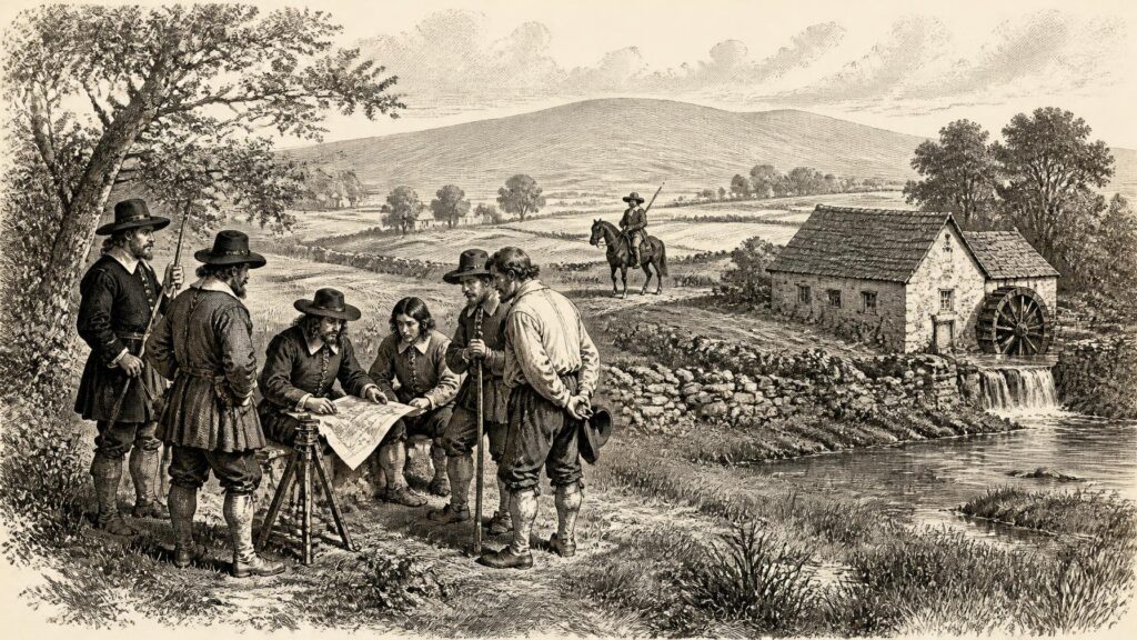
On 2 June 1654, commissions were issued for courts of survey. In Tipperary, for example, inquisitions began during July and continued through the year in different baronies. This work formed part of what became known as the Civil Survey of 1654–56. Its purpose was not initially to draw precise maps. Rather, local juries and witnesses were required to describe townlands, boundaries, soil, acreage, houses, mills, woods, fisheries, church lands, rents and the proprietors or possessors associated with 1641, before rebellion and war transformed the legal landscape. The survey’s retrospective character is essential: it preserved a picture of earlier ownership in order to decide later forfeiture and redistribution.
The surviving survey material gives an unusually concrete view of the Ireland that the Commonwealth meant to divide. It distinguishes arable land, meadow, pasture, mountain, bog, wood and unprofitable ground; it notes cabins and substantial houses, mills and watercourses, tithe lands and ruins. These were not neutral observations. A description of a place’s value could shape the amount and quality of land set out in compensation to an officer or creditor. Still, the records have an importance beyond the settlement that produced them. They retain townland names, family names, boundaries and features of local economies which would otherwise often be lost, particularly after the destruction of many Irish public records in 1922.
For ordinary people, the survey represented an intrusion into an already damaged countryside. Twelve years of warfare since 1641 had brought siege, displacement, epidemic disease, crop failure and disruption to trade and cultivation. It would be irresponsible to attach one national experience or one precise population total to 1654: losses varied greatly between regions and estimates remain contested. What can be said firmly is that the Civil Survey’s attention to productive acreage, livestock-bearing pasture, mills, timber and rents reflects a government urgently trying to identify what remained capable of supporting soldiers, settlers and taxation. Land was being made legible because it was to be made transferable.
Fleetwood’s Hardening Government
Charles Fleetwood governed Ireland through this difficult transition. A senior Parliamentarian officer and Oliver Cromwell’s son-in-law, he had been commander-in-chief in Ireland since 1652. In August 1654 he was appointed Lord Deputy, with a new council intended in part to regularise and restrain government. The title did not signal a softer settlement. Fleetwood’s priorities remained the consolidation of conquest, the punishment of those held responsible for the rebellion of 1641, confiscation from Catholic landholders, and the establishment of a Protestant interest rooted in land and army service.
Yet 1654 also exposed divisions within the victorious side. Some army officers favoured rigorous transplantation and feared that exemptions would undermine the entire conquest. Older Protestant landowners and urban interests often objected less from sympathy with Catholics than from practical self-interest: wholesale removal could deprive estates of tenants, servants, artisans and rent. In April, Oliver Cromwell’s intervention on behalf of the Earl of Westmeath sharpened dispute over the claims of Catholic officers in Leinster who relied upon terms of surrender. Later in the year, Cromwell authorised Fleetwood to grant exemptions, but Fleetwood resisted the moderating implication. On 30 November he declared that Catholics implicated in the 1641 rebellion were to be removed westward by 1 March 1655. That later deadline belongs to the following year’s story, but the declaration shows that the failure to complete transplantation by May had produced not abandonment, but renewed pressure.
Religion and property were closely joined. The Commonwealth did not compel Catholics to attend Protestant worship, but the public celebration of Mass remained prohibited and Catholic clergy faced exclusion and danger under rules introduced in 1653. In 1654 the language of official surveys repeatedly marked proprietors by religious identity, including the category “Irish Papist”. Such labels reduced varied communities—Gaelic and Old English, landlord and tenant, survivor, widow and heir—to classifications useful for confiscation. At the same time, Protestant settlers, soldiers and officeholders did not form a single harmonious bloc. Presbyterians, Baptists, independents and other Protestants held competing views on church government and the proper severity of the settlement.
Representation Without an Irish Parliament
The new Protectorate offered Ireland representation at Westminster but not the restoration of an Irish parliament. An ordinance of 27 June 1654 created twenty Irish constituencies returning thirty members to the First Protectorate Parliament. Elections were held during the summer, under a system in which military power and the Dublin administration exercised decisive influence; the parliament first met in London on 3 September. In Cork, surviving electoral evidence shows municipal officers and substantial Protestant interests participating in the selection of members. This was an institutional change of real constitutional importance—the first parliamentary representation of Ireland in a united Commonwealth legislature—but it was not representative government in a modern or inclusive sense.
For the Catholic majority undergoing confiscation and threatened removal, Westminster seats offered little practical protection. Nor did the arrangement transfer the centre of Irish decision-making to elected local bodies. The Lord Deputy, council, army commanders and land commissioners remained the machinery that mattered most. Nevertheless, the election revealed the regime’s ambition to bind Ireland into a three-kingdom Protectorate rather than govern it merely as a conquered dependency. It also provided a forum in which Irish Protestant critics of Fleetwood could make their opposition known, especially over the economic and political consequences of transplantation.
Petty’s Contract
The decisive administrative development came in December. William Petty, physician-general to the Irish army and already known for his practical and mathematical abilities, was entrusted with planning and managing a new survey of forfeited land. A contract dated 24 December is conventionally associated with the beginning of the Down Survey. The name came from the practice of setting measurements and boundaries “down” on paper. Petty’s later operation would use trained surveyors, chains and field measurement to produce county, barony and parish maps on an unprecedented scale. The full survey was carried out chiefly in 1655–56, with maps compiled thereafter; 1654 was the year of its authorisation and preparation, not the year in which Ireland was already completely mapped.
That distinction matters. In 1654, the Commonwealth was still assembling the information, authority and personnel required to convert forfeiture into parcels that could be allotted, sold or mortgaged. The Civil Survey preserved testimony about the old landscape; Petty’s projected Down Survey would measure the new fiscal territory with far greater precision. Together they made dispossession durable in paper records as well as in changed possession on the ground. The year therefore stands as a sombre hinge: war had given the conquerors power, but surveys, elections, exemptions and deadlines were intended to make that power permanent.
Primary Sources
- About the Down Survey of Ireland
- Petty, Sir William
- Fleetwood, Charles
- Civil and Down Surveys
- The Civil Survey (1654–6)
- Cromwellian Surveys
- The Transplantation to Connacht, 1654–58
- The Cromwellian Settlement of Clare, 1654
- Ireland, by the Deputy of Ireland
- Constituencies: Ireland
- Three Bog-Standard Cromwellian Elections: Co. Cork and its boroughs in 1654
- From Cromwell to the Boyne
- Cromwell and the Irish Land Settlement
- The History of the Survey of Ireland, Commonly Called the Down Survey
- The Civil Survey, 1654–1656, Vol. 7: Dublin
- The Civil Survey A.D. 1654–1656: County of Tipperary, Vol. I
- The Civil Survey A.D. 1654–56: County of Dublin
- The Civil Survey, 1654–1656, Volume 1
- The Civil Survey, A.D. 1654–1656: County of Waterford
- The Re-Conquest of Ireland
- Timeline: 1654
- Launch of the Virtual Record Treasury of Ireland